GSLV-F16/NISAR
Today’s the day!
Launch Day has arrived for GSLV-F16 & NISAR. GSLV-F16 is standing tall on the pad. NISAR is ready. Liftoff today.
🗓️ July 30, 2025
Live from: 17:10 Hours IST
Liftoff at : 17:40 Hours IST
Livestreaming Link:
https://t.co/52yTIpEBTZ
For more information:
https://t.co/Vgzdz4jGQo
#NISAR #GSLVF16 #ISRO #NASA
Margaret River, Australia cartographer Grant Preller walks the coast, surfs the breaks, then uses Google Earth, 1890s coastline maps, 1:50k topos, a pencil and CorelDraw to create 8-foot-wide maps that show where to catch a sick barrel 🤙
A true go-somewhere mapmaker
New project! We mapped Bangalore's natural drains to show how water flows and collects, and some identified locations which flood often. Find your area, or just pan around to see how water ends up in the nearest lakes and reservoirs. w/ @Vonterinon
🔗 https://t.co/W9sYZxbHS7
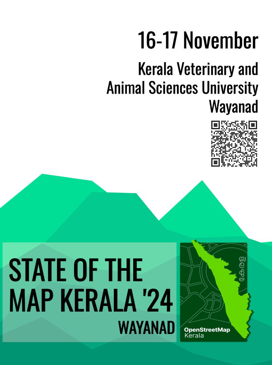
Announcing the State of the Map Kerala 2024! First ever regional #SotM in the country & 2nd SotM (sotm asia being 1st) happening in #India. #openstreetmap#Kerala#Wayanad
For More:
https://t.co/rEGWaG6CG4
🚍 Calling all PMPML Pravasis! We're looking for people who use the PMPML frequency, have knowledge about routes, and keep a tab on PMPML related news. If you're who we're looking for, please reach out to us!
@srinualavilli@opencity_in@parisarpune@GeoPune
OpenStreetMap users in Bengaluru have been mapping the status of street lights in their neighbourhoods.
Want to do it in your neighbourhood? Install the @EveryDoorOSM app and try it out in your area.
Curious about Ola Maps? Join @chinmaymaps & @DevTen85 for a fireside chat!
We dive into:
- What is a map?
- @osm_in's role, and building a FOSS map stack
- What brings value?
Full video: https://t.co/bjht4c4MWk
(Disclaimer: We're map geeks, not Ola insiders)
Wanted to check the election results for your constituency quickly? This map made by our very own Nikhil Sheth helps you to do just that:
https://t.co/8vkezriMCi
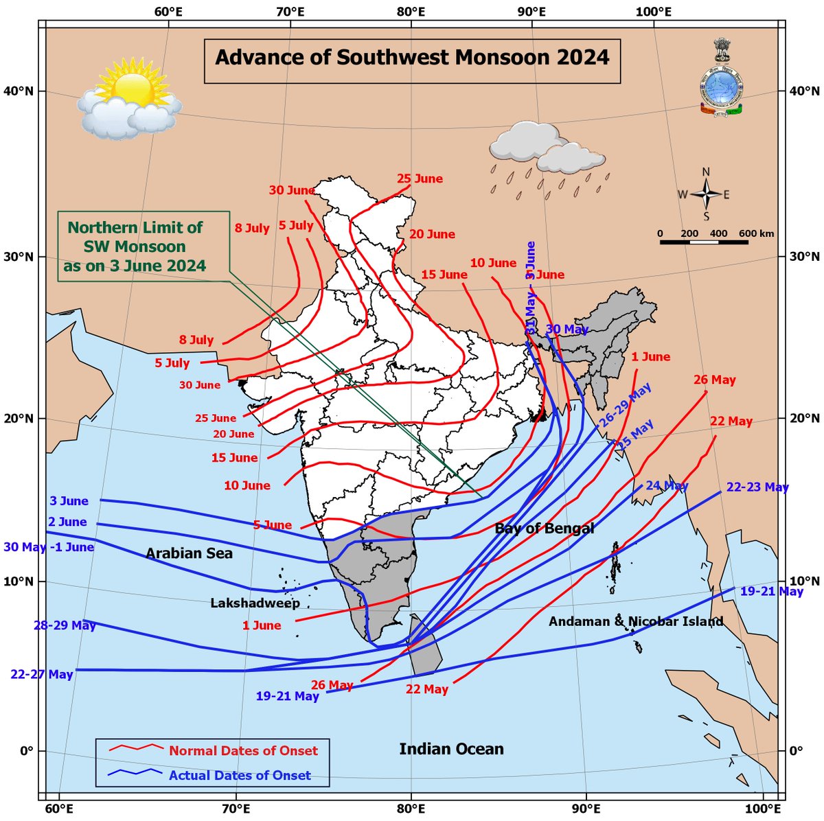
Southwest Monsoon advanced into some more parts of central Arabian Sea, some more parts of Karnataka, Rayalaseema, Coastal Andhra Pradesh, some parts of Telangana and some more parts of Westcentral and Northwest Bay of Bengal, today the 3rd June.
🚨🚨Announcing the publication of our own global, cloud free Sentinel-2 dataset. 12 bands, all in full resolution, aggregated over all of 2023 — over 33 TB in total!
We've partnered w/ the @source_coop team to make this dataset open & accessible. 👇🏽
https://t.co/tfIpEnFGMJ
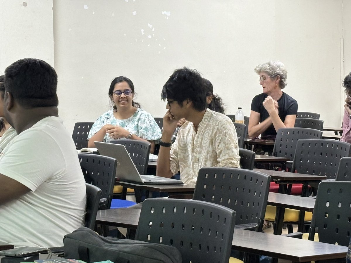
Team ‘Paul’ Vat/ footpath talks about inaccessibility to #walk or #cycle in Pune in 7 wards but show a lot of demand by extracting data from @Strava & surveys by @CyclePlanPune
But they also point out at inconsistency and reliability of #data! Need more accuracy and updation.
‘Transport Warriors’ presenting their assessment of the route from MaNaPa to Hinjewadi Phase 3 and results raise discussions around the missing data on number of #bus commuters, points out to advantages of #BRTS & also the significance of last mile connectivity & shared #mobility
Team ‘Paul Vat’ / Footpath
Problem statement: Assessing the accessibility of cycle tracks for schools and healthcare.
@PMCPune@MORTHRoadSafety#PuneDataJam
Team ‘Transport Warriors’
Problem statement: Plan a trip from point A to point B, visualise time-cost analysis and potential risks in commute.
#PuneDataJam#publictransport@PMPMLPune@PMCPune