Remote Sensing for GeoHazards (RS4GeoHZ) group at GFZ Potsdam, Germany, focuses on understanding the geo-hazards in light of the current Climate Crisis.
We join those universities and research institutes in Germany to discontinue our activities in this platform. Thank you for following us over the last yrs. You can find updates about our reseach in the following address:
https://t.co/6MAdBAQfts
Ministry of Natural Resources in China releases the first LuTan-1 (L-band SAR satellite)-based earthquake displacement field and fault slip model associated with Jan. 7, 2025 Mw 6.8 earthquake that occurred in Dingri County, Shigatse City, Tibet.
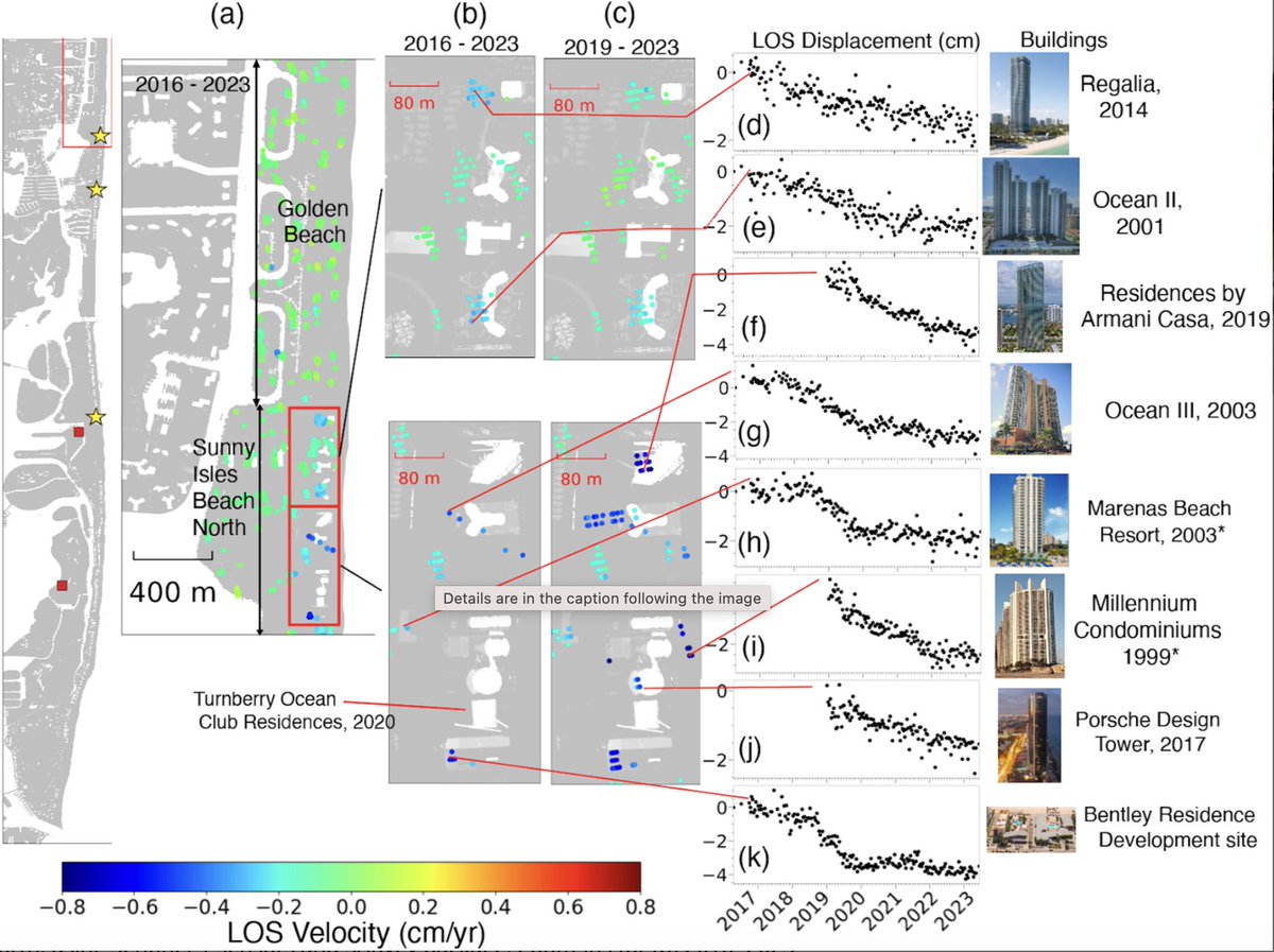
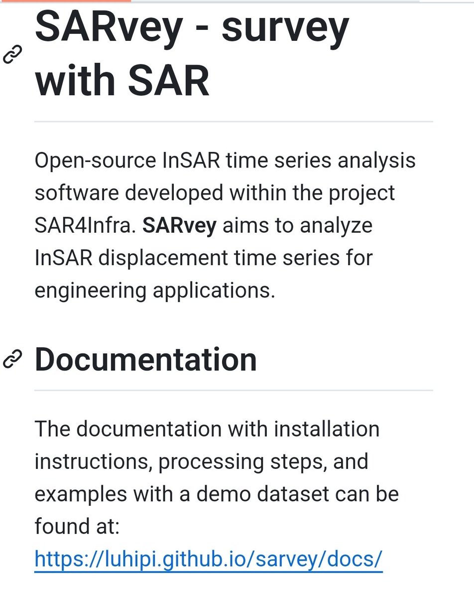
In a new study together with colleagues in the US, we used our newly developed open-source #SARvey software to analyze structural instability of coastal buildings in #Miami .
link to the article --> https://t.co/7eT0lGT0Pt
link to SARvey --> https://t.co/q4jZudQmNq
Thrilled to announce the release of #SARVey, an open-source #software for the #InSAR time-series analysis using both #Persistent & #Distributed scatterers in #Python.
link to software ->
https://t.co/q4jZudPOXS
The paper describing the methodology->
https://t.co/90IC1A0GAJ
Analysing complex #SAR#echoes associated with #powerlines is important for inspection management applications. In this paper, we proposed a novel tracing method to analyze #multireflection effects of such objects in #TSX data. @WHU_1893
link to paper -> https://t.co/BjEkba8dtf
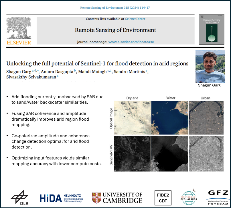
New paper alert! In this new study, led by @ShagunGarg1511-PhD student from @Cambridge_Uni & #HIDA scholar at @GFZ_Potsdam, we have shown how potentials of #SAR data can be exploited for accurate flood mapping in arid regions
link--> https://t.co/62yIvlphaw
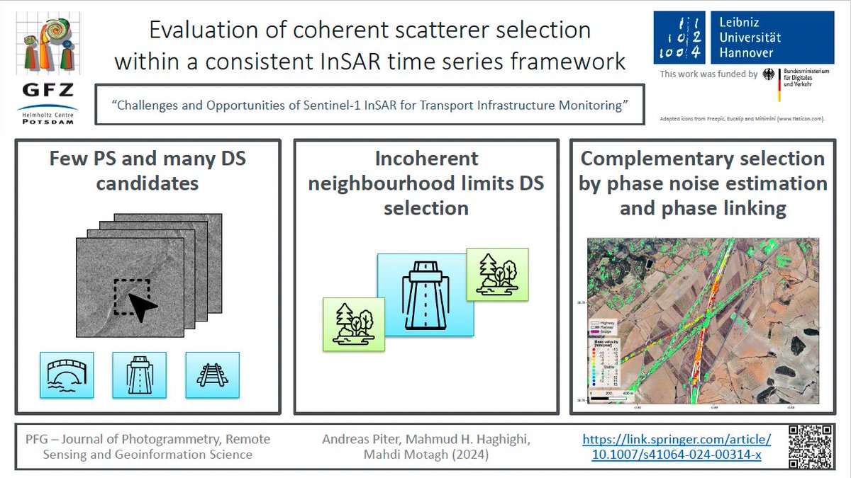
New Paper Alert!
Are you interested in applying #Sentinel1-based #InSAR measurements for #infrastructure stability analysis? Then please see the paper led by our PhD student Andreas Piter about challenges and opportunities in this regard.
https://t.co/90IC1A0GAJ
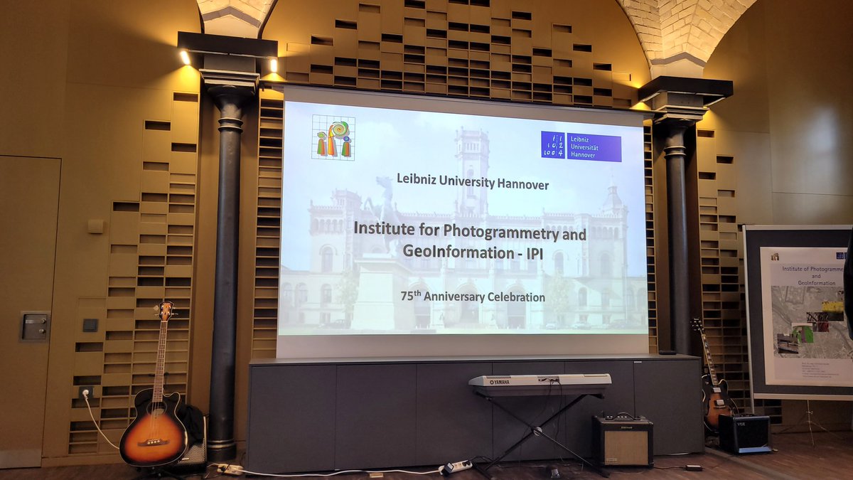
At @UniHannover we are proud for our internationalization and be inclusive for different cultures. A memorable night for 75th anniversary of the #IPI institute with amazing performance of traditional Indian dances from a member of our #RADAR group @Ritushr80919287 from 🇮🇳
📍New paper out!
We explore how to detect floods in arid regions better using #Sentinel -1 SAR data. These areas are often ignored in global flood mapping, but our work highlights a new approach that improves detection by up to 50%!
A thread 🧵 (1/n)
https://t.co/SWFrhBjXUO
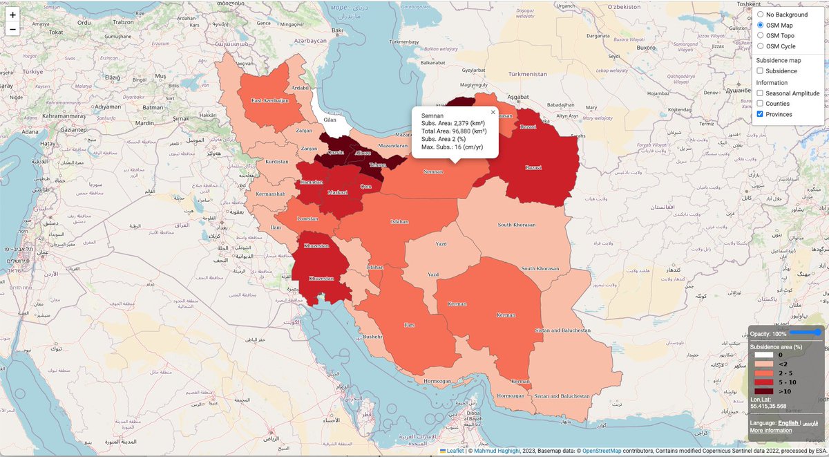
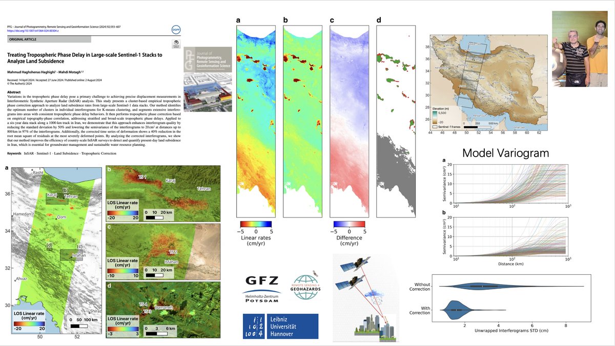
🔔New paper alert!
A cluster-based approach for mitigating #tropospheric phase delay in large-scale #Sentinel1 stacks for mapping land #subsidence
https://t.co/GVjM5v6YbE
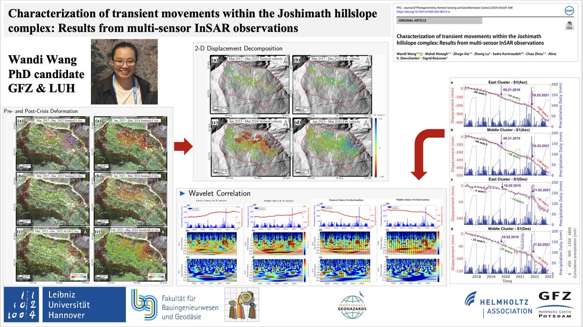
New paper alert!
In this paper, led by Wandi, we investigate #slope instability processes before & after the 2023 slope destabilization crisis within the #Joshimath hillslope complex in #India using #Sentinel1
, #ALOS2, and #TerraSAR-X #InSAR
https://t.co/XkX6v48ioM
🔔New paper alert!
A cluster-based approach for mitigating #tropospheric phase delay in large-scale #Sentinel1 stacks for mapping land #subsidence
https://t.co/GVjM5v6YbE
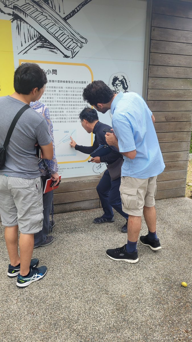
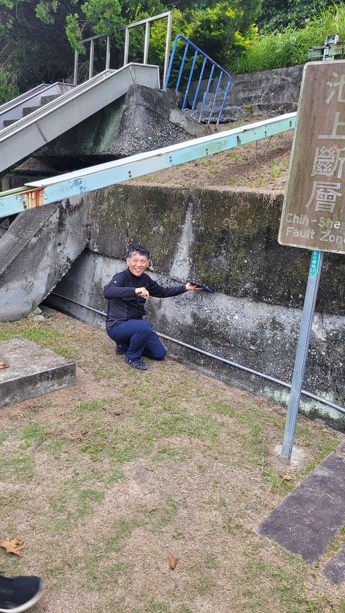
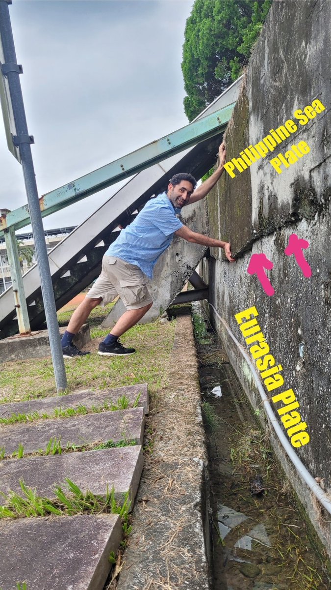
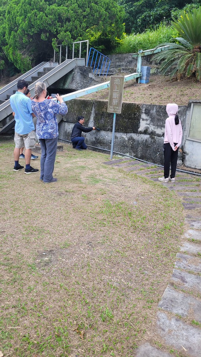
Visting the creeping section of the #Chihshang fault in 🇹🇼 . @Mahmudhh is doing his best to stop the fault slip between the Philippine Sea Plate & the Eurasian Plate😉