La función de los spoilers no es frenar el avión, estás equivocado.
Y no te voy a mentir, yo también pensaba lo mismo.
Al fin y al cabo, cuando se despliegan aumentan la resistencia aerodinámica y también contribuyen a reducir la velocidad.
Pero esa no es su función principal.
A Via Láctea em diferentes comprimentos de onda!!! Cada um revela uma característica diferente da galáxia, por isso o ideal na astronomia é integrar os mais diversos comprimentos de onda para se ter no final uma imagem que tenha todas as características do objeto estudado.
Today, we're introducing AlphaEarth Foundations from @GoogleDeepMind , an AI model that functions like a virtual satellite which helps scientists make informed decisions on critical issues like food security, deforestation, and water resources. AlphaEarth Foundations provides a powerful new lens for understanding our planet by solving two major challenges: data overload and inconsistent information.
1️⃣ It combines information from dozens of sources to analyze the world's land and coastal waters in 10x10 meter squares, allowing for remarkable precision while tracking changes over time.
2️⃣ The system's key innovation is creating a highly compact summary for each square. These summaries require 16x less storage than those produced by other AI systems and enables scientists to create detailed, consistent maps of our planet, on-demand.
AlphaEarth Foundations represents a significant step forward in understanding the state and dynamics of our changing planet. 🌎🌎🌎
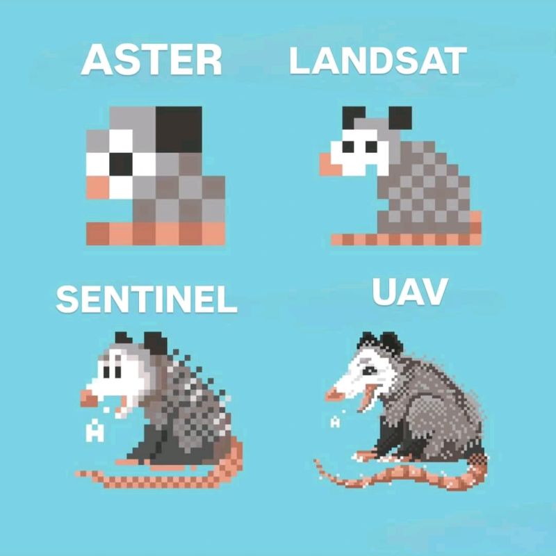
1. Spatial Resolutions: ASTER, Landsat, Sentinel & UAVs
In EO, spatial resolution determines the size of the smallest object that can be detected by a sensor. Choosing the right dataset often depends on the balance between resolution, cost & coverage. Here's a quick comparison:
NEW
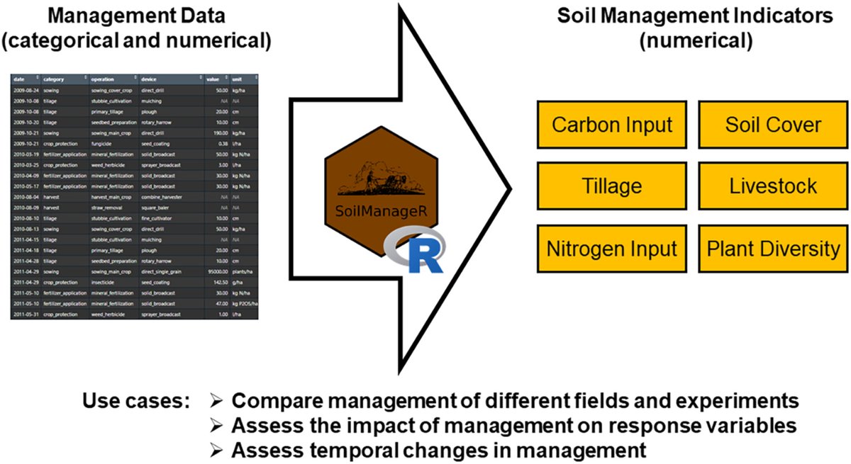
SoilManageR—An R Package for Deriving Soil Management Indicators to Harmonise Agricultural Practice Assessments
Heller et al.
https://t.co/9QVmq2h7j4
@agroscope
@wileyearthspace @SUMjournal@Soil_Science#Soil#Research
It's now incredibly easy to build calendar heatmaps!
Thanks @joseph_barbier for your dayplot library!
Documentation:
https://t.co/QyCBM9FV85
If you like making charts with Python, come learn with us at https://t.co/sCU4unfXJY!
Get the dirt on soil like you’ve never seen before!
The World Soils 250m layers in ArcGIS Living Atlas are the best available medium scale world soils data and maps from the International Soil Reference and Information Centre (ISRIC).
🔸Learn more: https://t.co/0SPl9k5YTQ
📢 𝐍𝐞𝐰 𝐑𝐞𝐥𝐞𝐚𝐬𝐞 (🗞️ Pre-print, Open Code & Data)
𝐈𝐜𝐞𝐂𝐥𝐨𝐮𝐝𝐍𝐞𝐭 now provides 𝟑𝐃 𝐫𝐞𝐜𝐨𝐧𝐬𝐭𝐫𝐮𝐜𝐭𝐢𝐨𝐧𝐬 𝐨𝐟 𝐜𝐥𝐨𝐮𝐝𝐬 learned exclusively from sparse examples! 😶🌫️
Fantastic work led by Kai Jeggle 🚀
More info in 🧵
Code: https://t.co/cJG7B7OFwC