Expertise at the intersection of drones (UAV) and ecology. Our main objective is to narrow the distance between UAV technology and research @Alertaforestal dron
👉NOVA WEB @InForestDron Science Inspiring Future Forests Des del 2015, la unitat ha treballat introduint els drons en recerca forestal, ecològica i sobre biodiversitat. Aquí en podeu veure els resultats @ctforestal @CREAF_ecologia https://t.co/JnZfutouUj
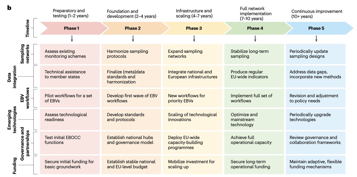
Our roadmap for a European biodiversity monitoring system is out in @NatRevBiodiv, lead by Daniel Kissling. Perhaps the most important output of @EuropaBon_H2020.
Google just dropped another banger 🤯
It’s called PaperBanana, a new tool that generates publication-ready academic illustrations directly from your methodology text.
100% Free.
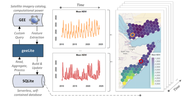
New tool alert: geeLite is an #R package that makes it easier to work with satellite data from Google Earth Engine—locally, reproducibly, and offline. From drought tracking to vegetation monitoring, this streamlines remote sensing workflows.
👉 https://t.co/NvSpmQFKZc
Recent wildfires scorched South Africa’s Western Cape. Landsat tracks the lifecycle—from lush vegetation, to fire, to burn scar—and provides critical data for recovery and monitoring. When every day counts, Landsat delivers.
#LandsatInAction#WildfireMonitoring
🎉Landsat marked some major milestones in 2025—from celebrating Landsat 7’s 26-year legacy to welcoming a new Landsat Science Team. While we look ahead to what’s next, you can read our 2025 Year in Review: https://t.co/hYwqSUZbRc.
#LandsatLegacy
Whether it’s mapping coastlines, monitoring biodiversity, or supporting education in remote areas, drones are changing how we engage with sustainability. Drone Systems and Applications invites submissions that link drone research to the @UNEP SDGs.
▶️ https://t.co/4V2NgBg0MT
Drone use for monitoring Scotland’s biodiversity is growing fast. In this article we explore how UAVs can help land managers track habitat and species change, what tech is involved, and whether to invest yourself or hire a professional. ⬇️
https://t.co/vytGZKpBxK
A map of 260 EUNIS habitat types for Europe has been prepared under the leadership of Sara Si-Moussi and Wilfried Thuiller and published in Scientific Data. It shows the most probable habitat for each 100-m pixel.
Article: https://t.co/9vZqvrbd1S
Map data: https://t.co/GU6Ut3WNuk
🛰️How can novel technologies improve biodiversity #monitoring?
In our last webinar, we explored the evolution of remote sensing for biodiversity & shared early results from the Biodiversa+ Habitat pilot, comparing remote-sensing techniques across Europe.
➡️https://t.co/lzokWBojL3
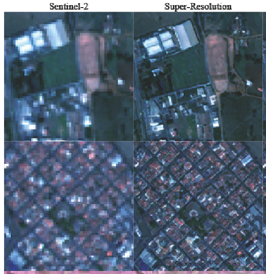
High-resolution satellite imagery is incredibly expensive to acquire.
But there is a way to turn free, medium-resolution data into high-quality images using AI.
ESA just released a framework to make this accessible to everyone:
🆕 in our Vegetation Ecology track: A hot & dry future may shake up Yellowstone forests—think fewer spruce, more fire-tolerant neighbors
📄Simulated postfire tree regeneration suggests reorganization of Greater Yellowstone forests during the 21st century
https://t.co/nMq4O4QU2I
Combining drone based LIDAR, NDVI and orthoimagery with in situ measurements to provide high resolution maps of biomass: our paper is out today in Science of Remote Sensing. 1/#👇
It is time to celebrate! 🎉
#OTD 4 years ago, #Landsat 9 launched 🚀 into orbit – and continues a 53-year legacy of monitoring 🌎Earth’s land masses from space.
Visit https://t.co/iNXF5BV6MU to learn more about the Landsat 9 mission.
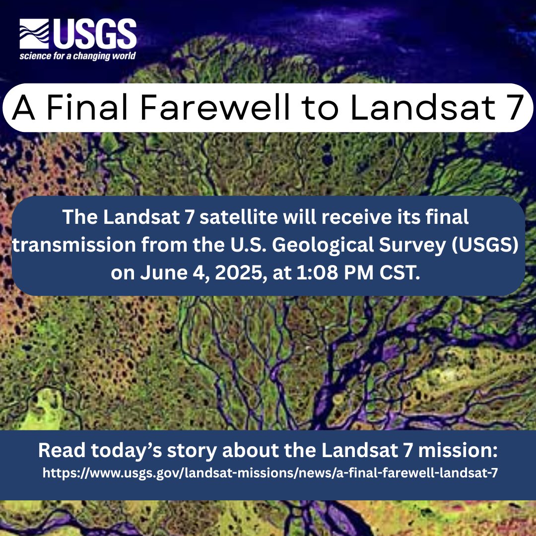
Remembering its 25 years of faithful Earth observation, the USGS and NASA announce the decommissioning of #Landsat 7 from active service June 4th.
Read more here: https://t.co/VYPMec1le7.
Species-specific machine learning models for UAV-based forest health monitoring: Revealing the importance of the BNDVI - ScienceDirect https://t.co/kwmyVrhpBW