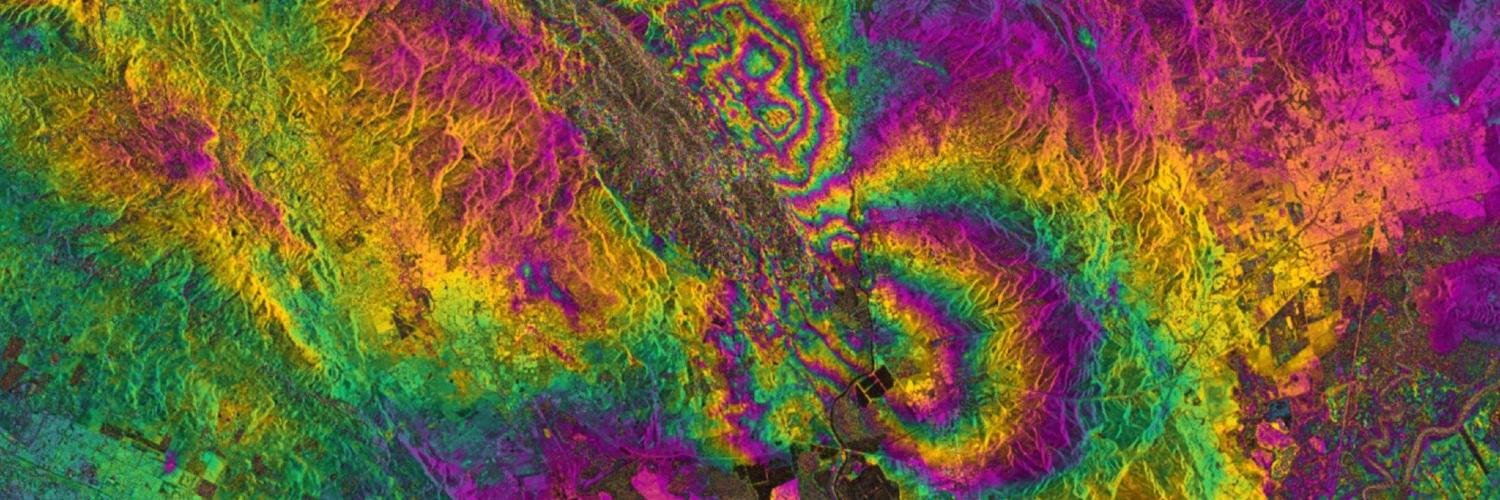
Only for InSAR geeks! Check out our new manuscript: "An Improved Phase Filter for Differential SAR Interferometry Based on an Iterative Method" https://t.co/3ViLS0m4F4 very proud of our collaboration with Juanma's radar group @ Alicante University https://t.co/TYxixSTm4F
The #NISAR project & science teams are proud to announce release of the NISAR Science Handbook. Learn all about NISAR and its many science goals @ https://t.co/G4jo4jVkZn. Proud to be a member of this mission. #GoldenAgeOfSAR@InSARinfo@UAFGI@ESA_EO@NASAEarthData
Planning to buy an Electronic Corner Reflector for radar radiometric calibration and interferometric measurement, any suggestion about suppliers? @InSARinfo @ESA_EOHelp @NERC_COMET@NASAJPL
Come and learn #InSAR at @UNAVCO in Colorado with me and the developers of ISCE from @NASAJPL (including @parosey, @SARscience and @HereshF)! (Or go to Scripps to learn about GMTSAR, it's all good...) Remote participation options are available too! https://t.co/FcwFVOJF2F
We are due for another! Dario Solano-Rojas (@Mr_InSAR) is defending today. He dissertation title is "Geological Hazard Assessments for Mexico City and its Surroundings Based on Synthetic Aperture Radar Interferometry Observations"
Long time in the making, but my latest paper on boundary element modeling of the 2014 Bardarbunga/Holuhraun rifting event constrained by GNSS and InSAR is online: https://t.co/VqycMLBLwx
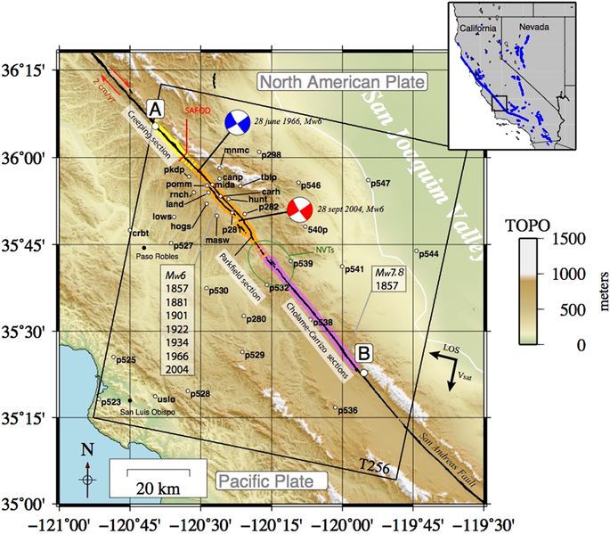
Shallow deformation of the #SanAndreas fault 5 years following the 2004 Parkfield earthquake (Mw6) combining ERS2 and Envisat InSAR https://t.co/qz2b6sD5jr
Good note from Alessandro Ferretti. First two points can be paraphrased to:
1. Don't try to sell people magic beans.
2. Beware of magic bean salesmen.
Timely, in light of recent #InSAR media coverage in UK. https://t.co/ifPW66OCBM
@spodzone It's a processing artefact. Suspect their processing chain has a problem with incorrect averaging across the boundaries between data bursts. QC should have picked that up though, it's very easy to fix.
@EricFielding @seismo_steve It doesn't have a time-series, it's basically just stacking. And beware those intricate details, much of that apparent variation will just reflect that the uncertainties vary hugely spatially due to differences in inputs, plus some potential for bias/aliasing in the velocity calc
If it seems to good to be true... No way I believe results over thick forests, actively worked gravel pits etc. Almost every park area in London is sinking? And only the parks? https://t.co/nIRfPBTBY5
Ready to meet the RUS team at #EGU18?
We will demonstrate the usage of the Open Tools available within the RUS environment focusing on the exploitation of #Sentinel1 InSAR for subsidence monitoring! 🛰️
Tereza, Miguel and Michael will wait for you at 13:30 – Room 2.16