NASA's IMERG algorithm estimated precipitation totals from #HurricaneHilary, which brought record-breaking rainfall to the Southwestern U.S. this weekend https://t.co/I0DWnBnJ0t
For the latest air quality information in your area, visit https://t.co/vqNhiZykOD. The fire and smoke map is an interactive map co-produced by the US Forest Service and EPA that shows fire locations, smoke plumes, and air quality information.
If you're still at #ams2023 and are interested in IMERG, check out Upgrades, Early Results, and Status for V07 IMERG, Mile High Ballroom 1E-F at 3:45 https://t.co/osu0IcZKXF
The NASA / JAXA GPM Core Observatory satellite captured a 3D view of precipitation within #HurricaneIan as it was strengthening south of Cuba on Sept. 26 https://t.co/TcdLoj4bma
Thank you to everyone who attended the seminar!
Don't worry if you couldn't make it! The recording/slides from our wonderful speakers (@JacksonTanBS@ellie_gbr , Dr. Brenda Dolan) can be found on our webpage: https://t.co/PEGN16MPdM.
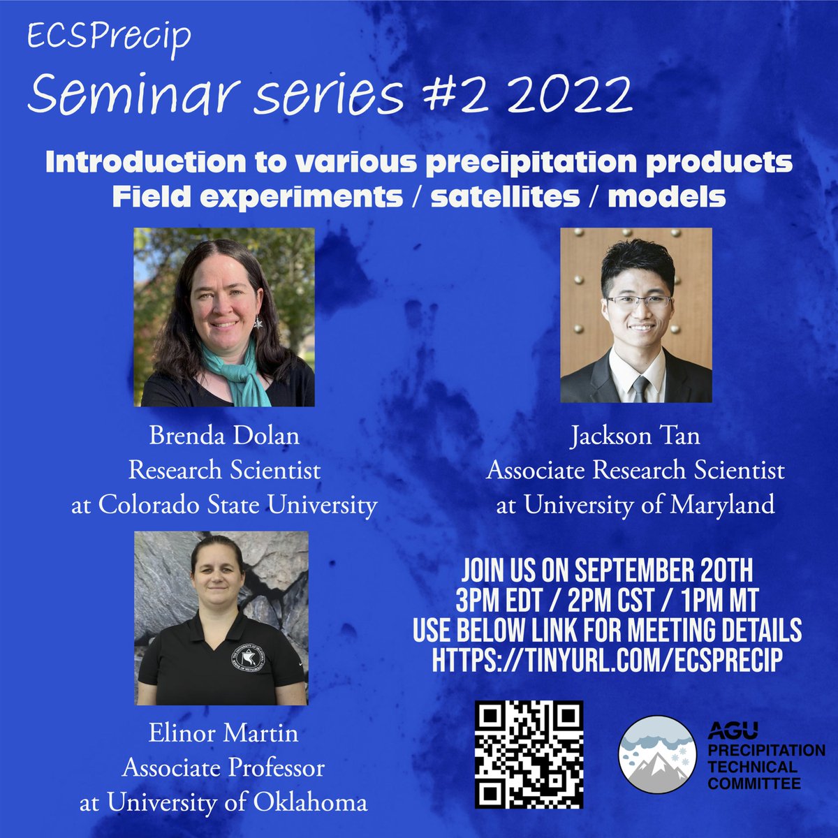
Its tomorrow!!!! Don't miss this opportunity to discuss with our precipitation experts from satellites/fields/models.
@JacksonTanBS@ellie_gbr Dr. Brenda Dolan.
Zoom link on our webpage: https://t.co/6RE3OR2nAh.
Spread the word and reach out to students starting their research!
Second quarterly seminar
Title: Introduction to various precipitation products: Satellites/Field Experiments/Models
When: Sept 20, 3pm EST.
Our amazing speakers: @JacksonTanBS@ellie_gbr Dr. Brenda Dolan
Details on our webpage: https://t.co/PEGN16MPdM.
For Dr. Aaron Piña, the fear of hurricanes as a kid quickly turned into a fascination, and a career in weather research, data, and technology. #PrideMonth
https://t.co/4CJ8XBeNLI
📢 📢 #Precipitation Seminar Series:
From this year, we’re starting a quarterly seminar series! Book your calendar for our first seminar scheduled on June 30, 2022 at 2pm MDT/4pm EDT/ 1pm PDT.
Visit our website for details:https://t.co/9Q0keKpEpn
Our new study provides the first rigorous demonstration that climate models are capable of successfully diagnosing clear-air turbulence and its response to climate change.
In other words, we are very confident climate change is making turbulence worse.
https://t.co/nEH9Yy8VYc
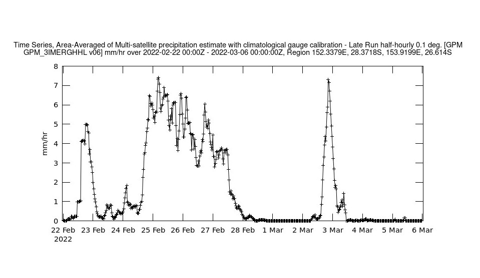
In late February 2022, Brisbane, Australia and the surrounding area received a huge amount of rain, causing heavy flooding. The NASA #GESDISC used IMERG precipitation data, Giovanni, and #GIS to examine the event in detail. Learn more: https://t.co/4EWYrbAPy9
New visualization alert! Watch global temperature changes from 1880 to 2021 by latitude zone. As you can see, global warming isn't uniform around the planet, and the Arctic has been warming much faster than other regions. Learn more and download the video: https://t.co/h64PlcCDsi
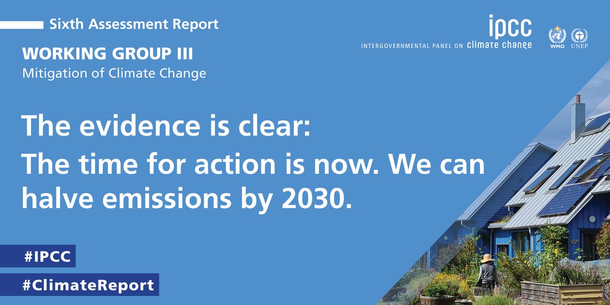
The evidence is clear: the time for action is now. We can halve emissions by 2030.
The #IPCC has just released its latest #ClimateReport on the mitigation of #climatechange.
Press Release ➡️ https://t.co/N9cLJFBbnA
Read the report ➡️ https://t.co/mIdBKgvokW
In the coming years, the Earth System Observatory – a collection of five satellite missions – will provide a complete, three dimensional view of our planet from the atmosphere to below the ocean’s surface. #StateOfNASA https://t.co/9rXa2QwbFr
Our Earth-observing satellites give us a unique view of our planet. Studying Earth from space helps us understand the effects of human-caused climate change, and empowers scientists and decision makers to address climate change with strategies informed by science. #StateOfNASA
Our work in space helps us better track changes here on our home planet. Dr. Christa Peters-Lidard is working with @airandspace to share how @NASA's view helps monitor fires and air quality, water, and sea level rise.
Register for her March 29 talk: https://t.co/pZ9cs91GUk
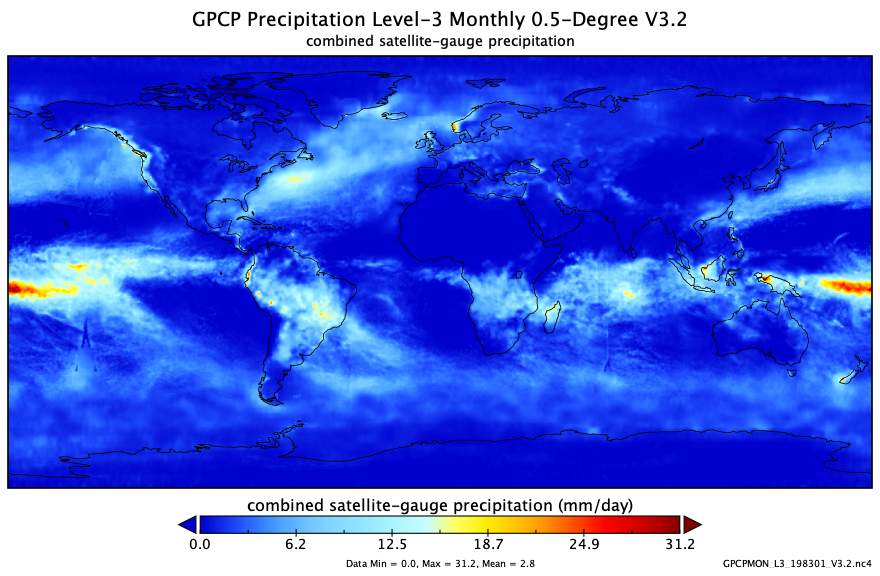
Examine where rain is falling around the world with the new V3.2 of the NASA MEaSUREs Global Precipitation Climatology Project (GPCP) global daily and monthly #precipitation products, released by #GESDISC. Learn more about these data: https://t.co/giEaHoUAO7