After 7 years as a geospatial data scientist, I quit my job.
I'm going all in to tell you stories hidden in satellite data
I've worked on cocoa and coffee supply chain monitoring, near real time flood maps with radar satellites that see through clouds, mapped trees in 3D to prevent wildfires and built pipelines that analyse crop yields at the scale of the US
But I've always kept going back to telling stories
I've done 70+ interviews of data scientists, CEOs, engineers, policy makers and artists all trying to better understand the impact of data, maps & satellites images in our lives
I've made videos seen by hundreds of thousands of people on how satellite & maps work.
So now I'm going all in
I believe the worlds need more people telling stories, of people; that statistics and data changes the world, but people and stories are what resonate.
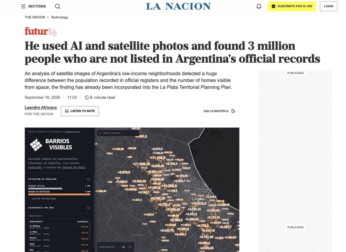
A few weeks ago I already put a video out with @OurRadiantEarth about millions of people being miscounted in Argentina. One of the largest press outlets picked the story up, and now there's a conversation about this problem, that's what I want to go do
This is probably the scariest thing I've ever done in my life, but I'm also really excited about it
If you're a company doing cool, impactful stuff with satellite images, geospatial & data and can't get the world to pay attention, let's work together.
I have some cool stories coming up and some collaborations in the pipes.
So, if that sounds cool, I'll see you around on the internets
Well, @LANACION (one of Argentina's largest media outlets) picked up on the story of millions of people being miscounted
A major news outlet is talking about GeoParquet, @source_coop and @duckdb!
Journalists from @LANACION reached out to Nissim after seeing our video on the benefit of open cloud data and now this is in a major news outlet!
Nissim Lebovits accidentally found 3 million people missing from the official census in #Argentina. We worked with @MaxLenormand to learn more about how.
Watch the full video: https://t.co/YAoEpI3FzW
🎙️ Your Fields of The World podcast playlist:
🌍 Spatial Stack w/Matt Forrest -https://t.co/r08VOvgP6o
🛰️ Satellite Image Deep Learning w/@robmarkcole -https://t.co/9NwtKw5SIF
💡 Great Data Products w/@jedsundwall@OurRadiantEarth@source_coop -https://t.co/3ryOXjDu1f
A Loyal Heights resident is floating an idea for a community-owned redevelopment for the street corner across from Larsen's Bakery. https://t.co/Updv7fL5Pp
A Loyal Heights resident is floating an idea for a community-owned redevelopment for the street corner across from Larsen's Bakery. https://t.co/Updv7fL5Pp
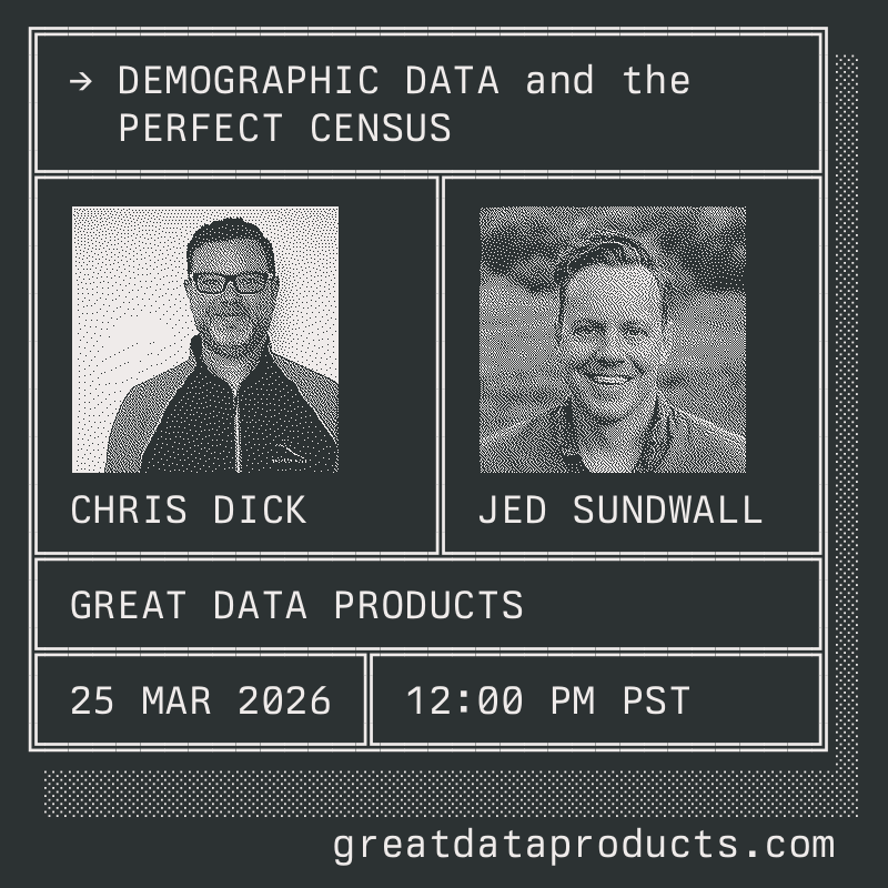
Missed the live podcast? Catch the conversation btwn @jedsundwall & Chris Dick, founder of Demographic Analytics Advisors & former pop estimates researcher at the Census Bureau. They talk about counting people at scale, legal & tech constraints & more
https://t.co/iFGZ6F8UKv
What would a "perfect census" look like from a data science perspective?
🗓️ Wed March 25 at 12pm PDT, @jedsundwall sits down with Chris Dick of Demographic Analytics Advisors to dig into demographic data products. Join the conversation
LIVE on YouTube → https://t.co/3bBE2htqJV
I really enjoyed this chat with @jed.co on his podcast @techsontexts.net
A Pattern Language is a special book. If you’ve read it I hope this conversation deepens your appreciation for it. If not I hope it encourages you to check it out for yourself
https://t.co/gJwm4UUnJ8
Our next Great Data Products #podcast convo is with @GeoSkeptic about how open tech standards evolve. Matt & @jedsundwall will use @STACspec as a case study & will explore how community-driven design made it successful & how standards enable orgs to align w/out central control...
OpenBuildingMap has building footprints, heights, floorspace and 8 categories of use across 2.7B buildings around the Globe. https://t.co/tq4Mg8I0Mf
Thank you Laurens Oostwegel for your great research & thank you to @jedsundwall for hosting the Parquet version on S3.
“Welcome to #CNG2025!” 🌍 @jedsundwall kicks off 2.5 packed days with ~250 attendees from 100+ orgs—all ready to learn & share what it takes to build #geospatial workflows for the cloud
🎥 Watch his welcome 👉🏽 https://t.co/aMibkuyCvW
📝Read the recap 👇🏽
https://t.co/yjvOnpXhIH
🌍 I've developed an interactive web app that allows you to search and visualize open geospatial data from the Amazon Sustainability Data Initiative (ASDI). Try it out:
🔗 Web App: https://t.co/txmUxzjPal
📂 GitHub: https://t.co/3X4L7FYAb5
🎥 Video: https://t.co/NRveDeZtyI
Want to learn more about ASDI? Check out https://t.co/5IN4DriiZJ
#geospatial #sustainability #leafmap #maplibre #opendata
6) A “unicorn for the middle class” (a business that generates $1 billion in increased wages for people who are unemployed or underemployed) should be a new status symbol, in the same way that the Malcom Baldridge award got more firms to focus on quality in the 1980s and 1990s.
A few thoughts. (1). Scenario planning is cheap. It is worth thinking about what we would do in the event of labor market disruptions, even if we attach a small percentage chance to any particular scenario occurring. @jasonfurman