The best bet for an Atlantic system during the next 10 days or so might not be either of the systems currently mentioned in the Tropical Weather Outlook (NE Gulf and off Africa).
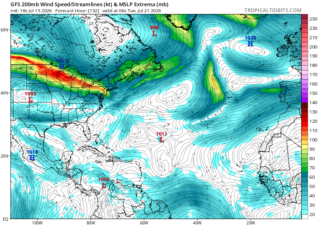
Keep an eye on a trough split over the Central Subtropical Atlantic. A piece of this could find itself under an upper level ridge in a fairly favorable environment (north of the Niño-boosted TUTT). A few Google DeepMind members hint at this scenario.
A ton of surrounding dry air could inhibit development. That's one reason El Niño years still only see limited TC activity even in the "low shear" regions in the subtropics. Being north of or inside a trough inside the most favorable thermodynamic setup.
Just something to watch in an otherwise quiet basin.
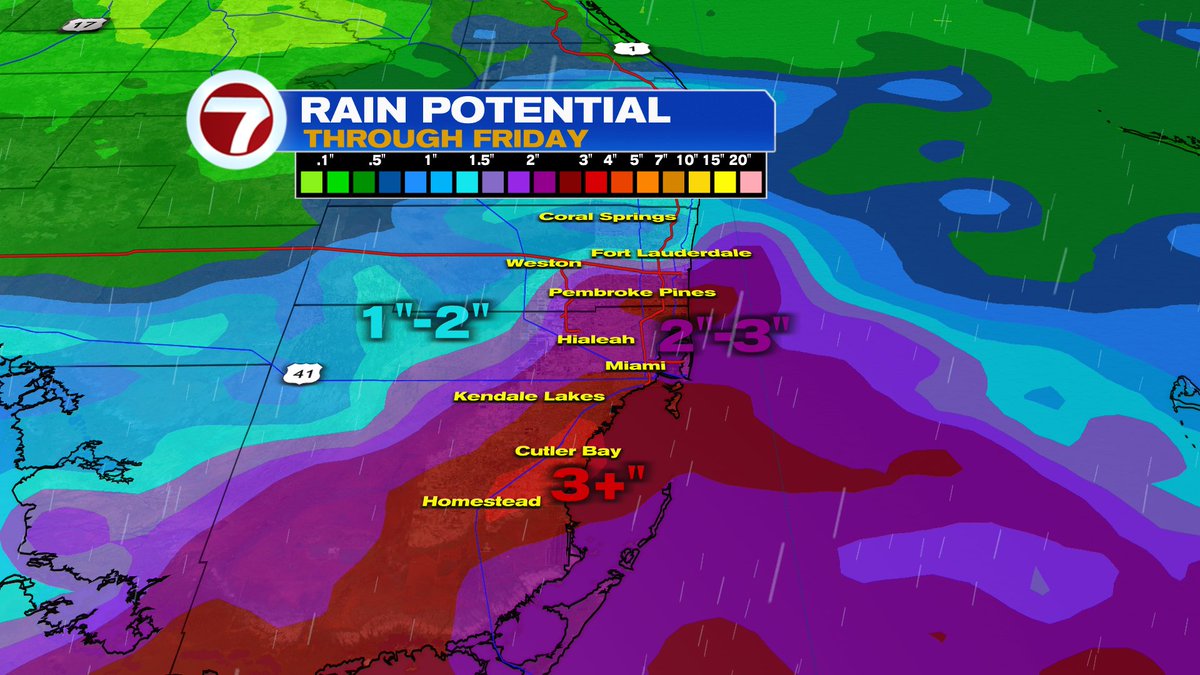
Beneficial rainmaker for the peninsula this weekend. Looks more like a soggy set-up rather than tropical troubles.
However, when a low pressure meets with a lingering cold front in July, there’s always a chance of tropical formation.
We’ll watch the NE Gulf later this week.
A surge of tropical moisture out of the Caribbean will continue to track northward. IF it doesn't fall apart, it may reach SE Florida around the 10 o'clock hour. A few more showers are possible Saturday before a thicker plume of dust arrives by the second half of the weekend.
There's a small spin over Eastern Cuba. This is a low pressure system in the upper levels of the atmosphere. By Saturday, it should swing some moisture our way, but by Sunday, Saharan Dust should arrive and lower the rain chances somewhat.
NEW ORLEANS TORNADO - A potential tornado ripped through the New Orleans Metro this morning. Here’s the possible track based on the power outages. 🌪️ #Arthur
It's official, NOAA releases an El Niño Warning. These hot waters impact marine & atmospheric currents. It makes conditions more hostile in the Atlantic for tropical systems to grow. It also brings the risk for severe weather here by winter.
The constant flow of moisture persists today into tomorrow ahead of a front, leading to rounds of rain and embedded thunderstorms along with lots of clouds.
Isolated areas of flooding will be possible!
While a rare cold front will bring drier air across the northern half of the state, rain could meander across South Florida for the weekend, and winds bring hazardous conditions along the beaches.
https://t.co/06sQ7o0Mit
7Weather is monitoring a deep pool of tropical moisture over the Gulf Waters. It's trapped by a high to the East and a low to the West. Eventually, the Subtropical Jet will push the rain our way. Models suggest its arrival by Thursday.
South Florida’s weather pattern turns wetter late this week. 🌧️⛈️ Deep tropical moisture moves in beginning Wednesday with rain and storm coverage increasing Thursday into the weekend. Heavy downpours and localized flooding may become possible. @wsvn#flwx@abcmiami18@7weather
A lurking, mid-level low near the Bahamas this week will send in moisture but also some drier air, aiding in elevated rain chances the next few days before it turns drier overall later on
Rainy season starts with a bang this weekend! Watch as the rain piles up day by day. A little at first Saturday, then widespread downpours Sunday and Monday afternoon. Up to 3” in some lucky locations! ⛈️
#rain#storm#Florida
The Rainy Season starts Dry this Friday the 15th. By next week, long range models suggest a blob of moisture could help kick it off. A higher rain probability will be possible then.