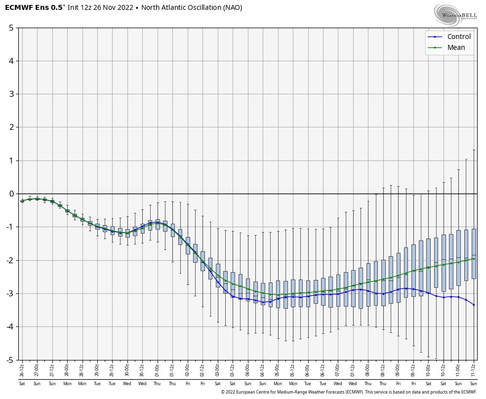
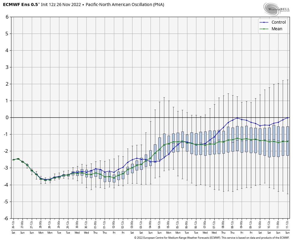
Looking a bit ahead in the Mid-Long Range, strong -NAO with weak -PNA/ Neutral PNA, and -EPO sets the stage for a nice pattern in December. With what the EPS is showing, this is arguably the best December pattern that we’ve had in a while.
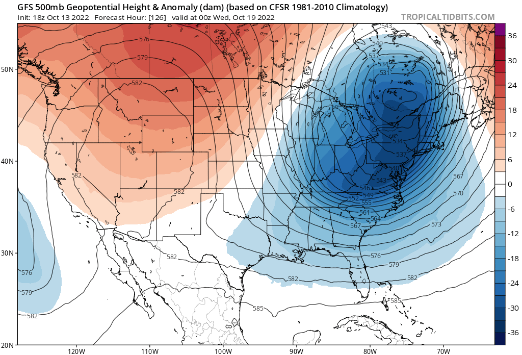
Big trough to swing in next week, likely will bring snow to the mountains, and may even get our first freeze of the season, although that is too far out to see who gets freezing temperatures.
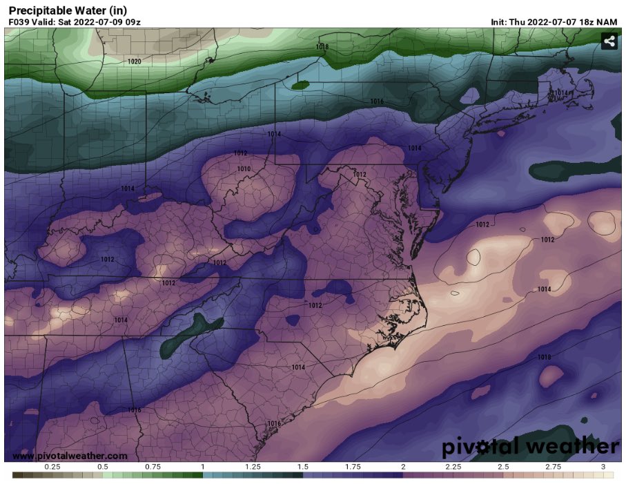
LWX suggesting that we could be dealing with a potentially significant flash flooding event. NAM does have PWAT values well over 2”. There are a lot of uncertainties as of now, but we will have to monitor this closely.