The first comprehensive analysis of vegetation changes across Europe, based on the ReSurveyEurope dataset, is out! In an article led by Stephan Kambach, we analyzed 57,390 time series of vegetation plots. https://t.co/LQIjuICQW0
CALL FOR PAPERS: Special Issue in @Land_MDPI on "Advances in Remote Sensing for Monitoring Agricultural Land Use and Land Cover Change Under a Changing Climate"
We look forward to receiving your original research articles and reviews.
https://t.co/T7dfyuJzU9
🌿 Field Botany Course at #ATBC2026
Join a hands-on course in Xishuangbanna, China, and develop skills in plant ID, taxonomy & tropical ecology with international experts.
🎓 Student support available
🔗 Apply: https://t.co/6sRobHzGRU
Excited to share our new paper published @JEcology . We found warming advanced leaf senescence in alpine meadow plants on the Tibetan Plateau through advancing leaf emergence and increasing soil drought. https://t.co/4wGhro4DOo
⏲️ Only one week left to apply to this year's #iDiv Summer School!
Accepted MSc students and doctoral researchers will receive expert guidance through hands-on data collection, trait measurements, phenology assessments, and ecological analyses. 🌿📏📊
Deadline: 31 March 2026
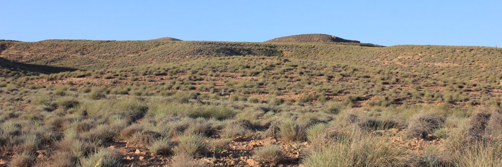
☀️This dryland study unveils diverse drought resistance strategies in annuals & shows that in open areas, more drought-resistant populations are more stable over time.
🔍Article: https://t.co/VVe6UCmJfq
📰 Blog: https://t.co/FOEr04ioeL
Detecting airplanes at DFW Airport from a single text prompt.
@Meta's Segment Anything Model 3 and the geosam R package make powerful image detection tools accessible.
📄🌿 Nuestro artículo ya está publicado en el nº 29 de Conservación Vegetal (CV29).
Gracias a la revista y a todos los coautores por el trabajo y la colaboración.
👉 Número completo https://t.co/hbMVUFcttl
¡Felices fiestas! ✨
🌟 The GeoAI QGIS Plugin v0.3.0 has officially been released! It has transitioned from an experimental phase to become a fully-fledged official plugin!
The smoothify package has been integrated into the GeoAI package to enhance AI-derived natural features, such as water bodies.
With just a few clicks, you can now harness the power of AI-driven spatial analysis directly within your QGIS workflow!
Important: For a smooth installation, make sure you install QGIS via conda-forge, so it’s compatible with PyTorch and other GeoAI dependencies.
🔗 Plugin Page: https://t.co/MkQtooIWL6
📖 Installation Guide: https://t.co/m6Kqs0KEut
📺 Full video tutorial: https://t.co/v4sr3C9nVk
👍 Like the plugin? Show your support by giving it a thumbs up on the official plugin page!
#QGIS #GeoAI #OpenSource #Python
🌿🌿 Mapping Seasonal Spatiotemporal Dynamics of #Alpine#Grassland Forage #Phosphorus Using #Sentinel2 MSI and a DRL-GP-Based Symbolic Regression #Algorithm
✍️ Jiancong Shi et al.
🔗 https://t.co/FzaIpCN7HE
Temperate deciduous forests are found in three global regions. We compared taxonomic and phylogenetic diversity of forest plant communities among these regions in a new Ecography article led by Javier Loidi and Josep Padullés Cubino:
https://t.co/CQ0LeYnAkJ
@EcographyJourna
Our new manuscript published in @plantandsoil highlight the significant role of the soil physicochemical environment on microbial functions that regulate enzyme production and respiratory metabolism in response to carbon availability. https://t.co/62Wy1JR7b3
Ready to turn your research into global impact?
Join the KAUST Global Fellowship Program and help shape the future of science and innovation, advance your independent research career, and tackle global challenges at a world-class university.
Calling all coders!🧑💻
The 2025 NASA Software Catalog is here, featuring programs developed by @NASA_Technology for our missions that you can use for your projects. Check out the free, downloadable programs at https://t.co/krKTe5xipB.
One of my recent articles published in Frontiers in Forests and Global Change just reached a new impact milestone. Here is the link if you would like to read our research: https://t.co/yyuNzJBPnM