@polybispo@NatureEcoEvo 🚨🔥🛰️our new paper lead by @polybispo, noticed that "Overlooking vegetation loss outside forests imperils the Brazilian Cerrado and other non-forest biomes"
@NatureEcoEvo
link: https://t.co/b1Hwx08vjK
1/4 In the first episode of Season 14, we talk to Dr.
@Vivianribe about the challenges and opportunities of the new European Union Deforestation free Regulation (#EUDR) in the Earth Observation Sector. https://t.co/NGZIwZigBQ
#forest#earthobservation#deforestation#supplychain
@polybispo@NatureEcoEvo 🚨🔥🛰️our new paper lead by @polybispo, noticed that "Overlooking vegetation loss outside forests imperils the Brazilian Cerrado and other non-forest biomes"
@NatureEcoEvo
link: https://t.co/b1Hwx08vjK
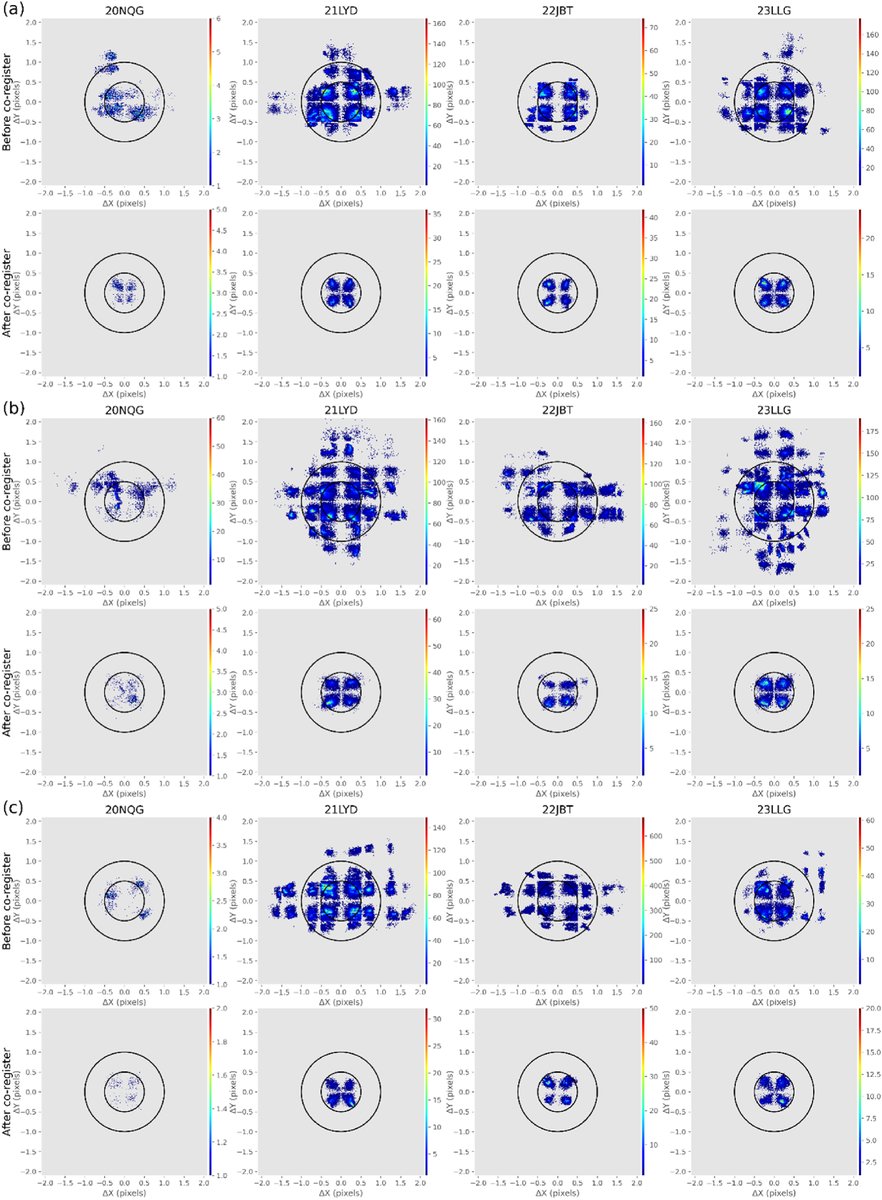
🛰️Our new paper, led by @oldoni_lucas at @dsrinpe, proposes a framework for the automatic registration of WFI images (#CBERS-4, #CBERS-4A, and #Amazonia-1)
🚨This work presents the first study to assess the geometric accuracy of WFI images.
Link: https://t.co/pGCPbQP9U1
Deforestation alerts in the Brazilian Amazon in 2022 have already surpassed previous years, and you can check where/when it is happening week by week using the Terrabrasilis Situation Room - soon also for the Cerrado https://t.co/7f45HBHQpf
BDC team is pleased to announce the new release of the Brazil Data Cube Explorer! It introduces enhanced features to access and visualize image time series from EO data cubes and land use and land cover trajectory data sets. https://t.co/ZZHB0SuNg9
#brazildatacube#inpe#diotg
Como escrito em @ScienceMagazine , os danos ambientais da pecuária se estendem além da Amazônia - pode usar ferramentas como @dopastoaoprato para controlar a origem da carne vendida em todo Brasil e incentivar uma pecuária mais transparente e sustentável https://t.co/5QyiJoUJXw
We are used to forecasting floods, fires, and such. But could you have an early warning system that forecasts potential changes in biodiversity? YES! @andrepazv@ana_bosslady and I combined near real time remote sensing and ground data to show how it could be done! @GEOBON_org
To All attending #ISPRS2022: If you are interested in unsupervised #segmentation and field size using @Planet imagery, come to visit our poster at Poster Session 1 - 7th June. Our work: https://t.co/pHt3K03ZFZ @PMeyfroidt @philrufin
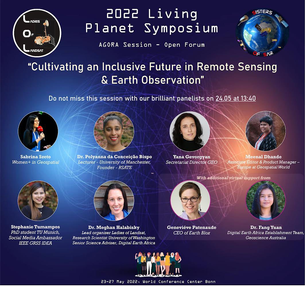
We are kickstarting ISPRS 2022 with a forum entitled, “Women in Remote Sensing, Photogrammetry and Spatial
Information Science,” in
partnership with the @LadiesOfLandsat. The forum aims to connect women in our field, within and outside ISPRS.
#ISPRS2022
Join us at #LPS22@ESA_EO
1. "#Mapping field size in the emerging #agricultural frontier of Southern Africa: New insights from the MIDLAND project" on Tuesday – 24.05.2022 - Poster Session Day 2 @Michelle_Picoli
WE ARE HIRING A GIS SPECIALIST! Full-time, open ended contract (i.e. permanent position). Come help us shape and advance geospatial teaching and research at @StirBES! Major perk: you get to interact with me a lot😄! We also have cool drones and other toys!
https://t.co/9ui2va9sFu
As our work on emerging land use frontiers in Southern and Eastern Africa progresses, we have now opened a Blog section on our website:
https://t.co/3atrAKPjTO
@GlobalLandP @ELI_UCLouvain @frsFNRS
"If we don't make efforts to transform the culture of geoscience, we are forcing marginalized individuals to suffer more and more harm..." https://t.co/WeKJh9qqb0
What have you done to change this reality? We invite everyone to #breakthebias! #InternationalWomensDay#EOchat