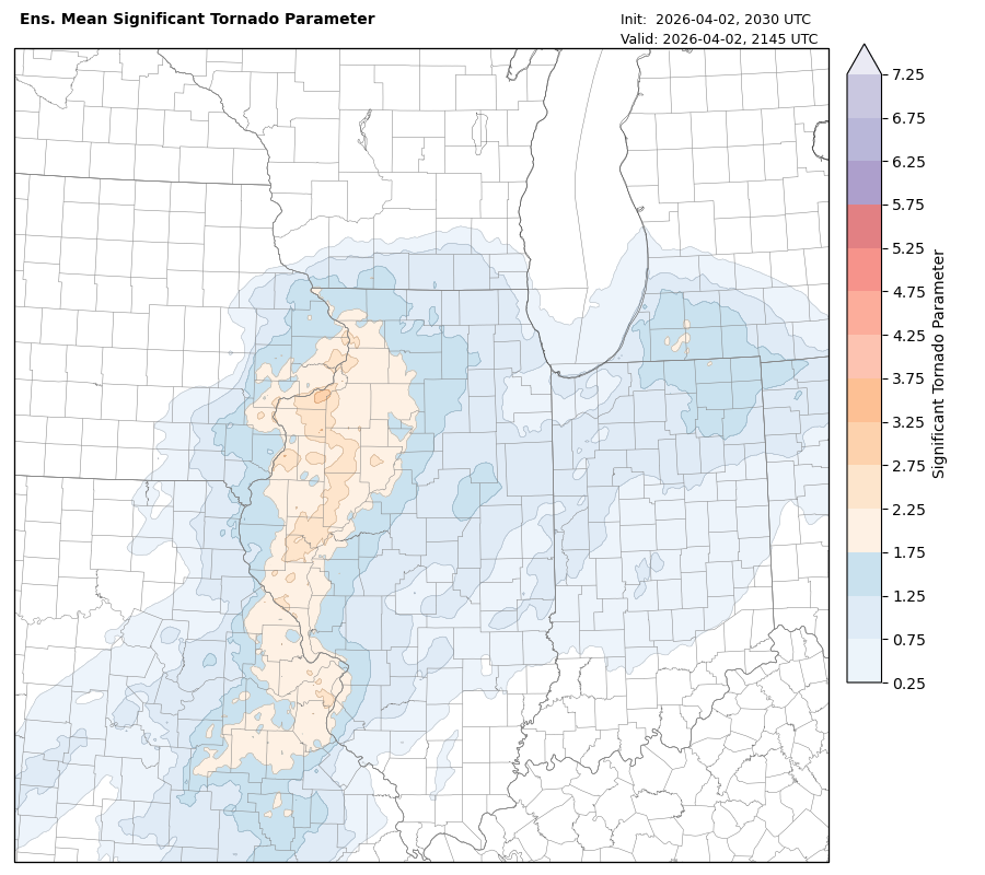
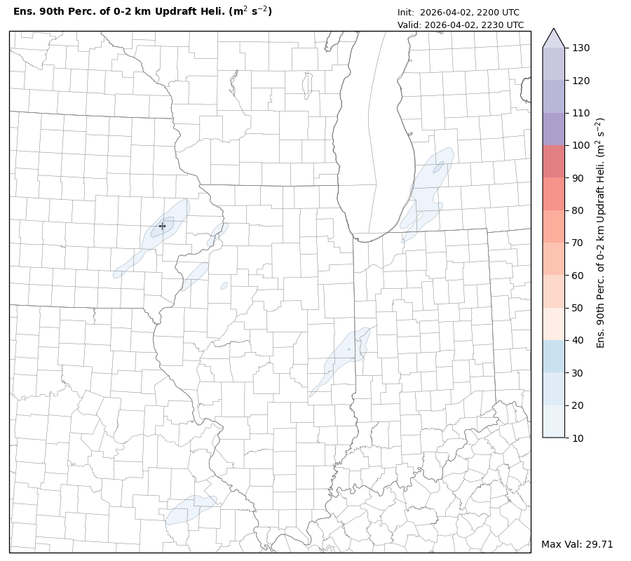
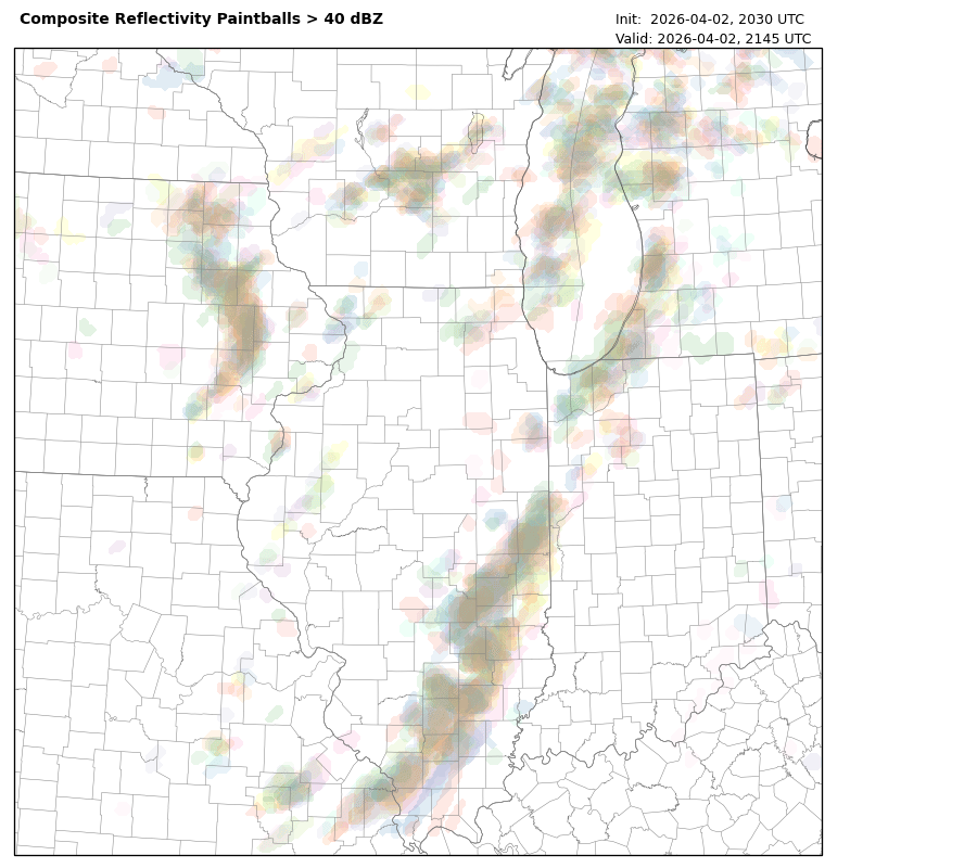
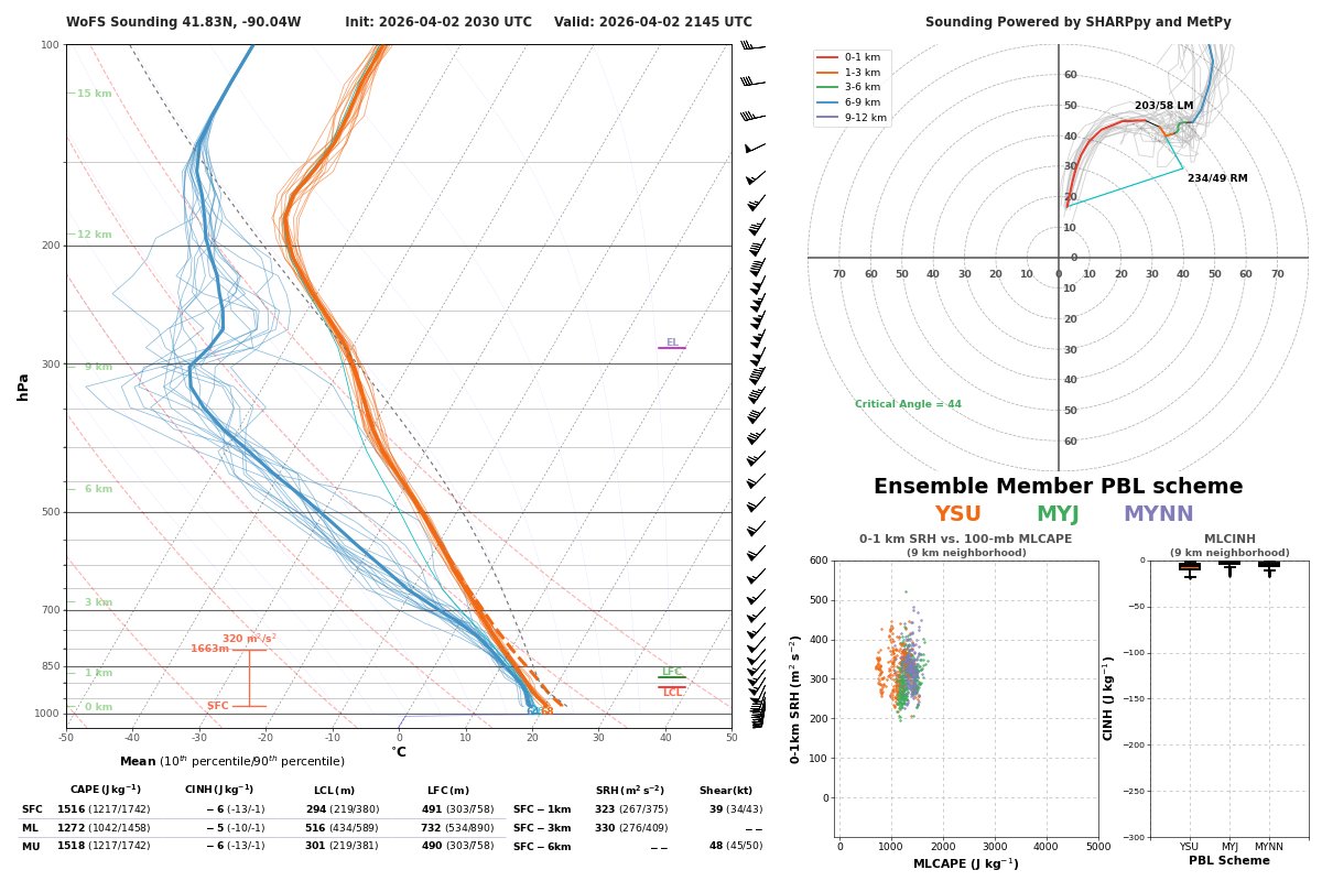
While WoFS hasn't fully initialized the cells in Southeast IA, the environment in Western IL downstream of those will be quite favorable for tornadoes over the next couple hours or so.
As we mentioned earlier, if these storms organize and sustain, strong tornadoes will be possible.
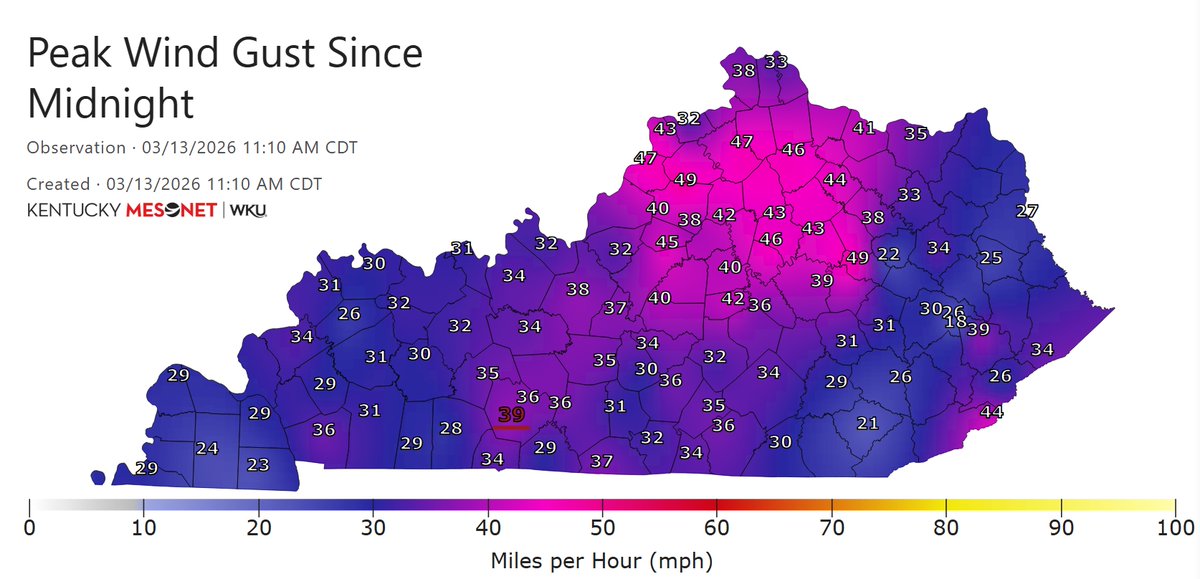
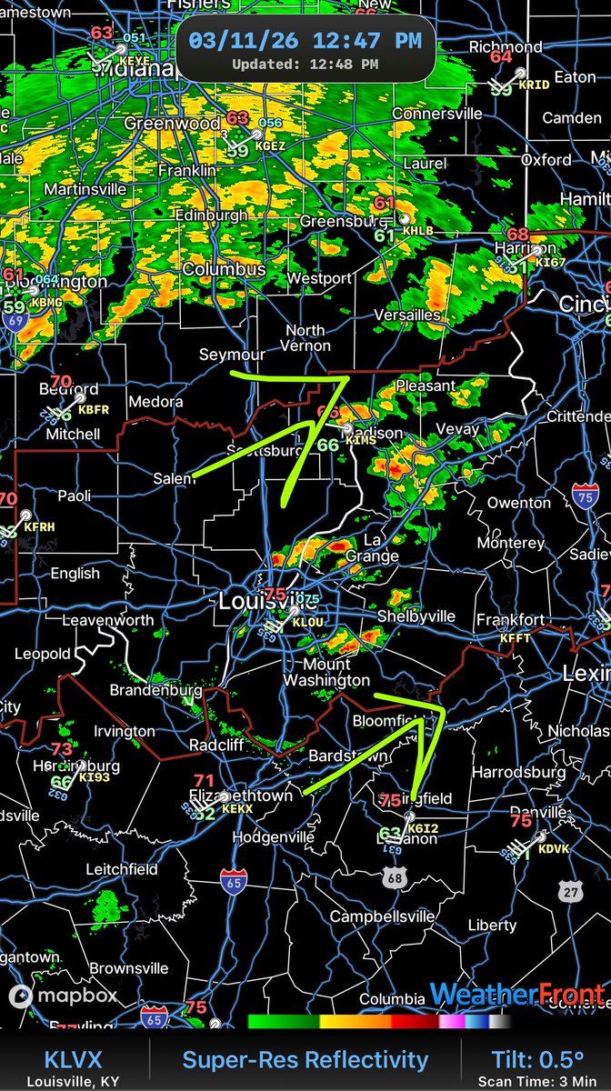
It's getting pretty windy across the Bluegrass this afternoon. Wind Gusts have generally been 35-45mph peaking up to 50mph. Cannot rule out isolated gusts above 50mph. #kywx
6:48pm ET:
~ This is it, Kentucky. The last area of concern. The severe warning has been knocked back down to 60mph winds and is heading between Jackson & Hazard. The cell in Williamsburg has flirted with being severe at times so we'll watch that one too. Damaging winds are the only real concern. - George
RIGHT NOW:
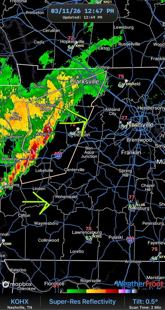
Storms have been tamed a bit across KY. Some showers are beginning to drop heavy rain, brief gusty wind at times across the Louisville vicinity moving NE along I-71.
As for TN, a strong, *not Severe* line is moving EAST toward Nashville. Gusty winds and small hail likely.
But, for Central/South-Central KY, quiet and cloudy. Few showers likely as these waves on both sides will clip and spread showers soon.
-Mike
Looking at the trend from the last HRRR runs there is a clear signal that we are going to have a bit more CAPE in the afternoon wave than originally thought (this matches radar too)
Expecting a couple of severe storms this afternoon! #KYwx
WNK ALERT DAY – Wednesday (OUR FORECAST)
A fast-moving line of storms may cross Kentucky late Wednesday into Wednesday night.
Areas in orange have the greatest potential to see stronger storms capable of damaging wind or isolated tornadoes.
The exact track of the strongest storms may still shift over the next 24–36 hours, so everyone across Kentucky should stay weather aware.
- There is also a Low risk of Severe Weather in FAR West KY, Tuesday. Transparently, this doesn't look likely, so we're focusing more on Wednesday. Next update comes TONIGHT! - George
Live emergency update on a bimodal strong #tornado threat tomorrow, March 10 afternoon and evening along a warm front from far northeastern Missouri across northern Illinois into northwestern Indiana, and also ahead of a favorable trough shape in West Texas. I would not be shocked if both modes were a later show, ramping up near sunset into the overnight.
We will be activating full-blown #stormchasing mode!
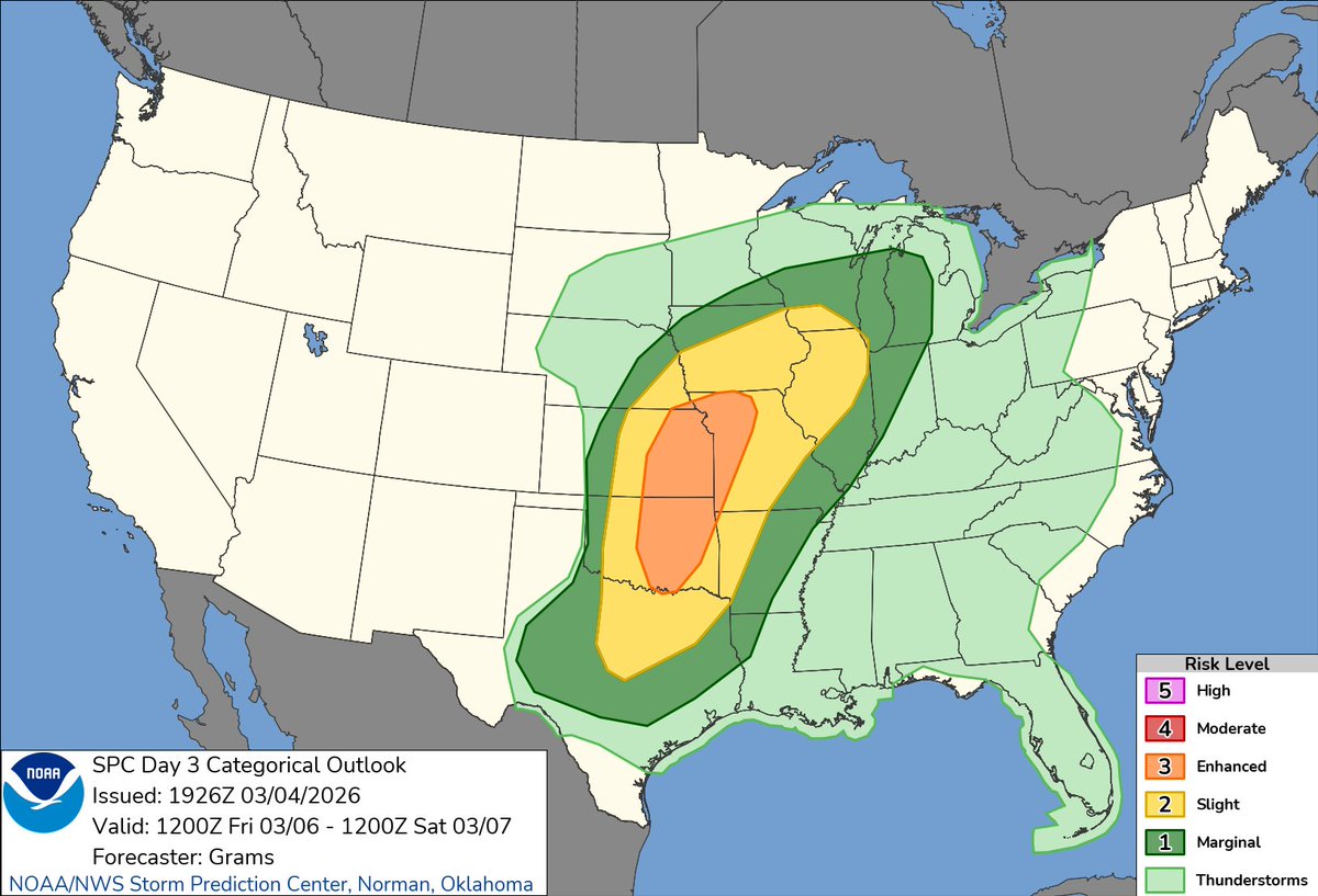
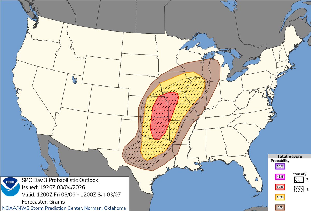
The Enhanced Risk on Day 3/Fri has been expanded Northeastward into Northern Missouri, with a massive expansion of the CIG1 probabilities in the Probabilistic Outlook.
All significant severe hazards, including tornadoes remain possible Friday afternoon and evening.
We're looking at high temperatures a good 20-40 degrees above average across the Plains and Midwest Tuesday and Wednesday. Take a look! https://t.co/dSR8iuD7sN
Lexington is under a Winter Weather Advisory until 2 AM EST Wednesday, Feb. 4. A wintry mix of rain & snow is forecast to begin around 5 PM. Plan on slick roads. Slow down, leave extra space between vehicles, & use headlights! Winter driving tips: https://t.co/wUuoCJ1fRG
Kentucky, this will be our 15th major weather disaster in the last six years. We know what to do. I signed a state of emergency, making sure we are prepared to respond at the state level. 1/2
With a significant winter storm expected to move into Kentucky late Friday and last through the weekend, Gov. Andy Beshear says state agencies are already taking steps to prepare and keep people safe. https://t.co/s4QoSw0CDQ