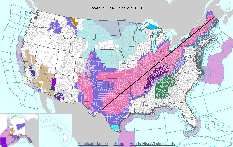
To give you an idea of just how wide of an impact this winter storm will have... you can drive in a (relatively) straight line from Crockett County, TX to Aroostook County, ME (on the border of Maine and New Brunswick) and never be out of a Winter Storm Warning! 🌨��❄️ #txwx #sjtwx
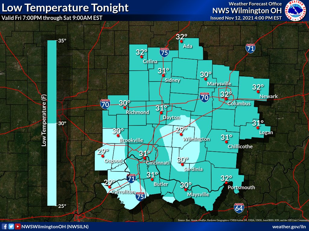
As rain starts to transition over to snow, sleet, and freezing rain along and northeast of I-71 tonight, please remember to use extra caution on roadways. Even if a road does not appear to have snow or ice, it still may still have black ice that you can't see.
[3:50 PM] Snow will overspread the area during the predawn hours Sunday and continue through mid afternoon. The greatest accumulations are expected near/north of I-70 with little to no snow south of the Ohio River. Visit https://t.co/nYG1ndpTB5 for more info for your area!
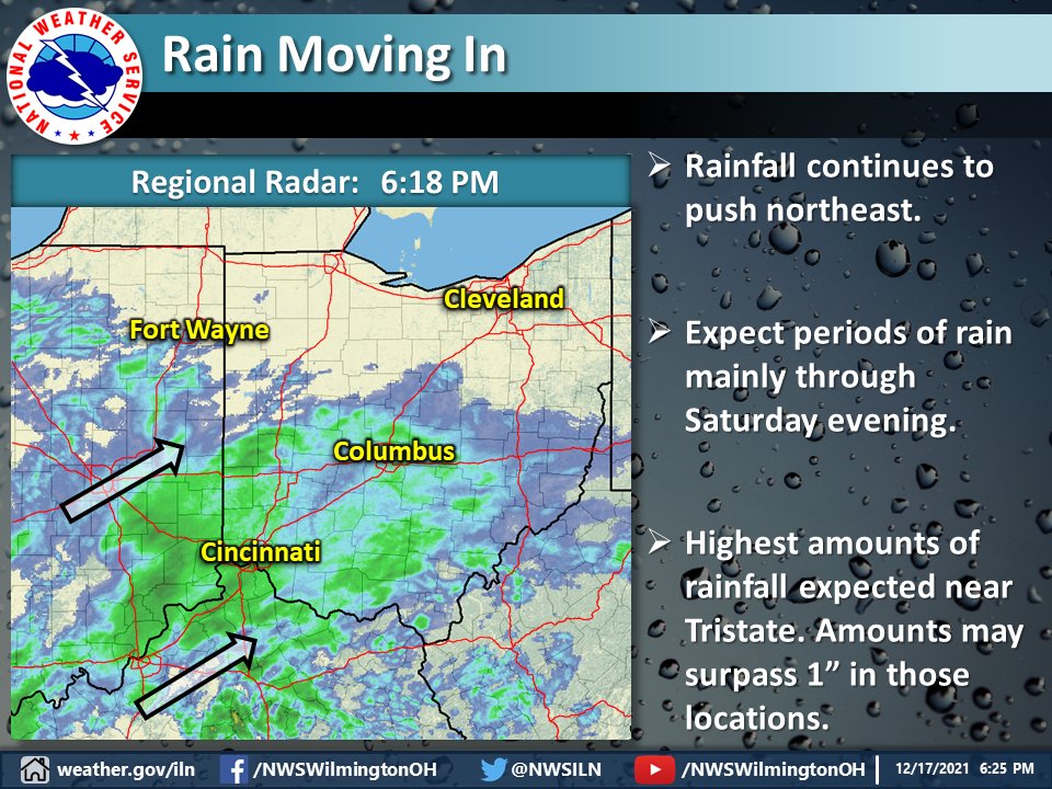
Radar imagery shows rain overspreading most of the Tristate and pushing further NE into central OH. Rain chances will be highest tonight through Saturday afternoon before a cold front moves through. Most locations will observe 0.5"-1.0", but up to 1.5" is possible near Tristate.
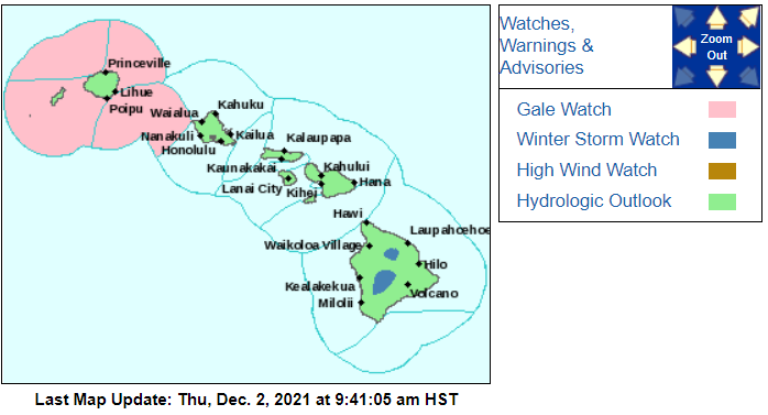
As of 3pm EST, only two states in the U.S. have a winter weather product issued within their borders. One is Alaska and the other? Hawaii! 🌴 The current snowpack on Mauna Loa's summit can be seen with visible satellite, with more snow expected to fall this weekend.
Night night sweet dreamies
Almost everything will work again if you unplug it for a few minutes.
Including you.
Please do look after yourself & rest when you need to as you matter 🧡
#CatsOfTwitter#CatsOfTwitter#CatsofTwittter#catsofinstagram
Moongazers unite! The longest partial lunar eclipse of this century will occur overnight, peaking early Nov. 19 at 4:03am ET (09:03 UTC).
Find out what parts of the world will be able to see it: https://t.co/wEuWtoZCMl
A partial lunar eclipse will be visible from North America tonight, lasting from 2:19 am to 5:47 am ET—the longest eclipse of its kind in 580 years!
#DYK that #satellites sometimes see lunar eclipses? NASA's EPIC camera on @NOAA's #DSCOVR 🛰️ caught this one on Sept. 27, 2015.
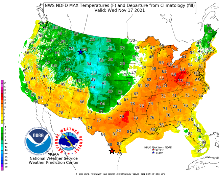
Here's a look at #forecast high #temperatures for #Wednesday, November 17. Ahead of a strong cold front pushing east and south through the Central U.S., above normal highs are likely from the Great Lakes, Ohio Valley and Mid-Atlantic to the Lower Mississippi Valley and Texas.
Experience the Butterfly Nebula through data sonification as it tears across space at more than 600,000 mph (966,000 kph). The “wings” of the butterfly are identified by strings and synthetic tones, while stars are represented by a digital harp: https://t.co/qVaNikWnPy
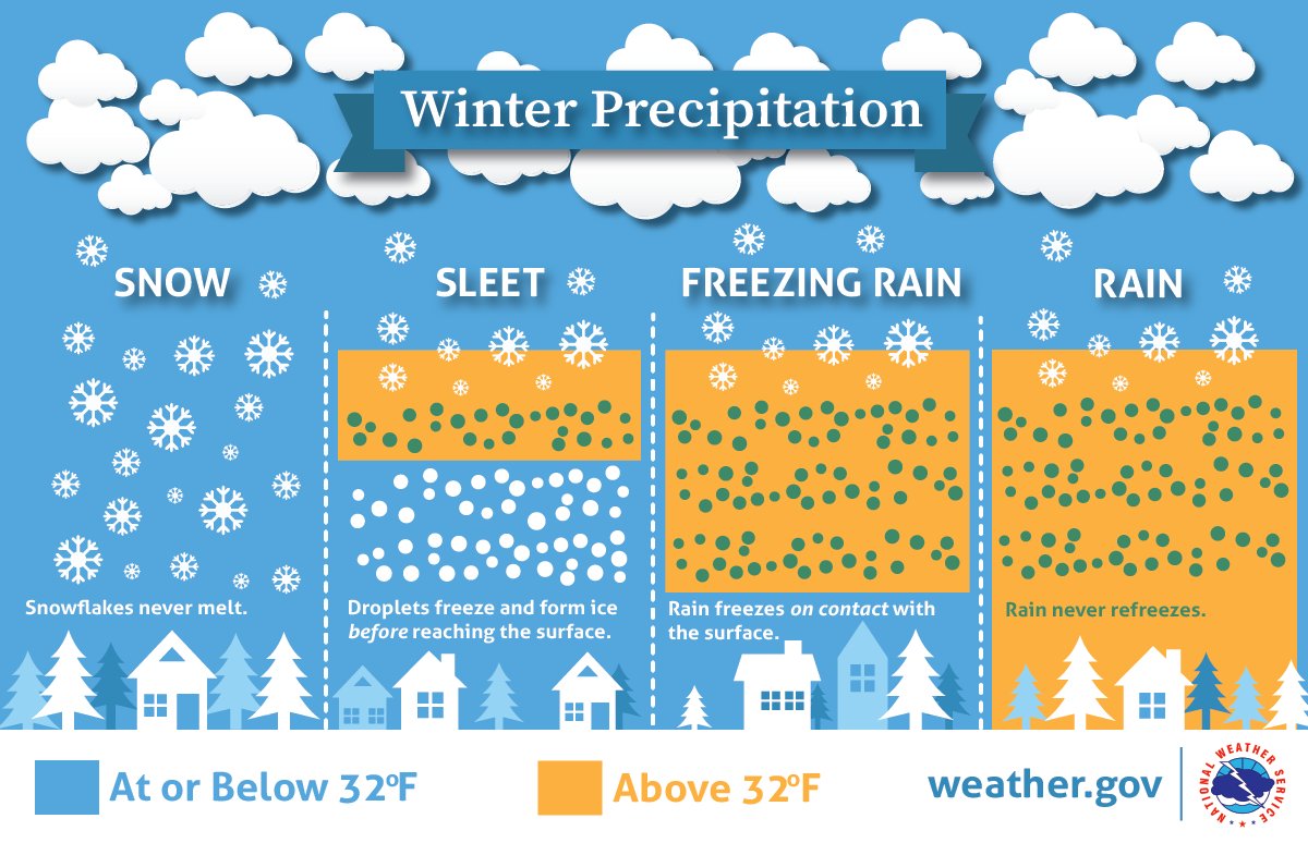
Want to learn more about what helps determine the winter precipitation types? This image provides a top-down approach of how the depth of the cold layer can impact what type of precipitation you’ll see on the ground. Visit our webpage for more information: https://t.co/ayWepBgwuN
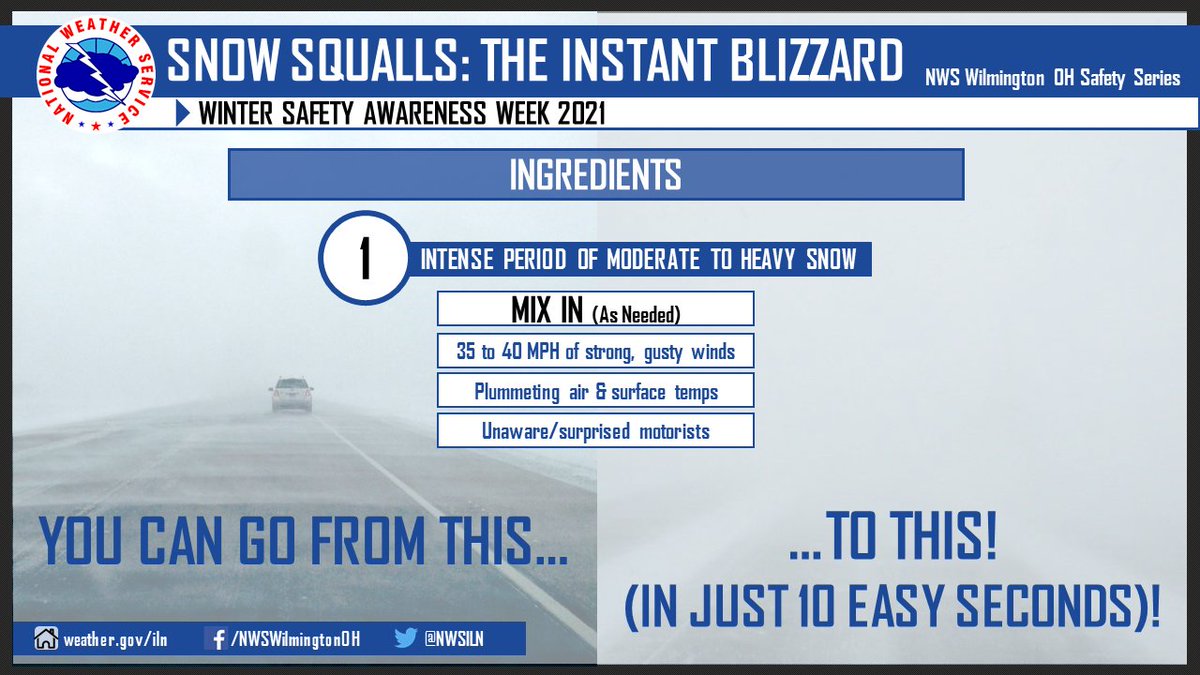
There's instant coffee. Instant mac n' cheese. Now introducing - the "instant blizzard." Snow squalls can bring blizzard-like conditions (in as little as 10 easy seconds!) But wait, there's more! Just think of snow squalls as "thunderstorms with snow" Quick-hitting & impactful!


![NWSILN's tweet photo. [3:50 PM] Snow will overspread the area during the predawn hours Sunday and continue through mid afternoon. The greatest accumulations are expected near/north of I-70 with little to no snow south of the Ohio River. Visit https://t.co/nYG1ndpTB5 for more info for your area! https://t.co/9U8Ptl09Af](https://pbs.twimg.com/media/FJu9KhmUUAELhzu.jpg)