We are thrilled to introduce the revamped TOLNet Ozone Lidar website, your go-to source for comprehensive ozone profile data!
New TOLNet URL:
https://t.co/oHHVudwbuU
Please message us to add your name to our mailing list!
The Tropospheric Chemistry group has another opening in mass spec. Please consider applying or help us to circulate !
CIRES/NOAA CSL Post-Doctoral Associate or Research Scientist in Chemical Ionization Mass Spectrometry https://t.co/Nq759jKJVv
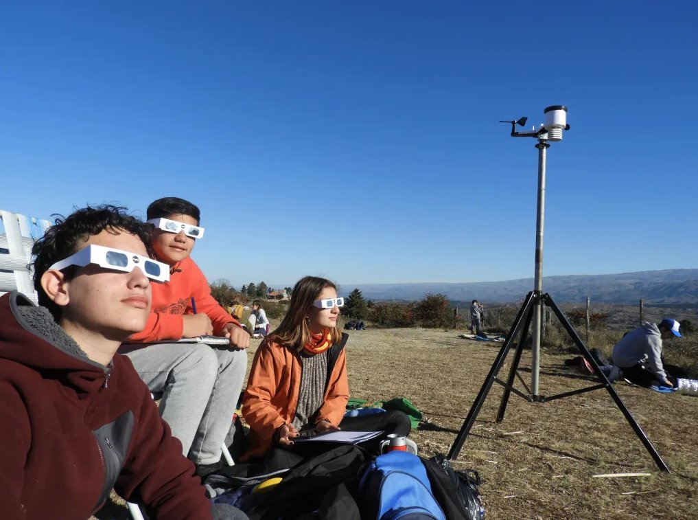
Got plans for the April 8 total solar #eclipse over North America? Want to @DoNASAScience?
Measure air temperatures and snap photos of clouds with the GLOBE eclipse tool! The data help @nasa scientists studying how the Sun influences climates on Earth. https://t.co/vglkn1tAv0
Nice visuals of NO2 from TROPOMI yesterday (2/20). Generally above average NO2 due to relatively stagnant winds. Also primetime for prescribed burning in the South Central & Southeast US. More images like these at: https://t.co/M9xBgPkadO
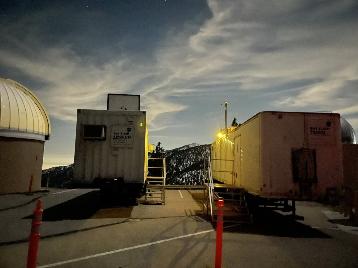
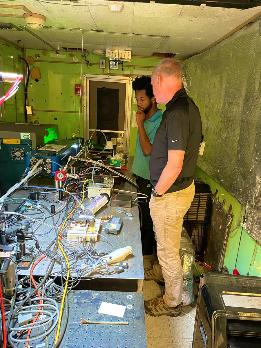
See the just published work on the first-ever on-road, mobile ozone and aerosol lidar retrievals. I am happy to have been part of this great work coming out the @NASA_TOLNET team. #ozone#aerosol#lidar#NASA#TOLNet
Link: https://t.co/Bg1exDSxyT
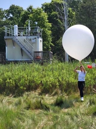
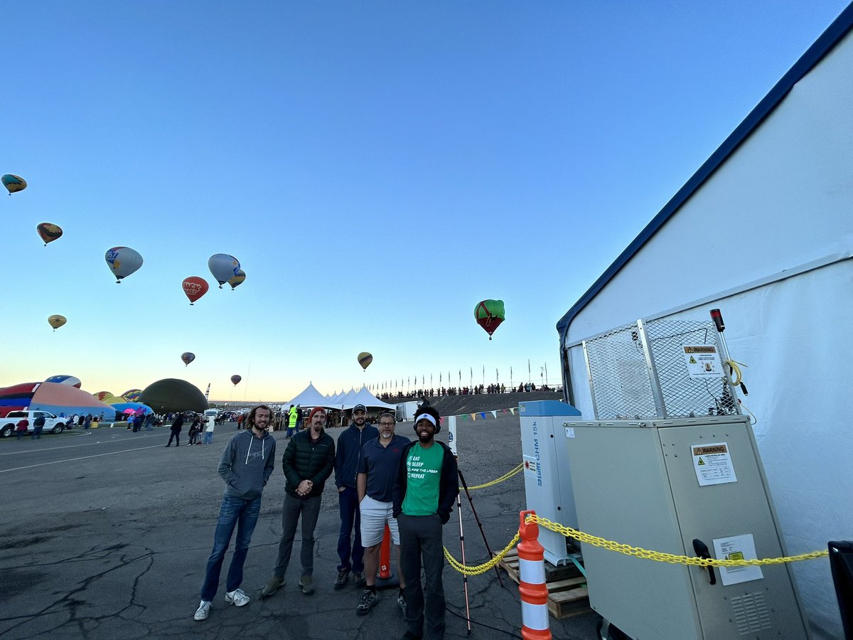
Balloon Fiesta Crew!
We deployed our SMOL ozone lidar and other ozone sensors to Albuquerque to show the public the all the fascinating research we’ve done over the last few years.
We will also host some ozone sensors on several balloons!
TEMPO, the first space-based instrument to continuously monitor North American air quality with the resolution of a few square miles, released its first maps: https://t.co/qJoWiM128F
TEMPO studies the effects of traffic, fertilizer, and fire to the neighborhood level.
This month, scientists from @NASA, @NOAA, and several universities are measuring air pollution in U.S. megacities!
NASA’s STAQS mission is studying air quality from sidewalk to satellite. The @noaa AEROMMA project is measuring atmospheric chemistry.
The STAQS team is tracking where air pollutants come from, how they change hour by hour, and which neighborhoods are disproportionately exposed to unhealthy air. https://t.co/S7u9fT4Dkm
From city street to stratosphere 🏙️🛫🛰️
This summer, @nasa’s STAQS mission is mapping air pollution in 3D across several megacities: New York City, Chicago, Los Angeles and Toronto. https://t.co/S7u9fT4Dkm
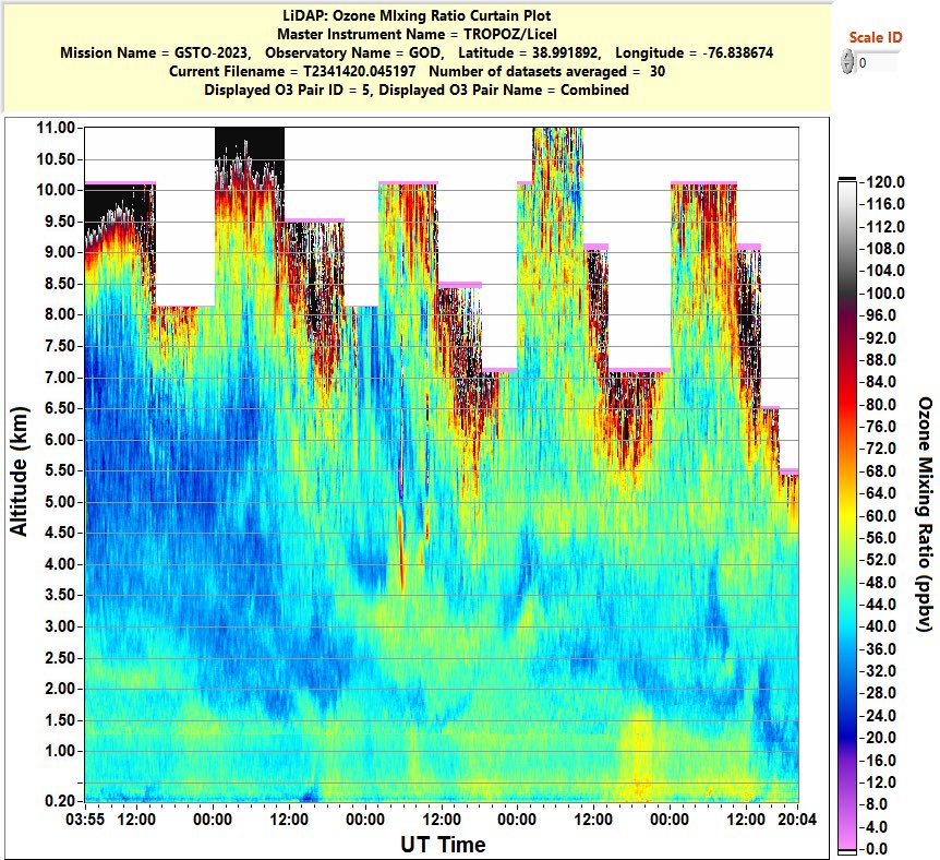
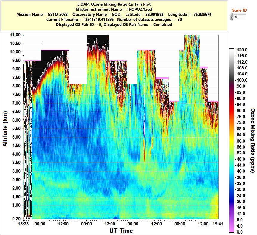
@NASA_TOLNET real time observations at @NASAGoddard over the last 4 days. Boundary layer ozone ramping up in the last few hours (1 min obs exceeding 72ppb)