What’s going on here? 🤔
The poles are the only places ICESat-2 can’t gather data. Instead, the satellite’s orbit is designed so that it can better study the edges of the polar ice sheets and sea ice, where much of the change is happening.
@CDCgov The work builds on 20+ years of collaboration between NASA and the CDC.
The partnership illustrates how NASA shares information freely and openly to the public, as well as agencies and industries around the nation. https://t.co/jS81Aj0R1M
Goooal! ⚽
During the #FIFAWorldCup, NASA air quality data is helping @CDCgov and its partners better understand the air that soccer players, fans, and nearby communities are breathing during the 2026 games.
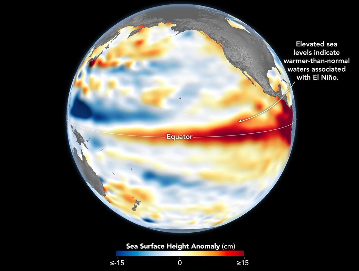
@NOAA Observations of sea surface height from the Sentinel-6 Michael Freilich satellite in June indicate that the 2026 event was continuing to strengthen. More: https://t.co/bDboBf6Lv2
Recently @NOAA announced the return of El Niño, as ocean temperatures in the tropical Pacific remained above average for several months. NASA scientists are seeing a complementary sign of El Niño: rising sea levels as warmer ocean water expands.
Recently, two powerful earthquakes struck Venezuela.
NASA satellites captured imagery and data that are supporting response efforts. This NISAR map shows how the quakes shifted the land surface. Explore more: https://t.co/Z5QzddXuW5
Tonight's full Moon has an atmosphere too — just extraordinarily thin.
With about a quadrillion times fewer molecules in a given space than Earth's, it’s so sparse that space rocks strike the surface directly instead of burning up! https://t.co/Li8hlinNDy
📸 NASA/Bill Dunford
Something sweet is on the rise! 🍓🌕
The Strawberry Moon will light up the night sky tonight, reaching peak illumination in late afternoon. The best time to see it will be shortly after sunset.
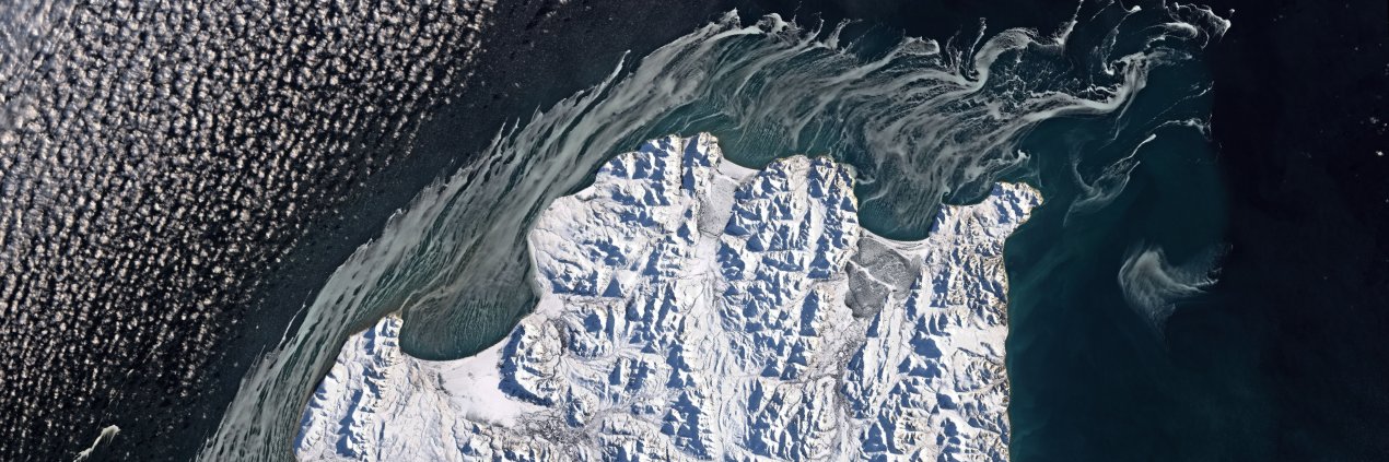
When you wish upon a star (dune)… ⭐️
These windswept sand formations, known as star or pyramid dunes, are a distinctive feature of the Sahara and have sharp multidirectional ridges. They form when the wind transports and deposits fine sand, forming mounds of sediment.
A NASA-sponsored team developed an open-source tool that uses machine learning to speed up identification of potential flash floods, delivering near real-time insights to help communities respond faster.
Explore how this data-driven tech tracks extreme weather and produces forecasts in as little as 15 minutes: https://t.co/CiyGQrm1hT
Breakups are hard 💔
Unless it’s stuff breaking up in Earth’s atmosphere. Then it’s just cool! A @Space_Station astronaut captured an object breaking up in the atmosphere on April 27. It could have been part of a rocket, satellite, other human-made space debris, or a meteor.
Seems like everyone’s watching Fiji right now… 👀🏝️
Even @NASA satellites!
NASA has a fleet of more than 20 satellites that study our home planet and capture images — including this one of the islands of Fiji, which are home to a certain iconic villa.
Dengue, which is spread by mosquitoes, is a serious health threat in Puerto Rico and a growing concern in parts of the U.S. 🦟
Scientists are using @NASA data to track the environmental conditions linked to dengue and improve forecasts of dengue risk in Puerto Rico.
Happy summer solstice ☀️
Today marks the start of astronomical summer in the Northern Hemisphere and the longest stretch of daylight. It’s the day the Northern hemisphere is most tilted toward the Sun. https://t.co/k0qPHyGw5l