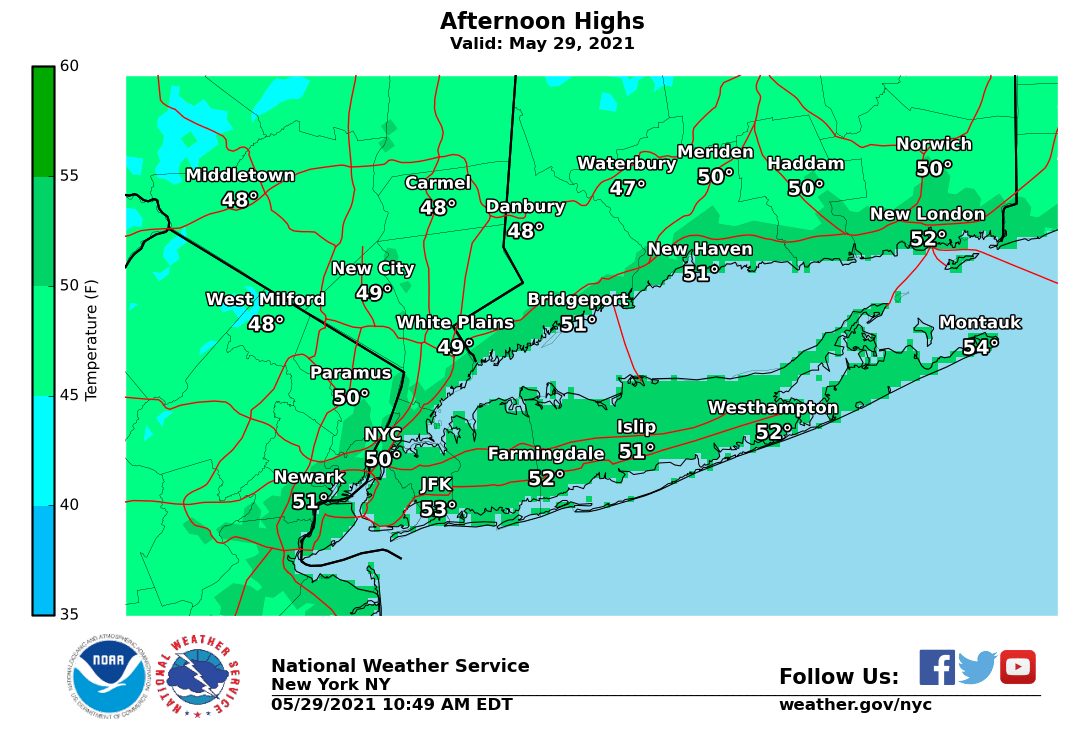
Record low maximum temperatures are forecast to occur at our climate sites today. The record low max temperatures for 5/29 are:
NYC 51/1884
JFK 57/1967
LGA 58/1950
EWR 60/1950
BDR 58/1950
ISP 58/2017
#NYCwx#NYwx#CTwx#NJwx
At 6:21 PM this evening, the #Buffalo Niagara International Airport (KBUF) reached a temperature of 90 degrees Fahrenheit. This breaks the previous record of 89 degrees set in 2012. This is also the first 90 degree reading at KBUF since August 13th of last year.
When I wanted to pursue a meteorology degree all I kept being told was “at least you’d be working a job where you’d get away with lying!” Like weather is a science and obviously can have factors that alter a forecast🤦🏾♂️
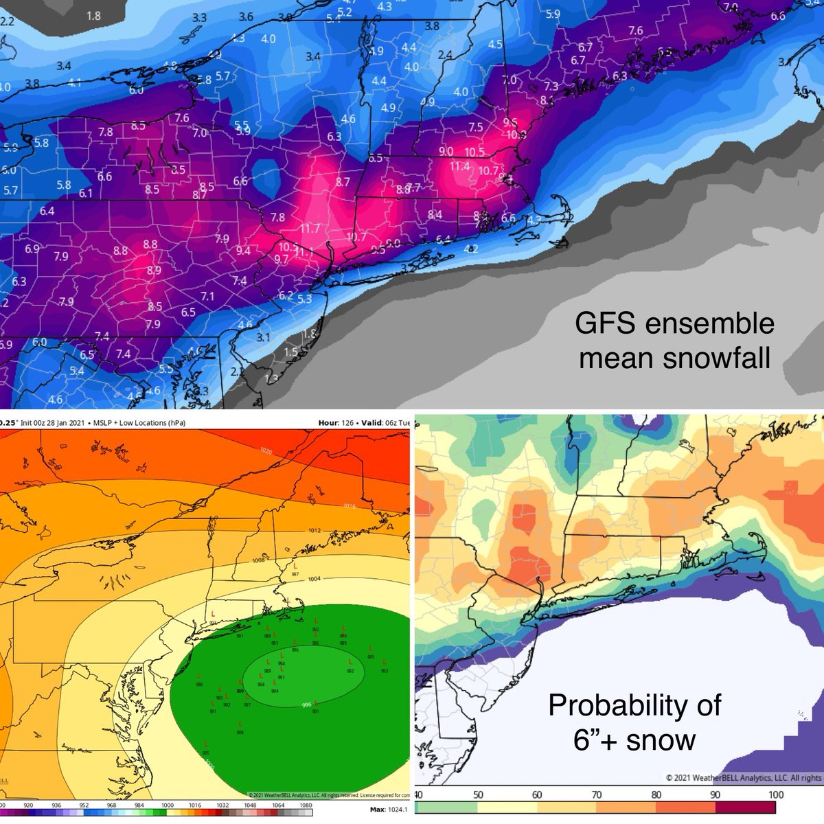
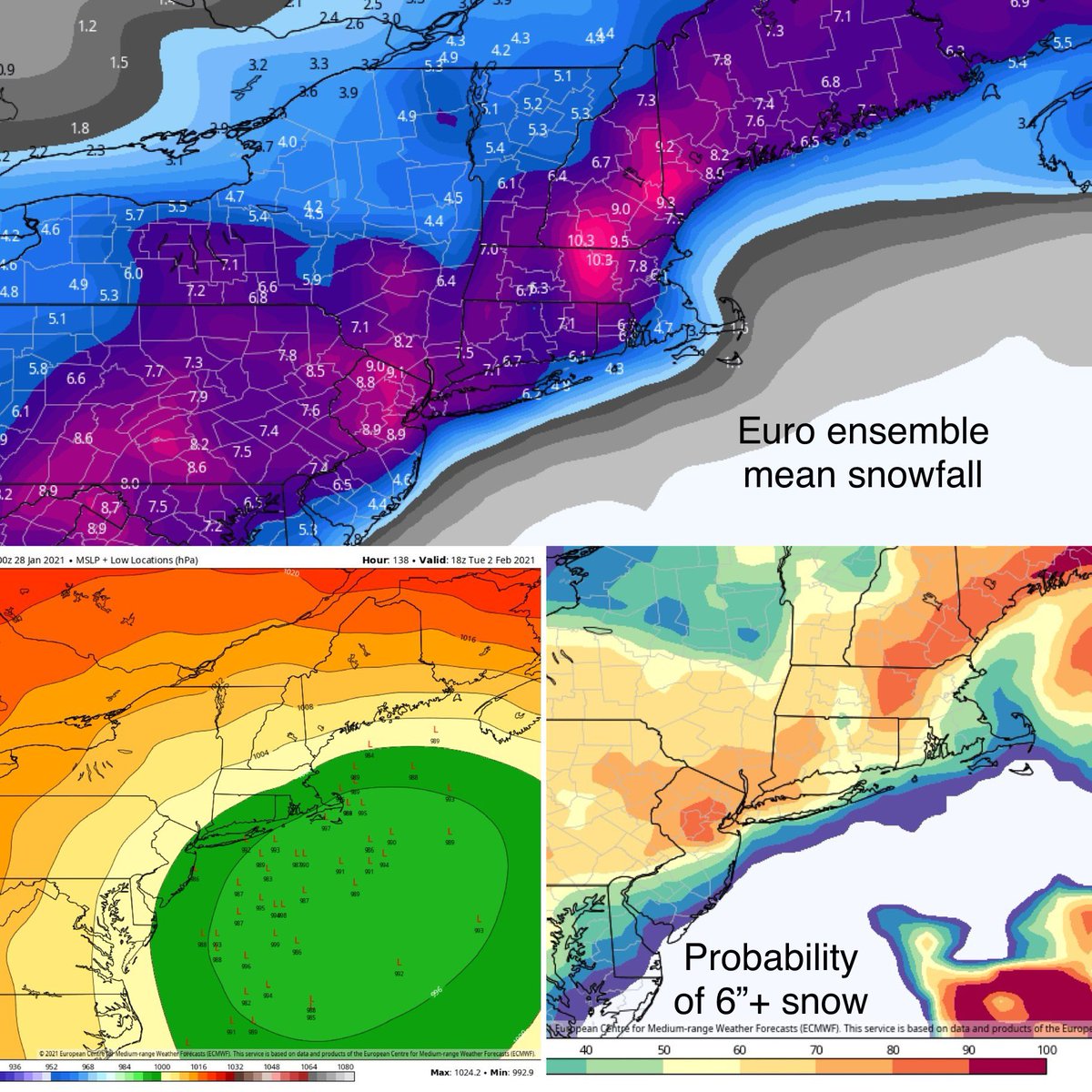
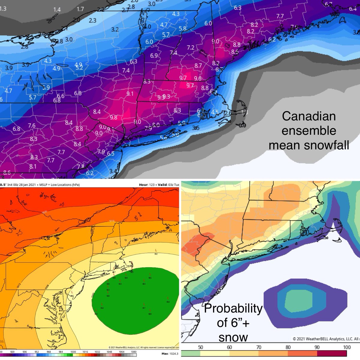
Confidence is increasing that a major nor’easter will impact the area Mon-Tues. All ensembles below. All have most of SNE w/ a greater than 50% chance for 6”+. An impressive look! High level agreement but variations with details on track, timing & strength. Stay tuned.
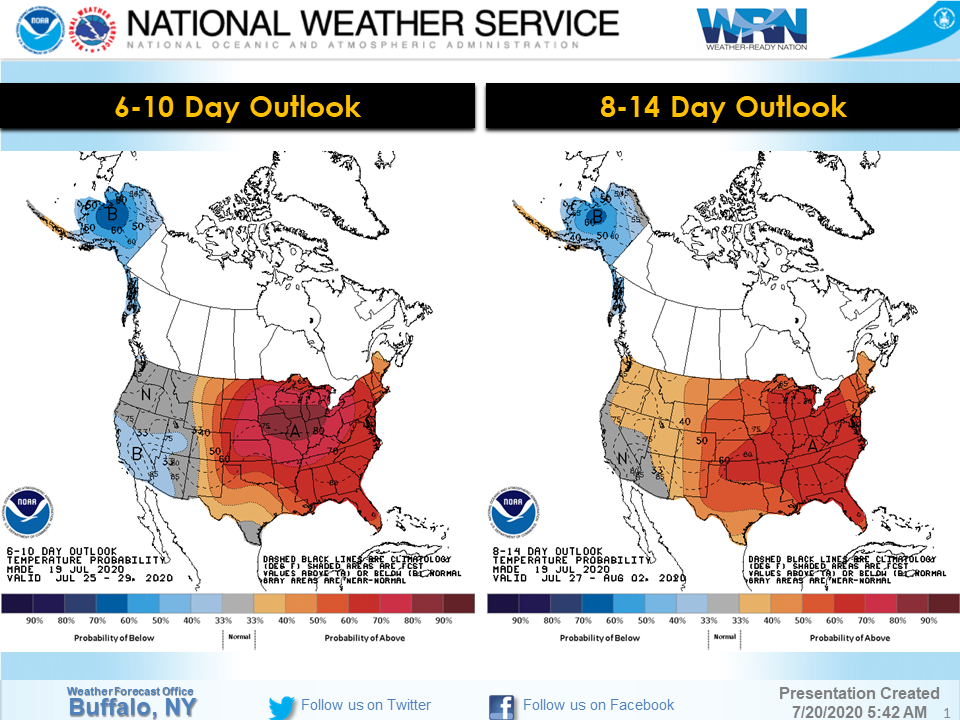
Tired of the heat yet?? Well, taking a look at the Climate Prediction Center's longer range outlook for the last week of July into the start of August, appears no relief from the heat coming anytime soon. Do you like the heat we've been experiencing, or prefer it a bit cooler?
How do you post and repost all these Black Lives Matter and R.I.P. George Floyd posts on social media and then have the nerve to post something that counters these movements and protests. You are not an activist if you are not “fully” about the cause...I said what I said.
It’s really a shame how quiet so many Montclairians are, about what going on. You’d think a town that prided and boasted on our so-called “diversity” would be one of the outspoken places right now but I’m honestly am just hearing crickets. Silence is being accepting of racism.
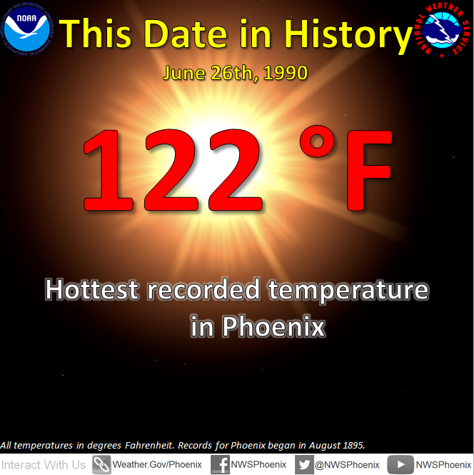
On this date in 1990 #Phoenix had it's hottest day on record of 122°! Expect a high of 105° today in Phoenix and 102°-105° for the greater Phoenix Metro Valley.
#AZWX
Oswego County’s a winter storm warning! What does that mean for us? Tune into WTOP 10 tonight to find out and consider getting another petition going! Conditions will be hazardous in some persistent snow band which makes commuting extremely difficult! ❄️🌨
1:26 PM: A Winter Storm Warning for lake effect snow is in effect for Wayne, Northern Cayuga, and Oswego counties until 10:00 AM Thursday. Winter Weather Advisories are also in effect for much of Western NY for lake effect. Find the latest info at:
https://t.co/d2oOHulhUW
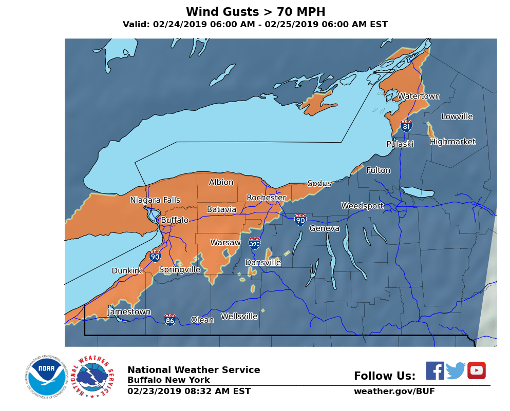
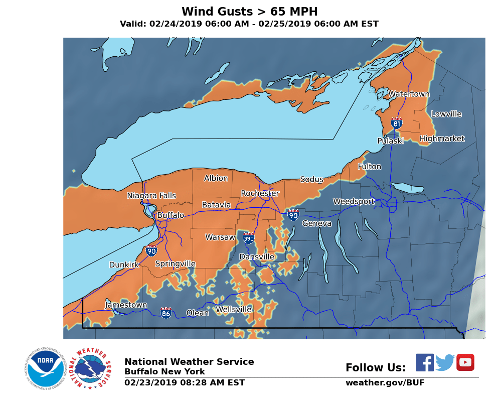
Quite some impressive weather we’re looking at tomorrow through Monday! Everyone stay safe and make sure you’re well prepared for this wind/snow event!😨
Here are our forecasts for winds exceeding 60, 65, 70, and 75 MPH Sunday-Sunday Night. Strongest winds are expected along and east-northeast of Lake Erie and Lake Ontario, extending inland across the lower terrain from the Buffalo Southtowns to Batavia and Rochester.
Thanks @NoahBlakeWTOP10 for stopping by our table! Hey @MollyTott @justindobrow this guy is a broadcasting major graduating this year in case you have any advice 😍