Blending art & tech with curiosity. Just planting small ideas that might grow bigger than compounding. Let’s build cool things together.
#CreativeTech#SlowGrow
Meet Washington State's only freshwater endemic fish: the Olympic Mudminnow! Many questions about this quintessential Washingtonian species remain unanswered 🐟 https://t.co/2wVquS5xFX
📷 Olympic mudminnow from a blackwater marsh, Olympic Peninsula. Courtesy of Lawrence Kent
Trying to beat the summer heat? 🌊
Take a look at the turquoise waters and biodiversity of Guinea-Bissau's Bijagós Archipelago, seen by Landsat 8. The spacecraft captured this image in November 2025, the same year the archipelago was designated a UNESCO World Heritage site.
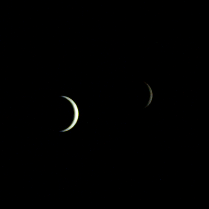
Say cheese, Earth and Moon! 📸
One of our two Mars-bound ESCAPADE spacecraft captured Earth and the Moon from 363,250 miles (584,600 kilometers) away. In visible light, both worlds appear as slim crescents.
But switch to thermal infrared and it’s a different picture 👇 🧵1/2
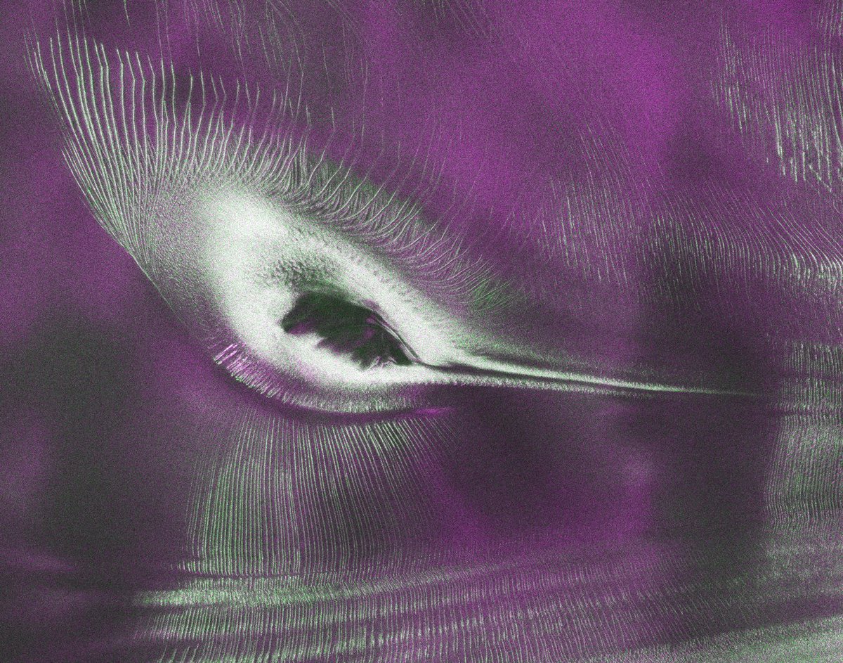
Do you see the hummingbird? 🐦
The NISAR satellite captured this radar view of East Antarctica. The “bird” is actually a mountaintop surrounded by flowing ice, with deep crevasses appearing as sharp green lines across the surface.
Six new multi-year @NASA projects will study everything from retreating glaciers to air quality to clouds generated by wildfires.
Despite their different topics, all of the missions will use sensors mounted on aircraft. https://t.co/u41C5yq5nY
Celebrating a legacy in Earth Observation! 🎉 🚀
On July 23, 1972, Landsat 1 launched into orbit and changed the way we see our planet. As the first satellite in what would become the world’s longest-running Earth observing program, Landsat 1 began a legacy of continuous, trusted, and scientifically valuable land imaging that still supports research, decision making, and stewardship today.
Within days of the launch, Landsat 1 acquired an image of an astounding 81,000-acre (327.8 square kilometers) fire burning in isolated, central Alaska. For the first time ever, scientists and resource management officials were able to see the full extent of damage from a fire in a single image while it was still burning.
Landsat 1 marked the beginning of a long partnership between the USGS and NASA that continues today. NASA developed, launched, and operated the satellite, while the USGS helped shape its scientific objectives and established the EROS Data Center to archive and distribute its imagery. Together, the two agencies laid the foundation for the enduring Landsat program.
From that first launch to the missions operating today, and those planned for the future, Landsat represents more than five decades of innovation, collaboration, and watching Earth change.
Here’s to where it all began! 🛰️🌎
🔗 Learn more about the first Landsat mission: https://t.co/IYva849EUX
📸1: Landsat 1 launched July 23, 1972, aboard a Delta 0900 rocket from Vandenberg Air Force Base in California. Credit: NASA
📸2: Smoke from a large wildfire in a central Alaska can be seen on this false color image acquired by Landsat 1 on July 27, 1972. Credit: USGS
#EarthObservation #LandsatLegacy
Discover the story beneath the waves. 🌊⚓
In December 1862, the USS Monitor sank during a storm off Cape Hatteras, North Carolina. More than 160 years later, the wreck has become much more than a Civil War artifact, it is the nation's first national marine sanctuary, an artificial reef supporting a thriving marine ecosystem while preserving one of America's most iconic shipwrecks.
In the first of this two-part series, explore the history of the USS Monitor, its final voyage, and why its legacy continues to matter today: https://t.co/6Wf6fxykZ3.
#USSMonitor #MaritimeArchaeology #MaritimeHistory #NavalHistory