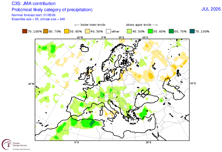
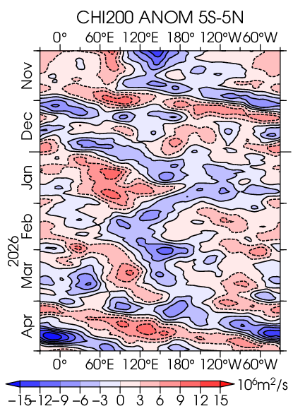
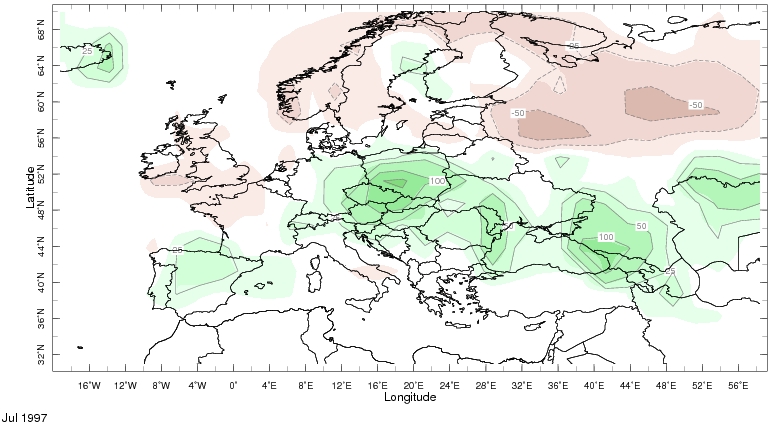
@Aigle_e Interestingly some models (JMA, UKMO, ~NMME mean) predict a dry-wet-dry flip-flop during the summer in Central-EU like in 1997 (see July anoms from the IRI maproom). Could be a similar subseasonal state? The current and forecasted April-May MJO resembles its state in 1997.
@Aigle_e Interestingly some models (JMA, UKMO, ~NMME mean) predict a dry-wet-dry flip-flop during the summer in Central-EU like in 1997 (see July anoms from the IRI maproom). Could be a similar subseasonal state? The current and forecasted April-May MJO resembles its state in 1997.
@Aigle_e Interestingly some models (JMA, UKMO, ~NMME mean) predict a dry-wet-dry flip-flop during the summer in Central-EU like in 1997 (see July anoms from the IRI maproom). Could be a similar subseasonal state? The current and forecasted April-May MJO resembles its state in 1997.
@webberweather Here is the most recent IRI plume with significant warming from its previous fcst. For comparison I also attache the fcst init in 2015 Apr.
@Superchri90 Worth noting the forecasted wave-1 field (here the 300 hPa with filled countours via @wxiscool ) resembles to the climatological mean wave-1 pattern (at 500 hPa in Fig.2.a from https://t.co/7iKRf1RiP2 ) at the beginning of the 2nd round of the PV weakening.
@JPWeiland@ryanweather The overall annual long-term trend shows improving scores. Interestingly, last April there was also (a bit weaker) decline in the second half of the month. No such stuff in 2021-23 BTW.
https://t.co/iLLrKpbF52
https://t.co/Rzedzui87J
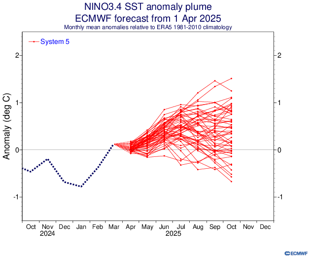
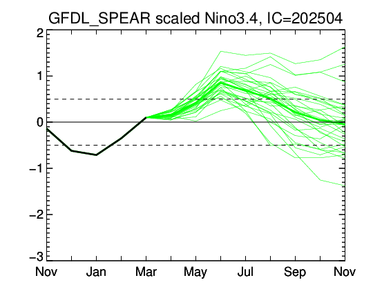
@WorldClimateSvc GFDL has a large spread this month. Looks like its lower and middle terciles are in line with the April's ECMWF forecast (⬆️ from the prev fcst). I bet Copernicus models will shift at least a little towards the Nino state.
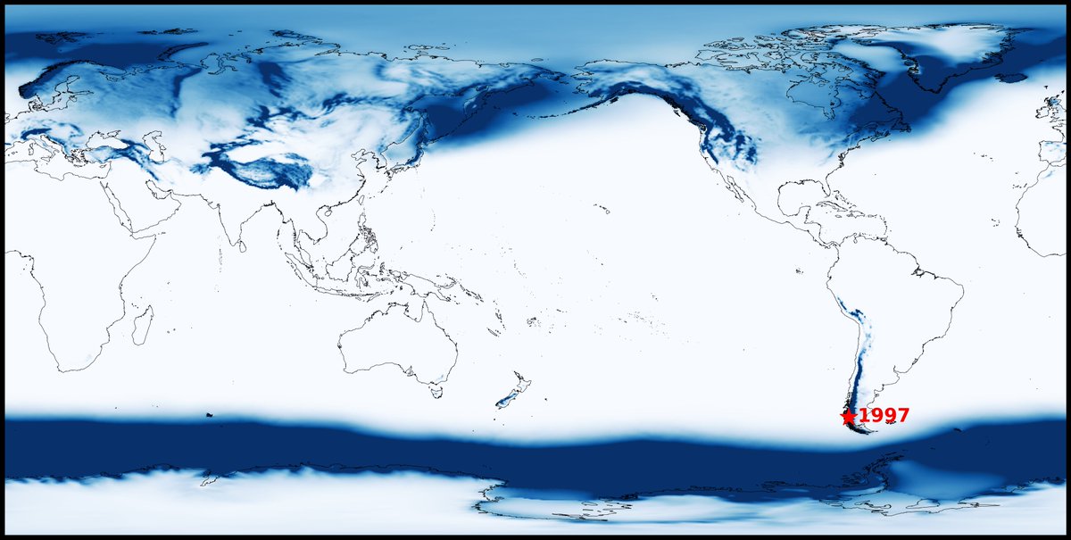
Have you ever wondered where the snowiest place on Earth is? Me too! ❄️
My calculation reveals that the Andes Mountains in southern Chile average up to around 2000 inches (5080 cm) of snow per year, making it the snowiest place on the planet according to the ERA5 reanalysis.
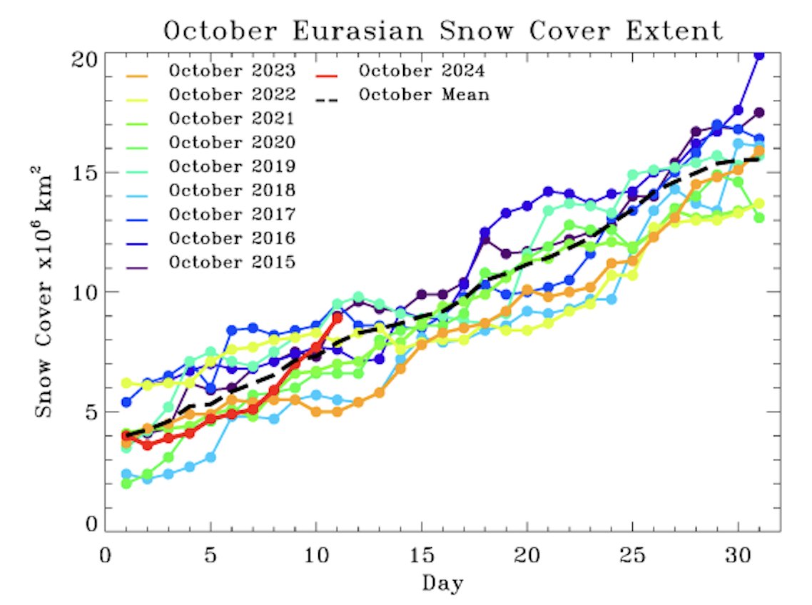
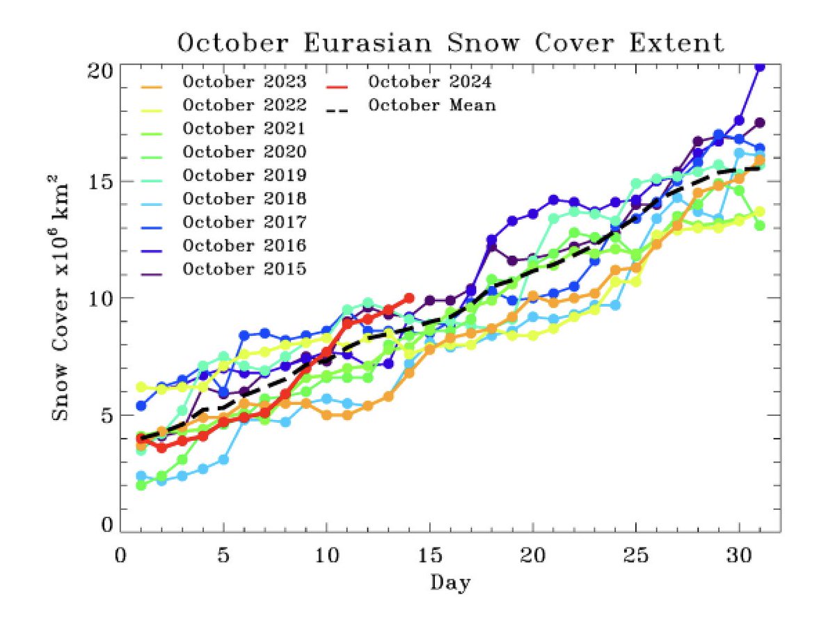
#Snow cover continues to advance across Eurasia at a good clip, now higher than the previous nine years (though behind 2014). If Ural/Barents-Kara Seas blocking continues in a favorable position, & not over Siberia, the October snow cover extent could be highest in several years
Maybe some good news for #winter weather enthusiasts. Ural blocking doing its magic & Siberian #snow cover has had a burst the past several days, putting some nice distance from last year's anemic pace. My research shows more fall snow in Siberia more winter cold & snow elsewhere
@cassouman40 Interestingly, #Boris was the third slow cut-off in Europe in recent weeks. Scandinavia, Biscay then over Central Europe. Strong or record-strong anticyclones/ridges surrounded these lows.
Central Europe is forecast to be among the wettest places in the world over the next four days...
This map highlights areas that are forecast to receive more than five inches of rain in the next four days.
The combination of a blocking high (atmospheric stop sign 🛑) and a cut-off low will cause prolific rainfall totals and the potential for flooding in the Czech Republic, Slovakia, and southern Poland in the days ahead.
This is falling as heavy snow in the Austrian Alps!