Back from a hectic yet productive time in Chengdu! Engaged in enriching discussions at the #InternationalMountainForum2024, #UIBnetwork meeting, #cryosphere workshop, and the Science-Policy Dialogue. Grateful for the opportunity to connect and collaborate!
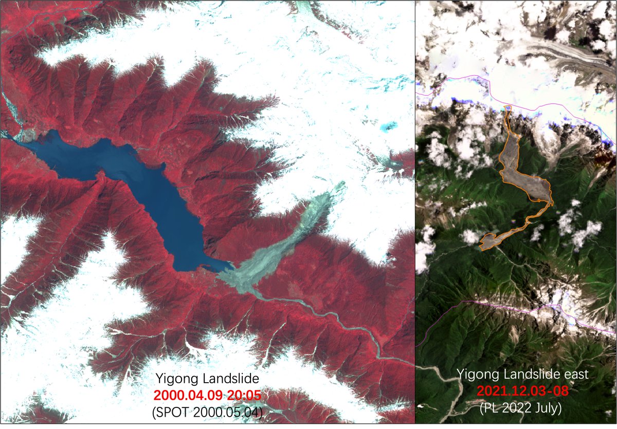
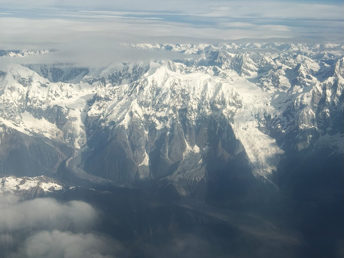
Captured the picture on China Air from Chengdu to Tibet Linzhi on 28 November. This gaint landslide happend two years before is closed and comparable to the famous Yigong 2000 Landslide.
@WaterSHEDLab According to modelled weather conditions from @meteoblue, high temperature fluctuations happened between 15th and 16th August. Also higher precipitation than 2023 August in the same location.
@nirojsedhai Based on the video, flood was from the tributary (also have some glaical lakes), not from the Dig Tsho. Have never been this region just compare and confirm it from Google Earth.
"Large rock and/or ice avalanches (RIA) are far from rare in High Mountain Asia (HMA) and are both lethal and destructive."
I'm happy 😄 to share our new paper on RIAs in HMA that has just been published in #Geomorphology (Elsevier).
🔗https://t.co/3jhkunUOSS
Captured the picture on China Air from Chengdu to Tibet Linzhi on 28 November. This gaint landslide happend two years before is closed and comparable to the famous Yigong 2000 Landslide.
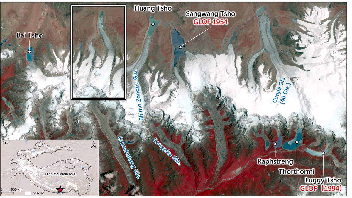
A landslide/avalanche trigger for the reported Thorthormi Tsho #GLOF in #Bhutan?
@ESA_EO Sentinel-2 imagery captured earlier today shows a dark smudge (mass movement runout track?) originating immediately north-west of the glacier terminus.
Repost Ralf Dujmovits
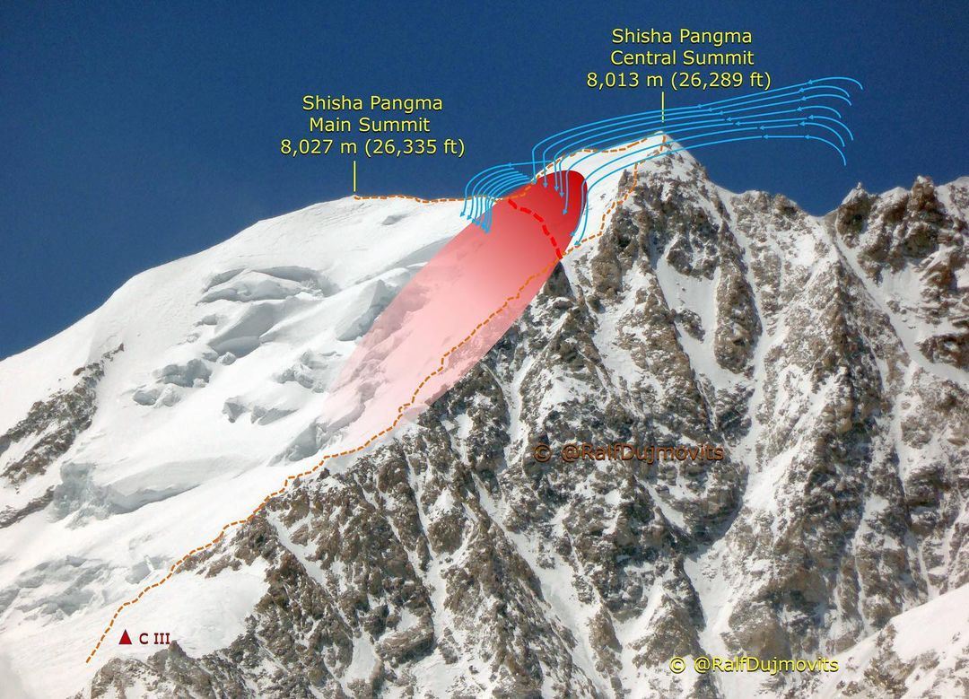
The deaths of four climbers on October 7th in the avalanche on Shisha Pangma (8,027 m) should not be in vain. We, the mountaineering and expedition community, should discuss and learn from this bitter event. I am not writing this to blame anybody – I only want to help climbers to better understand why it is almost never a good idea to attempt the normal, north-facing route on Shisha Pangma in the late post-monsoon (autumn) season.
🔴 In spring and autumn, there is usually a stable high pressure system over the Tibetan plateau which brings many days of good weather in a row.
🔴This high pressure system sucks in air at high altitudes. On Shisha Pangma‘s summit ridge this creates a relatively constant and strong flow of air from south to north (see fourth picture).
🔴 This southerly air flow transports snow from the southern side of Shisha Pangma onto its north face (see first photo).
🔴 While being transported, the six arms of many snow crystals break off and thus lose much of their ability to bind together. Continued wind can press the crystals together and form surface wind slabs which can form avalanches.
🔴 A second problem is that when it is very cold outside – like from the end of September onwards - moisture evaporates from inside the snowpack. This moisture condenses as it moves up through the snowpack and forms cup-like and angular snow crystals. This process results in snow that has the consistency of large grains of sugar - it is called faceted snow.
🔴 The gigantic slope above 7,300 m on Shisha Pangma’s north face (see third photo) is not steep enough to regularly avalanche naturally. However, when disturbed by the added weight of a climber or even through the vibrations of approaching climbers the faceted snow can collapse and, along with the hundreds of tons of snow on top of it, begin to slide.
🔴 The very cold temperatures of late autumn and the almost complete lack of sunshine on the slope preserve this particular avalanche danger in the snowpack – sometimes for weeks or months.
🔴 In spring, the longer, warmer days and the sunshine that hits the slope (even obliquely) help to bond the snow and significantly lower the avalanche danger. Of course, there are always exceptional weather conditions at any time of year, but generally speaking, Shisha Pangma is much safer to climb in April/ May than in September/October.
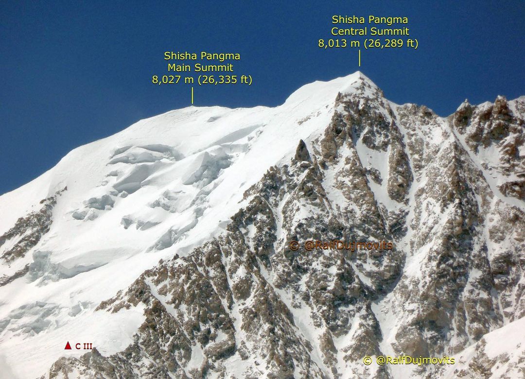
I climbed Shisha Pangma’s main summit twice: one time by the normal route and one time via the South Face. On another occasion, we turned back from Shisha Pangma’s central summit because the wind was too strong to stay on the safer ridge line and the avalanche conditions were not safe enough to make the traverse across the big slope to the main summit (second image). https://t.co/FelmF8eBUl
Man who is reporting is Mr Gyapu , Local Yak herder of Lhonak , North Sikkim
Informing in video that it is captured from bottom of Langbuk village as due to outburst all of his grassland destroyed & small bridge which connects Muguthang to Goma Lake has washed away completely.
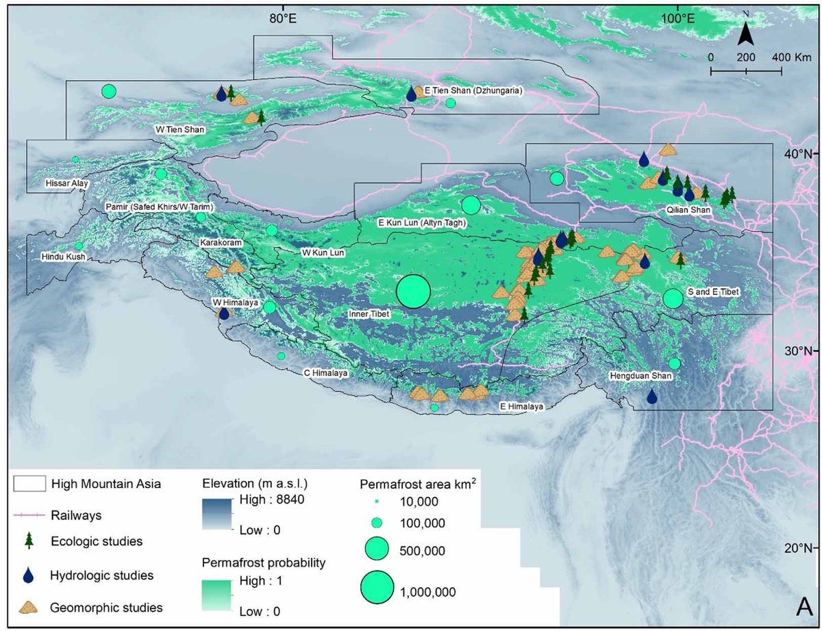
after a lot of work on compiling our state of knowledge on permafrost in high mountain asia, our review led by @meprashantbaral is now out in ERL @IOPenvironment with all data open access in accompanying repository https://t.co/k7TNcpLvyV