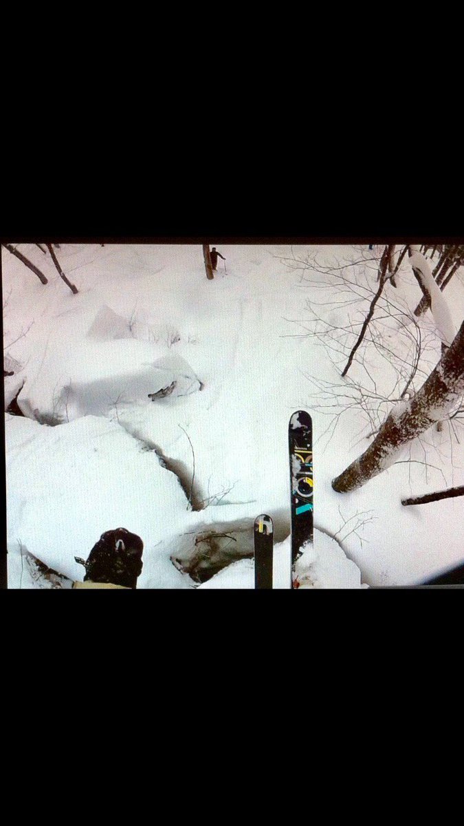
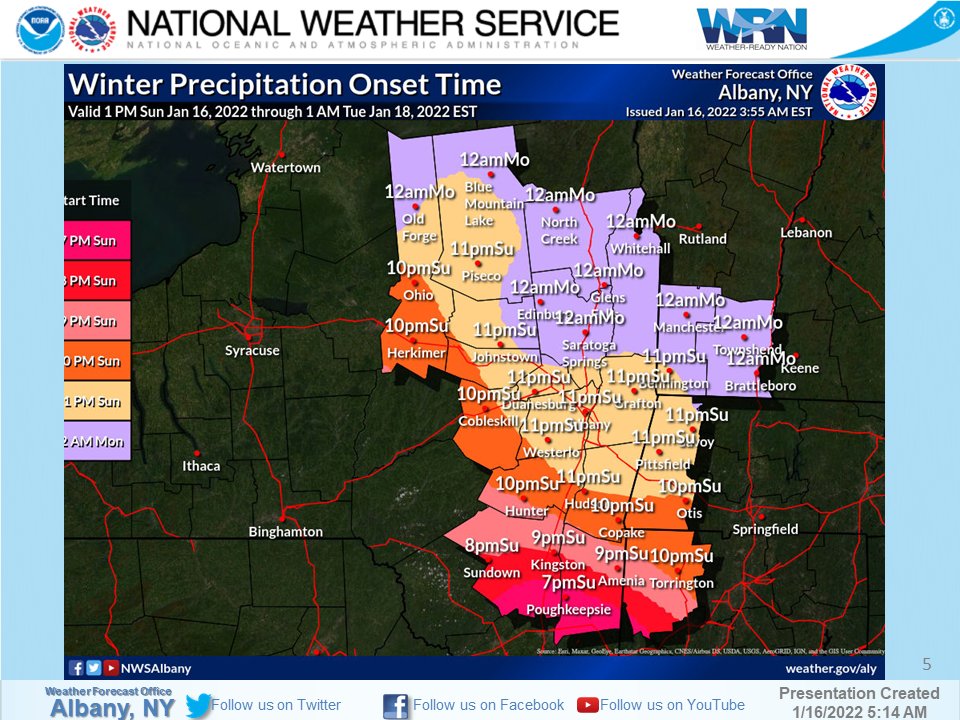
whoever is juuuust north of this changeover line, near I84, with the firehose pumping in, is gonna THUMP for several hours before dry slotting or changing to mix... we're gonna see some people overperform at higher elevations north of I84 across PA/NY/CT/MA
models have been showing consistently one of the best upper level snow/cold patterns we've seen in years- guess those 30 day teleconnections readings we were discussing 2 weeks ago when some people said winter is over in December did pretty damn good
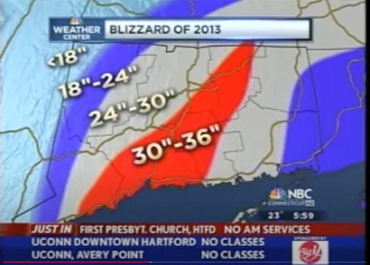
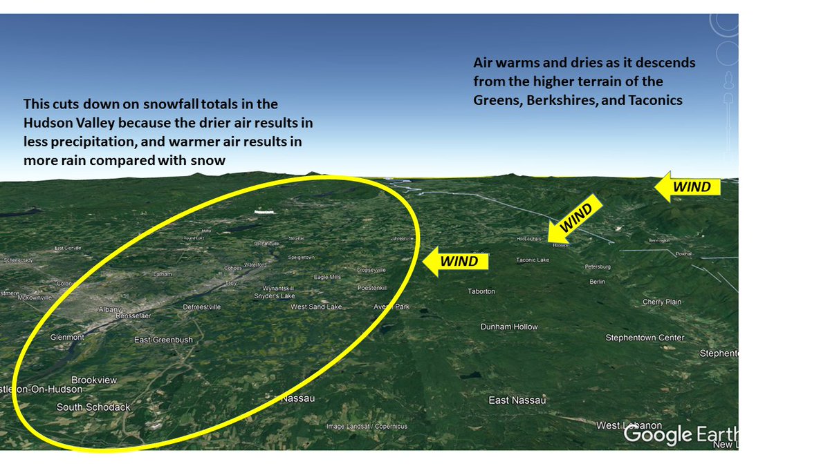
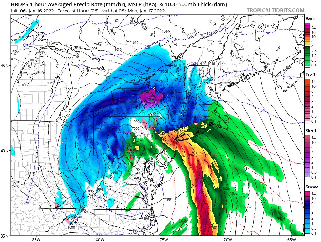
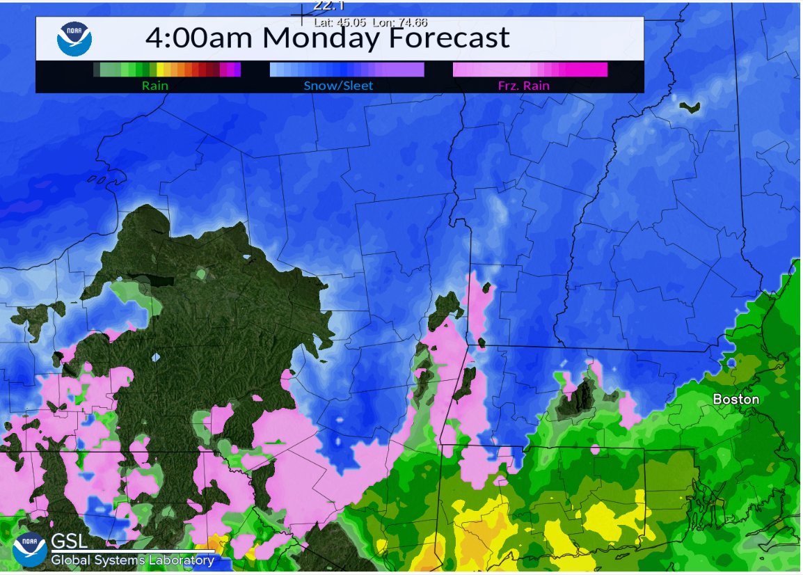
So what's the reason for the sharp gradient in snowfall totals from the Hudson Valley to the higher terrain to the west? Warming and drying due to winds downsloping off the higher terrain to the east.
Well, I’ve seen sea smoke and river smoke. But this is the first time I’ve seen waterfall smoke. Wadsworth Falls is stop #1 on a waterfall tour this morning. #Middlefield
this whole storms gonna be wild to unfold- models are still all over the place with cold air displacement- and changing areas back to snow as SLP passes, and dry slot etc etc
15 minute pressure altimeter change via ASOS NWS/MADIS 5 minute interval data. Shows the shockwave from the #Tongaeruption , feel free to use as you wish.