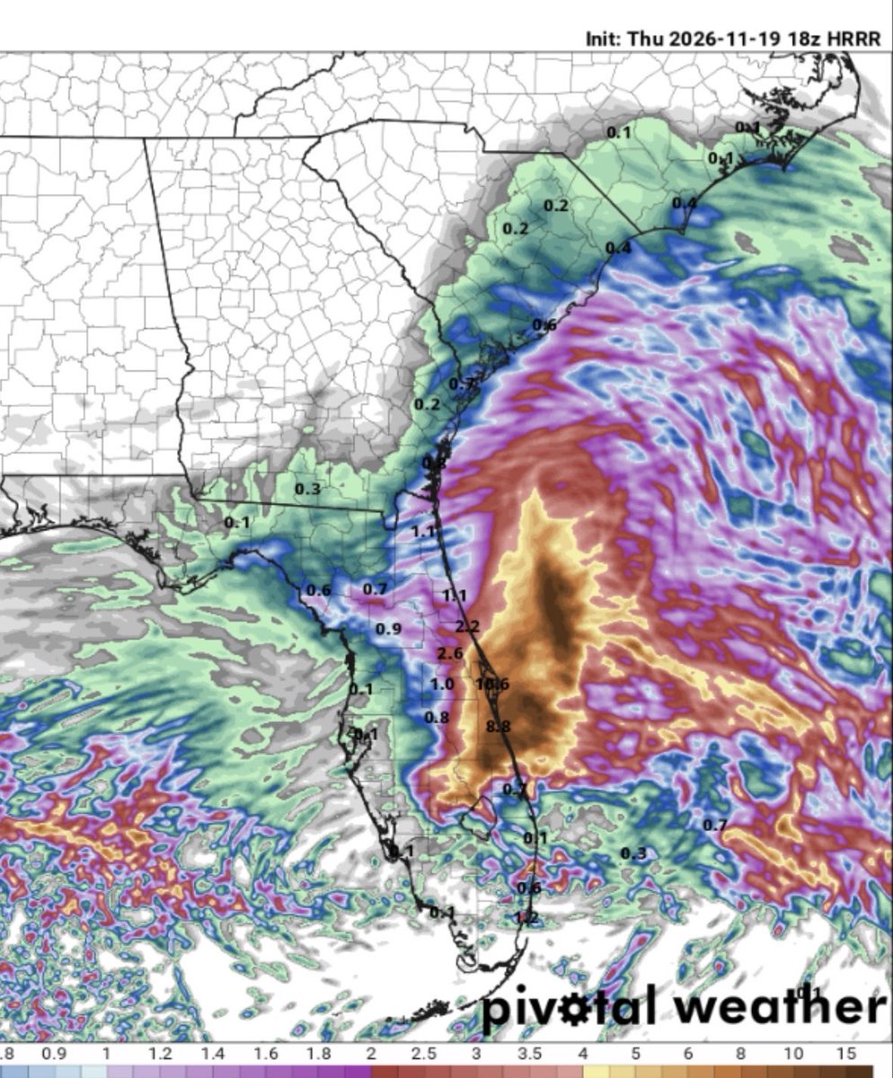
A truly catastrophic heavy rainfall event is ongoing across much of central Florida’s east coast, which will easily be the worst flooding event on record for the St. Johns River.
This event is exacerbated by the nuance of the St. Johns River — persistent easterly flow is not easily allowing water to drain. Not only will this event be the flood event of record, but the river will remain above record flood stage for a LONG time. Infrastructure that is underwater now will remain so for days on end.
The river at Cocoa is already in record flood stage and a staggering amount of rainfall is in the forecast tonight and tomorrow. WPC has issued two consecutive High Risks for excessive rainfall today and tomorrow, further elevating the St. Johns River to levels that have not been recorded. Areas that have never flooded will flood and remain flooded for an extended period of time.
The scale of this event is hard to comprehend.
@therobdale No, not at all. But it doesn’t matter if it’s well-discussed in the weather community. I was trying to promote coverage beyond that proportional to the scale of this event and the damage it will cause.
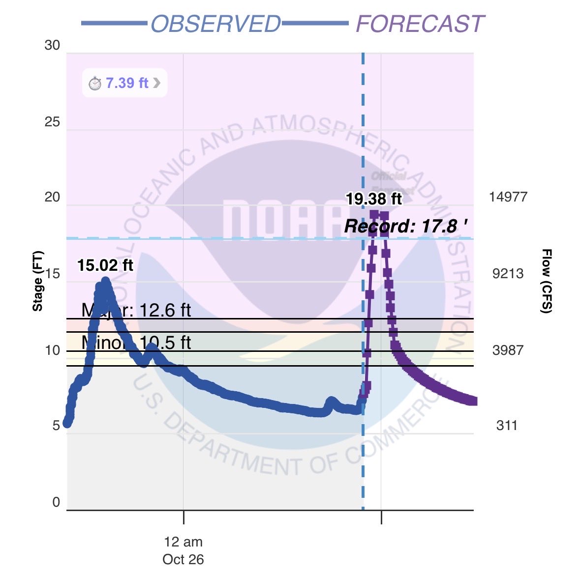
I don’t think the hydrological event in southwest Colorado is getting enough attention. This flooding event is historic and that is not hyperbole. The San Juan River at Pagosa Springs is now expected to crest at 19.38 feet; nearly 4.5 feet higher than the historic flood just last week and almost 2 feet above its all-time record.
Successive events of similar magnitudes compound impacts given that infrastructure has previously been weakened. I expect this event to cause significant damage to infrastructure across much of Southwest CO.
@therobdale Not sure what you’re disagreeing with. I agree the NWS has been advertising well. The propagation of the info beyond the NWS silo hasn’t occurred until this afternoon.
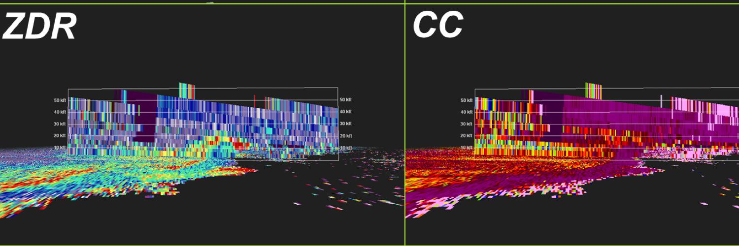
For the meteorologists:
I finally watched Pressure last night and it was incredible. I caught (what I think is) a subtle yet powerful homage. When Eisenhower shakes a seemingly random soldier’s hand, it just so happens that his name is Euler. I highly doubt it’s coincidental. In my mind this was a nod to the Eulerian principle which is the idea that properties are measured at a fixed location and change over time. In this case, the fixed location was Normandy and communicating how quickly conditions would change is symbology but curious on others’ thoughts.
Hopefully this was a break from your doomscrolling and thanks for your attention to this matter.
On August 20 every year, Dr. Bill Gray would ring a bell denoting the start of the climatologically most active portion of the Atlantic #hurricane season. Historically, about 2/3 of all Atlantic hurricane activity occurs between August 20 - October 10.
– Atualização da Avaliação de Danos –
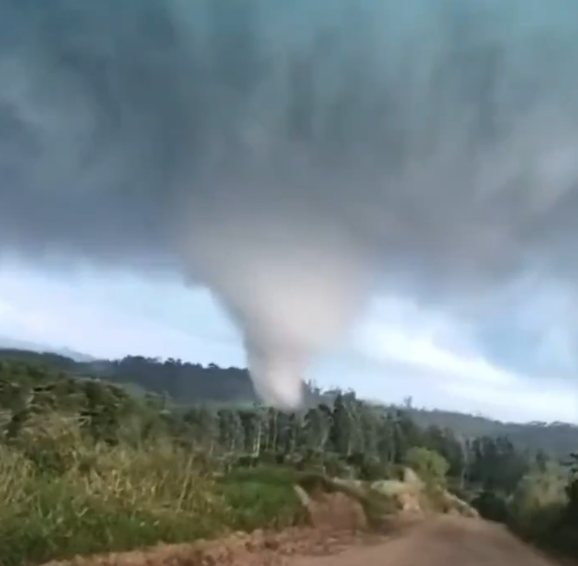
O tornado violento que atingiu Piraí do Sul, Paraná, Brasil, em 8 de agosto, foi classificado como um tornado F4, com ventos estimados em pelo menos 380 km/h (236 mph), segundo o PREVOTS (Brasil). O tornado percorreu uma trajetória de 26,1 km (16,2 milhas) e atingiu uma largura máxima de 750 m (820 jardas).
A classificação F4 baseou-se principalmente nos danos extremos à vegetação e ao solo ao longo de partes da trajetória. Isso incluiu a remoção completa de galhos e folhagem de árvores nativas de tronco rígido, o descascamento de mais de 60% dos troncos e um padrão característico de abrasão (efeito de lixamento) em suas superfícies. O tornado também arrancou grandes áreas de pastagem a profundidades de 10 a 30 cm, com áreas individuais medindo aproximadamente 127 a 188 m². Determinou-se que esses indicadores de danos excepcionalmente intensos eram compatíveis com ventos de pelo menos 380 km/h (236 mph).
Este é o segundo tornado violento (F/EF4+) de 2026, excluindo-se o tornado de Kushva, na Rússia, ocorrido em 22 de junho — classificado como IF3 pelo ESWD, embora um avaliador local lhe tenha atribuído a classificação F4.
A reminder at how effective natural features such as reefs or mangroves are at dissipating wave energy. This is an incredible example of that — look how still the water is landward of the reef.
LIVE update from beautiful Ishigaki, Japan in the path of Super Typhoon #Bavi with massive breakers out at the reef. We are in preparation and scouting mode today on this stunning island. The conditions will begin to deteriorate tomorrow night
#stormchasing#Dominator
I think this is an absolutely fair critique of “general” forecasts. On the meteorology, the evolution synoptically is highly favorable to air-mass recovery given the south-southwest trajectories behind the morning convection. It’s uniquely positioned to advect low-level moisture behind the convection, ahead of the cold front, on highly anomalous low-level flow for June. South-south-easterly flow could not achieve this but this synoptic can which is why I think the ceiling is high.