Severe weather enthusiast from South-East Australia. I particularly enjoy studying the fluid dynamics of tornadoes with the use of physical tornado simulators.
Looking west into a potentially #tornadic#supercell at ~5:45pm on Sunday 25/08/24 shortly after impacting Dookie, VIC and surrounding areas. The northerly inflow was incredible as it rushed into the storm at 40-50kmh with decent low level rotation evident in the cloud field.
@VORTEXJeff @brandonwxil Another very possible factor contributing to this flow structure is highly convergent radial inflow caused by cyclostrophic disruption via surface drag. Especially considering this tornado appears to be over a forested area where the effect is likely being amplified.
After nearly a year's worth of work, @MikeBWeather and I are excited to announce @aguacerowx. We believe this platform will usher in a new wave of what is possible in data visualization. Sign up for the early beta for free here! https://t.co/CW5nvLSPK6
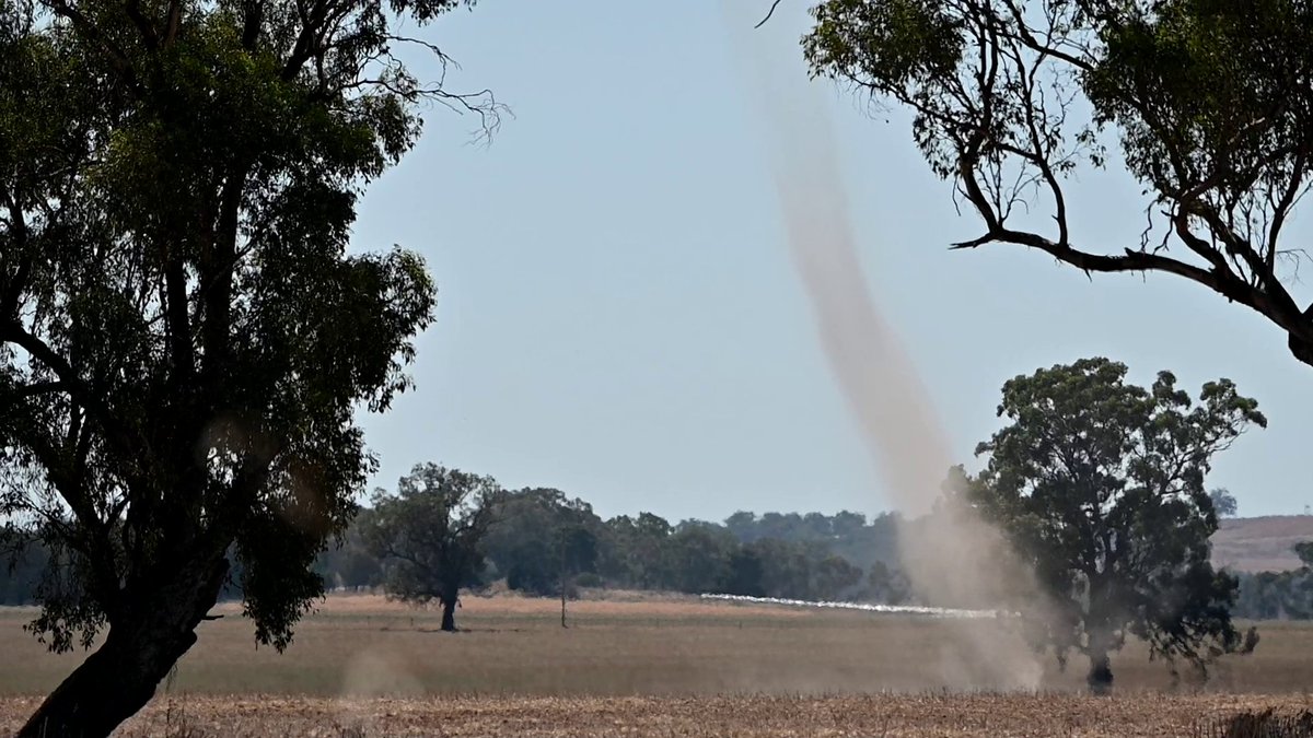
Went #dustdevil spotting near Howlong, NSW today. Most of them were small, lasting less than a minute or so. There were a few larger ones but sadly they remained out in the fields away from the road I was viewing from. A fun afternoon nonetheless!
@tornatrix Awesome! Hope it goes well. The work done with that simulator was so important to our understanding of tornado vortex dynamics (and sparked a likely life long fascination of tornado vortex dynamics and simulators for me).
@tornatrix Love finally being able to see the full footage of this. Do you happen to have any restored (or plan to restore) footage of the Purdue Tornado Vortex Chambers from Church & Snow et al?
@TomSaundersABC@romysteph@abcnews Looks like the cell developed directly over the southerly change which would have provided ample surface vorticity to get the job done. There were a few other cells about that displayed some rotation as well. Gotta love cool season surprises!
Conditions were ripe for dust devils along the NSW/VIC border today. I positioned myself next to a freshly plowed field between Howlong and Corowa and saw numerous smaller dust devils. This one was the best of the chase. So much fun! https://t.co/IejGMgQkCU
@jeremy_gibbs I see evidence of a dust-devil-like vortex that extends about half way up near the center bottom left. Unsurprisingly, its right where convective cell branches are intersecting.
@TysonMillar@Ben_Domensino@jtmiske Yes! All these features (especially the NWP & OBS soundings/skew-ts) would make Layers the ultimate one-stop forecasting & nowcasting tool publicly available for Australia.