With recent release of QGIS 3.8 you can now export image sequences from the 3D viewer and patch them together as animations (using an external tool - I used ffmpeg for this)
Here's a little tour of Ben Nevis in Scotland - 'tourist path', Carn Mor Dearg arête, Allt a' Mhuillin
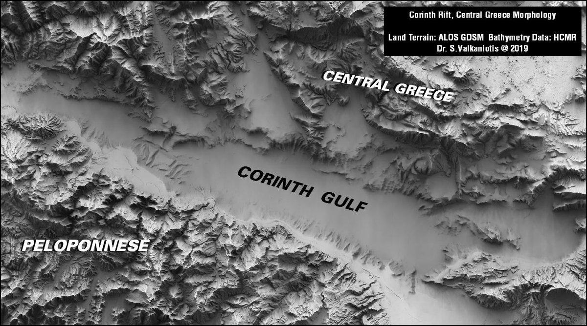
#CorinthRift in all its magnificence: combining terrain & bathymetry, revealing the complexity of fault structures. SkyView rendering using GrShade command from #MicMac, is 10x fastest than other similar skyview tools (e.g. SAGA or GRASS)
Our automated ESRI to #QGIS conversion tool just hit a major milestone: now you can directly open vector .lyr files within QGIS, with symbology converted automatically for you. No ArcMap required! Read more at https://t.co/yk7T3LnAY6
Andreas Kääb and team leveraged sub-daily Dove imagery & optical flow techniques to track the movement of ice debris and estimate the velocity of high-latitude rivers with an astonishing accuracy of ~ 1 centimeter per second! Read more here: https://t.co/7kJ78AmoYT
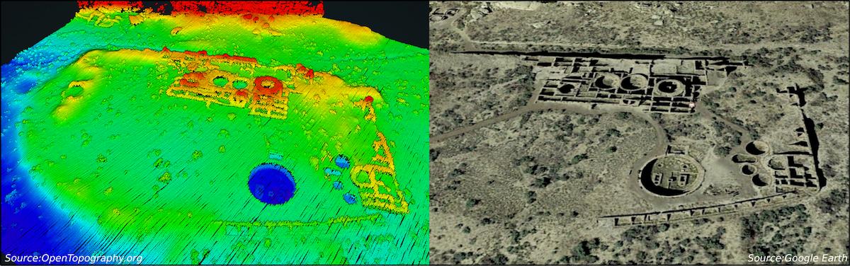
New #lidar data: Chaco Canyon, New Mexico 2016. 545 sq km of very high point density data collected by @NCALM_UH for PI @wdorshow: https://t.co/lGMmummYw1 Images: Chetro Ketl & Pueblo Bonito in Chaco Culture National Historical Park @ChacoCultureNHP
#CNRSleJournal 📰 | C’est historique : les scientifiques de la collaboration Event Horizon Telescope viennent de révéler la première image d’un trou noir, celui niché au cœur de la Galaxie M87. Explications et reportage en Espagne, au pied du radiotéles... https://t.co/b2hguXLjly
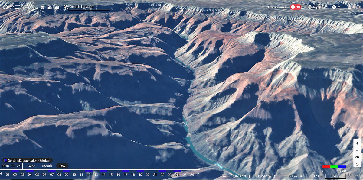
Nothing compares to the breathtaking spectacle of the #GrandCanyon! Fly with me through the high walls, following the #Coloradoriver, in this #Sentinel2 3D image processed by AdamExplorer. Make your own 3D with our tutorial https://t.co/ZfccTzSFel #EarthObservation#VisitArizona
Images acquired every six days by EU's #Copernicus#Sentinel1 satellites are being used to map ground movement across two billion measurement sites in #Norway. Thanks to this information, #InSARNorway has recently been launched.
#InSAR#subsidence
See: https://t.co/getLj4ZqUx
🔥🌳 Nei giorni scorsi un vasto incendio boschivo ha interessato la provincia di Varese bruciando una superficie di 350 ettari.
L’area percorsa dal fuoco vista da #Sentinel2 🛰🇪🇺
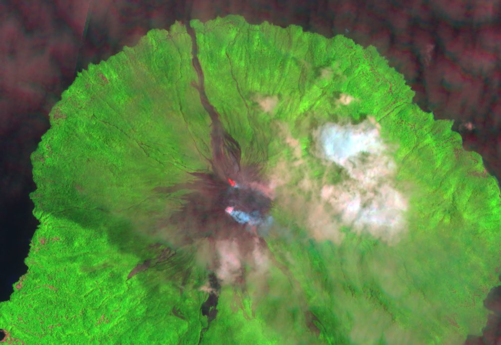
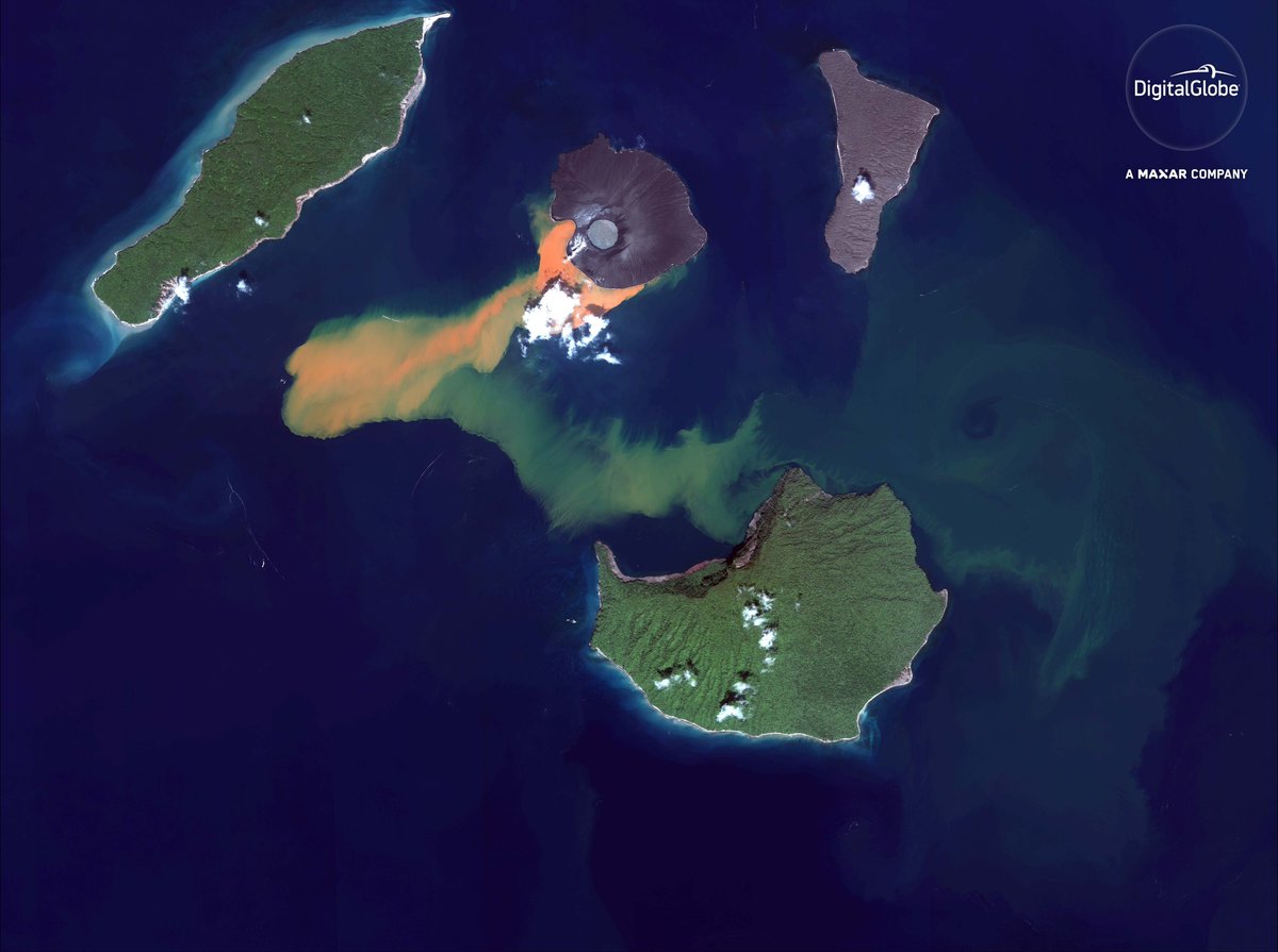
Reconstruction attempt of volcanic-plume canopy height for #AnakKrakatau using latest (Jan 8) #Sentinel2 image, using disparity map (displacement) of bands 8 and 8A. First attempt of this method, so a bit cautious about absolute values of results.
@EricFielding Bands 8 (10m) and 8A (20m) have a signigicant time delay, and also share similar wavelenght/features that enable better matching. A little bit of epipolar geometry & trajectory calculations and can have very good results on high features such as volcanic plumes.
LiDAR-based hillshades show details of thin "slab-slides" in Appalachian Valley and Ridge: "This 1-meter dataset reveals slides unlikely to be identified by any other means..."
By @vtgeosciences at #AGUblogs
https://t.co/4G717PIpRX
With my seismometer safely at rest on #Mars, I was able to release my hold on it. There’s still some more instrument prep to do, but it’s looking good.
Le grappin qui va me conduire à la surface de Mars vient de se positionner juste au-dessus de moi ! La semaine qui s'annonce va être historique 🇫🇷, je dirais même, SEIShistorique ! #SEISsurMars