Want to ask a question about Transitland? Or would you like to share the app, map, analysis, or other type of project that you've created using Transitland APIs or data? Come join us on our new GitHub discussion boards: https://t.co/PqJbd68nvx
Any recommendations for a Mastodon server that's about open data, transit, mobility, or open-source software? We're thinking of also posting about @Transitland for folks who are switching to Mastodon.
We are slowly adding coverage of France to Transitland. However, our team has very limited skills at reading French (and none at writing :) We welcome French-speakers to help add more GTFS feeds to https://t.co/Zvtzu5WGMr Thank you/Merci!
🚌🚈L'application @transitland est un bon indicateur pour se rendre compte du degré d'avancement de #standardisation et d'#ouverture des données publiques des transporst en commun en France 😅
cc @transportdatafr
➡ https://t.co/iTL1zJD6um
@HugoLucasBLN@BorisMericskay@transportdatafr Bonjour/Hello. Our main staff have very limited skills at reading French (and no skills at writing French :), so we are very slow to review and add GTFS feeds from France. We would love any assistance adding public GTFS feeds to https://t.co/Zvtzu5WGMr
Transitland now aggregates from both static GTFS feeds and GTFS Realtime feeds. The "stop departures" API endpoint returns times derived from both static schedules and up-to-the-minute trip updates (* when provided by transit agencies)
We've added new documentation covering the Transitland v2 REST API "stop departure" endpoint, which can be used to see when buses/trains/subways/ferries/etc serve a given stop: https://t.co/V8q6pjU21G
today I learned about https://t.co/8HdXLiXALm:
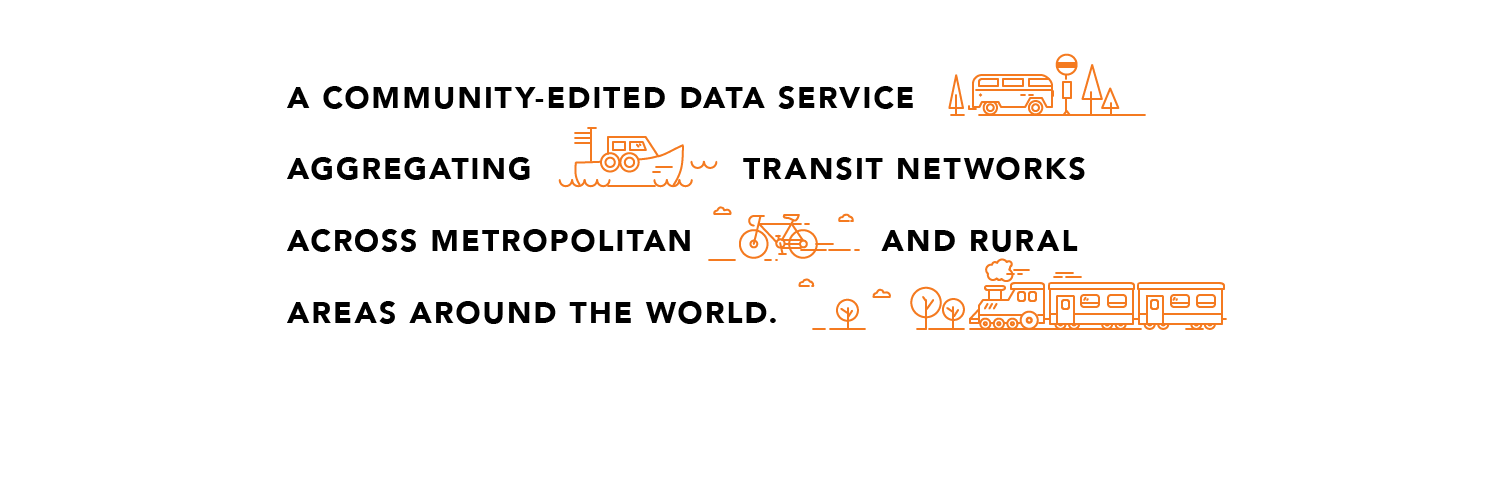
A COMMUNITY-EDITED DATA SERVICE AGGREGATING TRANSIT NETWORKS ACROSS METROPOLITAN AND RURAL AREAS AROUND THE WORLD.
via @burritojustice on @RollOverEasy
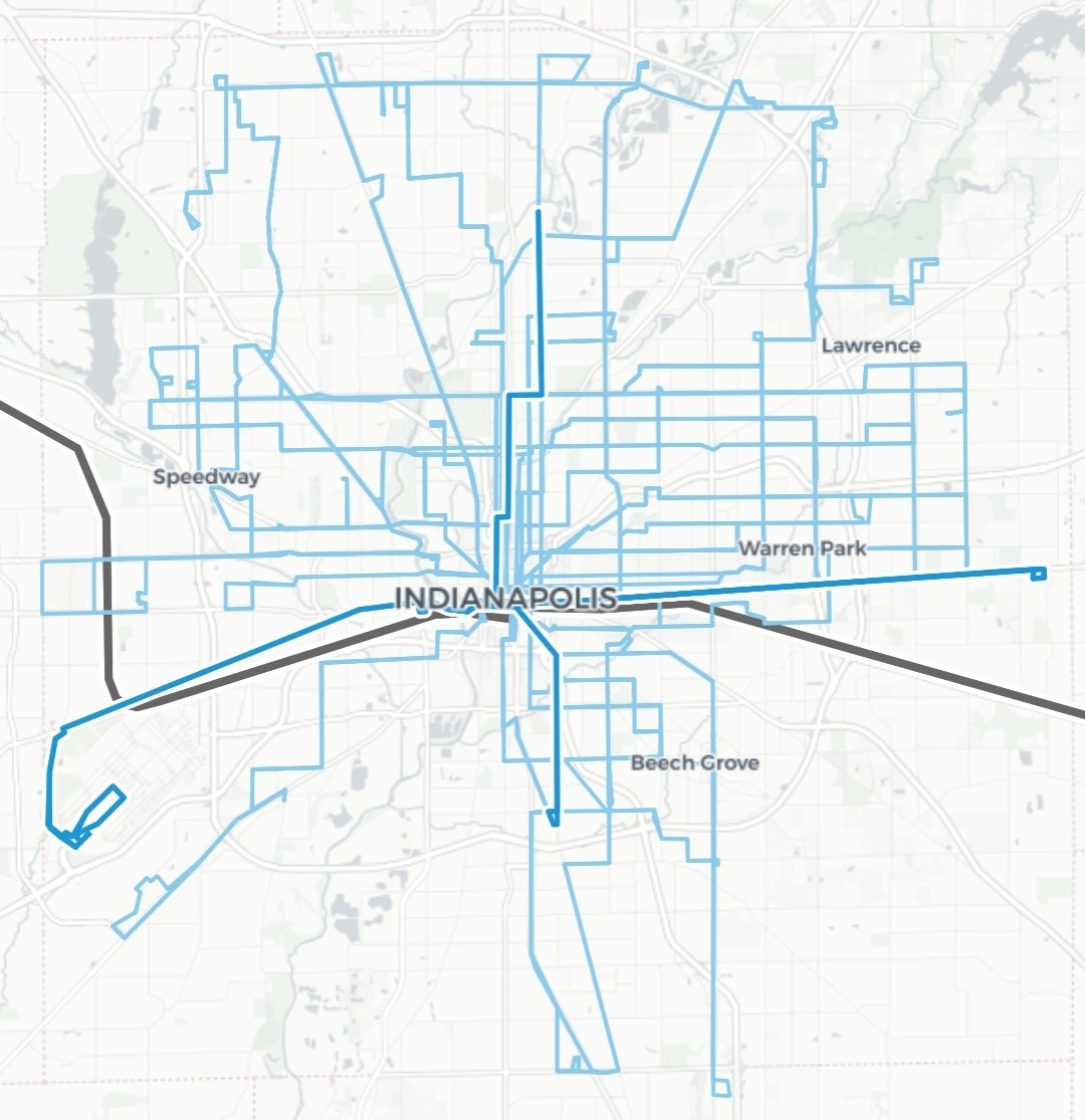
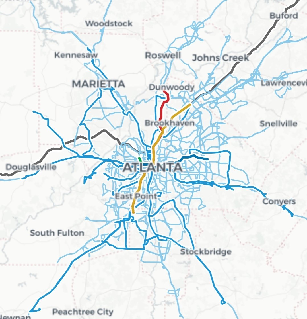
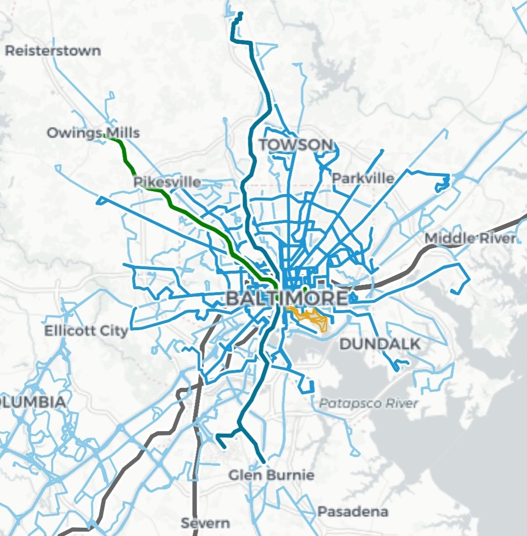
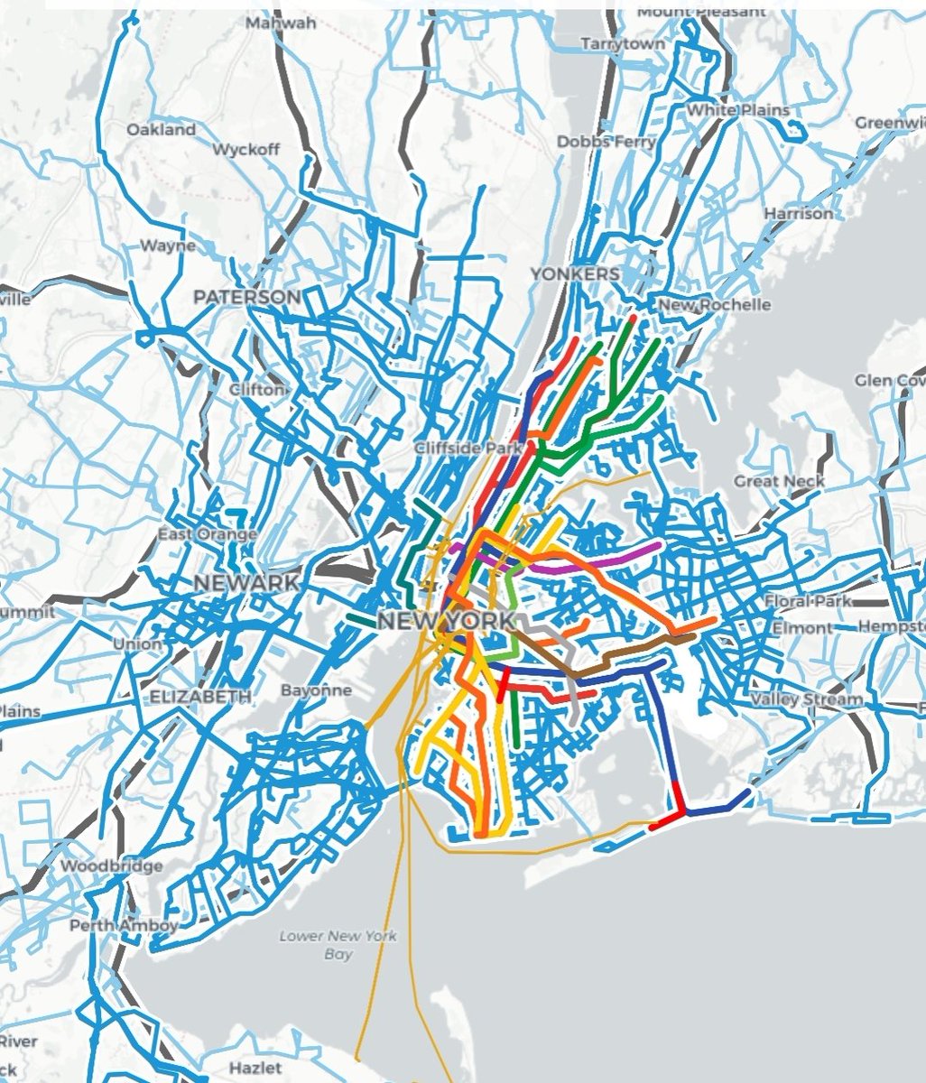
Pictured is some U.S. cities compared at the same scale:
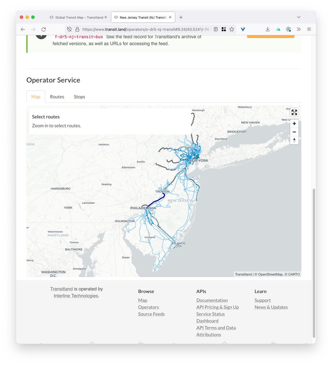
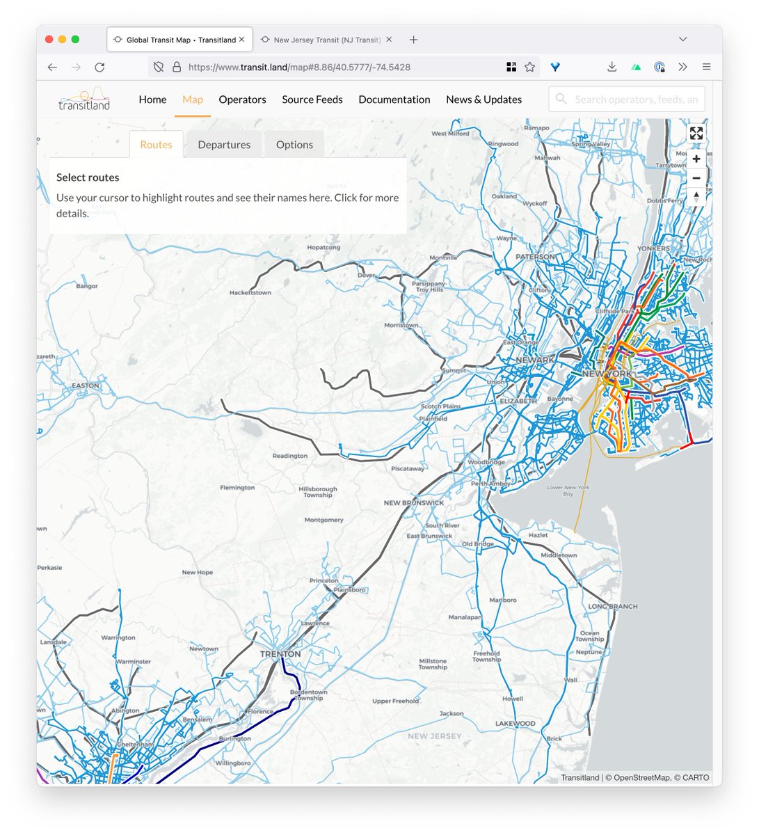
The @FTA_DOT is proposing that American transit agencies submit URLs for GTFS feeds in their reports to the US National Transit Database. This is a great idea. We're pleased to share some feedback based on the experience of operating @Transitland: https://t.co/IU0wVtlRwI
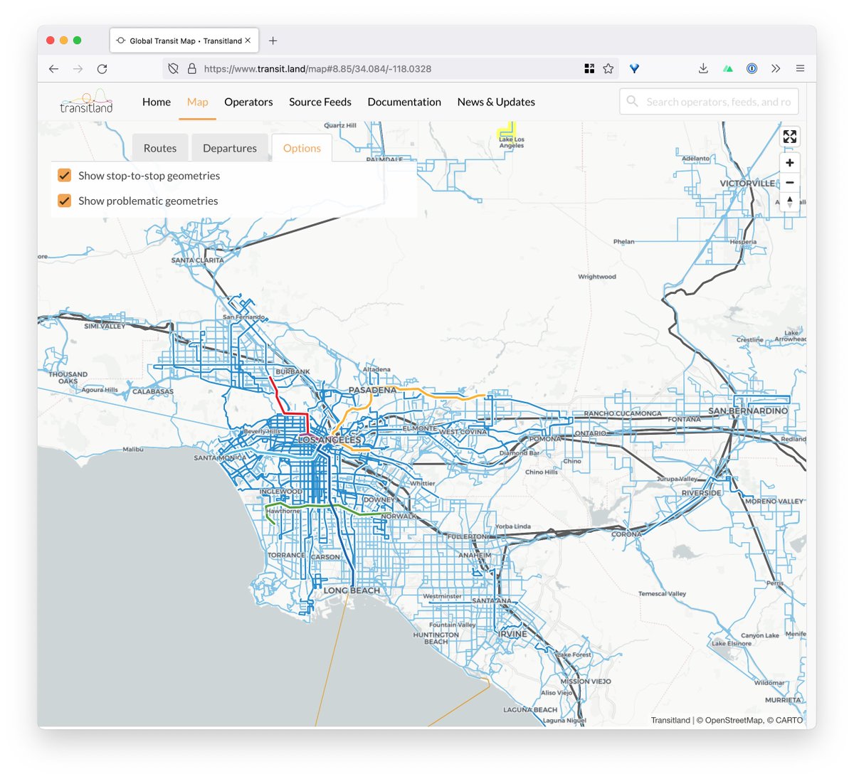
@akaDirigibles @codehawkfalcon Metrolink does not supply shapes in in GTFS feed, so Transitland has to draw straight lines between distant stop locations. This can clutter the map, so we hide it by default. Go to the Options tab and toggle both options on:
Perceptive users of the Transitland map may have noticed that BART didn't appear for a couple weeks. Thanks to @SFBART for fixing the shapes.txt records in their GTFS feed, we're now able to display the curve of the Transbay Tube and along with all other BART route alignments:
@SFBART As always, the Transitland global transit map can be browsed at https://t.co/736Y7bUgum or integrated into your own projects using the Transitland v2 Vector Tile API: https://t.co/AAIzvNOOqy
Perceptive users of the Transitland map may have noticed that BART didn't appear for a couple weeks. Thanks to @SFBART for fixing the shapes.txt records in their GTFS feed, we're now able to display the curve of the Transbay Tube and along with all other BART route alignments:
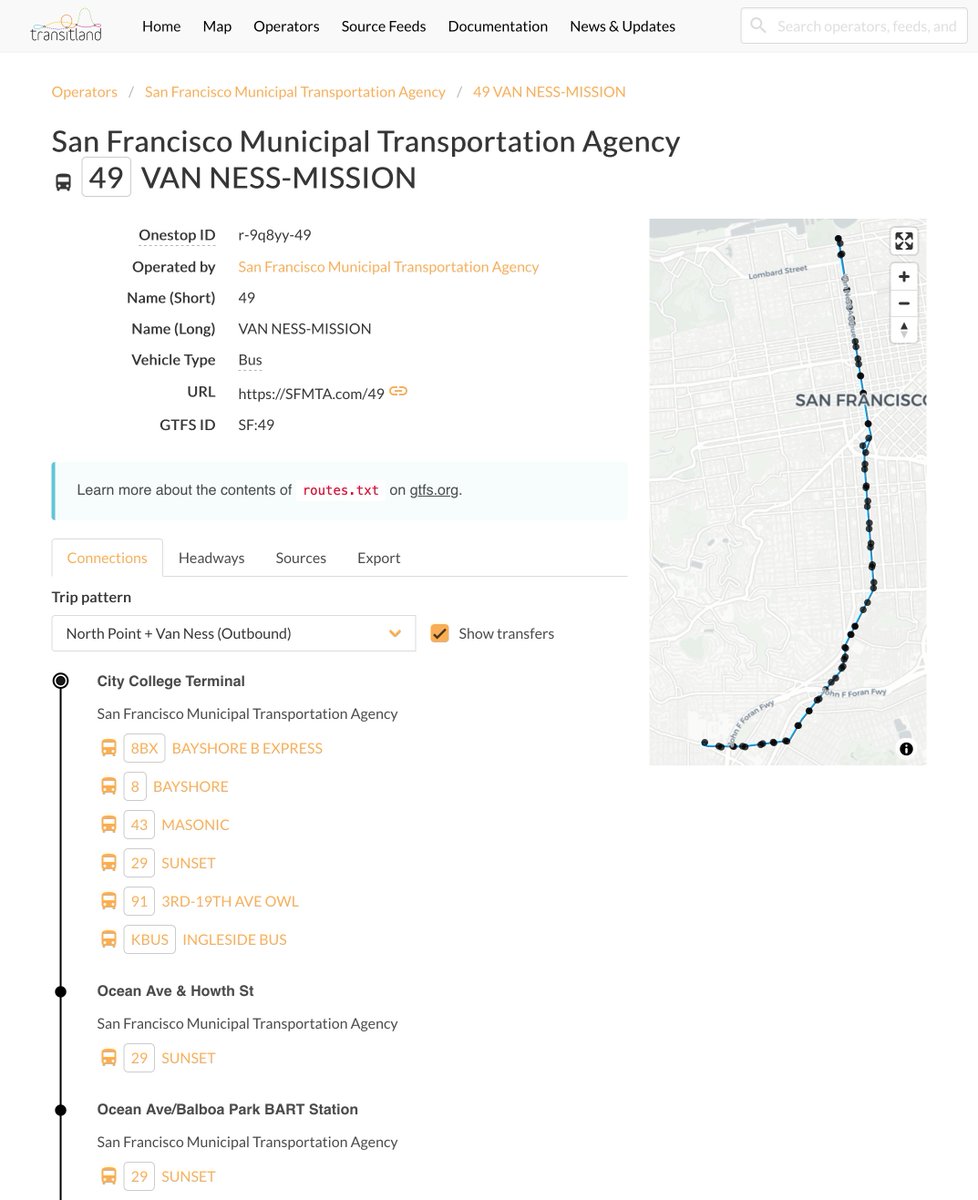
A new feature on the Transitland website: see how one route connects to others. See the Connections tab on each route detail page, or access this information through the Transitland v2 GraphQL API.
Using @transitland to compare service provided in the four main cities I've lived in. Baltimore, Atlanta, Indianapolis and New York City. Transitland is an open data platform that collects GTFS, GTFS Realtime, and other open data feeds from transit providers around the world.
@Indy_Austin @nickhasthoughts@jahorne GTFS is a "bottom up" format intentionally designed to be simple and North America-centric; and as the continued evolution of the spec shows, GTFS has limitations modeling particularly complex systems like in Japan. "Why" is a bit too big a topic for 280 characters.
@WillFedder@WatsonLadd@larry_htx @codehawkfalcon @TransitCon Our map includes nearly all agencies that publish GTFS transit data in the United States; Europe is a more complex situation because other transit data formats are more common there.