Los modelos indicando la formación de una baja presión lejos de la costa noreste para el jueves. Existe un mayor consenso entre ellos que muestra principalmente un evento de lluvia y vientos en corredor I-95 y con nieve mezclándose en las montañas y en las elevaciones más altas.
Seguimos esperando una gran área de aire frío que se desplazará hacia la mitad este del país durante el resto de la semana y el fin de semana. Las zonas cercanas a los Grandes Lagos registrarán temperaturas a los 20 grados mientras que en Florida entre 40 - 50 grados. #weather
After a dry stretch of weather through Wednesday a late week storm will bring a cold rain for most. However, some wet snow for the higher elevations is possible, though impacts impacts should be minor. Confidence is low to moderate, so check back as we get closer.
🌡Cold front moves through the area Wednesday and will push temps below normal by Thursday and onward.
🌬 Cold front will turn winds out of NW with speeds to around 20 mph and gusts to around 30 mph.
🌦 No notable rain chances until at least the latter half of the weekend.
El Niño causes a more southerly storm track compared to normal. More frequent low pressure systems develop & move across the peninsula as a result. This results in an increased chance for tornadoes, damaging winds, & other coastal impacts.
#Day2#FloridaElNiñoAwarenessWeek
Releases from Painted Rock Reservoir have begun and are expected to increase flow in the Gila River downstream. It will take the water on the order of weeks to make it all the way down to the Yuma area. Please heed closures of low water/dip crossings! #azwx
Varios sistemas de tormentas llevarán lluvias, inundaciones y nevadas a distintas regiones del país en los próximos días; sin embargo, en el sur de Texas, las precipitaciones más intensas comenzarán a disminuir.
https://t.co/GZbkGXFK4j
The next mid-upper level low is expected to approach the region this weekend, but there are still some uncertainties in the track and timing of the system. Rain chances are expected to increase during this period, but forecast changes are likely as new data arrives. #dfwwx#ctxwx
Dry conditions continue on Wednesday with sunny to mostly sunny skies in the morning before cloud cover increases in the afternoon. Afternoon highs will reach the upper 50s to low 60s, with light winds throughout the day. #NYwx#NJwx#CTwx
Strong El Niño winters see about 3x more *total* severe weather reports than neutral winters here in South Florida.
Note: Severe weather can happen in any winter. El Niño raises the odds but it doesn't guarantee the outcome.
#Day2#FloridaElNiñoAwarenessWeek
A series of disturbances will bring periods of light to moderate rain to the area late Thursday through the middle of next week. Adjust plans as needed to avoid wet and cooler conditions during this time. #CAwx#SoCal
A storm system will likely bring the first accumulating snow to the higher elevations of the central Appalachians and the interior Northeast late week into the weekend. In the low elevations, precipitation will mostly fall as rain. Visit https://t.co/D8jZlzOsbd for more details.
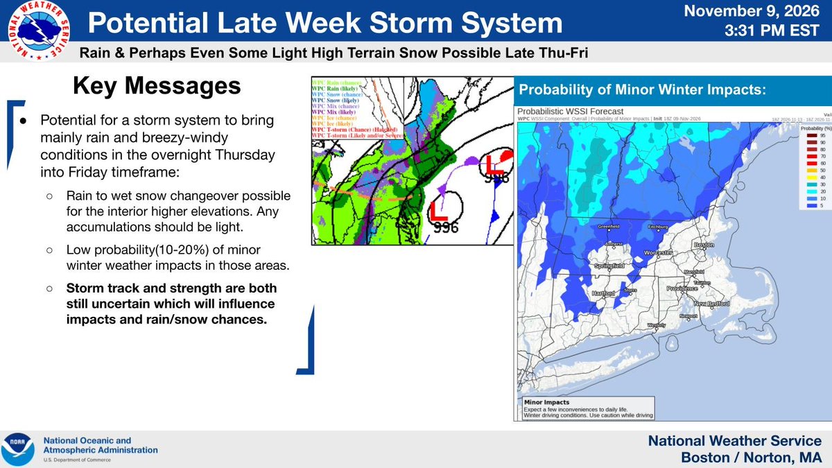
🌧️ Heads up: A late-week storm could bring rain & gusty winds Thu night into Fri!
❄️ Higher interior elevations may see a changeover to light, wet snow.
❓ Exact track & strength remain uncertain, which could shift rain/snow chances. Stay tuned.
#MAwx#CTwx#RIwx
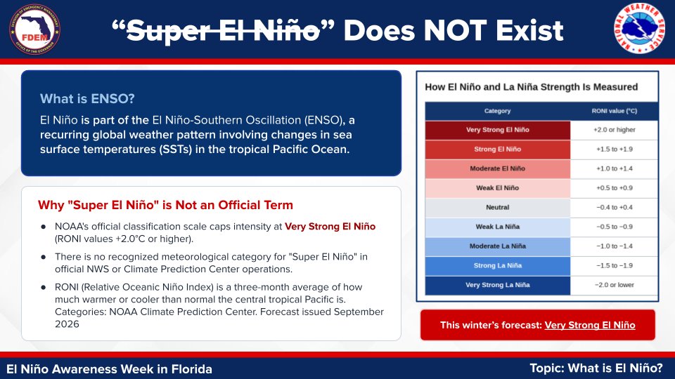
What is El Niño? 🌊
It brings warmer Pacific waters, steering an active jet stream over Florida from Nov to Apr.
That typically means cooler, wetter, and stormier.
Time to restock supply kits and review family emergency plans! 🔦📦
#FLwx#FloridaElNiñoAwarenessWeek#ElNiño
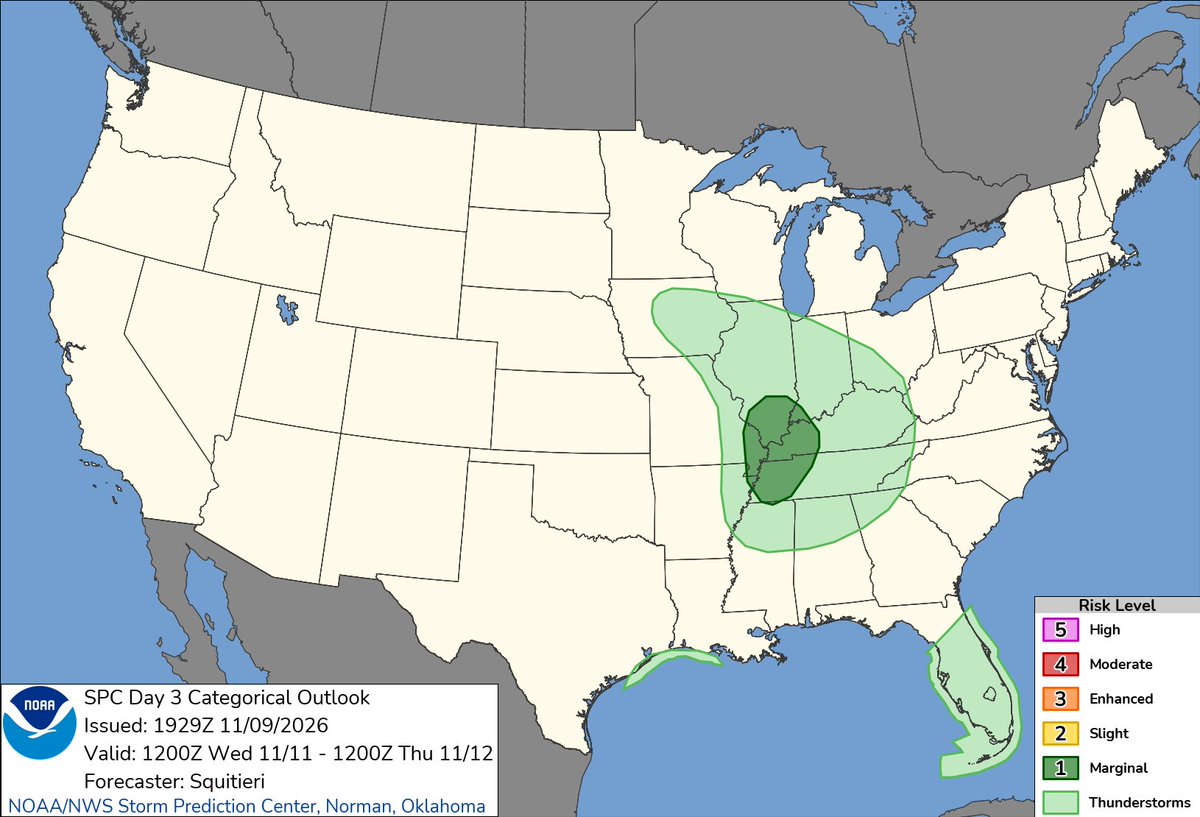
Enjoy the pleasant weather the next few days because the weather will deteriorate Wednesday night into the weekend as a strong cold front moves through the area. Expect widespread rain and windy conditions Thursday and Friday, mixing with snow at times. #ohwx#pawx
Near record warmth on Wednesday will give way to near or even slightly below temperatures by the start of this weekend as cooler air from the north returns. However, dry air will keep rain chances away with skies remaining clear the latter half of this week.