A weather service dedicated to the Poconos specializing in school predictions. Supported by an awesome community. Predictions are my own opinion. #InVogtWeTrust
With a winter storm on the way, this is a great time to sign up for Premium!
✅School predictions for all districts in PA.
✅Zip Code predictions with weather graphs.
✅County-level predictions for the Northeast USA.
✅The original NEPA-focused graphics.
https://t.co/O7AWYGcF2D
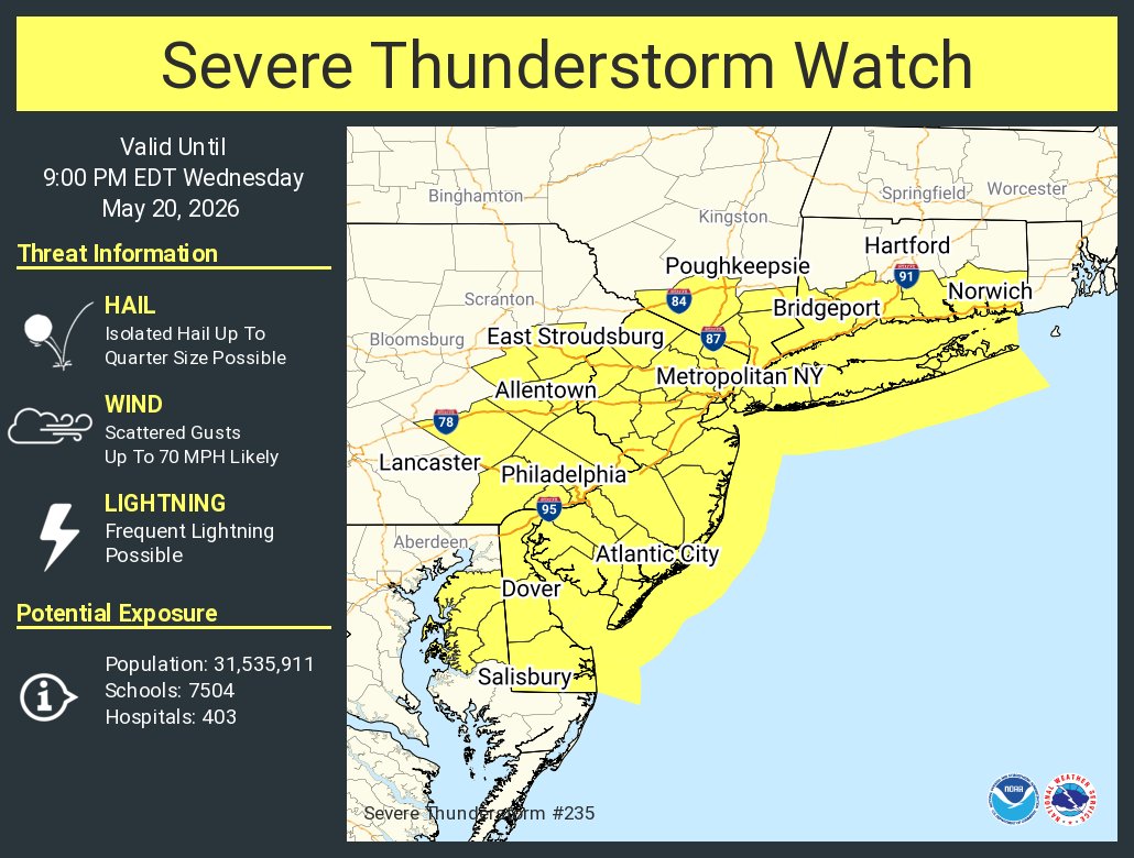
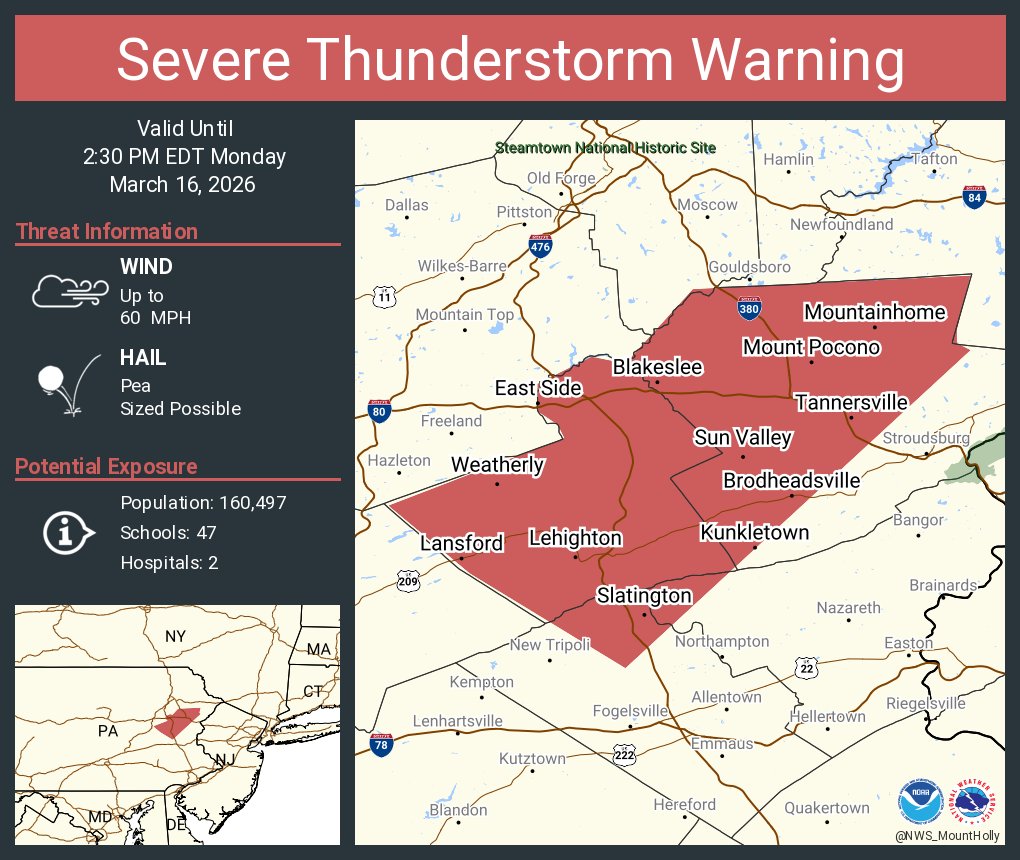
A separate severe thunderstorm watch has been issued for areas farther to the east of the previous/existing watch (Central PA)
This one is in effect until 9:00pm today with similar expectations. Damaging wind gusts are the primary concern.
@LI_Weather516@Eweather13 Have to agree, it's performance has been extremely volatile from run to run. The other models were more consistent and steady. Have to admit, @eweather13 is the only voice I have heard so far in the weather community that is supportive of the RRFS.
@StormNetWx Not sure how comfortable you are with this idea, but have you thought about aligning the colors or risk level descriptions to that of the SPC? That way it would be easier to see the SPC equivalency.
ESASD Recognizes Administrative Professionals Day. Thank you to our Administrative Assistants, Administrative Services Staff, Business Office staff, Bus Aides, Bus Monitors, Front Desk Receptionists, Secretaries, and Information Technologists for all you do.
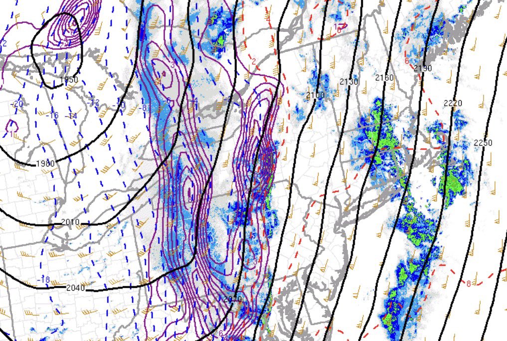
For our region, I don't see much threat for severe thunderstorms outside of maybe a weakening severe thunderstorm from central PA into eastern PA. Primary focus this evening will be on heavy downpours and occasional strong wind gusts.
Rain is transitioning to heavy snow as our front pushes through Pennsylvania.
Snow reports out of Western Pennsylvania have been around 2-4”+. Comparing current observations to some of the mesoscale guidance, it appears that the transition to frozen precipitation is moving quicker than modeled.
This is likely because of the abundant frontogenesis at 850-700mb, supporting more potent dynamic cooling as soon as the front passes through and temperatures plummet.
We’ll likely see a brief period of moderate-heavy snow, perhaps as far east as Eastern PA, around or just after midnight. Any accumulation of snow that does fall will likely be on grassy surfaces up to 1”.
#PAwx
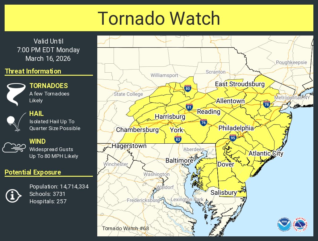
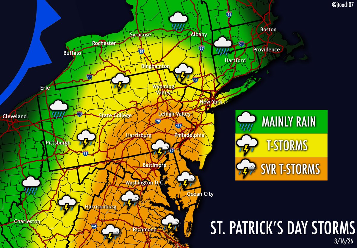
WATCHING MONDAY...
Confidence is increasing for some significant severe weather as a strong cold front with a negatively tilted trough moves through the region. Warm moist air will surge in from the south with abundant wind shear that will aid destabilization in the atmosphere, causing widespread, powerful thunderstorms to develop.
The primary hazard looks to be damaging winds, with a QLCS/squall line looking probable, but hail and a few tornadoes cannot be ruled out and remain fully in play.
#PAwx #NJwx #NYwx #MDwx #DEwx #VAwx #WVwx
@Eweather13 People also forget ENSO forecasts are not as accurate during the Spring months due to seasonal changes. El Niño coming? Sure, but not super, IMO.


![iembot_phi's tweet photo. PHI issues Winter Weather Advisory valid at Mar 6, 12:00 AM EST for Monroe [PA] till Mar 6, 10:00 AM EST https://t.co/WvfJFwQYxx https://t.co/LLgSMa90LE](https://pbs.twimg.com/media/HCqspOtXMAAh6Xt.png)