More than Naught: The “Z” of Where Land Meets Sea:
Harnessing 30 years of #Landsat data, a team of researchers from Australia (@GeoscienceAus) has created the first 3D model of Australia’s entire coastline.
Details: https://t.co/2CprNGBqOE
🔴 Skills in #RemoteSensing or good ideas? Take part in the Sentinel Hub Custom Script Contest! Write a custom script for the #EOBrowser🌐 and win attractive prizes, including a trip to @esa in Rome! Students welcome! More information ➡️ https://t.co/hrzyj31wsD #CSC2019
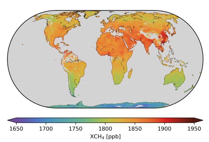
The @CopernicusEU#Sentinel5P mission has been used to produce global maps of methane and ozone - two atmospheric gases responsible for making our world warmer.
Read more from @ESA_EO: https://t.co/YaUiJiXl0B
🛰️🌍Trends in #EarthObservation #1 – Diversification of users & their demands
There is a growing interest in #EO-based solutions by non-technical users. They usually require "crunched" information rather than raw data.
📕Copernicus Market Report: https://t.co/kaH3oFXVMC
Warm cows on a cool day. An RGB and thermal image from our inaugural flight with a thermal camera up in the Quiet Corner region of CT. Drone flight planned by @yaleFES students for Drone Remote Sensing course. #drone#remotesensing#yale#cows 🐄🐄🔥🔥
As it cut across the Southeast, #HurricaneMichael knocked out power and telecommunications to millions of Americans. These images, based on data from the VIIRS sensor, show nighttime light from Panama City, Florida, on October 6 and 12. https://t.co/sHL67OpOxp
A beautiful landing by Captain Varoon. @YaleFES & @YaleArch students on a field trip for Drone Remote Sensing course. Captain Sully would be proud. #drone#remotesensing#yale
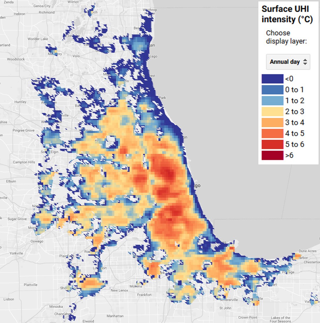
Just launched: the Global Surface UHI Explorer, an interactive web portal to monitor urban heat island intensity across nearly all urban clusters on Earth. Created by @YaleFES student TC Chakraborty. Check it out here: https://t.co/TFKnVonWzX
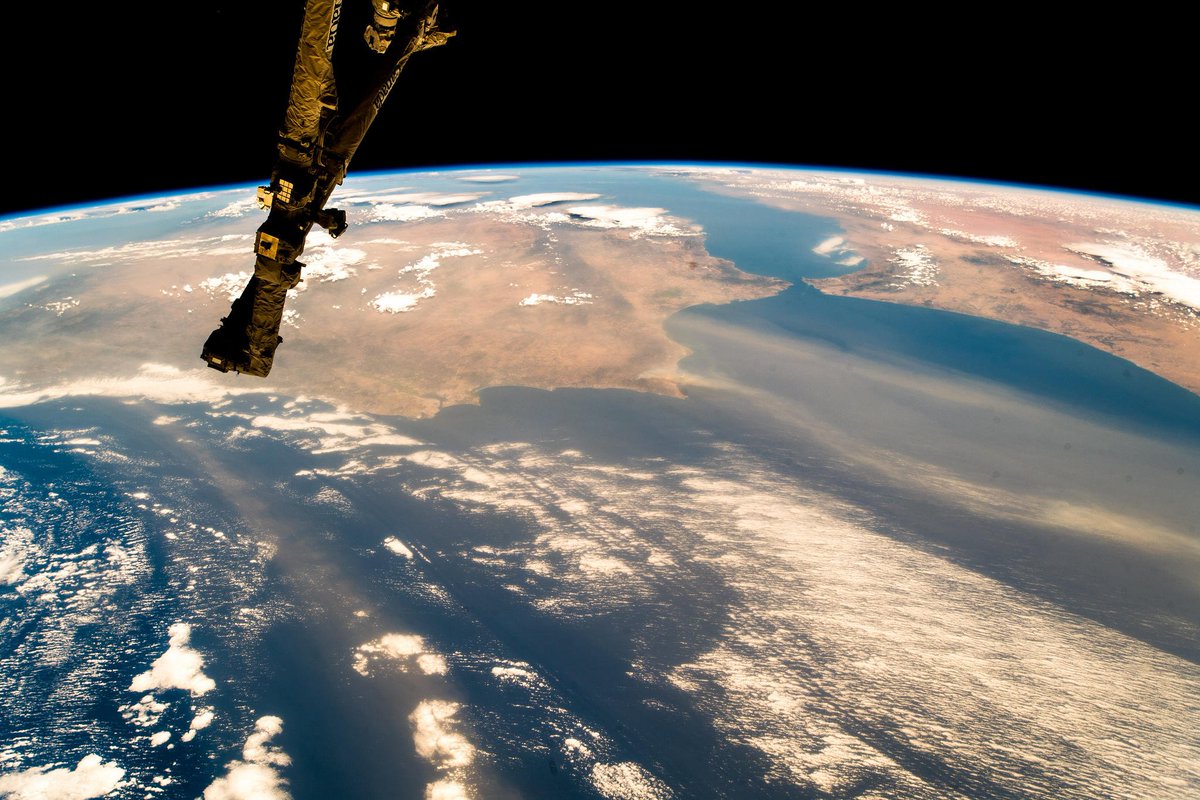
Dramatic view from the @Space_Station posted by @Astro_Alex yesterday, showing smoke from fires in Spain and Portugal reaching far into the Atlantic Ocean https://t.co/1ItJEHcTna
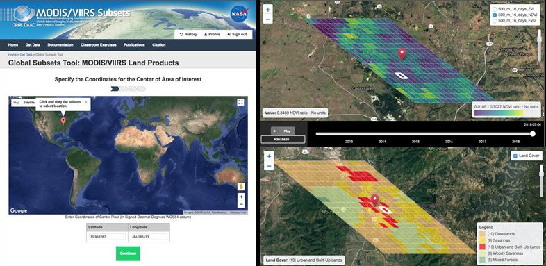
Webinar on 8/16/18: MODIS and VIIRS #Data Tools and Services at your Fingertips- Learn how to discover, subset, access +visualize both MODIS and VIIRS data products w/a suite of #NASA ORNL DAAC user-friendly tools. To register: https://t.co/PA12kvnPp4
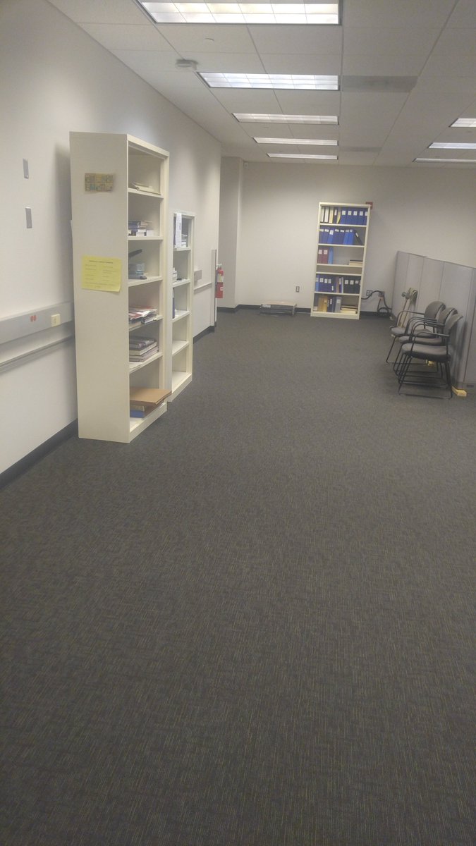
The #YCEO is getting a facelift! New paint, new carpet, brand new workstations about to be installed. Working hard to be back up and running before fall semester. Stay tuned... #remotesensing#Yale#labupgrades
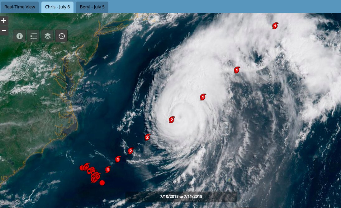
Today for the first time, @NOAA Satellite's Atlantic #Hurricane Tracker premiers with real-time satellite imagery and current and past hurricane tracks available to view and interact with. Track the storms and check it out HERE: https://t.co/xGOoQhzFnq
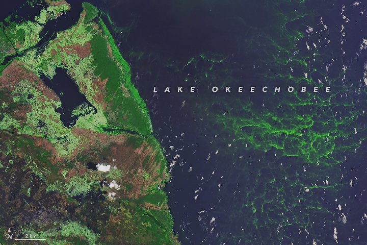
Summer phytoplankton blooms are here. Check out these #Landsat images of cyanobacteria blooming in Florida’s Lake Okeechobee and offshore the Michigan coast in Lake Erie. https://t.co/FY9cZPkpdE
A first-of-its-kind survey of the world’s sandy shorelines with satellite data found that they have increased slightly on a global scale, but decreased in protected marine areas, where many beaches are eroding. https://t.co/Bpn5VkfiMG
Arctic circle forest fires are hitting today's news headlines.
The @esaclimate Fire_cci team have a global burned area data product (2005-2012) available: https://t.co/sGzzzqkdMZ #climate#fire@ESA_EO
Using #Landsat to track patterns in irrigation may help water managers sketch out a more sustainable future for the Ogallala Aquifer in the central United States, story via @NASAEarth https://t.co/OgogKN0TdL @USGSLandsat