@FalcnStormChase You can oftentimes determine an individuals motivation in this field based on this. It's becoming more and more of a "hey look at me" culture, especially online.
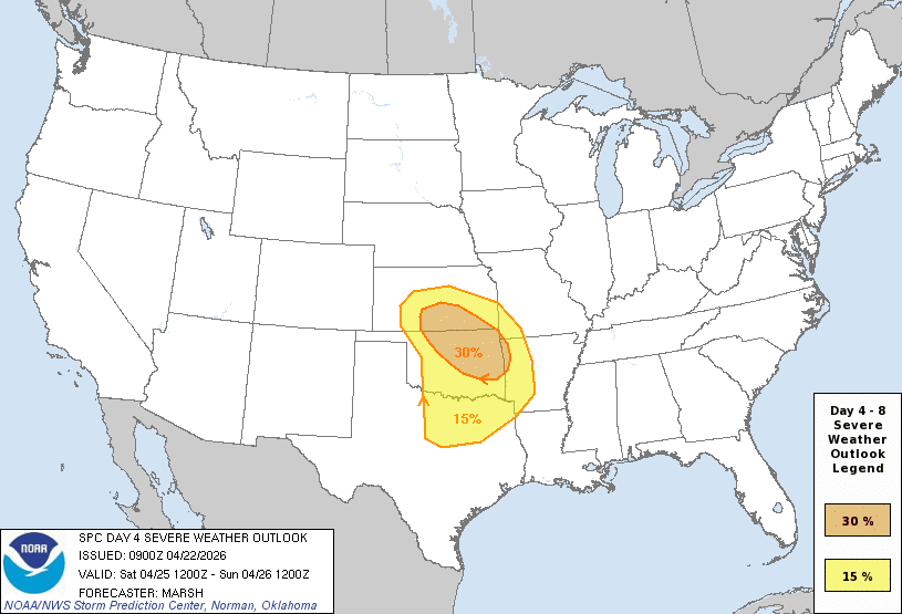
A very active period of severe weather is forecasted for portions of the Midwest and South over the next several days, with hail, tornadoes, and damaging wind gusts all expected. Chase mode = Activated!
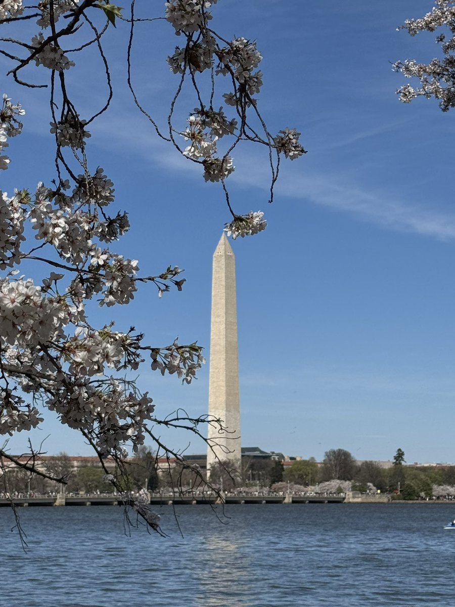
It was an absolutely gorgeous day to check out the cherry blossoms in DC! The festival should continue on for the next few days, before the next rainstorm arrives by mid-week. 🌸
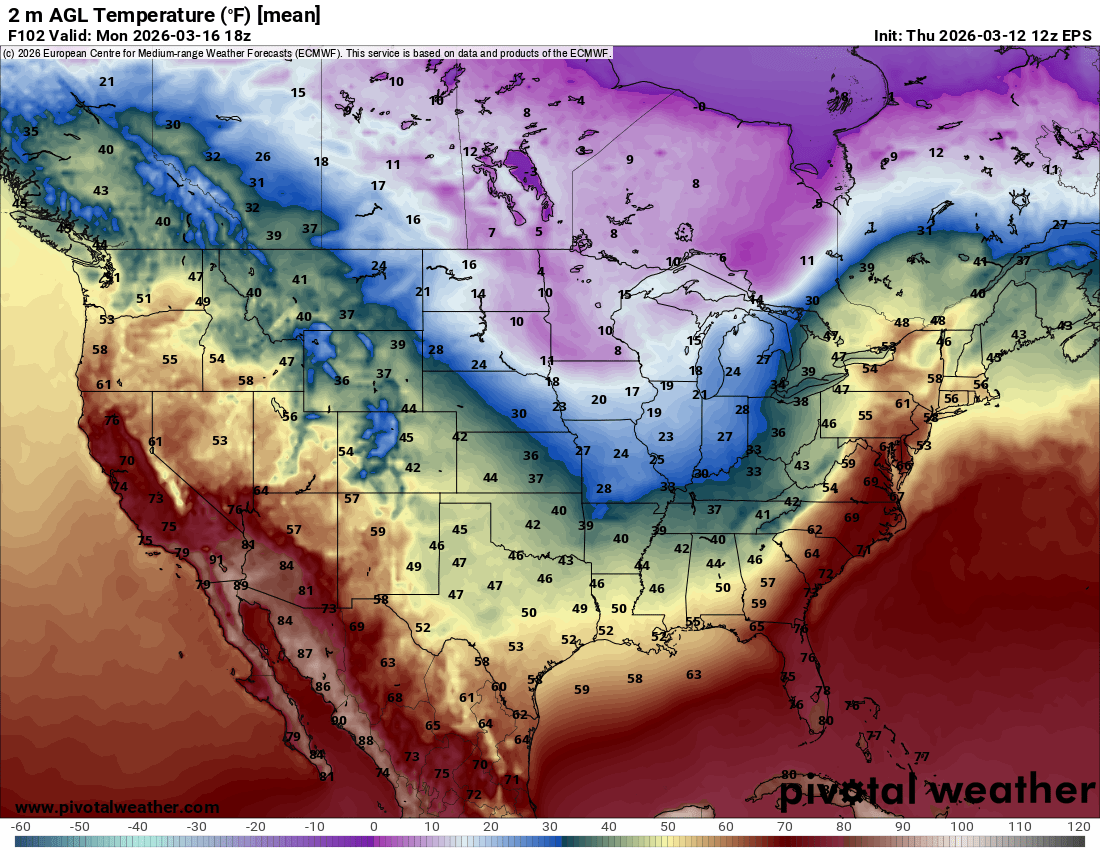
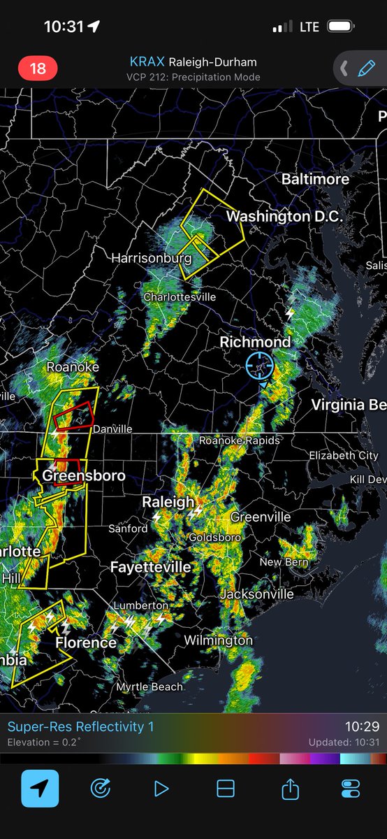
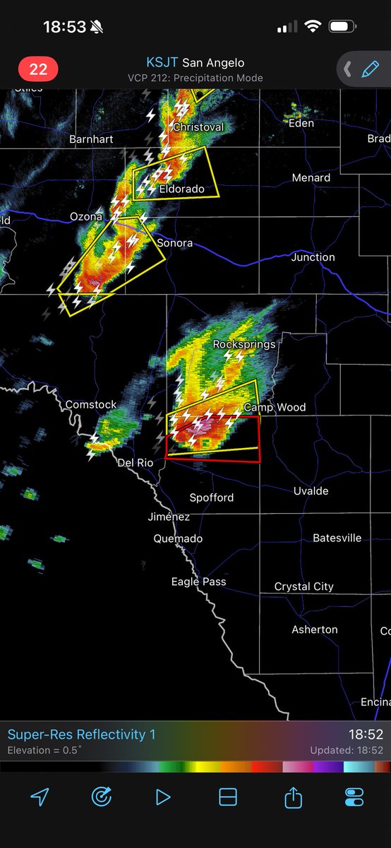
Out and about today in VA/NC to see what this storm system is made of. Instability looks to increase over the next few hours, which could help ignite this line as it moves into Piedmont
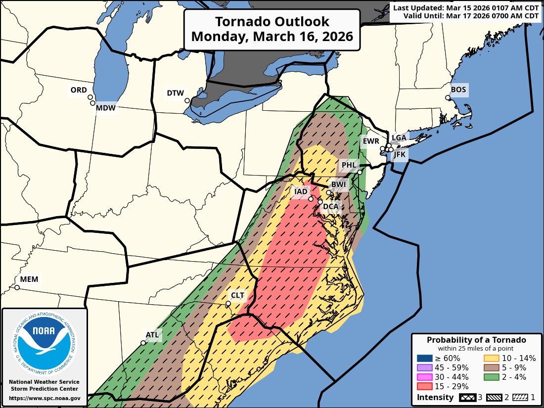
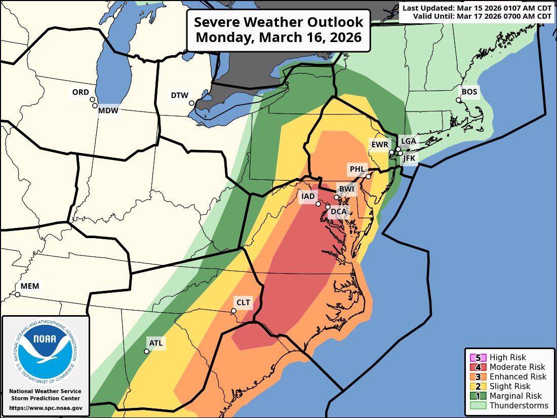
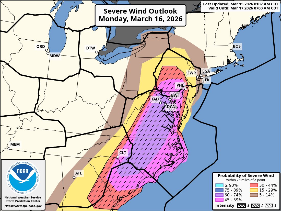
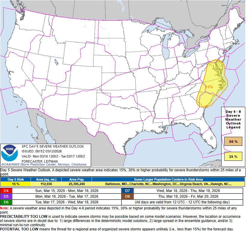
An outbreak of severe thunderstorms is expected tomorrow across the Mid-Atlantic and Southeast. This has high end potential for both tornadoes and damaging winds for an area that hasn't seen it in a while. Storm chase mode will be activated!
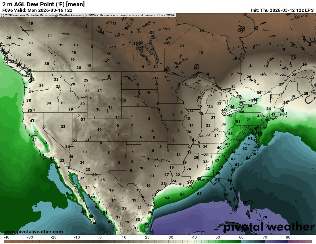
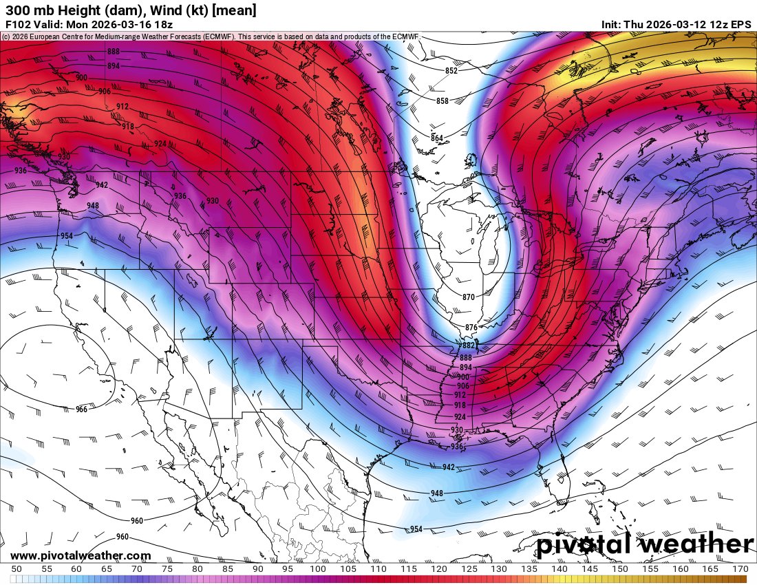
Keeping a rather close eye on Monday across the Mid-Atlantic for severe weather potential. The kinematics appear to be rather bonkers, with instability seemingly being the potential limiting factor. Looking more and more like a typical "Low CAPE, High Shear" setup here.