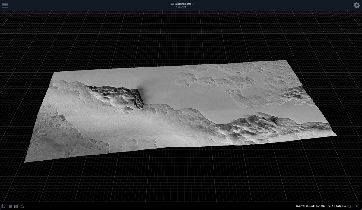
Happy HUGE 3D Data Release Thursday! 4800+ new @USGS_AstroGeo DTMs have just gone live at https://t.co/NxgZ0JneB3! This brings the total number of #3D#Mars slices you can view on mobile, desktop, or in #AR quicklook on #iOS, to over 7000 🛰️⛰️🤯
White Light Reference for Machine Learning.
Meet our inhouse tech Doggo "Rolo".
"More Doggo than Doggo"
Since July we've been redesigning our scanning pipeline to work with the new 3D Gaussian Splatting for Real-Time Radiance Field Rendering method from Inria.
https://t.co/FOauV1uWYx
IR's AeonX capture system has been designed to capture "Spatial" memories for the future.
We've built on a custom version of Inria's Sibr viewer to handle the playback of our multiple processed 4D frames.
GS has reignited our passion for 3D/4D scanning. Thank you to the team at @Inria
More content to come..
#guassiansplatting #ir #aeonx #4d #motionscanning #inria #ximea #idatronic #spatial #youth83
I lost my job yesterday. Still processing & trying to figure out next steps, but if you or anyone you know has opportunities for a cartographer & data visualizer with expertise in remote sensing data, please get in touch.
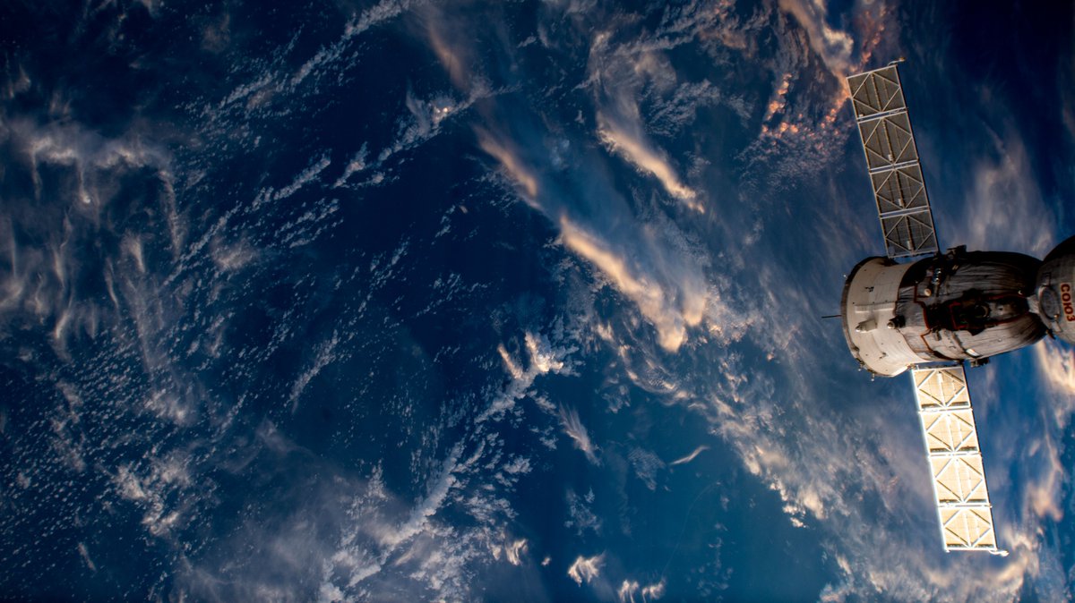
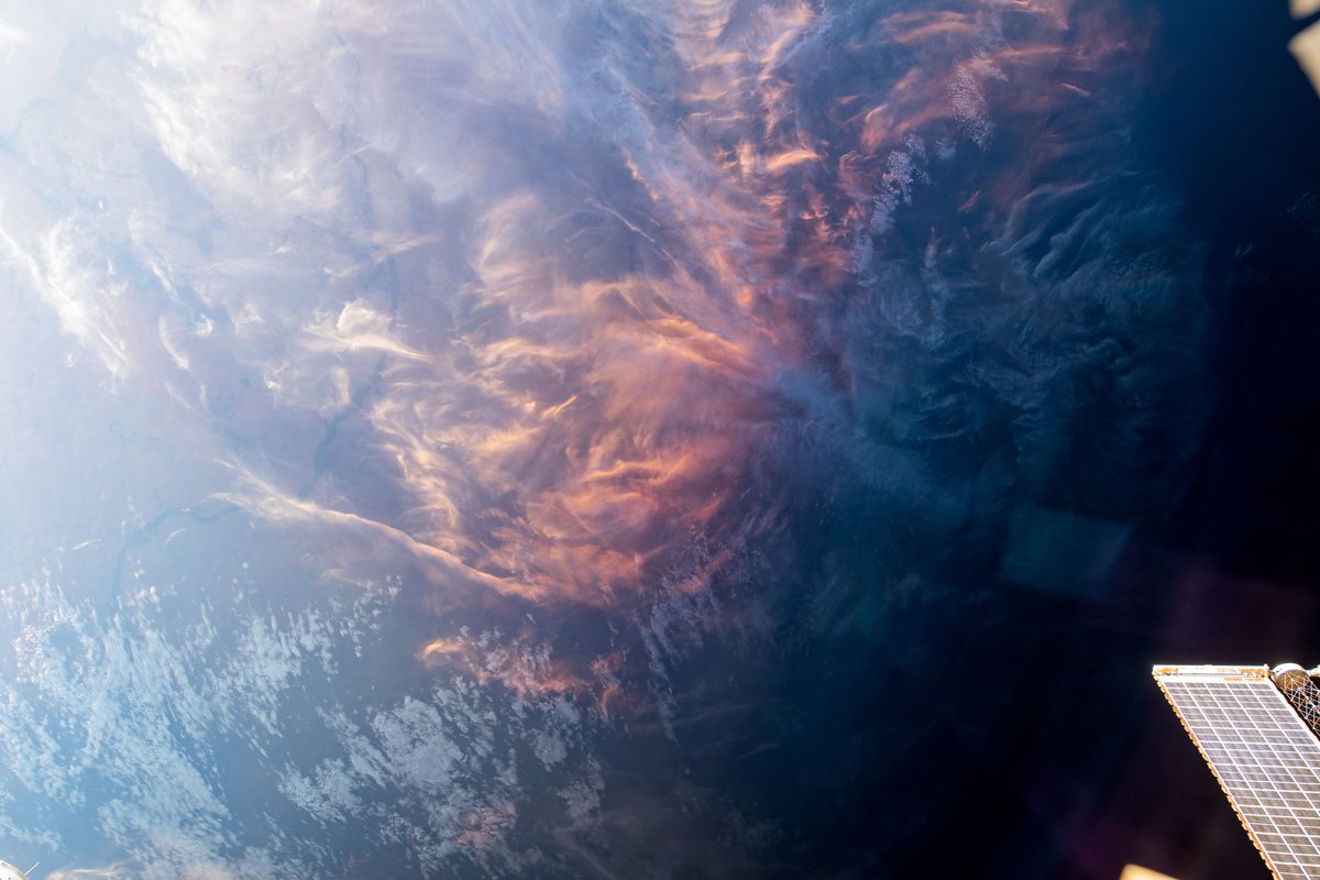
Clouds from above... ☁
Photos of pink and gold clouds hanging over oceans around the world were captured as the space station orbited roughly 260 miles overhead.
More of Earth from space: https://t.co/1ZUTE6Ezxa
Next quick #visionOS test - spheres representing cam pos + target vec for (nearly) every image Perseverance took on Sol 134! Red = MCZ, green = NAVCAM, blue = HAZCAM & yellow = SUPERCAM. The fridge is just a fridge... 📷⛰️ #PleaseExcuseMyTerribleDebugScenes
@stim3on Oooh thanks man, I hadn't seen these! These tests are in the simulator for Apple's Vision Pro, and funnily enough my plan is to really simplify the model as it'll serve as more of a navigation tool for seeing what imagery is available per sol.
Wahoo! Image plane code in and (very slow but kind of) working! Any actual image display would be handled in a shader, so this is purely for context. But now I can (try to) start merging planes to make a simplified 3D visualisation of available data for this particular sol 👍
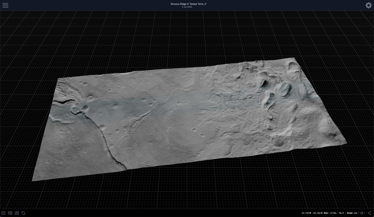
Hello you lovely lot! This month's fantastic new @HiRISE-based #Mars DTMs are now live over at https://t.co/NxgZ0JmGLv! Fun fact: according to a terrible python script I just wrote, the 979 available @HiRISE DTMs now cover ~114,000 (often overlapping) km²! 🛰️⛰️👍