Over 40 years ago, designer Peter Saville crafted the album cover for Joy Division’s Unknown Pleasures, lifting the image verbatim from a science book depicting the very first reading of a pulsar from 1967, CP 1919
[read more: https://t.co/n65YzAexm2]
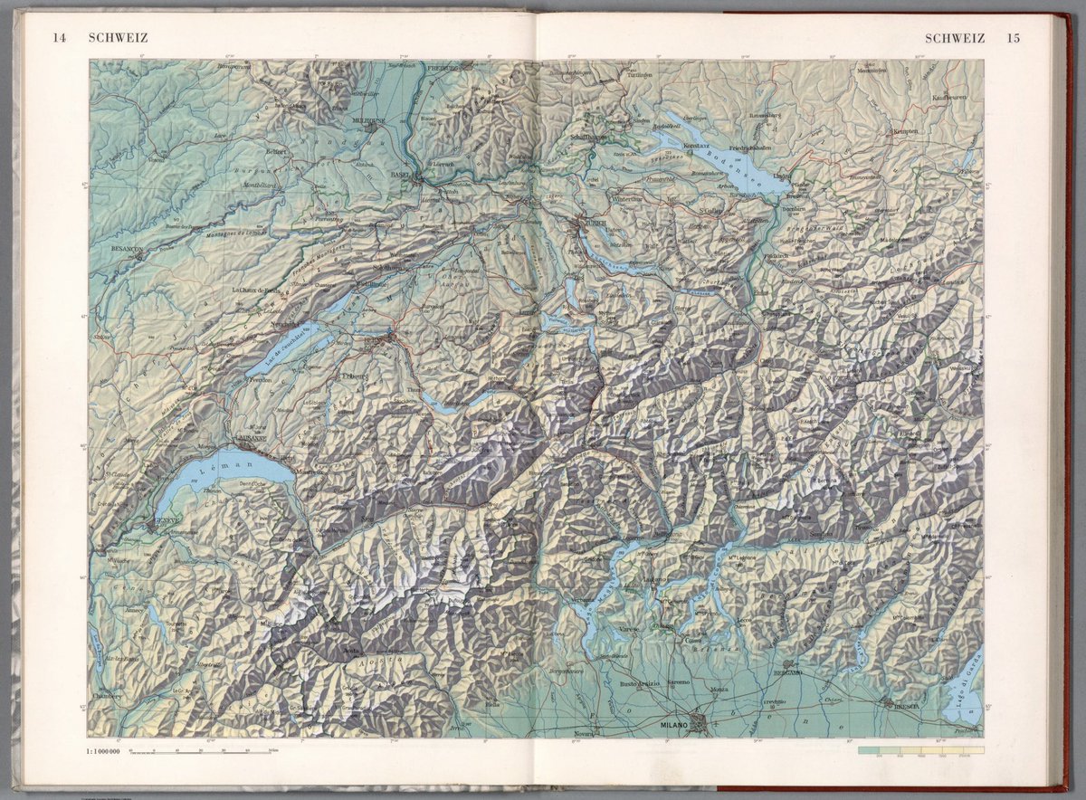
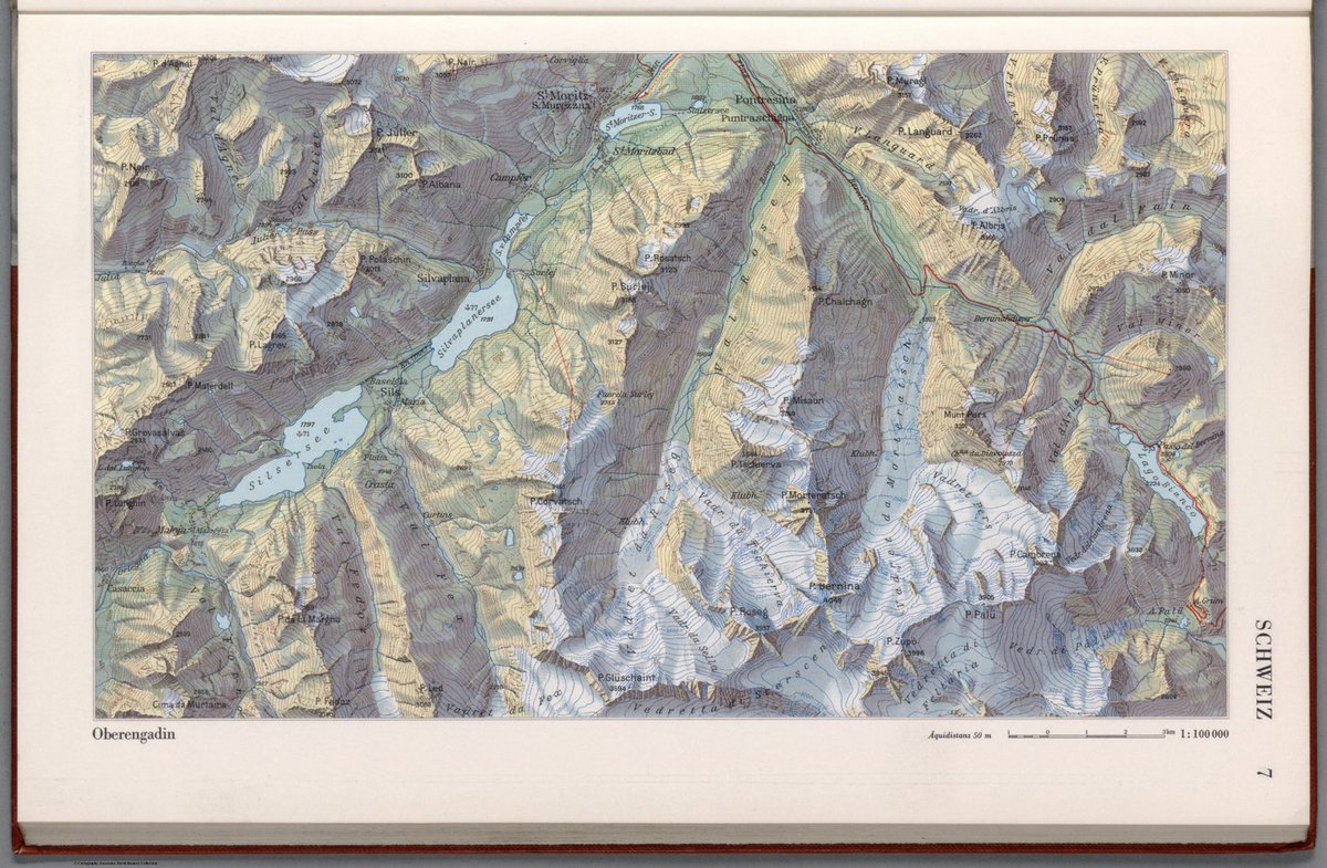
The beautiful cartography of Eduard Imhof created for a Swiss middle school atlas - "Schweizerischer Mittelschulatlas herausgegeben von der Konferenz der kantonalen Erziehungsdirektoren. Fünfzehnte Auflage, 1969."
https://t.co/Gm27h16yrc
In this 2017 marketing stunt, Michael Guerra shows how adopting this definitely unconventional position may result is an efficient aerodynamics vs the other cyclists
This is the physics behind it: https://t.co/pPufsoWVUN
[video: https://t.co/jwJ74vmOtZ]
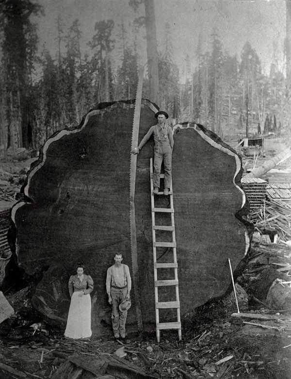
A family poses in front of a 1,341 year old Sequoia tree nicknamed "Mark Twain" that was felled in 1892 after a team of two men spent 13 days sawing it in the Pacific Northwest. The giant tree was 331 feet tall (100 meters).
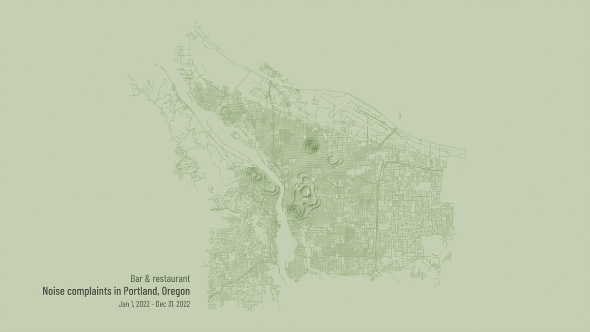
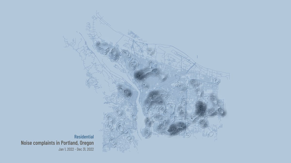
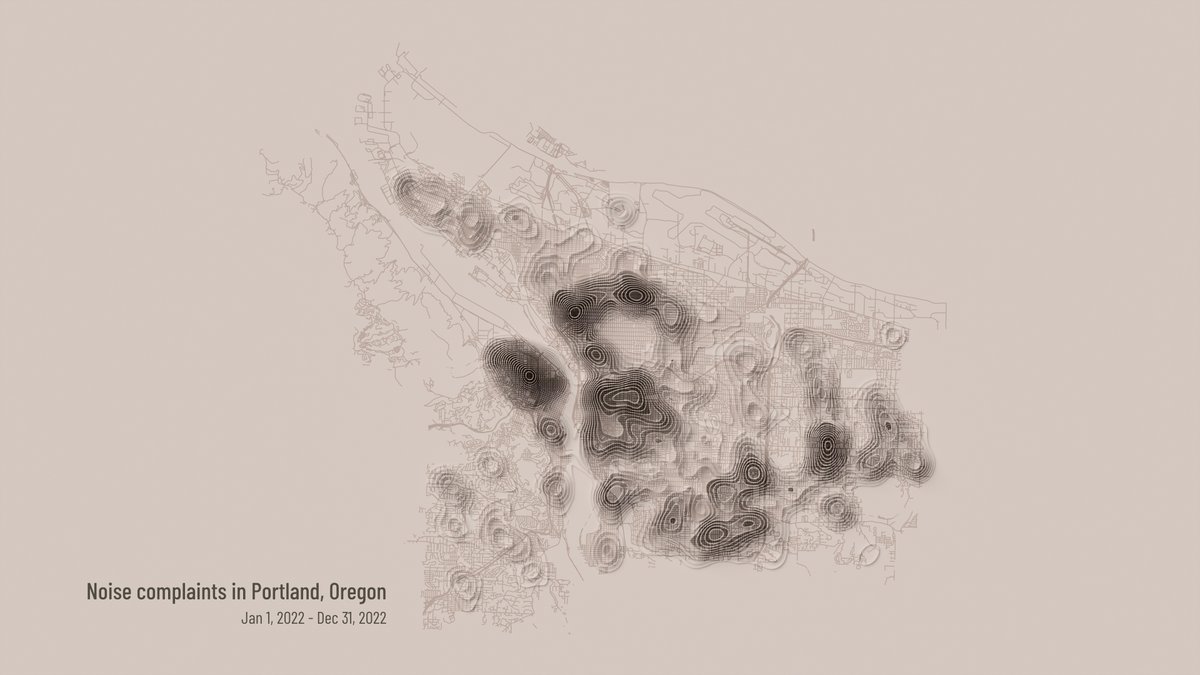
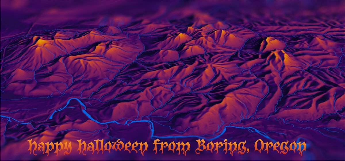
Inspired by a post I didn't read by @John_M_Nelson, I wanted to wish you a Happy Halloween from Boring, Oregon just east of #Portland. The @EduardShading was given an inverted Inferno tint from Matplotlib in #ArcGISPro to catch the SE-facing lava domes. @BoringMaps#3d#esri
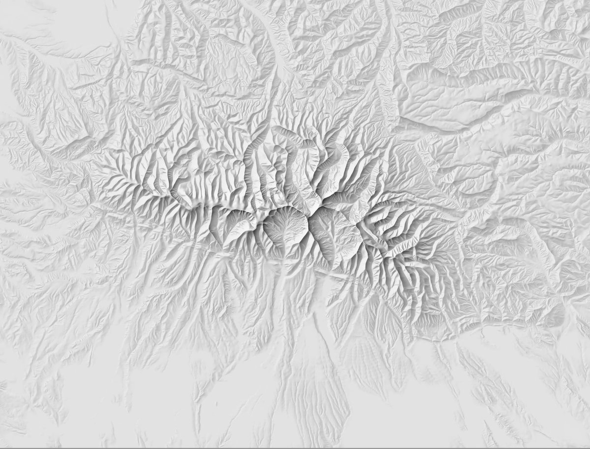
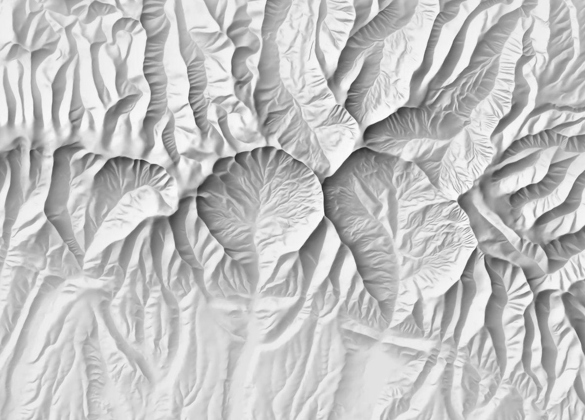
Inspired by @CSVerdel and @mappingbernie and @stefanvdwalt I added a little color and perspective to my favorite mountain range in Montana. It's a Big Snowy Inferno!
@ebreedon The video is much smoother and more detailed. Be sure to look closely at the baseball players changing innings, the funiculars, and the folks jumping off the Pitt bridge to celebrate winning the World Series in 1902. https://t.co/7aiYYIJX7h
Returning from #NACIS2022 filled with enthusiasm from being around so many talented cartographers. Excited for next year's conference in Pittsburgh, where I first animated an historic panoramic map using #aftereffects in 2014. https://t.co/5VwjGkPhO6
Saw @mappingbernie present https://t.co/PGXKqdvLXW at #NACIS22 and I couldn't wait to check out the Big Snowy's and Knife Blade Ridge. This software is amazing. Thank you!
@WarrenDz It’s been 7 years since these animations came together, but since they’re based on historic maps - maybe there’s still some relevance. https://t.co/LHVG1ucwZv


![Rainmaker1973's tweet photo. There are 12 black dots at intersections in this image. Your brain won’t let you see them all at once. Here's why [read more: https://t.co/5iQR5WHFf0] https://t.co/Km2OeDbtin](https://pbs.twimg.com/media/FfahNToXkAATsOs.jpg)


