The work of Dr. Arpan Shastri and Dr. Chandrakanta Ojha on the coastline of Chennai featured in @ttindia.
The research appears in Nature Scientific Reports: https://t.co/WuvBI5WfkM
Congratulations, Dr. Shastri and Dr. Ojha!
@chandraphyctc
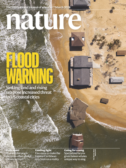
This week in Nature: Flood warning - Sinking land and rising sea pose increased threat to US coastal cities
Browse the full issue here: https://t.co/4JO7ZItbmY
How a satellite-based radar remote sensing technique can precisely measure the sea level rise along the shoreline?
A collaborative work of our colleague Dr. Chandrakanta Ojha has found place on the cover page of @Nature. Congratulations, @chandraphyctc!
https://t.co/23IxR7sXjO
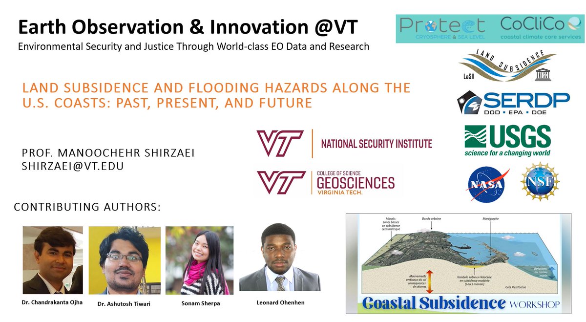
A paper in @Nature suggests that a considerable amount of land in 32 US coastal cities could be at risk of flooding by 2050. The findings indicate that 55,000 to 273,000 people and 31,000 to 171,000 properties may be affected as a result. https://t.co/IfooOvOvQE
******** NEW PAPER ALERT*******
In our new paper just published in @Nature led by Leonard Ohenhen (@Leonardgeol), we present the first map of #VLM and #flooding for the #USCoast. we show 1,006 and 1,389 km2 is threatened by relative #SLR by 2050, posing a threat to a population of 55,000–273,000 people and 31,000–171,000 properties.
Congratulations Leonard!!
Coauthors: Sonam Sherpa (@sonamfutisherpa ), Chandra Ojha (@chandraphyctc ) and Robert Nicholls.
pub: https://t.co/9dOWteY6BO
@VT_Science@vtgeosciences@EOI_lab@HIRSlab
***** NEW PAPER ALERT****
Published in @PNASNexus, a collaboration between @EOI_lab of @VT_Science and @USGS, Leonard Ohenhen (@Leonardgeol) shows #subsidence rates of 2 mm per year affect up to 2.1 million people and 867,000 properties on #USEastCoast and critical #infrastructures such as #roads, #railways, #airports, and levees are also affected by differing subsidence rates and some are in critical condition. Congrats, Leonard!!
@VTresearch@vtgeosciences
Pub: https://t.co/HwXG9hHfFE
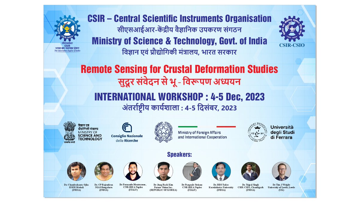
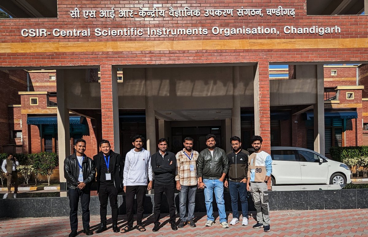
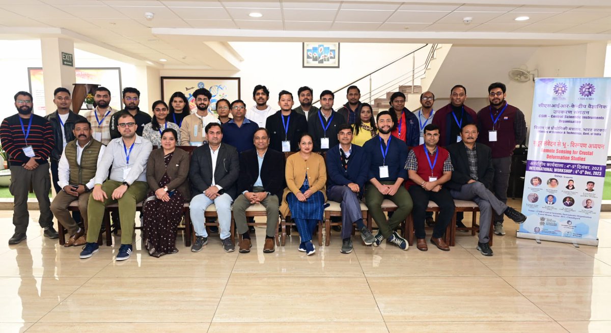
Thoroughly enjoyed and gave a short tutorial of GMTSAR software in the 2 Day International workshop "Remote Sensing for Crustal Deformation Studies" at CSIR CSIO National Laboratory, Chandigarh. Thanks to all the speakers @chandraphyctc@timwright_leeds@maferp_13@cprajendran
Our paper on "Disruptive Role of Vertical Land Motion in Future Assessments of Climate Change‐Driven Sea‐Level Rise and Coastal Flooding Hazards in the Chesapeake Bay", is out in JGR, https://t.co/dlNxCQAYT2. #SeaLevelRise@shirzaei@chandraphyctc@DRRM_VT@vtgeosciences
@EaDARLab A new study on the US Atlantic coast shows that different land covers (from developed areas to wetlands) are losing elevation, with rates up to 3 mm per year @Leonardgeol@shirzaei@chandraphyctc@theswampboss
https://t.co/wxFhnjCnuo