Heavy rain moves into SE AK Sat evening thru Sun. 1 to 3 inches over next 48 hours. Be alert to ponding of water on roadways and low lying areas as well as potential rises in small streams. #akwx
Sea ice piled up on the shoreline. Unlike a lake, the ocean is dynamic and always moving so the wind and tide keep breaking the ice and blowing it up along the shoreline.
Flash Freeze expected across southern New England today as temperatures plummet. This will result in dangerous travel due to icy road conditions. Check out https://t.co/Z6HH110P0x for the latest road conditions. #mawx#ctwx#riwx
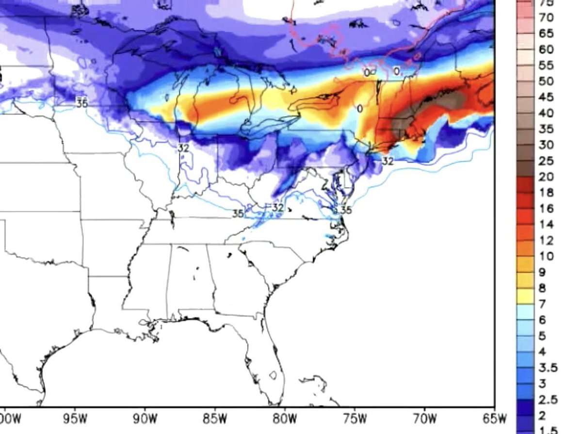
Happy Valentine’s Day from the 12z Euro. Sweet of the model to throw a little red in there too.
Not a forecast….but this has been the period to watch for a few days now with a favorable upper air pattern for something to develop.
Every year, more than 400 people die from carbon monoxide poisoning - many during attempts to heat their home during power outages.
Make sure you're heating your home properly. Your household's safety depends on it.
(Video credit: @FEMA)
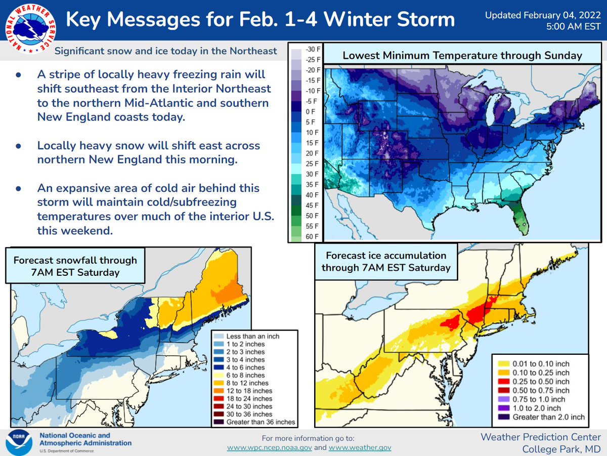
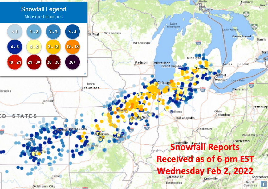
The latest snowfall and ice accumulation forecasts for the next 48 hours (7 pm EST Wed to 7 pm EST Fri). Also the snowfall reports received as of 6 pm EST Wednesday evening.
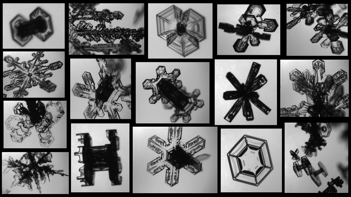
Beautiful in-cloud snow crystal images captures by the Particle Habit Imaging and Polar Scattering (PHIPS) probe onboard the NASA P-3 flying during the @SnowIMPACTS mission Friday February 4, 2022 over New England.
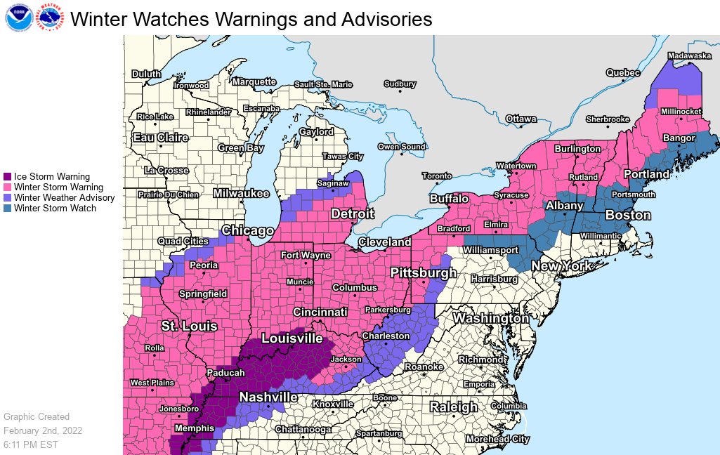
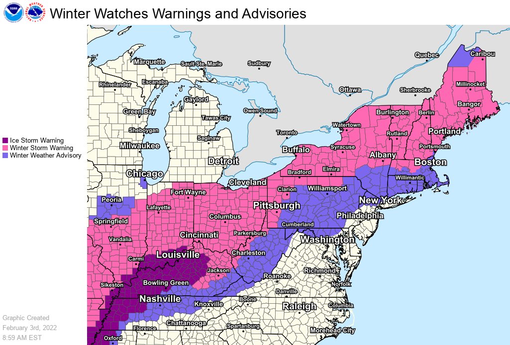
Colder air continues to push slowly south and east this morning across the Ohio Valley and eastern Great Lakes, causing the rain to change over to freezing rain, sleet, and snow. Here are the latest snowfall and ice accumulation forecasts.
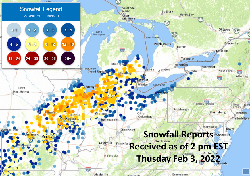
Snowfall and ice accumulation reports as of 2 pm EST Thursday. Highest snowfall totals by state so far:
IL - Chatsworth 15"
IN - Chesterton 14"
MI - St. Joseph 13.8"
MO - New London 12.2"
OH - Edgerton 8.3"
NY - Springville 4"
PA - McKean 3"
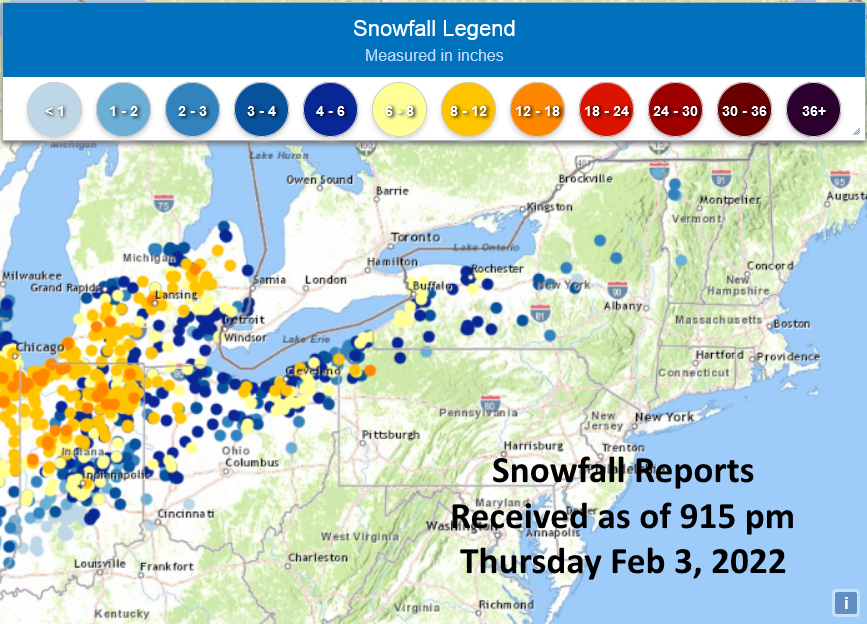
Snowfall reports received as of 915 pm Thursday evening. Highest totals by state so far:
IN - Peabody 14.7"
MI - St. Joseph 13.8"
PA - Townville 12.5"
OH - Ridgeville Corners 11.3"
NY - Rapids 7.5"
VT - Burlington 2.5"
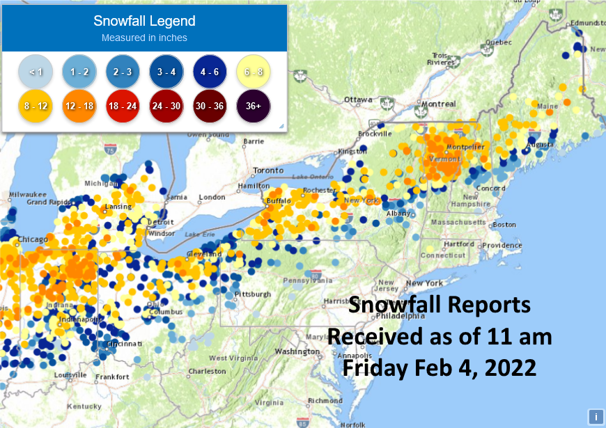
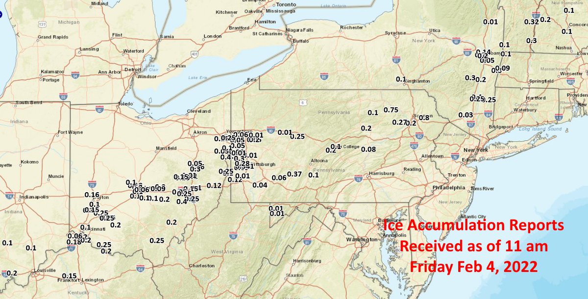
Snowfall and ice accumulation reports for the February 3-4, 2022 storm. Highest snowfall totals by state:
NY - Paris 17"
VT - Warren 17"
IN - Leiters Ford 17"
ME - Newry 16"
MI - Mottville 14.1"
NH - Whitefield 14"
OH - Chardon 13"
PA - Townville 12.5"
KY - Burlington 4"