CONGRATULATIONS Iowa and Illinois – you're more humid than the Amazon Rainforest.
Blame the corn. A single acre of mature corn this time of year can evapotranspirate, or "sweat," between 2,000 and 4,000 gallons of water per day. That moisture festers in the lower atmosphere, making the heat index values unbearable.
Dew points could reach 80 DEGREES. LUCKY US! Every cubic meter of air is holding more than half a shot glass' worth of water.
For comparison, the highest dew point I could find in the Amazon was 79º. So parts of Iowa and Illinois... yep. More humid. Enjoy. :/
Northern Indiana into Michigan.. 1 county separates a tornado warning to a winter weather advisory..
4 county separation of a tornado warning to a winter storm warning.. 👀🫣
November 30 marks the official end of the 2025 Atlantic hurricane season. It was a statistically strange year, packing 3 powerful Category 5 hurricanes into a 13-storm season.
Here's a collage of all the storms from this season.
#hurricaneseason#wxtwitter
Some still shots of the incredible waves that are smashing into the St. Joe, Michigan lighthouse this afternoon. Waves are forecasted to increase to nearly 40ft in height overnight! #MIwx
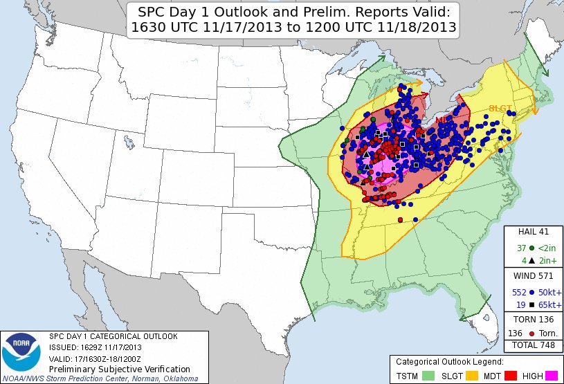
On this day in 2013 a High Risk was issued for an impending tornado outbreak. By that evening, 74 tornadoes had occurred, including:
2 EF4s
7 EF3s
and
24 EF2s
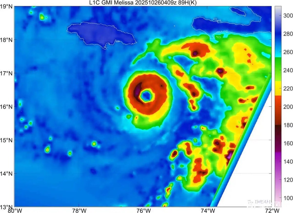
3:30 am. Couldn't sleep. Full-on obsessed. #Hurricane#MELISSA is bombing out in the Caribbean Sea, a beast closing in on #Jamaica. Feeling concerned for the island & its people. Also feeling great personal pressure to properly record & measure what may be a generational event—to collect the data that tell the story. Trying to keep emotions out of it & just stay focused. One task at a time, I tell myself. Right now poring over maps, plotting every town near the coast, figuring out my strategy.
Tail Doppler Radar (TDR) data from the current recon mission into #Melissa shows the vortex is vertically stacked up to 15 km w/ the upshear/NW quad being the strongest.
This vortex structure is *extremely* favorable for continued rapid intensification
Plots via @cyclonicwx
While the evolution of Mellisa is truly amazing and terrifying, I also want to state how lucky we are to live in such an amazing age of meteorological data.
For some of you kids (yeah, I'm aged like fine wine, kids), the most we had access to in the 1980s and 90s was getting some coverage by the amazing John Hope every 45 minutes on the hour. Now, we can refresh HiRes Satellite data at any time we want. Just amazing times to be a meteorologist.
It is becoming highly likely almost guaranteed at this point that #Melissa becomes our third Category 5 hurricane this year. That is possibly one of the thickest eyewalls I’ve ever seen.
Wind chills the next two mornings will be winter-like across the state. Besides areas downwind of Lake Michigan, our blustery wind gusts up to 25 mph will sink inland areas down to near freezing or perhaps below freezing for wind chills. As a reminder, the wind chill (similar to heat index) is the temperature your body feels. If you've got early mornings the next two days, make sure to bundle up in a couple layers each morning.
Coldest spots over the next two days appear to be in the western UP where wind chills could drop down to the mid-20's.
Here's a satellite pic., radar (lake-enhanced showers in West Michigan), the Muskegon Channel and the Holland Beach (water being pushed up on shore by the strong winds).
The wind on the Muskegon pier is west-northwest at 34 mph with a peak gust of 48 mph. Inland, peak gusts have been around 30 mph.
It's a little warmer at Lake Michigan. Current temperatures: Holland Beach 52, Muskegon Beach 51°. It's 45° at Fremont and 48° at Kalamazoo.
Waves are currently running 10.3 feet at the South Haven buoy and 11.5 feet at the Port Sheldon buoy. The water temperature is 54° at the Port Sheldon buoy and 56° at the Holland Channel.
Check out my daily YouTube videos at billsteffen616. #miwx #wmiwx
This article really bothers me. Criticizing the NWS is fair game, but the flood watch called for 5-7" maxima- a 10-25 year recurrence interval flood in the hills. Does anybody in the weather industry seriously think forecasting a locally generational flood counts as a "miss"?