GeoLibre v1.10.0 is here!
GeoLibre is a free and open-source, lightweight, cloud-native GIS platform for visualizing, exploring, and analyzing geospatial data. It runs everywhere you do, in the web browser, on the desktop, on mobile, and inside Jupyter notebooks, all while keeping your data local and private.
This release brings photorealistic city-scale 3D to the map, adds OGC API vector tiles, and makes vector tiles and live editing easier to work with.
What's new in v1.10.0
- Google Photorealistic 3D Tiles: drape entire cities in photorealistic 3D right in the map, streamed and rendered through https://t.co/Iu3zs18eJk.
- ArcGIS I3S scene layers: stream Integrated Mesh and 3D Object scene layers and render them in 3D on the shared https://t.co/Iu3zs18eJk instance.
- OGC API vector tiles: add standards-based OGC API - Tiles vector tile services as a remote source, right alongside XYZ and ArcGIS vector tiles.
- Local HDF5 and NetCDF-4 loading: open scientific HDF5 and NetCDF-4 files straight from disk, no cloud references required.
- GeoEditor from the current view: pull the vector features currently visible in the map into the GeoEditor and start editing what you are looking at, without re-importing the source data.
Try it out
- Launch GeoLibre Web: https://t.co/8gMtkVtfnm
- GitHub: https://t.co/VXq8c1o2Nd
- Documentation: https://t.co/7VA2AQoCUc
- Release notes: https://t.co/OQ74UTN7FT
#GIS #Geospatial #OpenSource #RemoteSensing #DataVisualization #MapLibre
GeoLibre now supports rendering 3D Tiles!
Try it out: https://t.co/YdRkXuhvUO
GeoLibre is a lightweight, cloud-native GIS platform for visualizing, exploring, and analyzing geospatial data across desktop, mobile, and web environments.
GitHub: https://t.co/VXq8c1o2Nd
Website: https://t.co/7VA2AQoCUc
#geospaptial #opensource #maplibre #GeoLibre
Working with HLS Data in QGIS: Access, Visualization, and Analysis
Learn how to access, visualize, analyze, and export NASA HLS (Harmonized Landsat Sentinel-2) data directly in QGIS using powerful plugins and AI-assisted workflows. In this tutorial, you'll discover how to stream HLS imagery, create RGB composites, calculate NDVI, build time series animations, extract pixel values, and even use voice commands with OpenGeoAgent. This workflow combines NASA Earthdata, Google Earth Engine, and QGIS plugins to simplify satellite imagery analysis without writing complex code.
Video tutorial: https://t.co/tQYzKpC3LE
NASA Earthdata plugin: https://t.co/YGSDfHmVa9
GEE Data Catalogs plugin: https://t.co/NB4shvsiWJ
OpenGeoAgent plugin: https://t.co/WgiWV1xeCq
#geospatial #opensource #qgis #landsat #sentinel
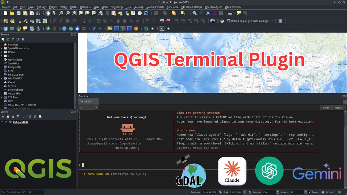
Introducing QGIS Terminal Plugin: An Integrated Terminal for QGIS
Discover the new QGIS Terminal Plugin that lets you run terminal commands directly inside QGIS , no more switching between your GIS desktop and external terminals. In this tutorial, you'll learn how to install the plugin, customize the integrated terminal, manage multiple tabs, and run tools like Claude Code, Codex, Conda environments, and standard Linux commands right inside QGIS.
GitHub: https://t.co/UVImjsM4BO
Video tutorial: https://t.co/DELpzzHbSq
#QGIS #geospatial #opensource
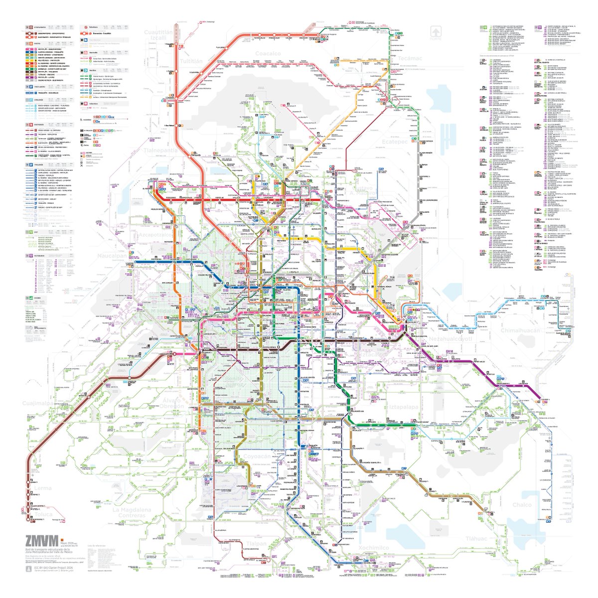
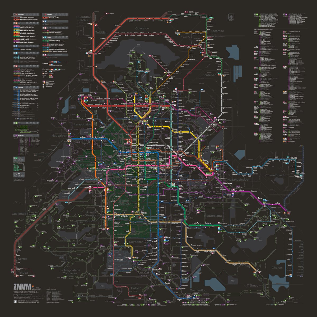
ZMVM 🚆🚇🚡🚎🚌🚲
Mapa general diagramático de transportes estructurados
Abril 2026 🆕
(clic y descargar)
ES ☀️: https://t.co/sGayQZkljS
ES 🌙: https://t.co/WBMN8QSS8J
Otros formatos y versiones:
https://t.co/0KlL3TLvcK
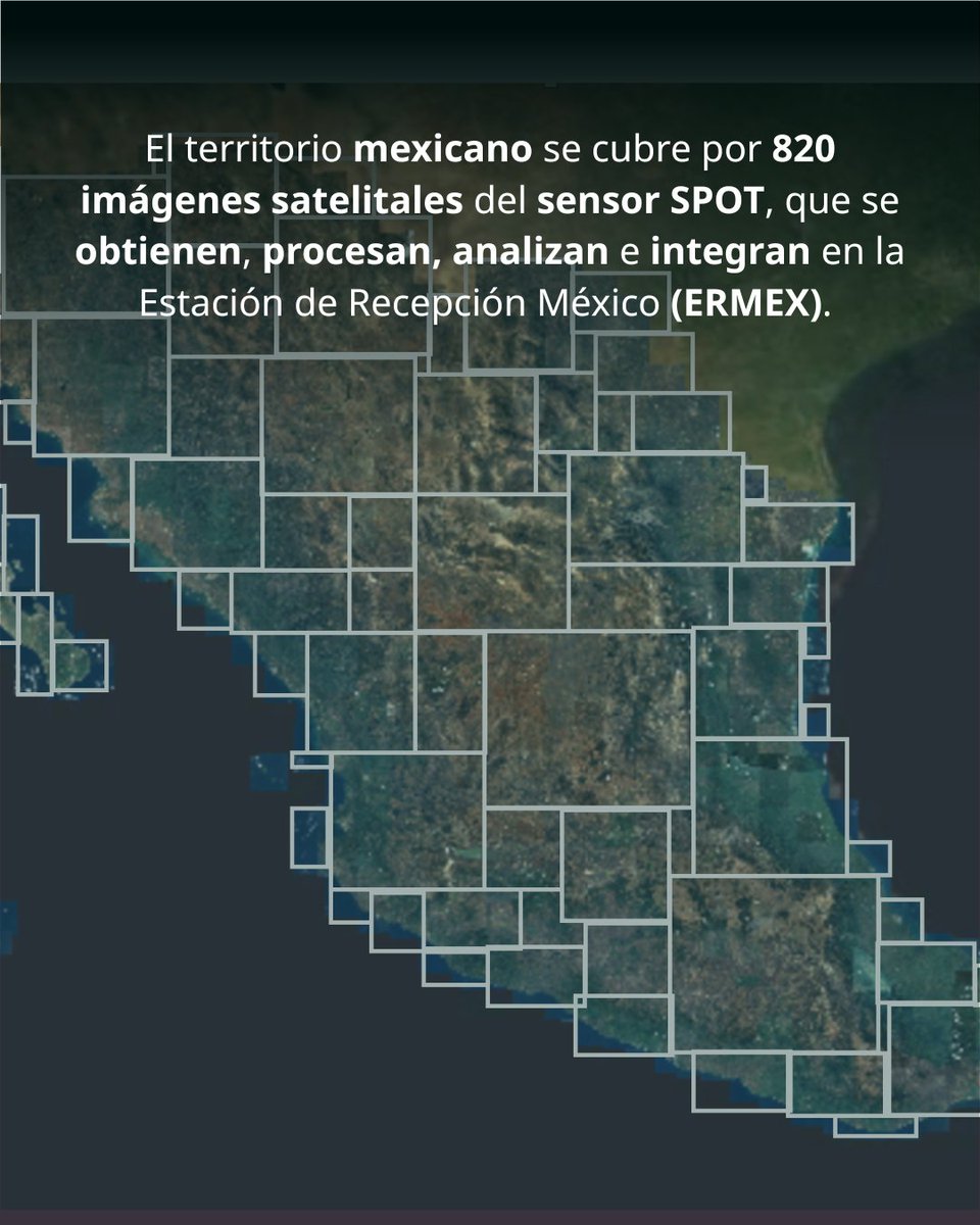
¿Sabías que el Mosaico Nacional de México es un insumo fundamental para el análisis territorial, el monitoreo de cambios en la superficie y el fortalecimiento de la toma de decisiones en el sector agrícola?
Consúltalo en: https://t.co/2Y7XQgUmrl
Any place on Earth can become a 3D city panorama.
This is downtown Copenhagen🇩🇰, rendered from OpenStreetMap data in 4K in under a minute with forge3d in Python.
👉 https://t.co/Y8AwdCGZ4l
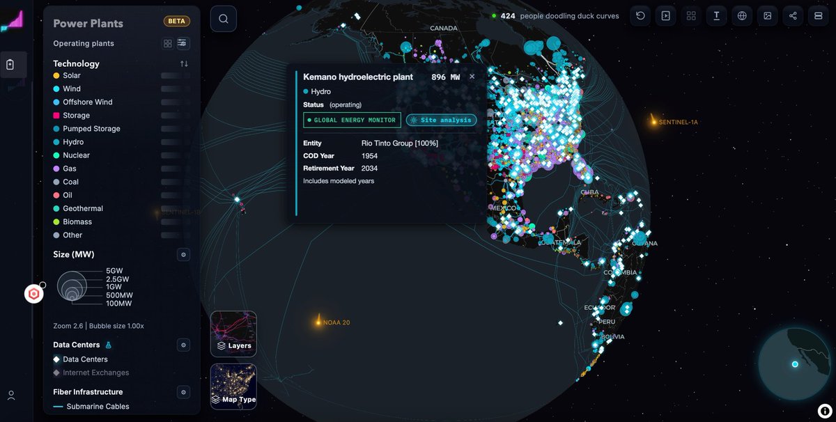
OpenGridNetworks
Interactive worldwide map of electricity infrastructure. Very detailed.
Power plants, data centers, fiber infrastructure, transmissions, substations.
https://t.co/d1P0EzzGVV
Creator BPBartholomew
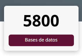
Esta semana la Plataforma Nacional de Datos Abiertos llegó a las 5,800 bases!!
Para su fin de semana largo subimos hoy un montón de bases del sector energético.
Bases nuevecitas de CFE, SENER y CNE...
Échenles un ojo y compartan lo que construyan!
https://t.co/b1vIzrtdM5
Di https://t.co/4ITu22D2tf juga bisa unduh data lokasi sarana prasarana/fasilitas umum, seperti sekolah, kampus, puskesmas, tempat ibadah, dll. Data diambil dari OpenStreetMap.
Silakan cek: https://t.co/gQR7RkQ6hG
More from the 2023 LODES dataset: 15 million jobs visualized across New York, New Jersey, and Connecticut.
Open data reveals fascinating patterns within NYC and around the region.
¿Quieres practicar ejercicios de ciencia de #datos? 📊
@datosgob te ofrece ejercicios prácticos paso a paso con el código disponible en GitHub.
Entra aquí: https://t.co/tQMO6hpTJJ
Hola🤠
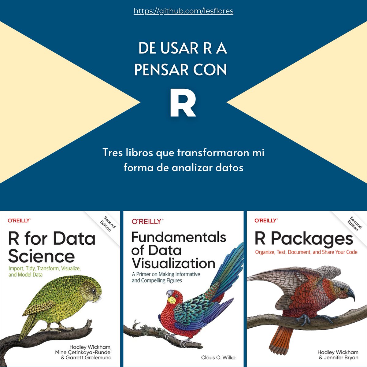
Aprender #R es fácil. Pensar con R toma tiempo.
📚Estos tres libros cambiaron mi forma de analizar datos📊, automatizar🤖 y comunicar resultados🎨.
La técnica importa, pero la forma de pensar SIEMPRE importa más.
🧵👇
#CódigoDeTodxs
🔗https://t.co/uCf1igT9zq