Good news: economic growth doesn’t have to come at the expense of air quality. Using @CopernicusEU Sentinel-5P data, researchers found many major cities are growing while cutting NO₂ - read the full story⬇️
https://t.co/gpACvO3JRl
Are you feeling the heat too?🥵
A heatwave is driving temperatures far above average across much of Western Europe and the UK, with record May temperatures reported in several countries.
This map shows land surface temperatures across Europe, using @CopernicusEU Sentinel-3 data from 26 May 2026.
🔗https://t.co/lsHPiYeKVO
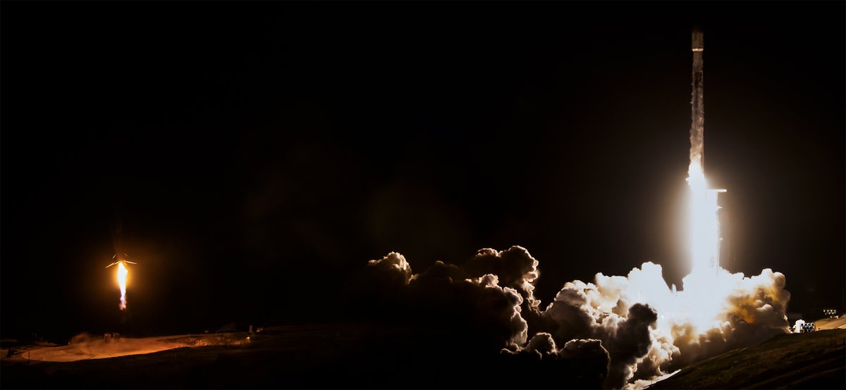
Two national EO missions were launched yesterday onboard a @SpaceX Falcon-9 rocket:
🛰️Italy's @IrideSpazio (https://t.co/C072CT8xAn)
🛰️Greece's Hellenic Fire System (https://t.co/mN8loPEROG)
Credits: SpaceX
Following the mandate given by our Member States to step up @ESA’s role in security and defence, this agreement marks a meaningful move from intent to delivery. Through initiatives such as the European Resilience from Space (ERS), ESA is already responding to Europe’s urgent security capability needs.
Strengthening our partnership with the @EUDefenceAgency allows us to align technology development more closely with both current and future operational and strategic requirements.
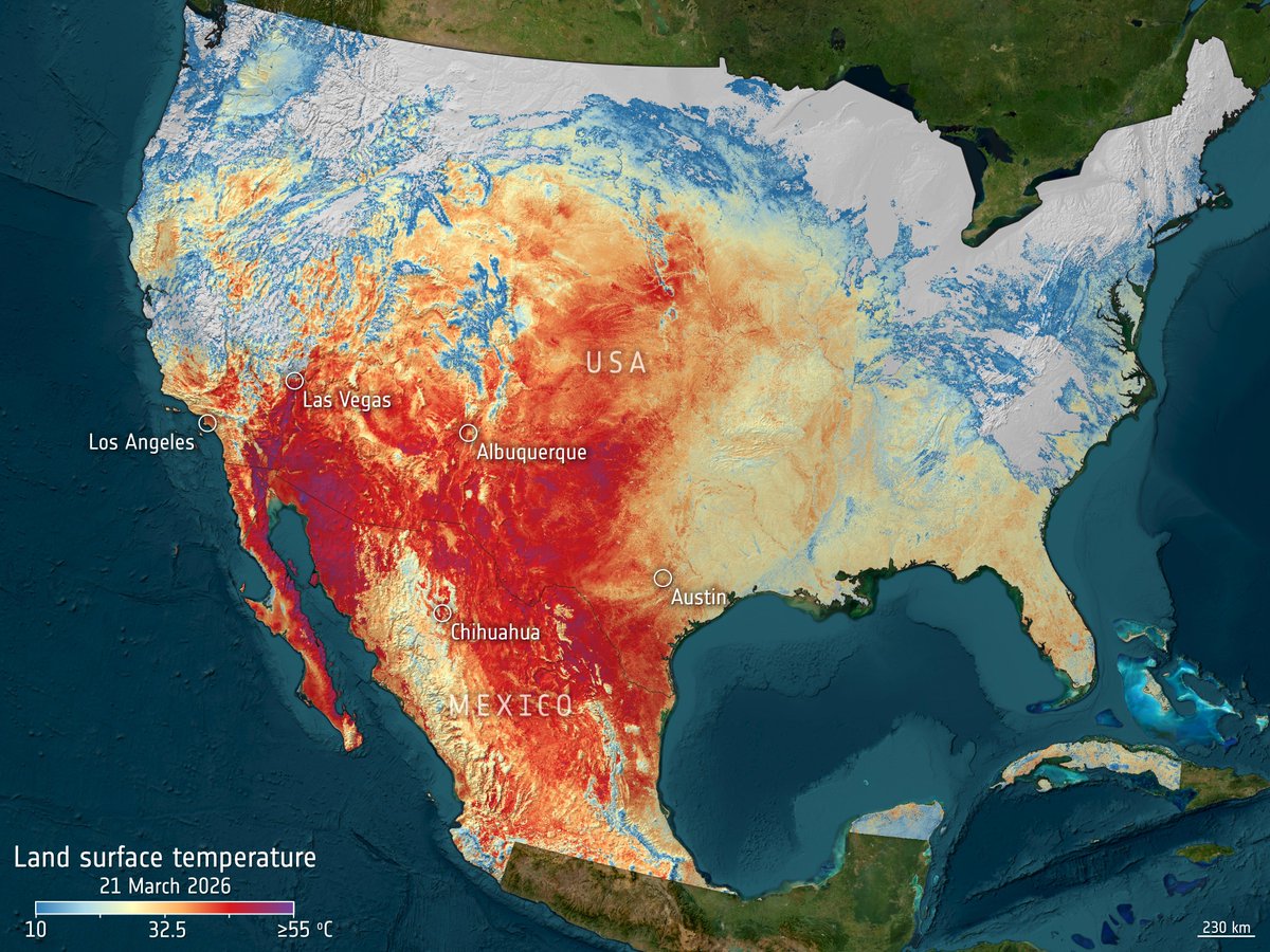
It's hot - and we can "see" it from space: On 21 March, Copernicus Sentinel-3 measured widespread land surface temperatures exceeding 40°C🥵
Recent extreme heat across the central and southwestern US and Mexico pushed ground temperatures far above seasonal norms according to @NOAA data.
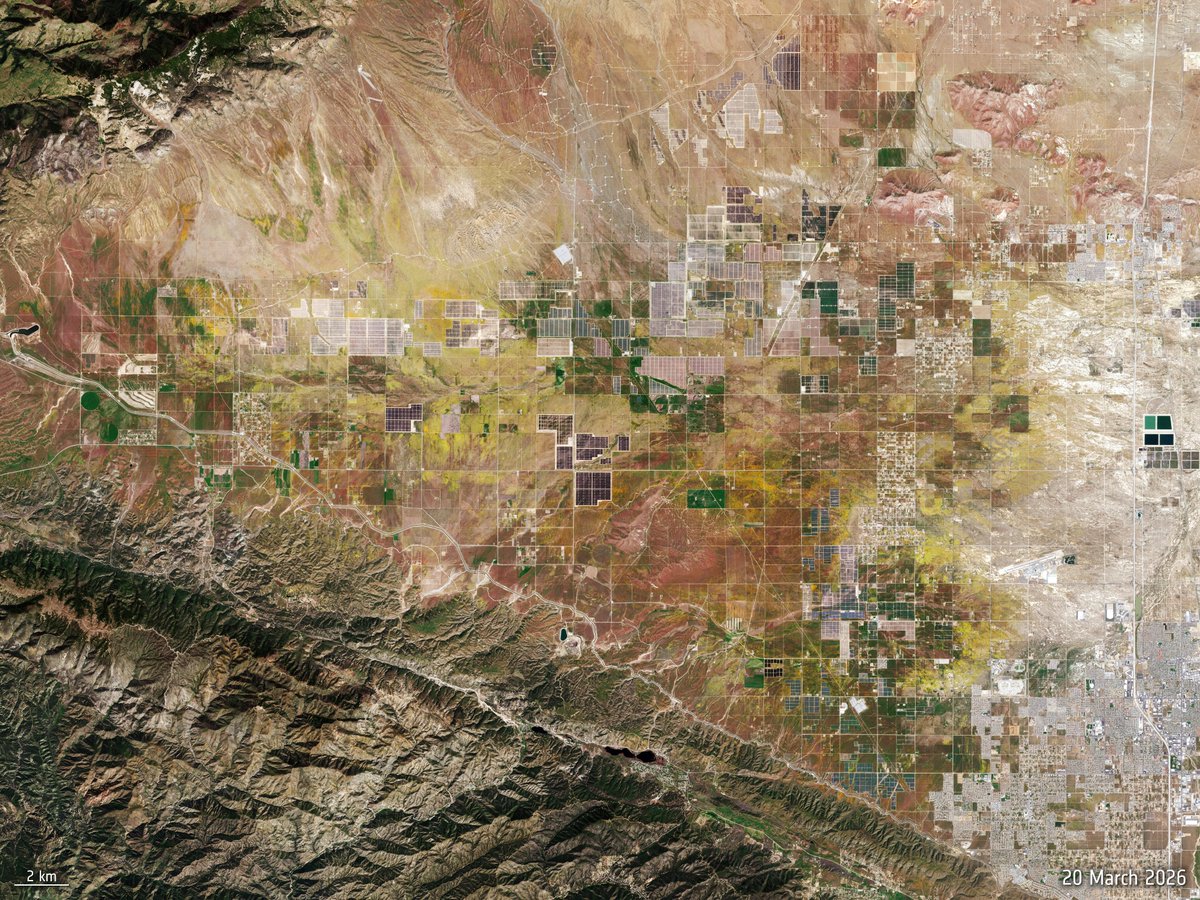
These extreme temperatures and winter rain have triggered a super bloom in some areas. On 20 March 2026, satellites captured expanded flower cover across Antelope Valley and Grass Valley — a rare burst of colour driven by the same unusual conditions.
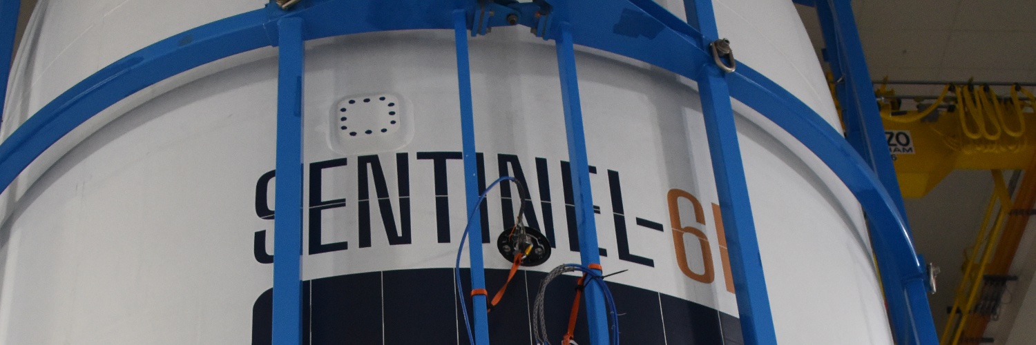
#MediaInvitation: journalists are invited to join a one‑off opportunity to see three ESA-built satellites in their final preparations before liftoff, at @Thales_Alenia_S, Cannes, on 16 April 2026.
Register by 31 March 👉 https://t.co/QELwOSSAeq
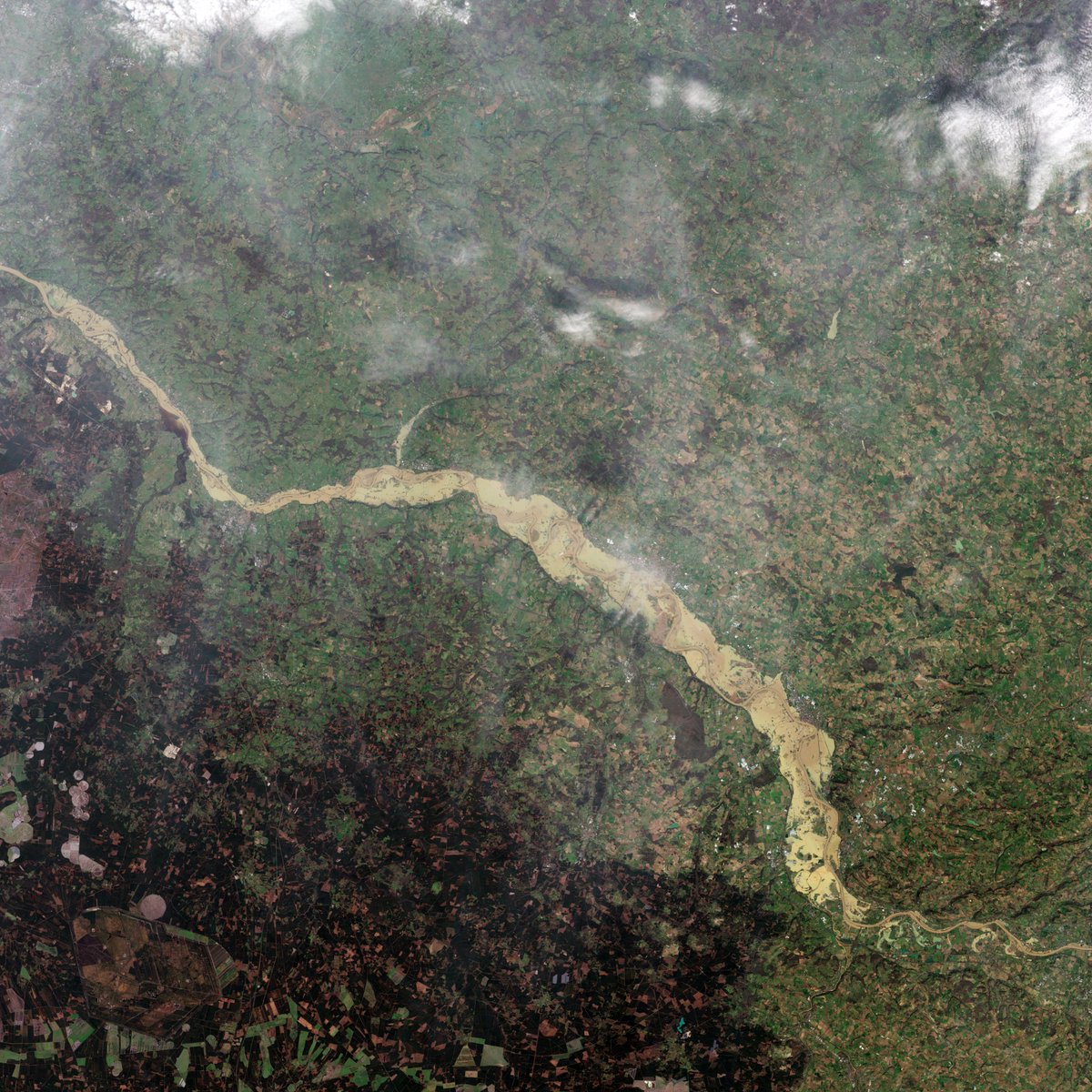
France has endured 35 consecutive days of rain.
One striking example:
According to @Vigicrues, the Garonne at Marmande rose from 3.50 m on 10 February to over 10 m by 14 February.
Here are 3 images that show the impact of the heavy rainfall from space:
• Accumulated rainfall map (9–18 February 2026) using data from the @NASA/@JAXA_en GPM mission
• Sentinel‑1 radar image (flooded areas in red)
• Sentinel‑2 true‑colour view of the same region
Our thoughts are with the communities affected as the region continues to face challenging conditions.
What does the latest research tell us about Earth's changing climate?
The '10 New Insights in Climate Science 2025' report highlights ten key findings, including accelerating ocean warming, record‑breaking global heat and reduced carbon uptake on land.
Read more:
https://t.co/TffwQvuH5o
📹contains modified Copernicus Marine Service data (CNR, Buongiorno et. al.), processed by ESA
I had a constructive first meeting in Washington, D.C. with my counterpart at NASA, @NASAAdmin. We had a very constructive discussion on space exploration and are fully aligned on our shared objectives: the Moon, LEO, and Mars. Looking forward to continuing the discussions.
Three winter storms — Kristin, Leonardo and Marta — soaked the Iberian Peninsula in early 2026.
🌧️ Rainfall maps show areas in Portugal and Spain receiving 250+ mm in a week.
🌊 Copernicus Sentinel‑1 radar reveals major flooding along Portugal’s Tejo River, comparing Feb 2026 to pre‑storm conditions.
During Covid, air pollution dropped — but methane levels rose.
Now we know why:
1️⃣ Lockdowns reduced emissions of nitrogen oxides, carbon monoxide and other pollutants.
2️⃣ These gases help form hydroxyl radicals — the atmosphere’s “detergent” that removes methane.
3️⃣ With fewer hydroxyl radicals, methane was broken down more slowly and accumulated faster.
4️⃣ At the same time, wetter conditions boosted methane emissions from wetlands.
The result: a temporary spike in atmospheric methane driven by both atmospheric chemistry and climate‑related natural emissions.
https://t.co/3Ai03AXgn9
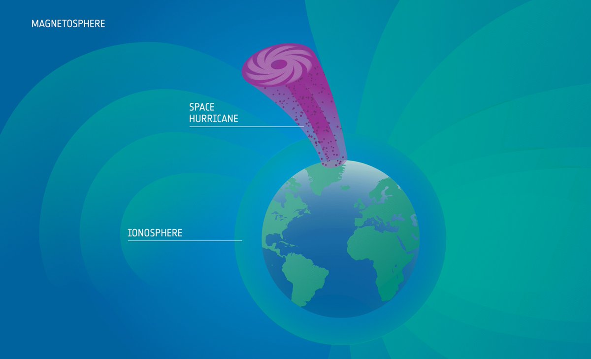
Data from @esa_swarm have helped scientists study a recently discovered phenomenon: space hurricanes.
These spiral storms of charged particles high above the poles can disrupt satellites, navigation and power grids — and the data show they can form even when geomagnetic activity appears low.
https://t.co/4LBXQuFcdr
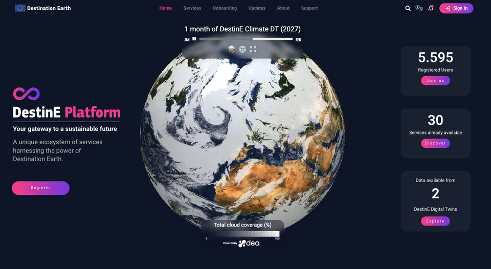
Destination Earth (DestinE), an initiative to build a high-precision digital twin of our planet, is getting ready for its next phase.
From July 2026, more users across Europe will be able to access DestinE's data and services, supporting climate action.
https://t.co/1AQ5ZYDXKf
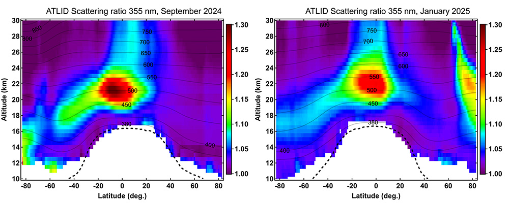
🌋When Mount Ruang erupted in 2024, @esa_earthcare captured the atmospheric aftermath.
Its ATLID lidar tracked ash and sulphates rising up to 25 km, doubling stratospheric aerosol levels.
Read how EarthCARE data were used to map the global spread of sulphates from the eruption: https://t.co/Eqa9GxbNrB
🧊Monitoring icy seas is a team effort.
Data from @CopernicusEU Contributing Missions, together with data from Copernicus Sentinel-1, are used to provide a continuous and complete picture of sea ice coverage.
This supports services such as @CMEMS_EU in monitoring sea-ice movement and boosting maritime safety: https://t.co/OKluTUu61O
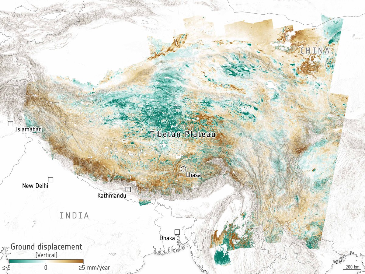
What if tectonic plates aren’t as solid as we thought?
Thanks to satellite data from @CopernicusEU Sentinel-1 and other data sources, scientists have mapped how the Tibetan Plateau stretches and shifts, showing that Earth’s crust and upper mantle behave more like flowing material.
📸ESA (Data source: Wright, T. et al, 2026)
https://t.co/wSLNLhorZD
ESA Council has approved Laurent Jaffart as the Director of the newly created Resilience, Navigation and Connectivity Directorate.
This new position reflects our commitment to bolstering resilience and enhancing navigation and connectivity in line with security and defence priorities.
Read more about the new ESA-RNC Directorate: https://t.co/IbB7mUpDol