@Casti_F@Laura_Bennati@Pallinov E nel mezzo, ricordi di vecchie campagne in mare con messaggi importanti affidati a onde e correnti in atlantico del sud...
We have better maps of the Moon’s surface than we do of the bottom of the ocean.
But the SWOT satellite, designed to measure surface water and ocean topography, recently published one of the most detailed maps yet of the seafloor. https://t.co/Tr0YeUCB35
🚇 Semaine Européenne de la Mobilité chez CLS
Du 16 au 22 septembre, CLS s'engage activement pour promouvoir la mobilité durable auprès de ses collaborateurs. À travers diverses animations et ateliers, nous souhaitons sensibiliser nos équipes à la mobilité douce et aux alternatives de transport plus respectueuses de l’environnement.
Au programme :
🚎 découverte ou redécouverte des offres de transport en commun actuelles, ainsi que les projets en cours visant à soutenir leur expansion,
🚴♀️ sessions de tests proposées pour s'essayer aux vélos électriques et mécaniques,
🛠 accès à des ateliers de réparation pour entretenir son propre vélo.
Des activités proposées par notre équipe RSE en partenariat avec celles de la commission environnement de notre CSE.
💡 Certains de nos collaborateurs appliquent d'ores et déjà de bonnes pratiques en termes de mobilité. Ce mois-ci, certains d’entre eux, courageux, se sont même lancés le défi de rejoindre Montpellier à vélo, depuis Toulouse, pour participer aux 30 ans la conférence annuelle de l'Ocean Surface Topography Science Team (OSTST).
Bravo à eux pour leur engagement !👏
Pour en savoir plus sur nos engagements 👉 https://t.co/2FVmgBUguZ
🌍 Celebrating 30 Years of Precise Altimetry! 🌊
💡 This year marks the 30th anniversary of precise altimetry, a major milestone in Earth observation. To celebrate, the @esa , in collaboration with our parent company, the French Space Agency (@CNES ), hosted the "30 Years of Progress in Radar Altimetry" symposium this week in Montpellier, France.
👨👩 As a global leader in altimetry, CLS is proud to have 42 of our experts giving 28 talks and also presenting numerous posters showcasing our expertise in data qualification and sea level products for the international scientific community.
🛰 With over 30 years of experience in processing, calibrating, and validating altimetry data, CLS has developed unique processing chains that provide critical data to scientists, climatologists, oceanographers, biologists, and hydrologists worldwide. These insights help calculate ocean, lake, and river levels, as well as address key environmental challenges like:
📈 Monitoring global Mean Sea Level rise, a key global warming indicator (in partnership with LEGOS and CNES)
💧 Tracking inland water resources, including surface, depth, and flow of water networks.
❄️ Observing ice sheet dynamics and their impacts on sea level rise.
🌊 Identifying areas at risk of coastal flooding.
👏 A huge congratulations to our team for their contributions this week, representing the 120+ dedicated individuals at CLS who work daily to advance these crucial activities. Together, we are turning data into action for the benefit of the planet.
#RadarAltimetry #EarthObservation #SeaLevelRise #WaterResources #GlobalWarming
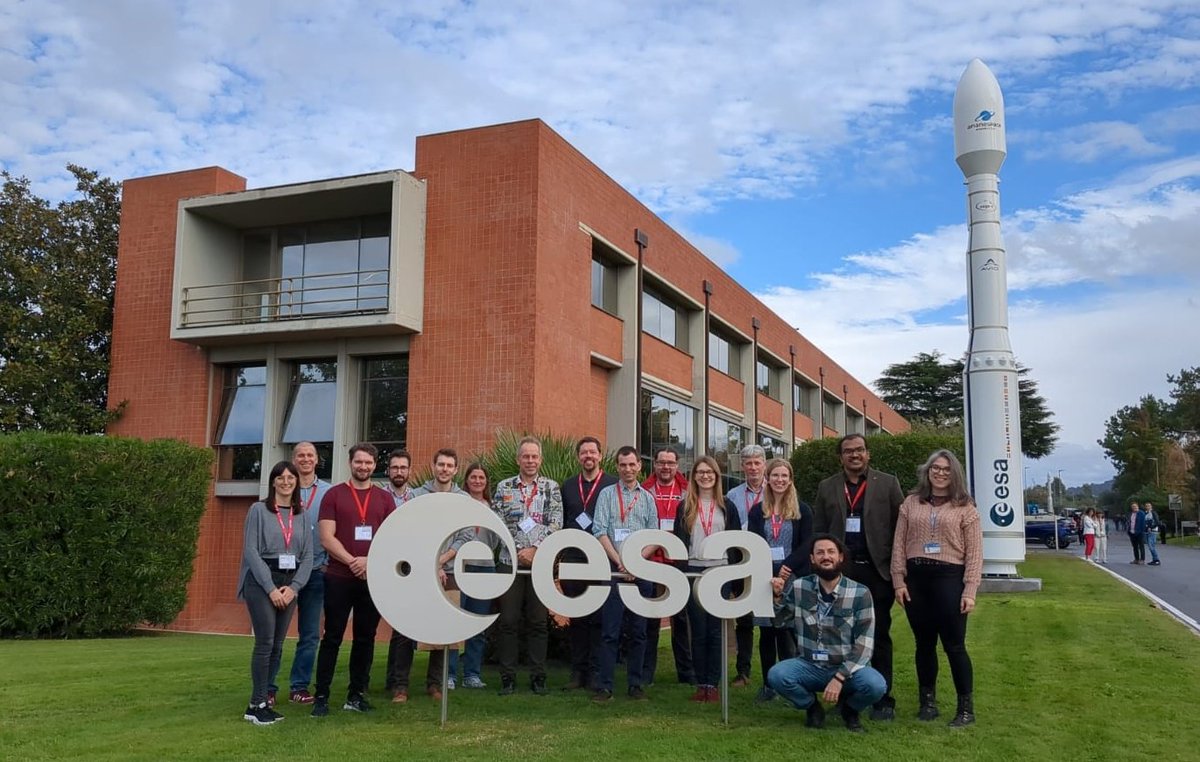
🤩 Thank you so much to all these fantastic people who joined us in ESRIN this week to discuss the next improvements to CryoTEMPO - an incredible 13+ year record of Earth's ice and water - with more soon to come 🤩
❄️📊❗️#CryoSat NEWS ❗️📊❄️ Brand new Cryo-TEMPO Baseline-B. New features across all themes: land ice 🏔️ sea ice 🧊 polar oceans 🌊 coastal oceans 🏝️ and inland waters 🏞️ Latest additions include enhanced SARIn processing and extended regional coverage.
🔗https://t.co/1v9axpVifk
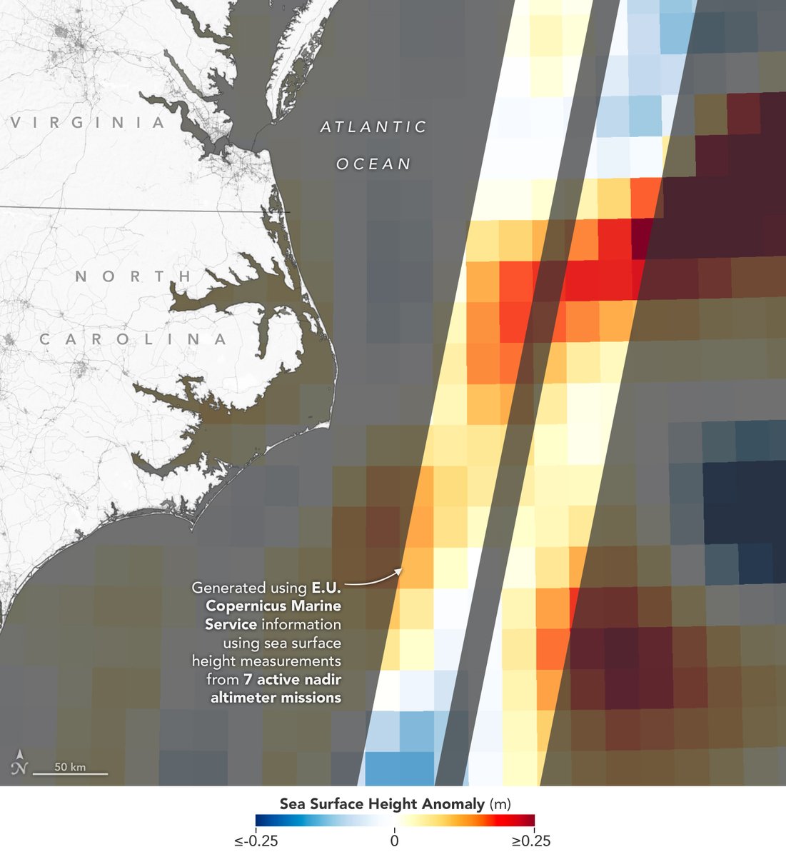
First light data from the NASA-@CNES SWOT mission reveals that it provides 10 times the resolution of ocean measurements than data gathered by seven other satellites combined. These measurements will help us better study Earth’s surface water. https://t.co/ALlduII2Nq
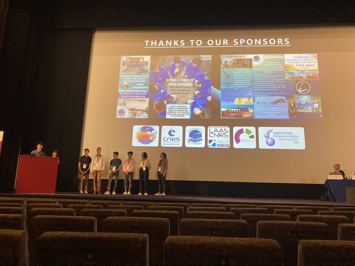
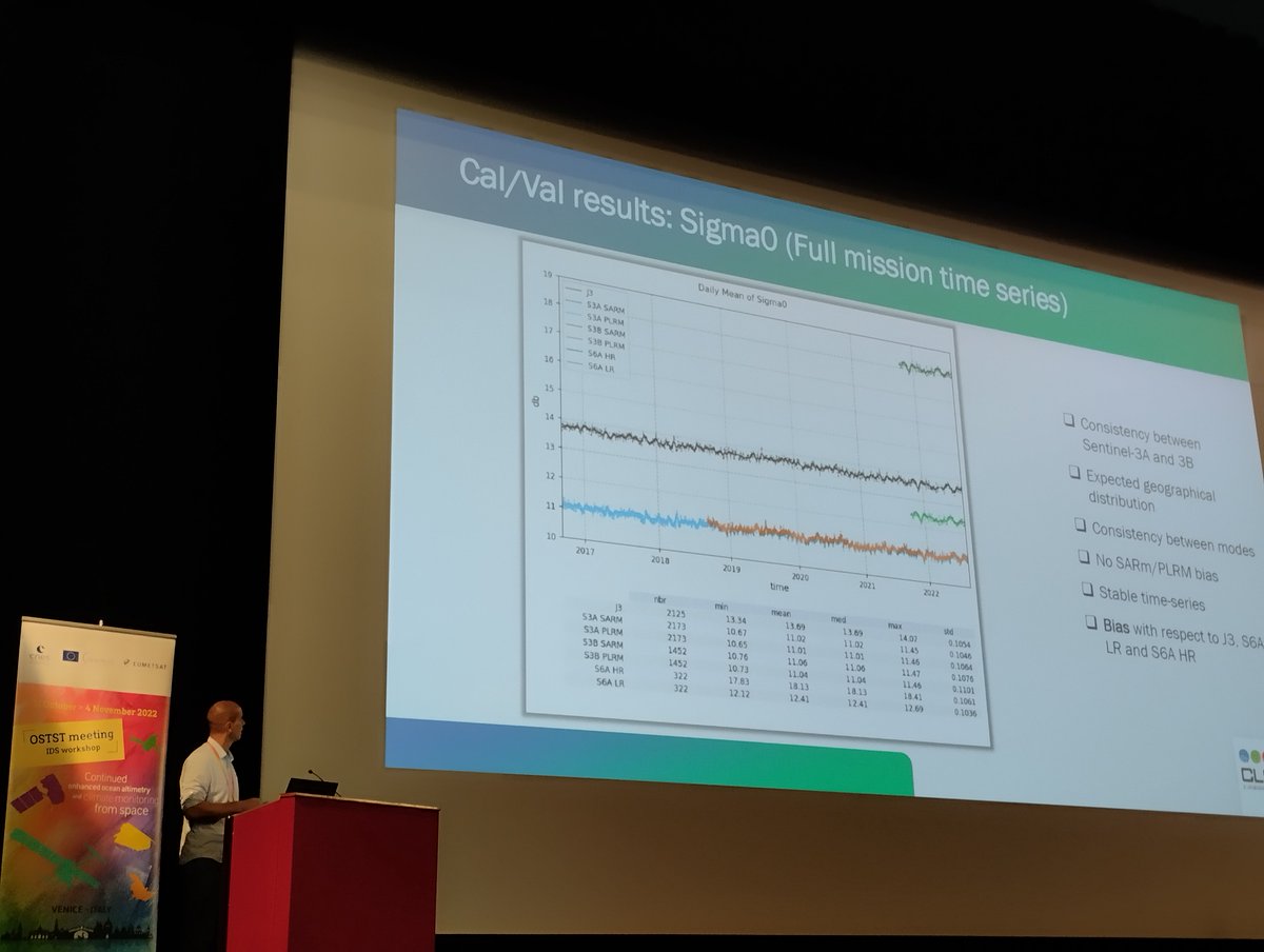
Utterly incredible presentation by a group of French high school students from Monteil who had built an ocean going buoy and got measurements to compare with a satellite at aged 17! #OSTST
We are looking for a new team member in the Cal/Val team @CLS_Group to work on climate-related issues with the satellite ocean surface topography observing system.
@brloveday@VittorioBrando@flacchy Yeah, the chickie-dinos look cool, but a bit sad over a bed of pasta... I'd say once you start frying, you keep frying.... So definitely 1+ to the idea of the veggieballs
We're excited to hear from @f_nencio@CLS_group at #LPS22 this AM on the Cryo-TEMPO Coastal Ocean Thematic Data Product - a 12-year quality controlled record of along-track sea level anomalies & absolute dynamic topography over the Mediterranean basin
👇
https://t.co/75rGcBW192
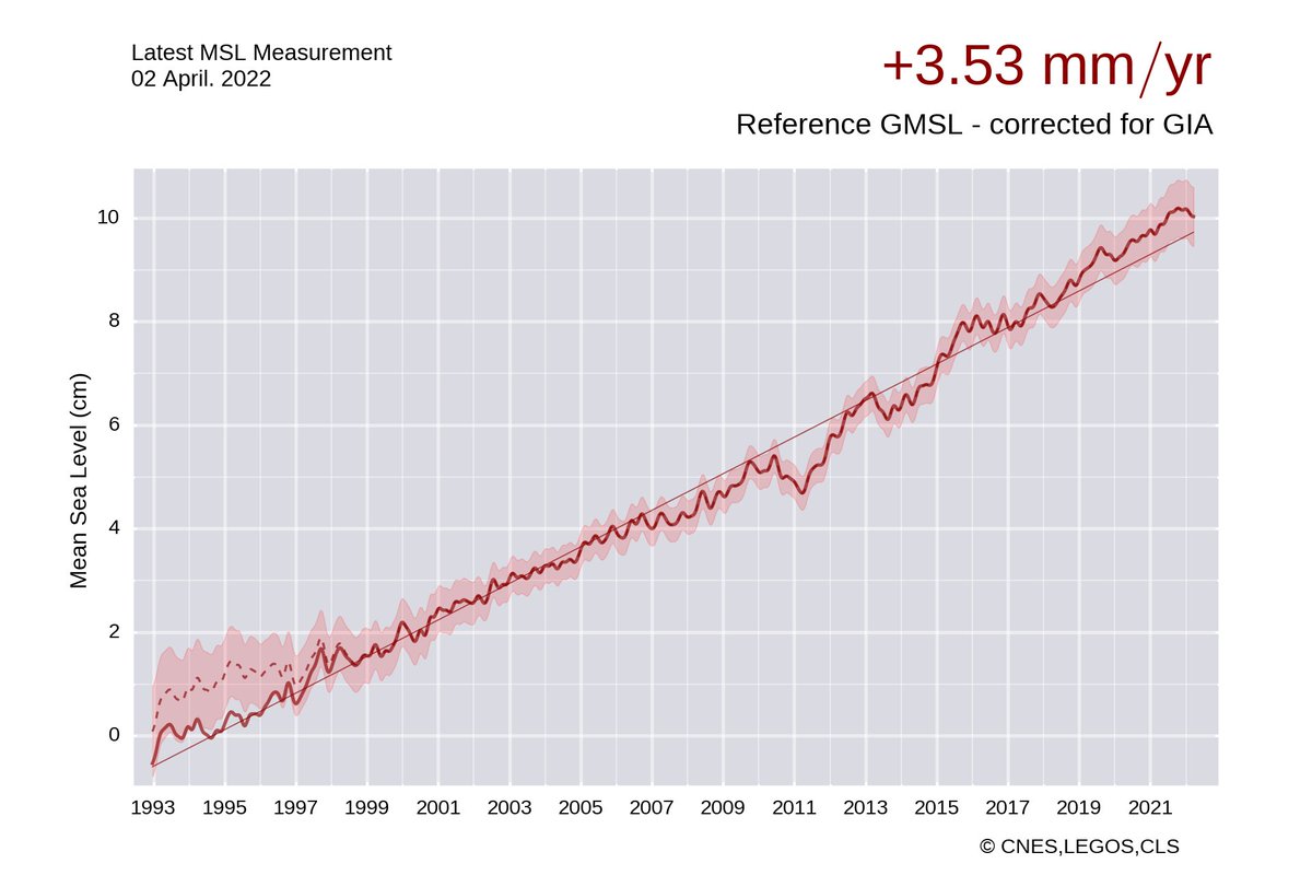
Global mean sea level rise - the latest satellite altimetry data has now been processed to mid-October 2021. Another climate change indicator... 🌊
[Data from @CNES (AVISO): https://t.co/4RVYNrh374]
Following months of careful testing, the stream of @CopernicusEU#Sentinel6 high-resolution data are now available!
Sentinel-6's task is to monitor the changing height of the ocean surface to track sea-level rise: https://t.co/TGz2u4dO8F
A difficulty in ocean science is that things you want to monitor keep moving. Analysis in a Lagrangian frame helps but what if you aren't savvy with fluid dynamics? Try -> Ocean Lagrangian Trajectories (OLTraj): Lagrangian analysis for non-expert users, https://t.co/9jiXqYbdcG
@orporick A proposito di LotR e russi, consiglio vivamente "the last ring bearer" (purtroppo non riconosciuto dalla Tolkien foundation) in cui parte della storia è raccontata dal punto di vista di mordor https://t.co/SBTp8ydyOx
#InternationalWomensDay CLS reconnait le talent là où il se trouve. Sans discrimination positive, la parité (managériale, expertise, salaire) est à l’équilibre chez CLS.
4 de nos talents féminins qui participent à notre réussite, prennent la parole 👇
https://t.co/2WQPZdVxYV











![ZLabe's tweet photo. Global mean sea level rise - the latest satellite altimetry data has now been processed to mid-October 2021. Another climate change indicator... 🌊
[Data from @CNES (AVISO): https://t.co/4RVYNrh374] https://t.co/e9a6Wj1D2d](https://pbs.twimg.com/media/FFZ8mFjVkAcR6An.jpg)


