Create a pollution task force - or a commission, tie its hands, lure some NGOs to join it, keep the public hoping, keep pollution profitable - and repeat as necessary.
@GreenJennyJones@premnsikka@Feargal_Sharkey@theipaper
The carved standing stone at Filitosa, located in southern Corsica, France 🇫🇷, a striking example of prehistoric megalithic art. Dating back to around 3000 BC, this stone forms part of the broader archaeological site that has been a focus of study for its intricate carvings and historical significance. The stone, one of many at the site, features detailed anthropomorphic carvings, often interpreted as representations of human figures or deities, reflecting the spiritual and cultural practices of the ancient inhabitants of Corsica.
Filitosa, a prehistoric archaeological site located in Sollacaro, Corsica, France, is renowned for its stunning megalithic monuments and stone statues, which date back to the Neolithic period, around 3000 BC. This historical landmark is best known for its collection of "menhirs" — tall, upright stones that were carved with anthropomorphic faces, believed to represent ancestors or deities. These statues are unique in that they display a distinct blend of prehistoric art and cultural symbolism, offering a rare glimpse into the spiritual practices of early human societies in the Mediterranean.
The site consists of several structures and enclosures, with the most famous being a series of large, carved stone figures known as "Filitosa statues." These statues, often referred to as "warrior figures," are thought to have served both ritualistic and defensive purposes. Filitosa was likely a site of both habitation and ceremonial significance, as it was strategically positioned to overlook the surrounding landscape, possibly offering both protection and an elevated space for religious activities.
Filitosa is known for its series of menhirs, large upright stones that were deliberately shaped and placed in the landscape. The carved standing stones are thought to have served both ceremonial and functional purposes, possibly marking important sites for rituals or territorial boundaries. The precision with which these stones were carved and positioned suggests a high level of craftsmanship and an advanced understanding of symbolism and astronomy in the prehistoric communities that inhabited the region.
The carved standing stones of Filitosa stand as a testament to the ingenuity of early human societies. As part of a larger megalithic site, they offer valuable insight into the rituals, beliefs, and daily lives of the people who lived in Corsica thousands of years ago. Filitosa remains a key location for archaeological research and a popular destination for visitors interested in the ancient history of the Mediterranean.
Today, Filitosa stands as one of the most significant prehistoric sites in the Mediterranean. It offers valuable insight into the ancient civilizations of Corsica and their complex societal and spiritual life. Visitors to Filitosa can explore the megalithic structures, stone circles, and burial sites, which tell the story of a civilization that thrived thousands of years ago. The site has been designated as a French national monument, attracting both archaeologists and tourists keen to unravel the mysteries of prehistoric Europe.
#archaeohistories
The Trier Gold Hoard is the largest #Roman gold hoard ever discovered. It comprises more than 2650 aurei (gold coins) with a total weight of about 18.5 kilogram. The aurei were hidden in 196 AD during the revolt of Clodius Albinus against emperor Septimius Severus. 🧵1/2
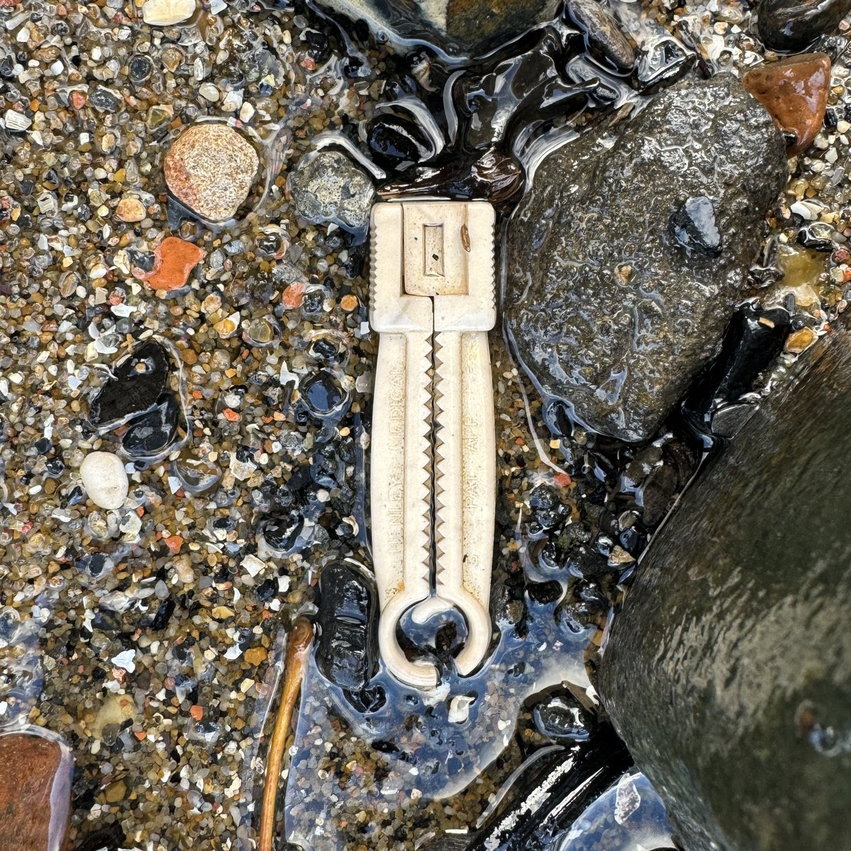
The Thames super sewer is now partially operational with it coming into full operation in 2025. They say it captured half a million cubic metres of sewage in a 24-hour period, but it missed this hospital waste today:
* Umbilical cord clamp
* ECG electrode sticker
* Pills
2,000 years ago the Romans sailed all the way up the River Ver to what is now St Albans.
Today a disaster area, over abstracted for its precious waters by @AffinityWater and filled with sh*t by @thameswater
That is how we treat a chalk stream. 1 of only 225 in the entire world
Roots of Fractionation: The Allotment Policy (1887- 1934)
In 1887, Congress enacted the General Allotment Act. This act carried out the allotment policy, which was aimed at breaking up Tribes and Tribal lands and assimilating Native Americans into non-Indian society.
Under the policy, Tribal lands were divided up and “allotted” to individual Tribal members. After allotments were made, any remaining Tribal land was deemed “surplus” by the Federal government and opened to non-Indian settlement. Allotment was not voluntary; the General Allotment Act contained no provision for consent by Tribes or their members.
The allotment policy quickly proved to be devastating for Native Americans. Between the inception of the policy and its end in 1934 over 90 million acres passed out of Indian ownership and control. Apart from the sheer loss of land, allotment gave rise to the problem of fractionation that persists to this day.
Published in 1928, Meriam Report provides an independent, contemporaneous account of the destructive impact of the allotment policy. According to the report, not only did the allotment policy fail at achieving its professed assimilation goals, but it resulted in widespread poverty among Native Americans.
The 1934 Indian Reorganization Act reversed Federal Indian policy aimed at assimilation and officially ended allotment. The act also provided means to reduce the loss of Indian land and rebuild the Tribal land base. Ending the allotment policy, however, did not prevent the ongoing fractionation of existing allotted land. With each successive generation, ownership in allotted lands became increasingly divided among more heirs.
In early 1960s, in-depth congressional reports were published on fractionation and legislation was introduced to alleviate what was recognized as an ever-worsening situation. While there was broad agreement on the causes and consequences of fractionation, two more decades passed before action was taken by Congress to address it.
Congress enacted the Indian Land Consolidation Act in 1983. The act sought to reduce fractionation by prohibiting small land interests from passing to heirs upon an individual Indian landowner’s death. Instead, small land interests would revert or “escheat” to Tribal ownership. No payment of compensation to the heirs was provided for escheated interests under the act. And, like the General Allotment Act, the escheat provision of the Indian Land Consolidation Act was not voluntary.
In 1987, the United States Supreme Court ruled that the escheat provision amounted to an unconstitutional taking without just compensation. Although the provision was amended in an effort to address constitutionality concerns, Supreme Court again ruled it unconstitutional in 1997.
#archaeohistories
There is a stone at Battle Abbey that marks the traditional spot where King Harold II fell. This stone is known as the Harold Stone. It is a rectangular stone plaque set into the earth on the site of the high altar, which is the traditional location of King Harold’s death. The stone serves as a memorial and a significant historical marker.
It’s interesting to note that the stone was moved about 20 feet away from its original location in 2016 to mark the 950th anniversary of King Harold’s demise. Despite the move, it continues to denote the “official” location of the last Anglo-Saxon monarch’s death, a tradition that has been upheld since the 1980s.
The Battle Abbey was built on the site of the Battle of Hastings, and it’s widely accepted that it was built exactly where William the Conqueror defeated King Harold. This location was chosen despite the local ground conditions being unfavorable, as William insisted that the high altar of the abbey church, the holiest place, should stand on the exact spot where Harold’s standard fell.
#archaeohistories
It's Marlborough's most famous manhole!
Yet again spewing untreated 💩 today straight into the Kennet, reducing the water quality of this rare chalk stream.
Yet again we've reported it to @thameswater Ironically the What3Words for its location is pollution.intention.fruit
If this goes ahead, it could be a nail in the coffin for #salmon on the rivers Wye, Usk and Severn. EDF wants to ditch the acoustic fish deterrent on its cooling water intake at @hinkleypointc nuclear plant.
Retweet if you think @edfenergy shouldn’t skimp on fish protection.🧵
My grandpa who is 85 started making this rock map of Scotland in 1992.He collected rocks during amateur geology trips over 30 years. He says it had to be geologically correct and also aesthetically pleasing.He asked if I could share online as He wants to go viral so please share
Great Jelling Stone of Denmark; was erected between 960-985 CE, by Gorm and Thyra's son Harald Blåtand (Harald Bluetooth) in Jelling in memory of his parents.
Stone's inscription speaks about Harald's merits, mentioning that he united Denmark and made Danes Christian.
Stone consists of three different sides. One side is engraved with runes, other side consists of a mythical beast and on third side of stone is a crucifixion image of Christ.
National Museum of Denmark
#archaeohistories
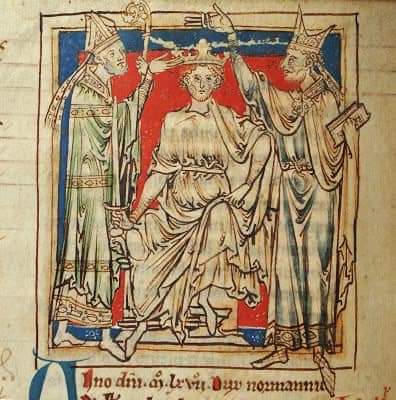
On Christmas Day of 1066 AD, William the Conqueror, also known as William the Bastard was crowned King of England at Westminster Abbey.
William the Conqueror is best known for his victory against the last Anglo-Saxon King Harold Godwinson at the Battle of Hastings that took place on the 14th October 1066 AD, during the Norman Conquest of England. William’s victory was an important event in English History as it’s course was changed, the English Aristocracy was replaced by a Norman Version, the culture and tradition of England also changed; for Normans spoke French and bought the culture during his conquest.
Normans were people who descended from Norwegian Vikings who settled in the Northern region of France. They were result of the ancestry of Vikings and the native population of Northern France which was known as Normandy.
#archaeohistories