

Top Tweets for #90w


#99P; LOW FORMATION CHANCE IN THE NEXT 48 HOURS.
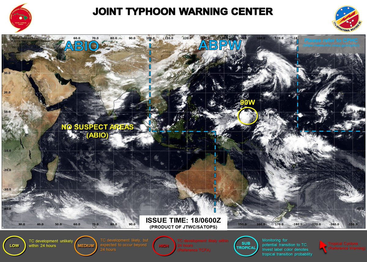
#90W; LOW FORMATION CHANCE IN THE NEXT 48 HOURS.
#91W; MEDIUM FORMATION CHANCE IN THE NEXT 48 HOURS.
#wxtwitter


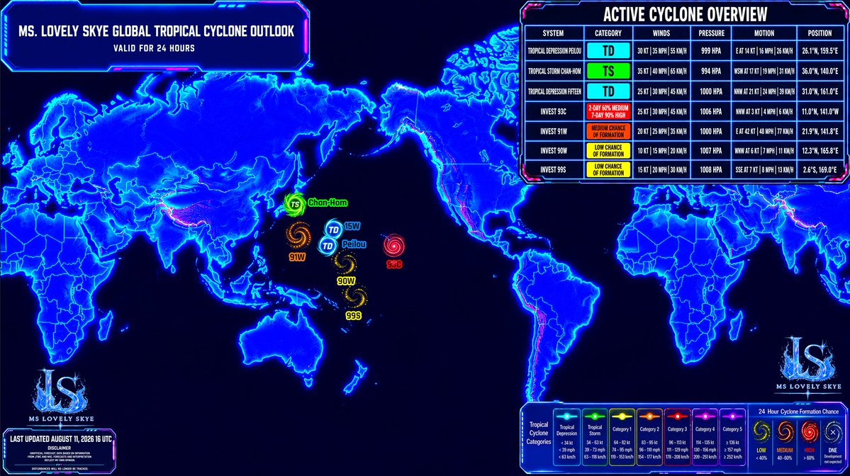
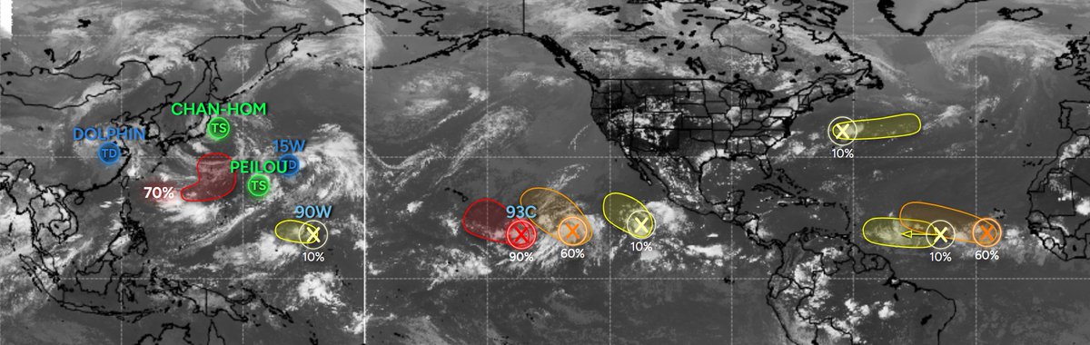
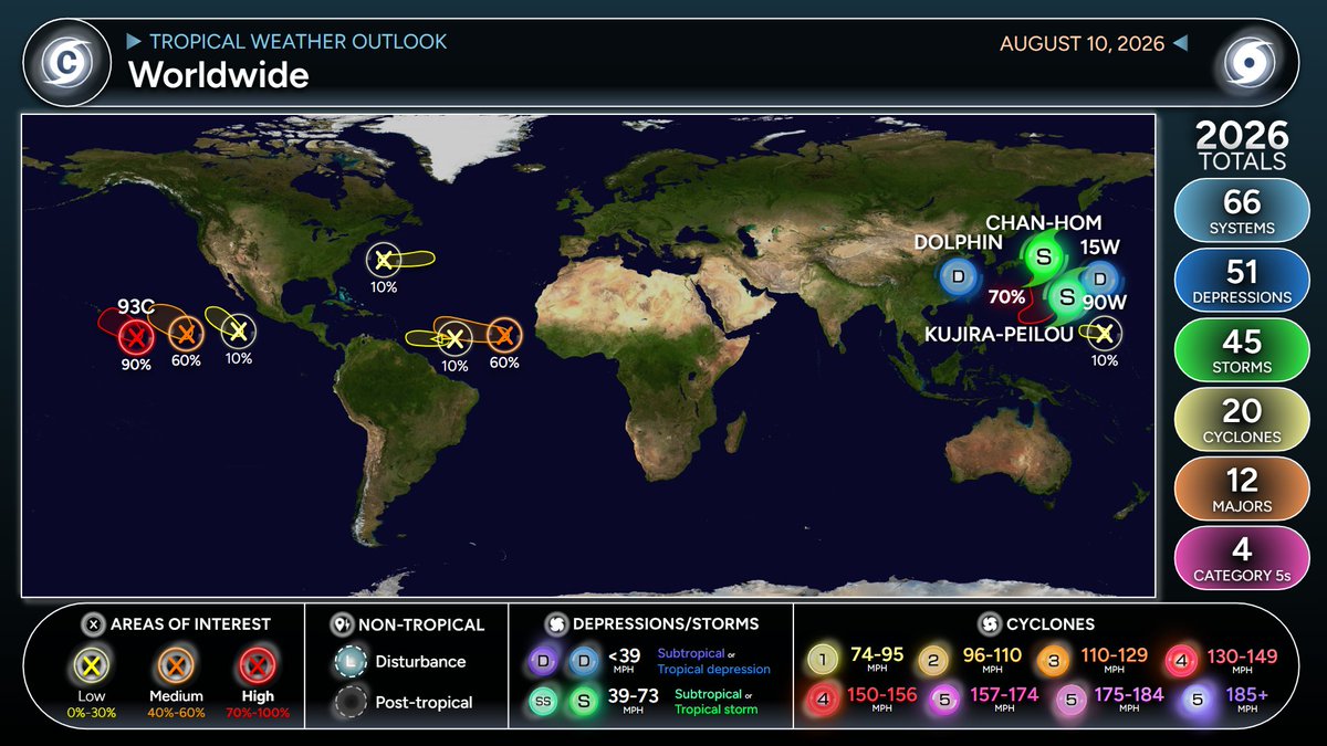
#90W; LOW FORMATION CHANCE IN THE NEXT 48HRS.
#CHAN_HOM; 50mph 980mb
Landfall in Japan to occur soon. Some heavy rainfall and gale-force winds will occur. Tread safely out there.
#PEILOU; 40mph 994mb
It's hanging in there for now.
#15W; 30mph 997mb
Won't last too long.
#wxtwitter


#tropicalupdate august 10 2026 #Dolphin is gone, TD #Peilou spinning out in the ocean, same as #15W, Tropical Storm #ChanHom nearing #Japan, #90W well who knows why it is there, and #93c has a medium chance to develop in the next few days #tropics #tropicswx

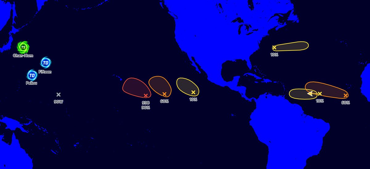


We are still monitoring five active tropical disturbances in the Western Pacific (WPAC) basin: Tropical Storm #Dolphin, Tropical Storm #Chan_Hom, Tropical Storm #Peilou, Invest #98W, and Invest #90W. All of these systems are currently located within a large monsoon gyre. ⚠️
MONSOON GYRE is a large-scale cyclonic circulation characterized by very large, closed isobars that typically occurs during the summer season in the WPAC. They are most likely to develop when an active, large-amplitude Madden–Julian Oscillation (MJO) event coincides with the monsoon trough and very-warm sea surface temperatures (SSTs).
Tropical Storm DOLPHIN
The former super typhoon is now undergoing rapid weakening as it moves inland over Mainland China. It is expected to weaken into a remnant low within the next 24 hours.
Tropical Storm PEILOU
Located northeast of the Marianas, the system is moving rapidly eastward at around 40 km/h. Later, Peilou is expected to turn northeastward as it becomes embedded in the southern flank of the gyre. It poses no threat to land and may weaken into a tropical depression within the next two days.
Tropical Storm CHAN-HOM
The Japan Meteorological Agency (JMA) forecasts the storm to make landfall along the eastern coast of the Tohoku region of Japan by late morning or early afternoon tomorrow as a tropical storm. It will then re-emerge over the Sea of Japan on Wednesday, August 12, before gradually weakening as it move towards South Korea.
Invest 98W
The subject of a Tropical Cyclone Formation Alert (TCFA) issued by the Joint Typhoon Warning Center (JTWC), the disturbance is expected to continue moving northeastward. It has a chance of developing into a short-lived tropical cyclone before eventually dissipating by the middle of the week.
Invest 90W
This disturbance is moving westward. Despite traversing an area of warm waters over the Pacific Ocean, it is not expected to develop into a tropical cyclone due to an unfavorable environmental setup, according to model guidance.
Potential Disturbance
Another area of low pressure may form over the northern Philippine Sea within the next 24 hours. Based on model guidance, this developing system is expected to follow a similar track to Peilou, posing no threat to any landmass.
Notes:
1. NONE of the aforementioned systems, including the potential disturbance, is expected to enter the Philippine Area of Responsibility (PAR).
2. The aforementioned monsoon gyre will continue to enhance the Southwest Monsoon (#HabagatPH) throughout this week.
3. Invest #97W near Hainan Island, China, and Invest #99W in the north-central Pacific Ocean have dissipated and are no longer expected to develop into tropical cyclones.
📷: Himawari-9 AHI visible imagery via RAMMB-CIRA
UPDATE: The Low Pressure Area (LPA 07c; Invest #90W) remains broad and disorganized over Micronesia. Due to the lack of a well-defined center, restricted outflow, and its nearly stationary movement, the system's development is expected to be remain limited over the next 5 days.
By next week, as #90W moves northwestward, a more favorable environment may support its gradual development, with model guidance beginning to converge on this scenario.
The GFS (US), GDPS (CA), and a few ECMWF (Euro) ensemble members have remained bullish in recent runs, indicating the potential for a significant typhoon by next weekend as the system move towards the Ryukyu Islands.
Meanwhile, Japan's GSM and Google's DeepMind models continue to show little to no development of the LPA #90W. However, the latter indicates another disturbance may form northeast of Palau by early next week, which could potentially affect the Philippines.
📷: Himawari-9 via CyclonicWX, CIMSS, JTWC, Weathernerds (GEFS)

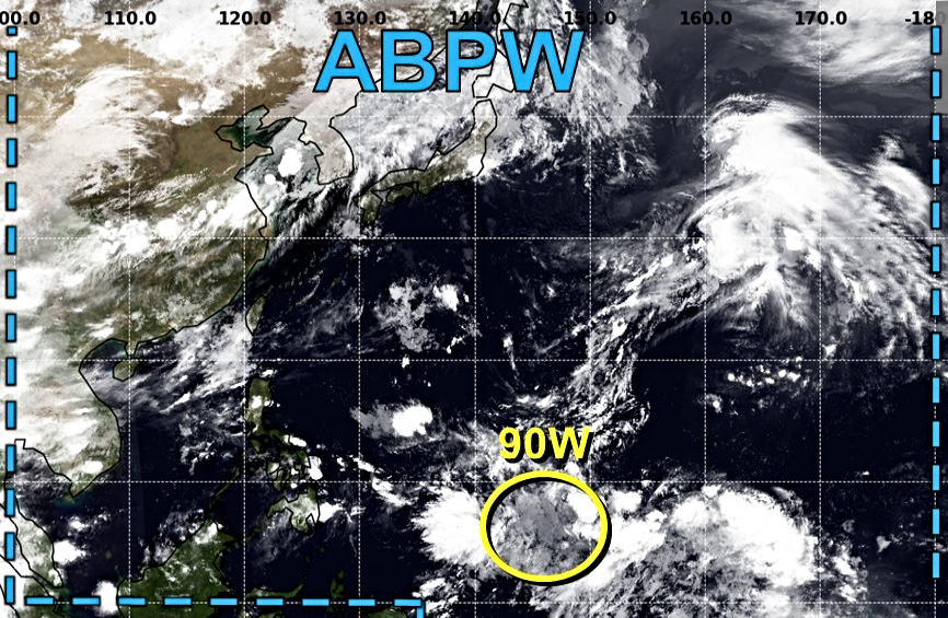
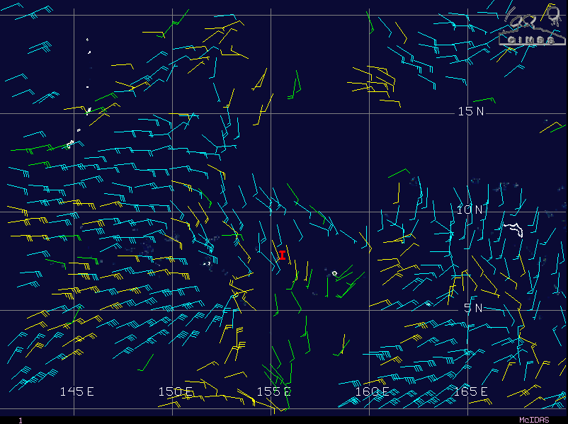

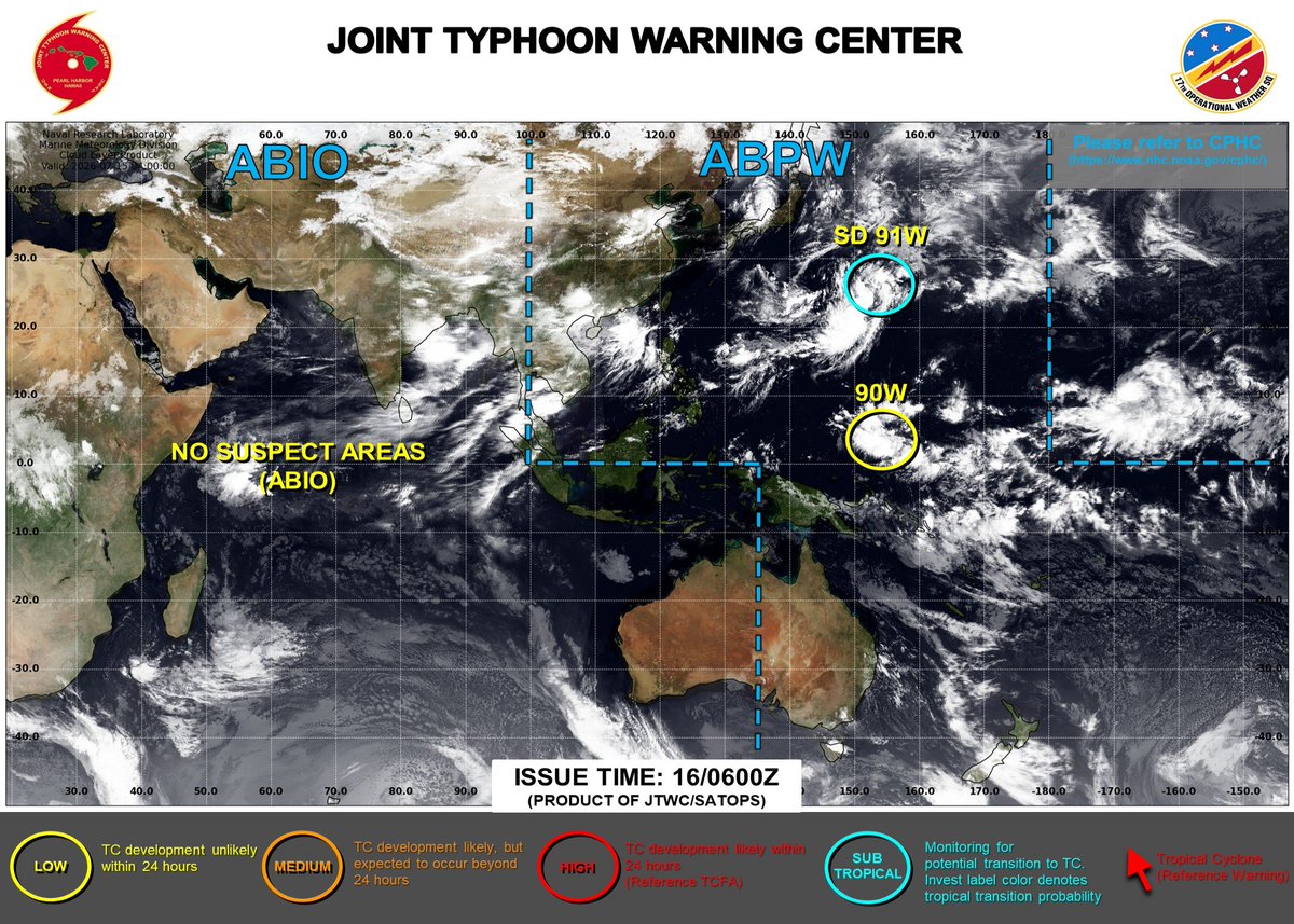
#90W; Low formation chance over the next 48 hours for the area. It is currently not a land threat.
#wxtwitter


Only 1 disturbance remains in the western Pacific Ocean and that is invest #90W that has a low chance of developing into a Tropical Depression within 24 hours as it meanders and produces light to moderate to heavy rainfall and some gusty winds #BREAKING #wxtwitter #rainfall #flooding #wind #severewx #tropicalupdate #tropicswx


Invest #90W – Tropical Cyclone Advisory #2 (FINAL): 1200 UTC 16 July 2026: Depression weakens and dissipates. This is the last advisory but regeneration is possible early next week. https://t.co/XInW4gG3Mn
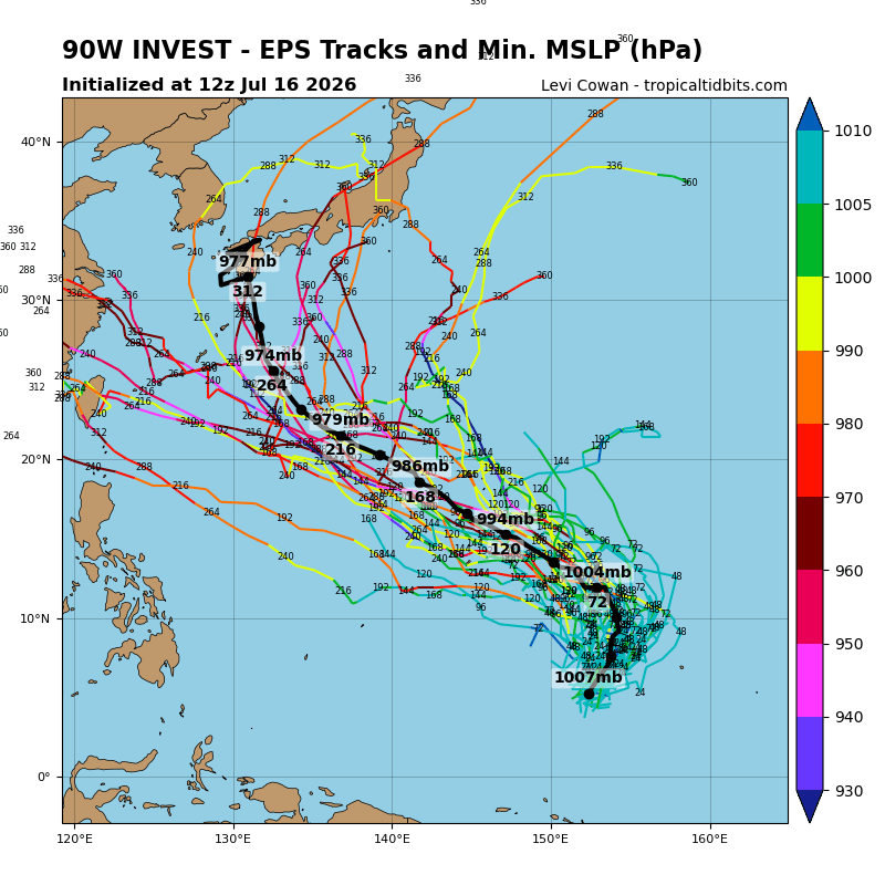
Regarding Tropical Depression #90W near the Federated States of Micronesia, there are currently three possible scenarios for its future intensity and track based on agency forecasts and numerical model guidance. The global models remain in significant disagreement regarding the disturbance's potential development over the next several days.
1. The Japan Meteorological Agency (JMA) no longer forecasts the disturbance to intensify into a tropical storm, as environmental conditions have become unfavorable.
2. Models such as the ECMWF (Euro), GSM (JP), and DeepMind (Google) show little to no development over the next few days, although a few deterministic ECMWF member runs indicate gradual development.
3. The US (GFS) and Canadian (GDPS) models are the only ones showing a bullish solution, forecasting the system to reach typhoon intensity next week as it move towards the Ryukyu Islands.
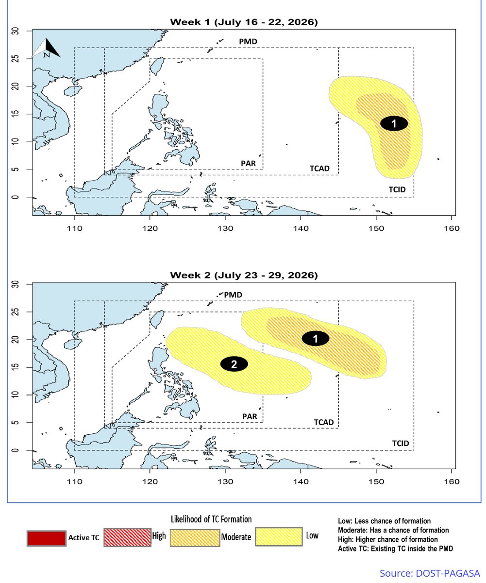
Meanwhile, @dost_pagasa has updated its Tropical Cyclone (TC) - Threat Potential outlook, indicating that TCLV-1 has a MODERATE chance of tropical cyclone formation over the next two weeks. Assuming this refers to #90W, the system may enter the Philippine Area of Responsibility (PAR) sometime between next weekend and the following week, but it is expected to remain offshore.
On the other hand, the Subtropical Depression #91W will NOT become a warm-core tropical cyclone anymore, as it has already encountered the mid-latitude westerlies.
📷: Himawari-9 via NRL-Monterey, Weathernerds (GFS), Tropical Tidbits (EPS), DOST-PAGASA

この夏は冷感グッズ必須
我が家は #屋外は日傘とクリップファン #屋内は着るエアコン で乗り切ります
なにせ沖縄も本土も亜熱帯化で本土海域で台風リスク認定 #SD91W
また元98Wも新たに #台風12号リスク #90W 認定
亜熱帯化しているこの先の日本海域どうなる?
#沖縄台風情報
https://t.co/UfvJTyyQww

#90W; Low formation chance in the next 48 hours.
#91W; 35mph 1001mbs- Low chance of becoming a TROPICAL CYCLONE, currently a subtropical depression per the JTWC.
#wxtwitter
Most Popular Users

Elon Musk 
@elonmusk
241.3M followers

Barack Obama
@barackobama
119.1M followers

Cristiano Ronaldo
@cristiano
113M followers

Donald J. Trump
@realdonaldtrump
111.8M followers

Narendra Modi
@narendramodi
107.1M followers

Rihanna
@rihanna
98.3M followers

NASA
@nasa
92.3M followers

Justin Bieber
@justinbieber
91.5M followers

KATY PERRY
@katyperry
89.1M followers

Taylor Swift
@taylorswift13
83M followers

Lady Gaga
@ladygaga
74.5M followers

Virat Kohli
@imvkohli
72M followers

Kim Kardashian
@kimkardashian
70.5M followers

YouTube
@youtube
68.8M followers

Neymar Jr
@neymarjr
65M followers

Bill Gates
@billgates
64.6M followers

The Ellen Show
@theellenshow
62.4M followers

Selena Gomez
@selenagomez
62.2M followers

CNN
@cnn
61.8M followers

X
@x
60.8M followers