Top Tweets for #Zoomstack

❗The #ZoomStack in action with the new #Zoom4S❗
In this #stroke case, the Zoom Stack works together seamlessly to travel to the face of an M1/M2 occlusion. Dr. Paul Schmitt applies Continuous Dual AspiraTion (#CDAT) using Zoom 4S as the inner catheter and Zoom 7X as the outer catheter.
The outcome? First pass, TICI 3 in 11 minutes with clot captured in both Zoom PODs.
Thank you for sharing this excellent case and your experience with the #ZoomStrokeSystem.
#stroke #neurointervention
Rx only. ISI: https://t.co/20ZwfceFWm

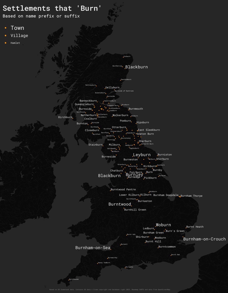
#30DayMapChallenge Day 15 – Fire.
I am still catching up so another simple one here. Place names in GB that begin with or end with 'burn'. Based on @OrdnanceSurvey #zoomstack data, made in #qgis.
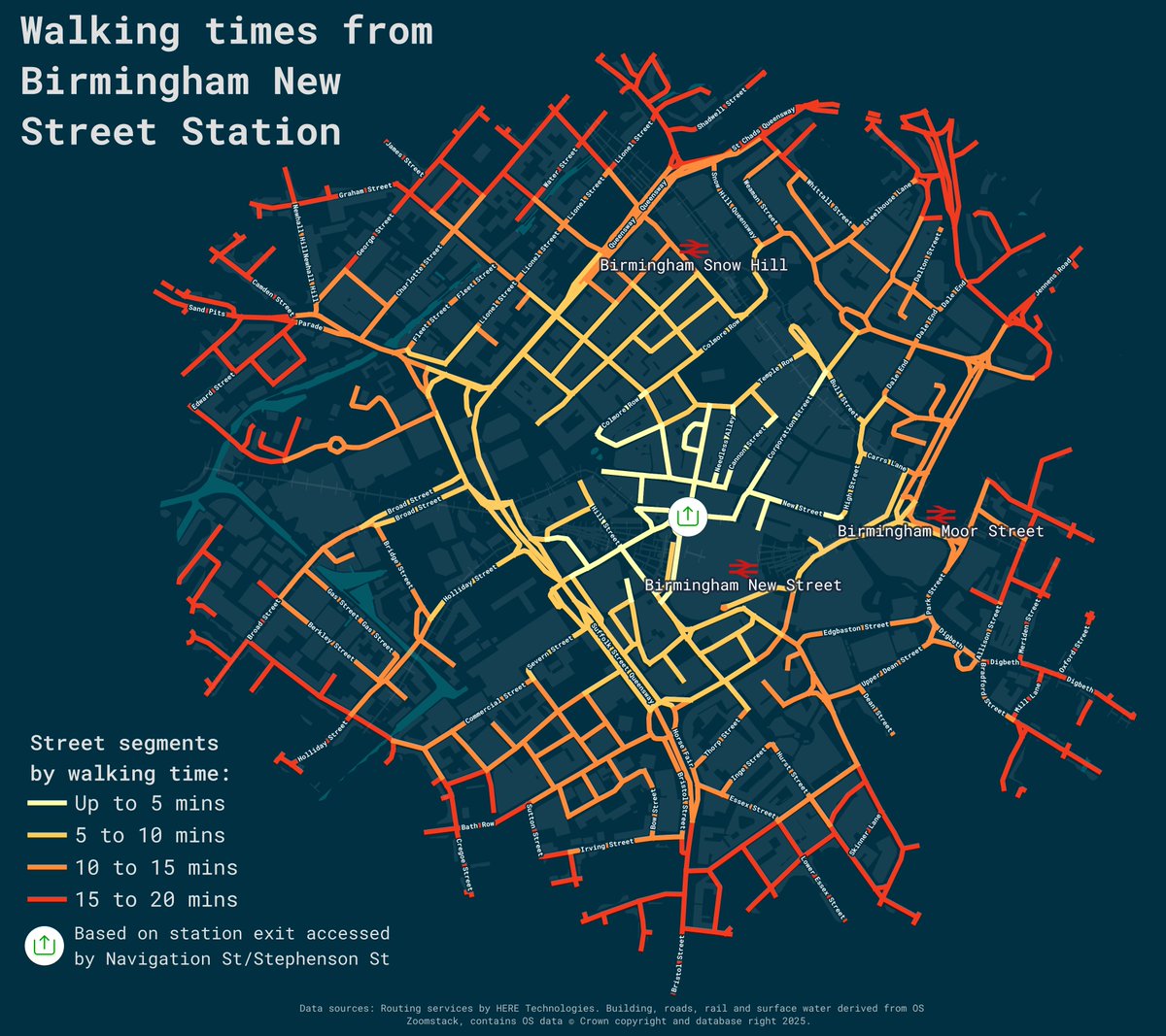
#30DayMapChallenge: Day 7: Accessibility
Walking times from Birmingham New Street. Made in #qgis with @OrdnanceSurvey #zoomstack data and using the @here maps routing API.
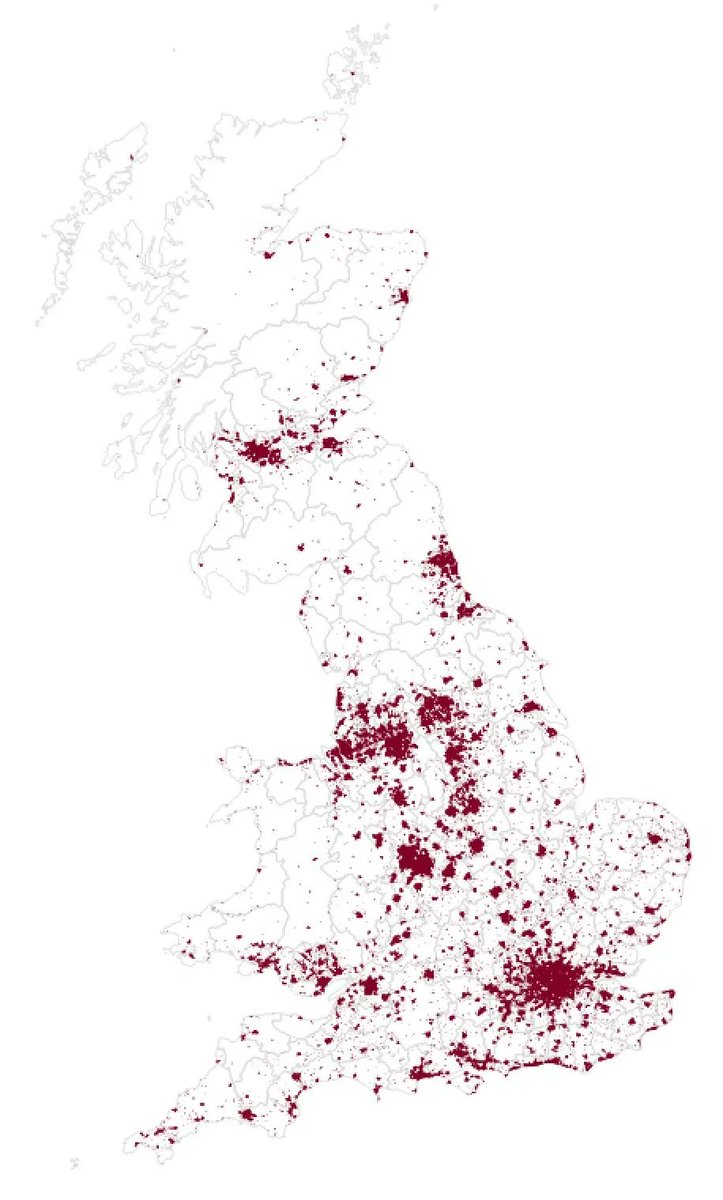
#30DayMapChallenge Day 3 - Polygons
Another play around with the new Index of Multiple Deprivation 2025, clipped to building polygons to show deprivation in #Birmingham city centre. Made in #QGIS with @OrdnanceSurvey #zoomstack buildings data.


It's #ColourBlindAwarenessDay today, so here's a friendly reminder that @Cadcorp SIS supports @OrdnanceSurvey Open #Zoomstack data, including its Colour Vision Deficiency friendly styles - #GIS #Spatialinsight #FridayMapFun


OS Open #ZoomStack served in #PMTiles by @protomaps and #RaspberryPi 4B. Powered by @maplibre GL JS and other great #opensource software. https://t.co/tBnpNAzk5h

#30DayMapChallenge Day 15: Food/Drink.
Literally had no time for a new map today so just posting this map of Brewdog pubs from an Ordnance Survey workshop I attended a few years ago using #Zoomstack data and #Mapbox
Working version at: https://t.co/U2BveHvKcD


Day 2 - 30 Day Map Challenge - Lines
More details from my LinkedIn page: https://t.co/HFUTb65fw2
In this example we look at the contour lines of Wales. Data from: https://t.co/RKhTILZmuz
#30daymapchallenge #zoomstack #GIS #businessdecisions @Cadcorp

#30daymapchallenge Day 22 - Boundaries. Using Ordnance Zoomstack to identify Urban Areas and Boundary Line to identify District Boundaries. @Cadcorp #zoomstack #boundary #district
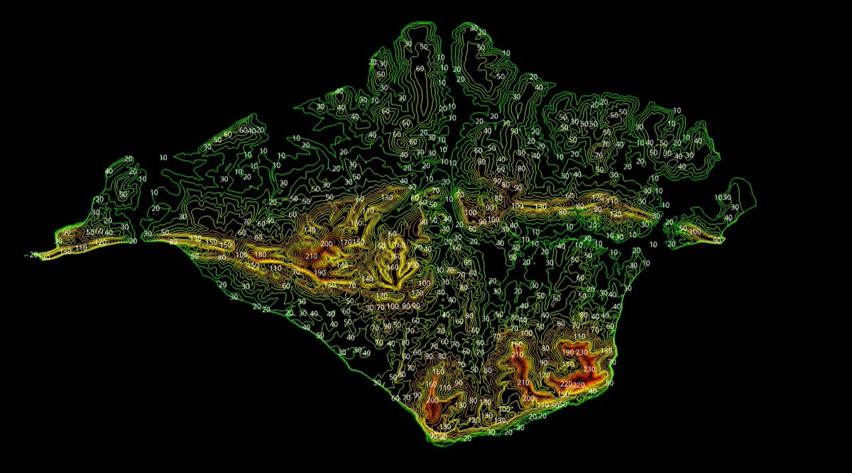
#30daymapchallenge Day 19 - Islands. Using Ordnance Survey Zoomstack Contours lines to identify the heights of the Isle Of Wight. Really struggled with this one, which is why its so simple. @Cadcorp #gis #zoomstack #heights
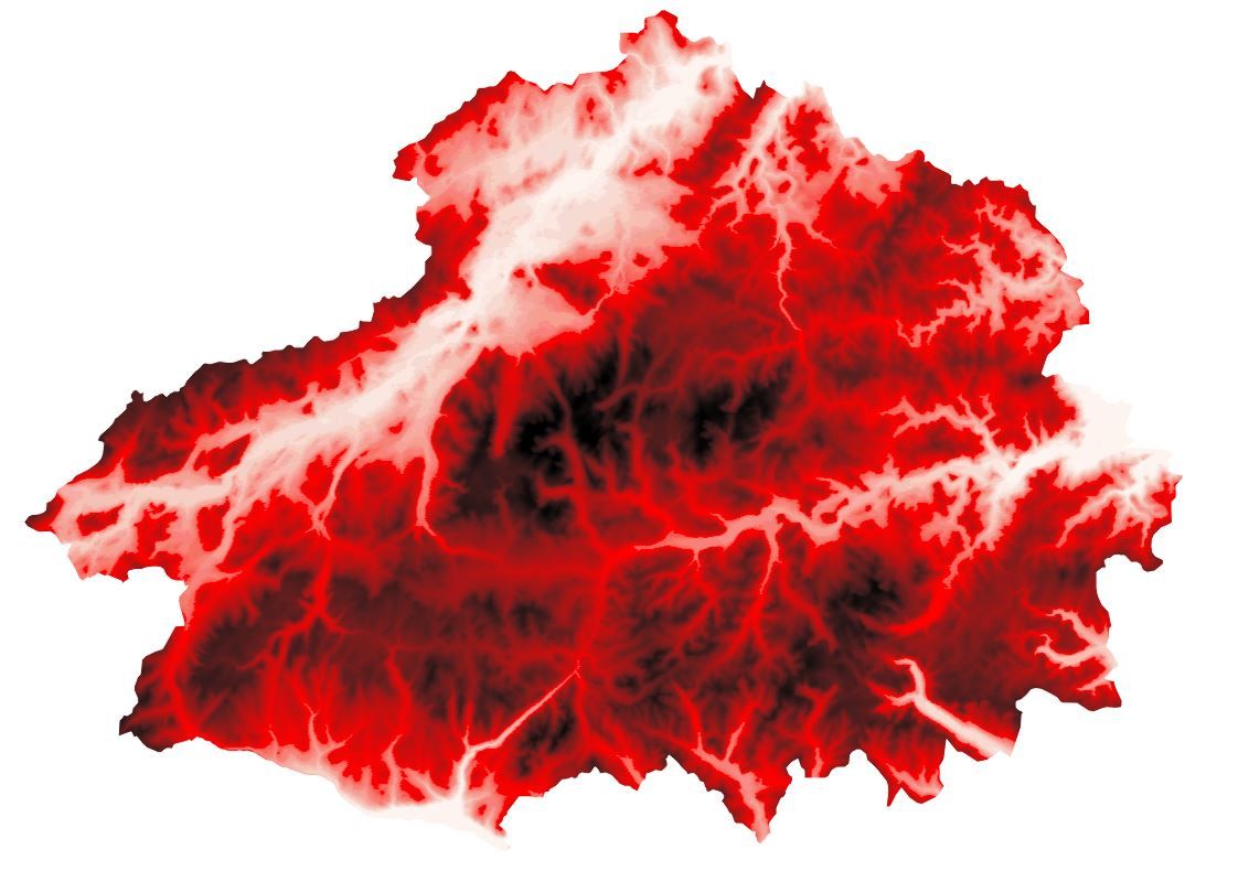
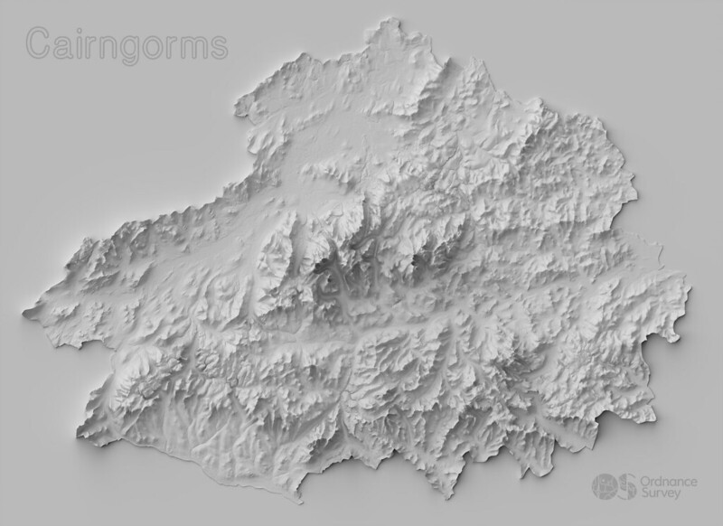
#30daymapchallenge Day 6 - Red. Cairngorms national park UK. Created using the contour lines within Ordnance Survey Zoomstack to define the heights. @Cadcorp #gis #zoomstack #nationalpark

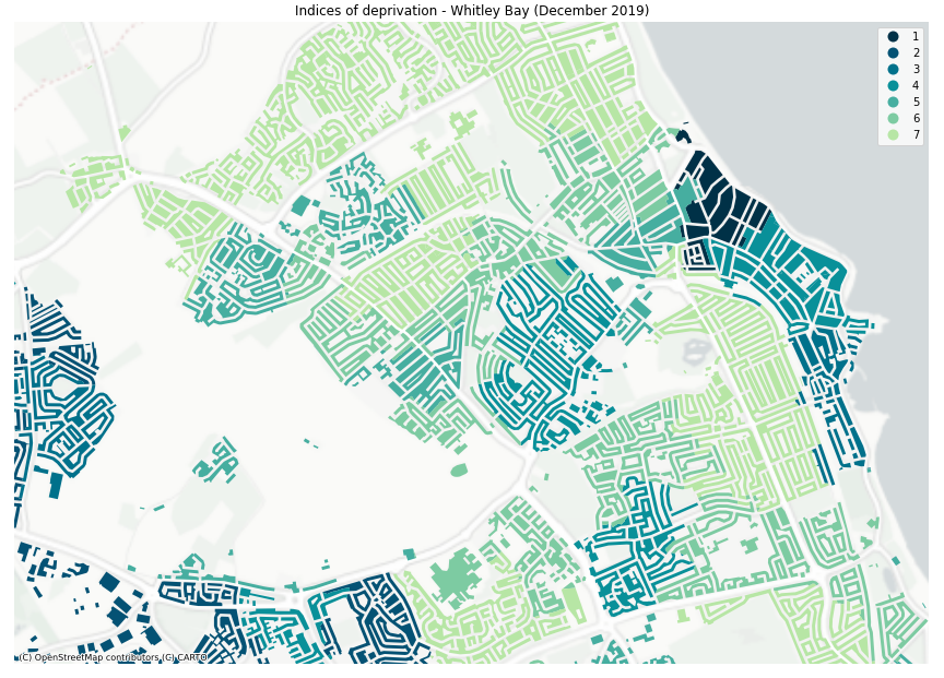
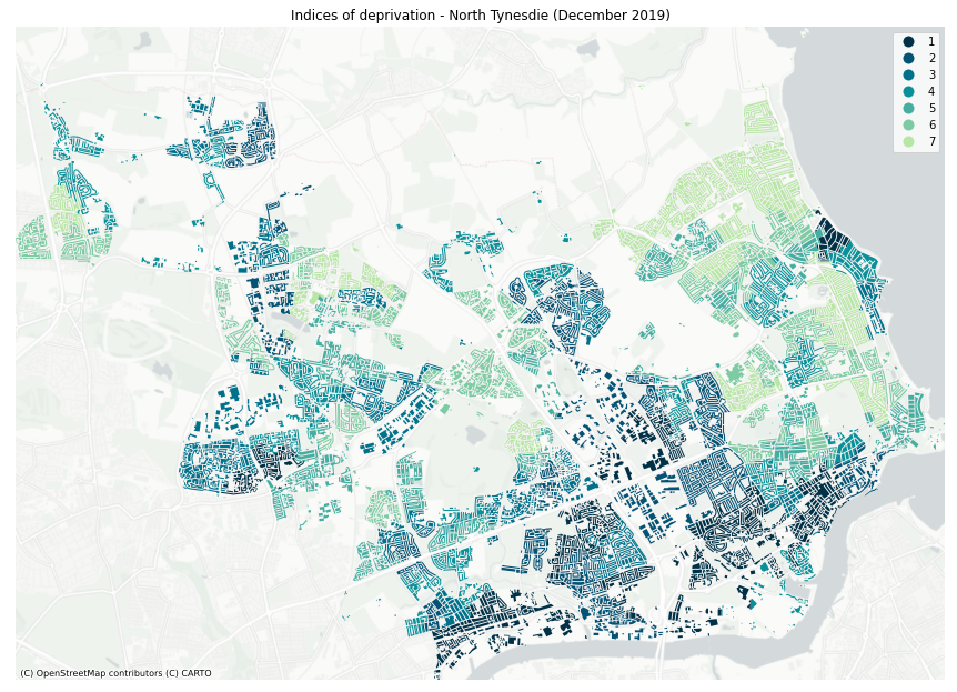
@Peter_Brace This is Indices of deprivation (2019) for North Tyneside and Whitley Bay. #30DayMapChallenge #GIS #ZoomStack #GeoPandas
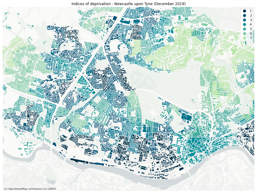
Final day of #GIS #DataScience training with @ONSgeography & @OrdnanceSurvey. Used what I have learned to build my own #Python pipeline to create a dasymetric map of deprivation in Newcastle, using APIs, #ZoomStack, OLSA and indices of deprivation data. #30DayMapChallenge
#30daymapchallenge Day 3 - Polygons. Buildings at risk from flooding (Flood Zone Level 2) along River Trent in Nottingham. Using Ordnance Survey Zoomstack Local and District Buildings. You can see both football stadiums in the centre. #gis @cadcorp #zoomstack #nottingham


Here's how to clip all layers in a #geopackage using #gdal in #qgis.
This demo uses the mighty @OrdnanceSurvey open #zoomstack
https://t.co/kxUYGqqi8L
@foss4guk @osgeouk @QgisUK #gischat


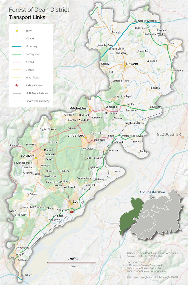
Work in progress based on OS #Zoomstack data - need to use this way more. Such a useful dataset - default form and style is great but completely customizable too. Great for place names! #gischat @QGISMaps @qgis @OrdnanceSurvey @CCRI_UK

Do you need a perfect map of the #UK 🇬🇧? Data from Britain's mapping agency @OrdnanceSurvey available in MapTiler Cloud. Use it with one of the map styles or customize it. Read more at https://t.co/SoDmjHv4Tw.
#ZoomStack #opendata #openzoomstack #Mapping

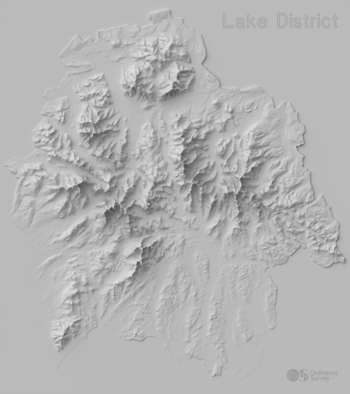
#30DayMapChallenge theme = elevation🌄
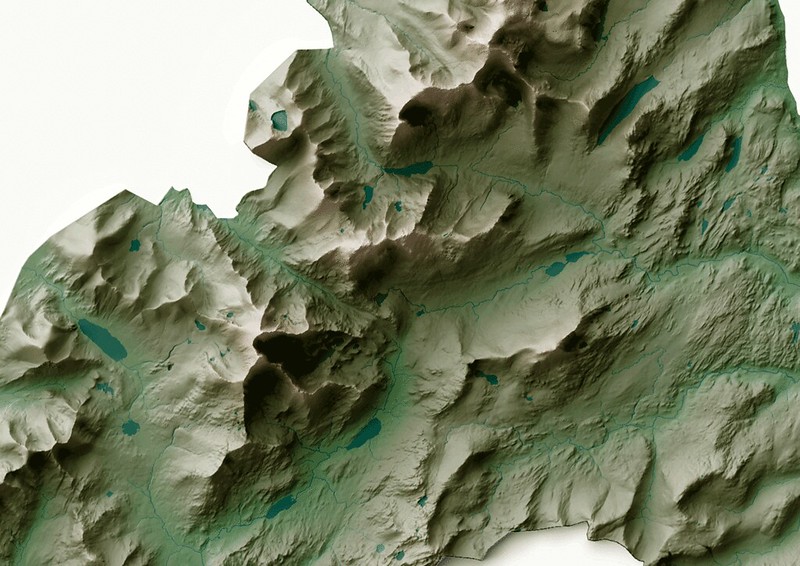
Our GeoDataViz team used OS Terrain 5, OS Open #Zoomstack and OS MasterMap Topography Layer to create the look and feel of our #GBNationalParks poster👇 https://t.co/vkKYU48IFN


We’re in this together. #ZoomStack

Interested in serving @OrdnanceSurvey #ZoomStack in @GeoserverO ? Our team is preparing a read-to-use data dir plus other instructions which we will release shortly for free. Stay tuned!
@OSGeo @foss4g @planetosgeo #geoserver @GeoNode @mapstore2 @foss4guk #sld #mapping #maps
Trends for you
Most Popular Users

Elon Musk 
@elonmusk
240.2M followers

Barack Obama
@barackobama
119.3M followers

Donald J. Trump
@realdonaldtrump
111.6M followers

Cristiano Ronaldo
@cristiano
108.9M followers

Narendra Modi
@narendramodi
107M followers

Rihanna
@rihanna
97.3M followers

NASA
@nasa
92.1M followers

Justin Bieber
@justinbieber
90.6M followers

KATY PERRY
@katyperry
86.8M followers

Taylor Swift
@taylorswift13
80.6M followers

Lady Gaga
@ladygaga
72.2M followers

Kim Kardashian
@kimkardashian
69.4M followers

YouTube
@youtube
68.6M followers

Virat Kohli
@imvkohli
68.6M followers

Bill Gates
@billgates
63.4M followers

The Ellen Show
@theellenshow
62.5M followers

CNN
@cnn
61.9M followers

Neymar Jr
@neymarjr
61.1M followers

X
@x
60.9M followers

Selena Gomez
@selenagomez
59.9M followers