Imagining Wallachia: Ruhedorf’s cartographic vision in the eighteenth century: International Journal of Cartography: Vol 0, No 0 - Get Access https://t.co/PcDag0HvBa
Our last article #cartography#romania#oldmaps#Wallachia
Our last article: The human and historical tapestry of fisheries in the Danube delta (Ștefan Constantinescu, Natasa Vaidianu, Petruța Teampău, Aurelian Giugăl & Priscila F. M. Lopes) https://t.co/XWTNShySZK
#Blacksea#Fisheries#Danubedelta
Our latest article describes the history of salt exploitation from the lakes located along the Black Sea coast. The article is open access.
https://t.co/NzmzgqGpg5
New online-first article!
'Mapping the liquid territories of the Danube Delta (Romania): The atlases of the European Commission of the Danube', by @katarlez, @budileanumarius & @cavrinceanu.
Read it here: https://t.co/xWBcfLfdkz
My latest research on Danube Delta has just been published with @SpringerNature in GeoJournal:
Misunderstandings and mastery: cartography of the Lower Danube during the Enlightenment era (1768–1774)
Read here: https://t.co/NMCpdUTjuP
#DanubeDelta#cartography#maps
Today’s @UCLgeography map library discovery!
Bruce Heezen and Marie Tharp’s HUGE 1961 map of the South Atlantic!
Alongside later @NatGeoMaps adaptation of entire Atlantic for scale! 😍
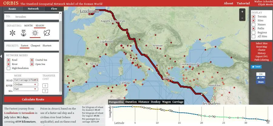
Sure, GoogleMaps is cool but not half as cool as ORBIS. The Stanford Geospatial Network Model of the Roman World allows you to check travel times during Roman times. You can choose your mode of travel too! Source: https://t.co/zgVnhUuMBP
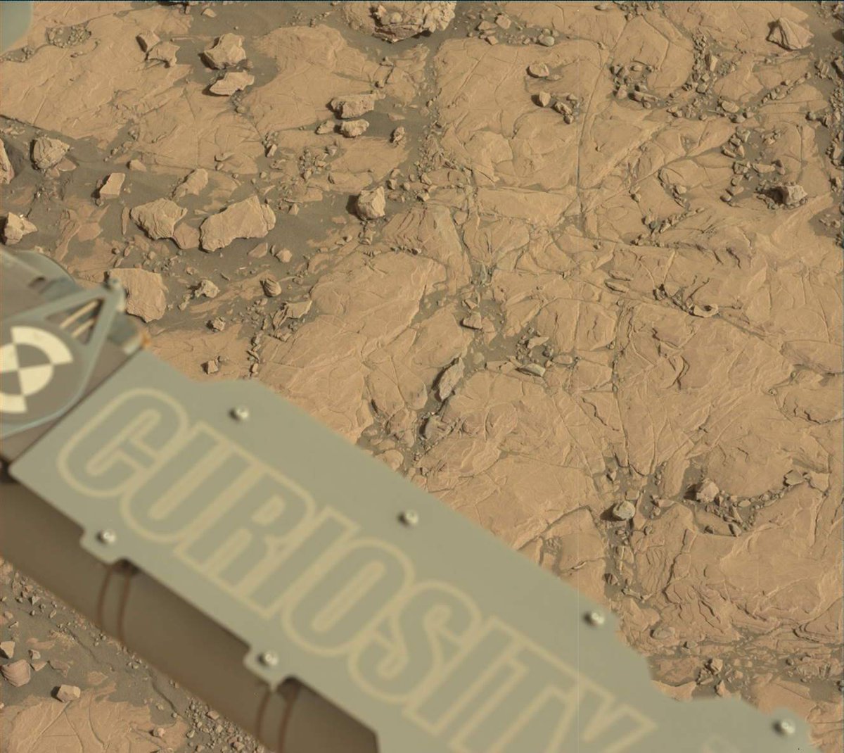
Once, twice, three times a rover… I’ve been on the Red Planet for three Martian years. That’s 3x longer than my mission was designed to last.
Keep up with my team through our blog: https://t.co/rOEt9diNzz