@owenbroadcast Cool! Great idea to gamify and socialize cultural knowledge like this
Check out my related project focused on comparative analysis of artifacts: https://t.co/HwJcFe5VFo
Trying to find the national archives of Nigeria online and there's two similarly-named websites as the top results, both mostly dead-ends as to where to access the collections themselves
Earlier this year I was getting frustrated with Claude's charts, fed this book to claude and had it generate a Tufte skill. Instantly got simpler/more beautiful visualizations.
https://t.co/lfXwyQfmQG
Cool progress on my "Ancient Symbolic Motif Analysis" project: applying Meta's SAM (segment anything) model to extracting specific motifs in Yoruba door panels
Goal is to speculatively interpret the "meanings" based on comparative knowledge of symbols like the ouroboros (pic #4)
Evening progress: tuned the segmentation, then extracted and clustered individual motifs bounding-boxes with tSNE
Looking to further improve with improved pre-processing, clustering and add surrounding context for the motifs to help interpret them individually
i made a reading interface for spinoza and its commentaries throughout centuries, inspire by talmud:
- scroll to adjust each era's thickness
- hover to discover cross-references between commentators
src code for subscribers ↓
@GoodfireAI Love this, the spatial visuals peak my curiosity
Was fun to play around with 2-d embeddings of geography vs. the real lat-long placement on a map… inspired by @mattdesl doing similar visualization of embeddings of color names
Another well-written piece by @DoubleEph
Don't go buy that house in St Tropez when you exit; instead, get stuck into the rewarding mess that's nation-building.
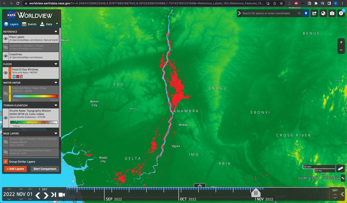
@AgoraPolicy@YAkinyugha Including a relief map layer shows why floods accumulate in lower-lying areas to the east of the Niger near Anambra, Enugu: https://t.co/UBYfkpSPJ2
Natural preventative measures _might_ include water cachement swales to allow more water to be sequestered upstream of tributaries