Two journalists @betsymason & @dosmonos who love maps and the stories behind them. Co-authors of the @NatGeo book All Over the Map: A Cartographic Odyssey.
It's here! Our new book "All Over the Map" goes on sale today. If you like maps, history, science, art, design, or just like good stories, you'll love the book! It has 80 stories & more than 200 beautiful maps, some you've never seen before. Check it out! https://t.co/DxyzSRS2gx
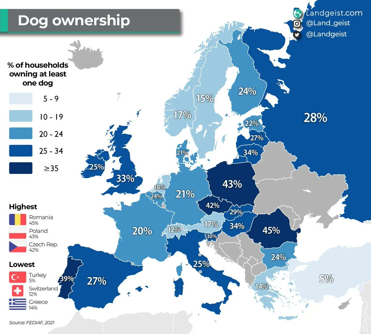
Lovely map by @landgeist shows us the share of households across Europe that have at least one dog. The biggest dog divide I can see runs between Austria and Czechia.
This World Braille Day we got our hands on some of the braille books in our collection. Because it takes more pages than a regular book to convey the content, many braille books are split into several volumes. Learn more: https://t.co/OQqJj5sJAD
📷:https://t.co/TAXmJcffOy
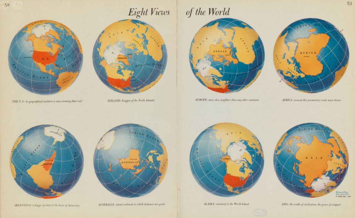
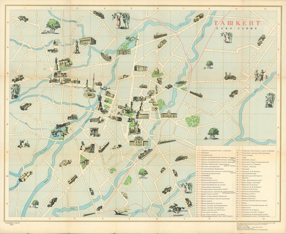
When the K12 education team at the Map Center teaches World Maps Over Time, students look for evidence of the cartographers' points of view and intended audiences. Who do you think these maps were intended for and what might we guess about Richard Edes Harrison, the cartographer?
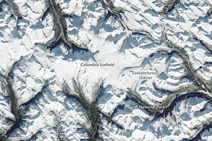
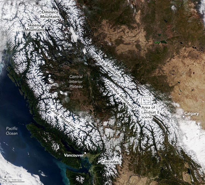
Northwest Ranges Make Rare Appearance: Clear skies between storm systems gave satellites a cloud-free view from the Coast Mountains in British Columbia to the Rockies in western Alberta.
https://t.co/044ZWvW0uu
#VIIRS#Landsat
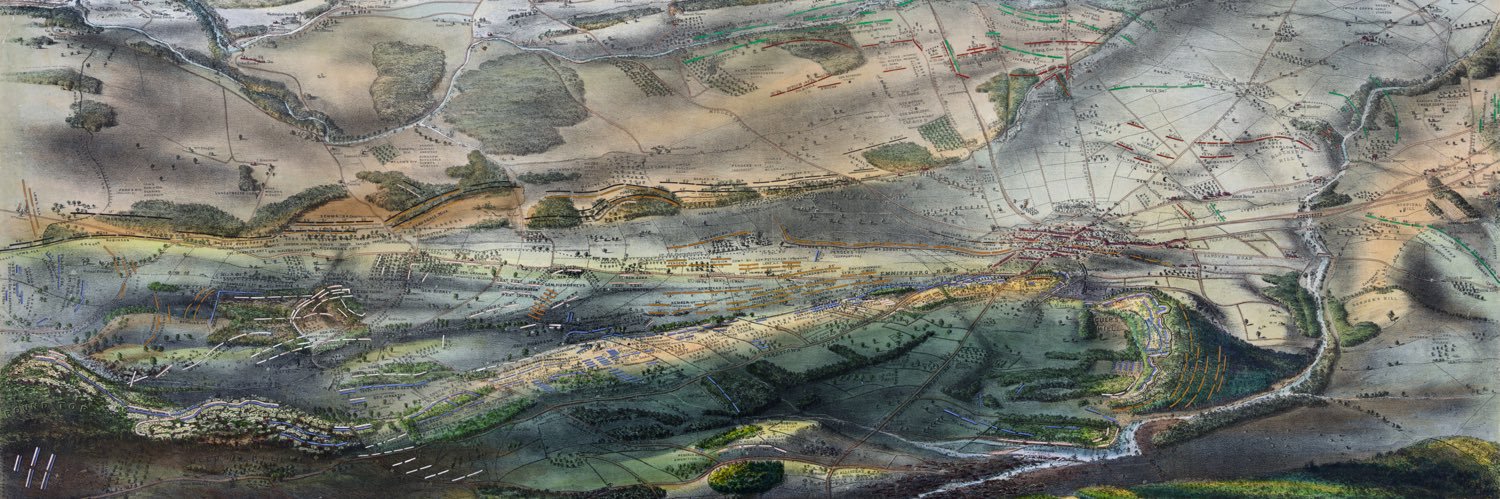
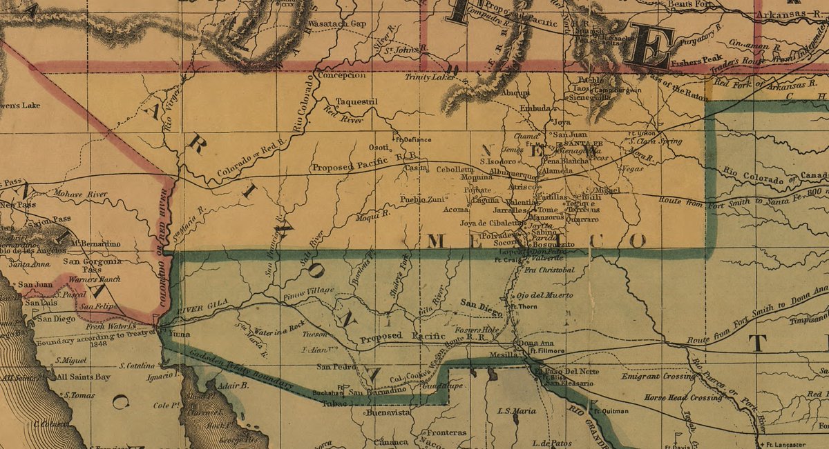
Our latest blog post discusses the fascinating dispute over borders and the mapping of #NewMexico and #Arizona during the American Civil War!
Read all about it here: https://t.co/EkOQ0C9tkD
Mount Etna, Europe's tallest and most active volcano, has erupted so much in the past six months that it’s grown about 100 feet in height, @SPACEdotcom reports:
https://t.co/jrlgyxOAU1
Want to help make USGS maps more accessible? @MeganSever4 is looking for someone to help edit, proofread and evaluate readability of maps for color-blindness.
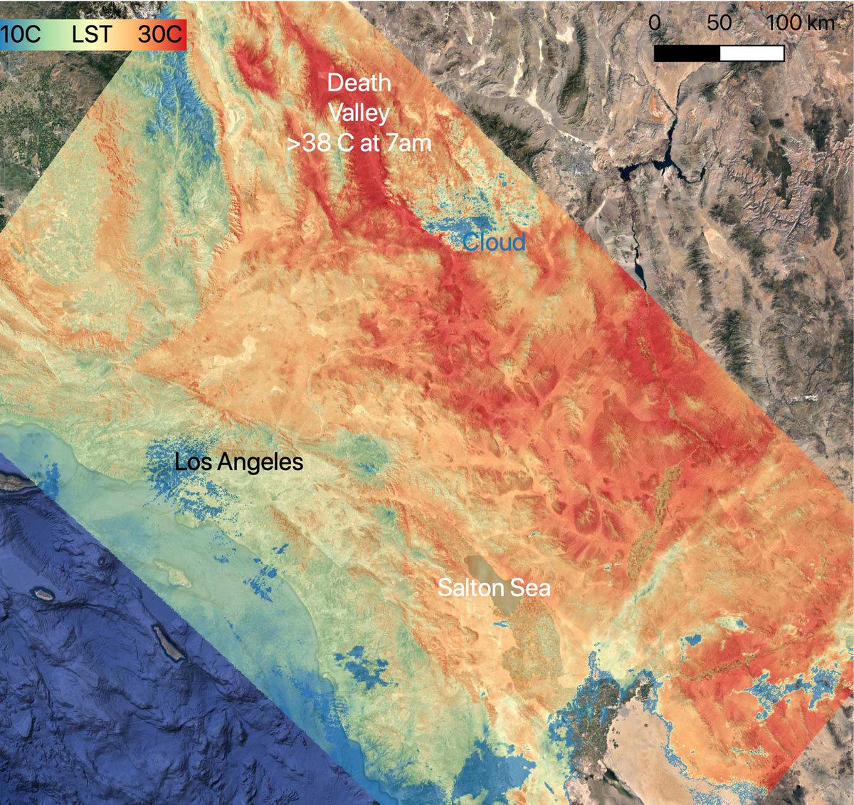
Meanwhile, ECOSTRESS -- an instrument attached to the @Space_Station -- captured ground surface temperatures in California. By 7 a.m. local time, some areas reached 86 degrees Fahrenheit (30 degrees Celsius), while Death Valley surpassed that.
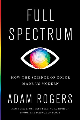
Do you care about #color? #maps? #dataviz? #brains? Then this fascinating new book on the science of color by @jetjocko is for you. Amazon: https://t.co/hLspMqleyT and IndieBound: https://t.co/LsEbgCGgwc
Do you like maps and data viz? Check out @infowetrust's new series of gorgeous books on Information Visionaries like Florence Nightingale & Emma Willard. New graphics you've never seen, new discoveries, untold stories. Did I mention the books are gorgeous? https://t.co/QpAhed5esn