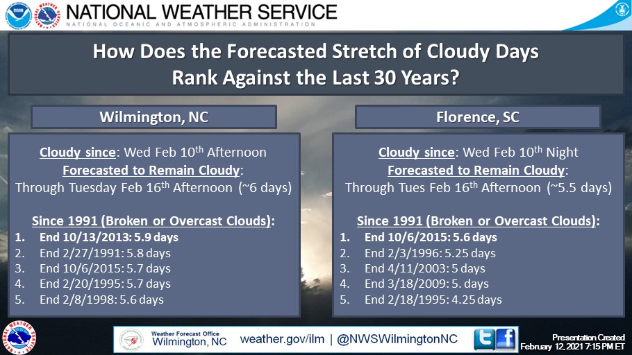
☁️ Based on the current forecast, most of our area will remain cloudy (broken/overcast) through Tuesday afternoon. We wanted to see how this stacked up against the last 30 years. Turns out we'll be close to record breaking if forecast pans out. #ncwx#scwx#ilmwx ☁️
Models are a good start, but it’s the meteorologists who make the final forecast and work within their communities to make sure they’re prepared that build a #WeatherReadyNation.
Speaking of which, we don’t see you on our list of WRN Ambassadors…
https://t.co/yUR46G7C9N
Thirty-one years ago Hurricane #Hugo was approaching the South Carolina coast with a huge storm surge. Damaging winds would spread all the way inland through Columbia, Charlotte, and into the NC mountains. Read more on this beast of a storm: https://t.co/zmbvU4IVTH #ncwx#scwx
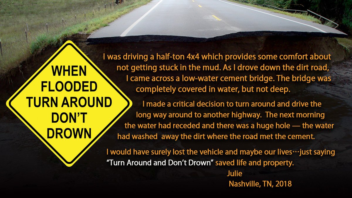
"I would have surely lost the vehicle and maybe our lives...just saying 'Turn Around Don't Drown' saved life and property."
You never know if the road is even below that muddy water anymore. https://t.co/OuQJQQYHa7 #WeatherReady
I saw a lot of comments online about not moving the track westward near Houston when this ECMWF ensemble plot came out. #Laura actually made landfall outside of that ensemble (and that model usually has too much spread). Trust the professionals and don’t just worship one model!
Long period swell in advance of Hurricane Isaias is beginning to arrive. We expect it to build through the weekend and lead to a high risk of potentially life threatening rip currents. See how the swell evolves in our experimental Coastal Waters Forecast https://t.co/Olmktin4sT
We're sure our beach-goers noticed the chilly water temps, but check this out: We have recorded the coldest water temperatures on record at Johnnie Mercer Pier between the dates of June 11th and June 20th!
⛈️Severe weather possible at times this afternoon through tomorrow morning. ⛈️
- Scattered storms later today will make way for widespread rain overnight, with potential for strong gusts.
- Convective line possible tomorrow morning.
Remain #WeatherAware.
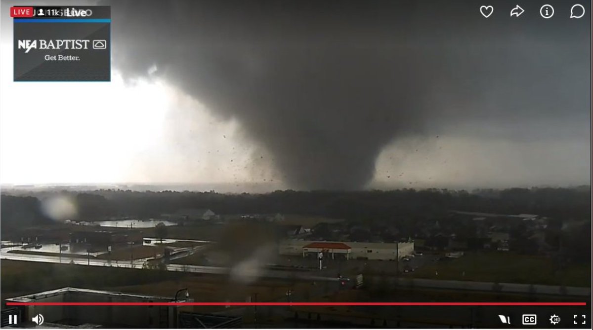
Despite our ongoing public health crisis, NOAA’s National Weather Service continues to provide lifesaving warnings, like here by NWS Memphis for a tornado in Jonesboro Arkansas yesterday afternoon. Thank you @NWSMemphis and all of Team NWS! #weather#nws#tornado#noaa
Incredible pressure falls continue offshore with rapidly intensifying low off the Mid-Atlantic coast, likely exceeding 20 mb in just the past 6 hrs -- #hurricane force wind warnings continue for OPC marine zones, seas quickly build into the 35-45 ft range later tonight #MarineWx
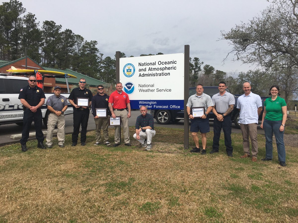
We proudly hosted a meeting with our beach partners earlier today. We discussed rip current forecasting and what more could be done to promote rip current awareness. We couldn't do what we do without partners like these! Thank you! #beachsafety