@KMS_PzEUGIN_III@digitalfish19 Organic products rely on natural ripening or mechanical cutting, whereas conventional crops sprayed with glyphosate are chemically killed to force uniform drying. Glyphosate is a neuro-endocrine poison that overloads brain cells with glutamate and sabotages your hormones.
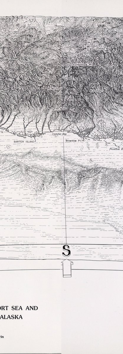
Most maps cut the ocean apart to keep the land whole. The Spilhaus projection splits the continents instead, so all of Earth's seawater reads as one body.
A year of surface currents, colored by sea temperature. Now also a print.
#ocean#dataviz
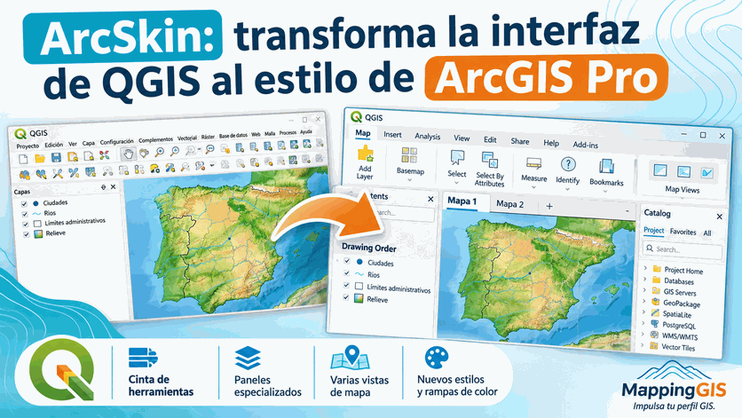
¿Vienes de ArcGIS Pro y todavía te cuesta acostumbrarte a la interfaz de #QGIS?
Ahora puedes hacerlo con ArcSkin, un complemento de QGIS que transforma su apariencia y reorganiza sus herramientas para ofrecer una experiencia inspirada en ArcGIS Pro
https://t.co/EawwUj8YWh
I did GDAL too. A MUCH faster engine for processing rasters is here!
GDAL is a is an open-source translator library for raster and vector geospatial data formats; it's behind the scenes for most modern maps you have probably ever seen. It takes ages to render maps because of how compute intensive it is--often times GIS people have their computers running overnight and then some to generate a single map.
Iterating on maps is a taxing process for everyone involved for this reason.
It's a bit of a misnomer, because unlike with PDAL there wound up being no real advantage to using the GPU, but with CPU threading we've made it ELEVEN times faster on some pipelines!
By combining a much faster GDAL for rasters and PDAL for point clouds, I intend to make a vibe cartography harness capable of fast iteration for feedback, and one that uses real geospatial data instead of diffusion pixel slop that's always inaccurate.
Full release coming soon!
Launching today: Land Intelligence.
Upload a deed and AI reads the legal description into calls, then places the tract on satellite imagery.
You check each call against the deed's own words, then export it to your GIS or CAD.
Built for energy professionals, mineral buyers and land teams.
OlmoEarth v1.3 beat Google's AlphaEarth on 10 of 11 tasks after training on 539 GPU-hours, 18% of Google's budget.
If you want to map crops in Ethiopia or oil palm in Indonesia, most of the effort comes before the map. You download years of radar and optical images, fight the clouds, and run a large model over every scene. Most researchers, NGOs and government teams can't afford that compute, so each project rebuilds the same machinery from scratch.
Embeddings are the shortcut. A big model does the heavy lifting once and boils down everything it sees at a location over a year into a short list of numbers describing what's there and how it changes. Anyone can then train a simple classifier on those numbers with a handful of labelled examples. Google DeepMind's AlphaEarth Foundations popularised the idea with 64 numbers per pixel, and Cambridge's TESSERA offers another version.
OlmoEarth v1.3 is Ai2's version. It learns from Sentinel-1 radar, Sentinel-2 optical and Landsat imagery, partly by hiding chunks of the data and predicting them, and partly by learning to reproduce existing maps of land cover, crops, elevation and roads. Instead of averaging a year of observations together, it learns which ones to trust for each pixel, leaning on radar when clouds block the optical view. A final step compresses the output to 128 numbers, and the first 64 work as a smaller version on their own.
On the same simple test AlphaEarth's own team used, the 128-number version beat both AlphaEarth and TESSERA v2 on 7 of 8 classification datasets. Accuracy on Africa's crop mask rose from 88.8% with AlphaEarth to 91.9%, and on US land use from 85.8% to 88.7%. The widest gap came on a crop-mapping test where the model has to work on an island it never saw during training: it scored 24.9 on a standard overlap score, against 19.1 for TESSERA and 15.8 for AlphaEarth. Across all 11 tasks under a nearest-neighbour test, it led on 10.
It was also cheap to build. Pretraining took 539 GPU-hours on H100s, 18% of what the first OlmoEarth needed and 53% of v1.2, for about 161 kWh of electricity. Producing the global embeddings is the expensive bit, at roughly 14,000 GPU-hours per year of data, about 26 times the training cost.
The data covers 2023, 2024 and 2025 globally from 59.5°S to 83.6°N, with 2017 to 2022 being filled in country by country. Each global year is about 150 terabytes, and the full archive will pass a petabyte. It's hosted on Source Cooperative with a browser explorer, and the weights and training code are open.
The team is upfront about weak spots though. Ethiopia is one... On Ethiopian crops the 128-number version scores 63.6, behind AlphaEarth's 68.5. The released embeddings were made with a slightly different tiling method from the ones benchmarked, so they aren't bit-for-bit identical. The licence also bars military and extractive industry uses.
There are now three planet-wide embedding sets competing on the same benchmarks. Someone mapping smallholder farms on a laptop gets to choose the best one for their region, for the price of a download rather than 14,000 GPU-hours.
link to full article: https://t.co/wTZmhVMyqg
I know what you need to do right now.
Go download the weights of these 4 open models and put them on your disk. Right now, even if you cannot run the big ones yet. Nobody knows where any of this goes next.
Qwen3.8-27B
Qwen3.8 Flash-Next
GLM-5.3-Flash
DeepSeek V4.1 Flash 1017
Grab the abliterated quants too while every link still works.
RIGHT NOW!