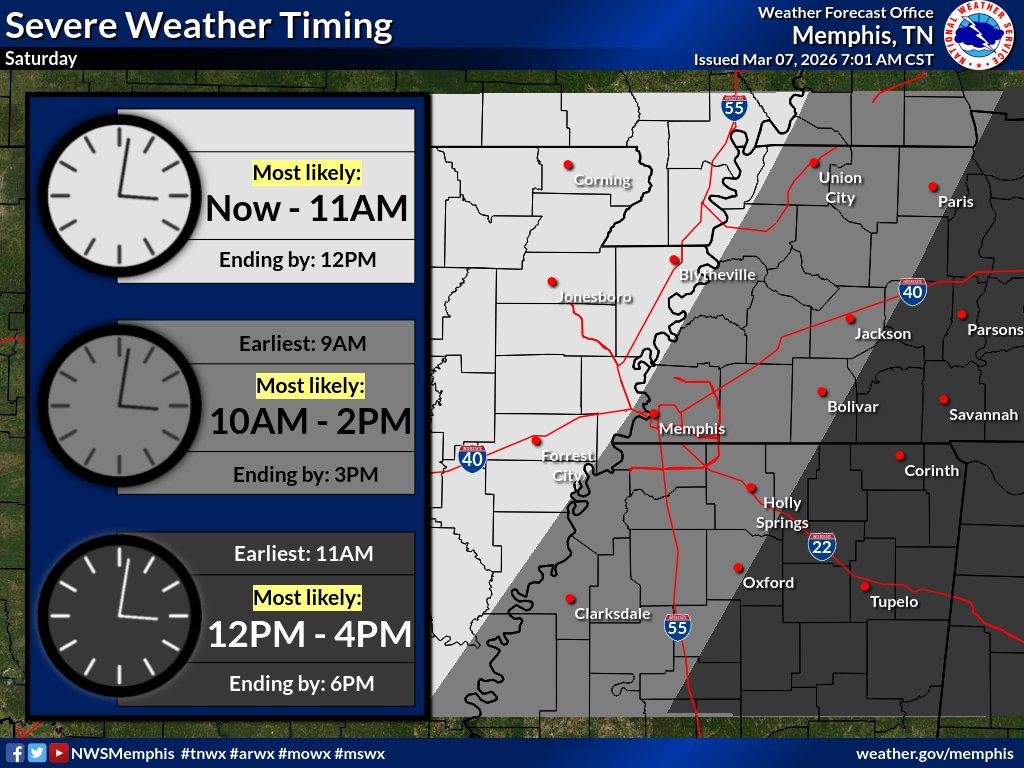
Now that we can see how this system is evolving, here is our latest thoughts on updated timing for storms through this evening. Our full thoughts can be found at the briefing link below. #arwx#mowx#mswx#tnwx
https://t.co/wIcYxXfV34
⚠️ The Slight Risk (2/5) has been expanded to cover the entire Mid-South today. Damaging wind is the main threat. Large hail and quick spin-up tornadoes are secondary threats. #tnwx#mswx#mowx#arwx#midsouthwx
A week from today, we will host an in-person storm spotter training in Jonesboro, AR. Join us at Valley View Church of Christ at 10AM on 10/14 to learn all about the storm spotting process.
Storm reports are very important to NWS offices because they help us understand what is happening in real-time. Information you relay to us is used to make warning decisions and could potentially save lives. #ARSWAW2026#arwx
It's now time to go over different hail sizes! A great way to report hail is by comparing the size to common objects below! Did you know that hail even as small as a quarter can fall between 25-40 mph?🤯 Please be mindful next time a thunderstorm hits. #MOSWPW2026
It's not just a phase... it's a ticket giveaway 🥀
Starting Monday, listen all week at noon to win My Chemical Romance tickets, built by Cedar Direct.
Show info: https://t.co/7o8GA56oDT
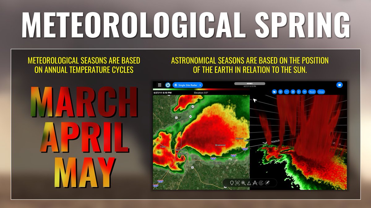
Happy first day of meteorological spring! 🌺🌦️
Unlike astronomical seasons, these fixed, three-month seasons are used in climatology to better align with temperature cycles, making them more consistent for climate records and data analysis.
LAST CHANCE TO VOTE! 🐾 Winner will be announced Monday!
Somebody's gonna win a pair of tickets to THREE upcoming concerts and a @clubScenthound gift basket. You can vote ONCE PER DAY!
Vote at https://t.co/oRMWXr3nvl!
A massive wildfire burning in southwestern Florida is sending thick smoke across Alligator Alley.
The National Fire, burning in Big Cypress National Preserve near the Florida Everglades, began on Sunday and has grown to 25,000 acres. The blaze remains uncontrolled. https://t.co/sg6d11qloW
Over 100 million people from the Ohio Valley to the Northeast could be dealing with snow and ice early next week. Models are still coming together but the signal for a significant winter storm Sunday through Tuesday is getting hard to ignore.
#RipCurrentAwarenessWeek
If you're vacationing at the beach for Spring Break, make sure you know how to spot a rip current. Subtle differences in the water's texture, color, and movement can clue you in that it's not safe. Be on the lookout and if you don't know, don't go! 🌊