7/28 8pm PDT update on Hurricane #Genevieve: Large swells from the major hurricane will continue to produce life-threatening surf & rip currents along the west coast of the Baja California peninsula, spreading to southern #California on Wednesday.
See https://t.co/Oy8uoeRKme
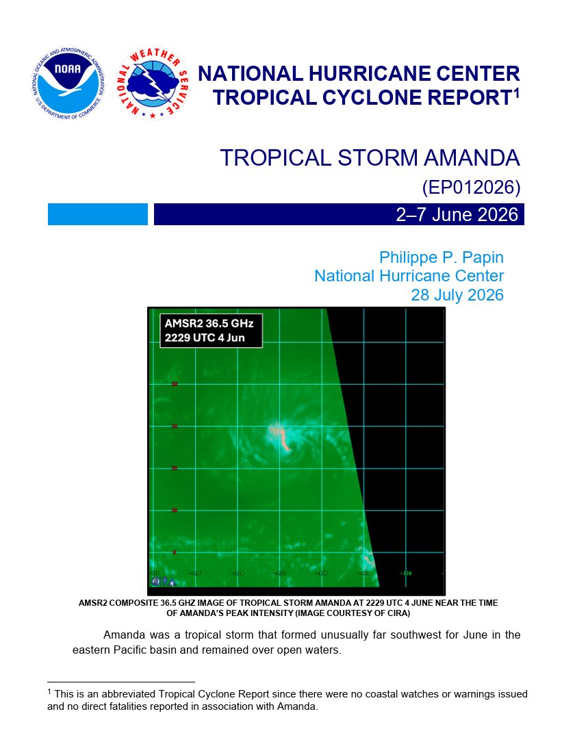
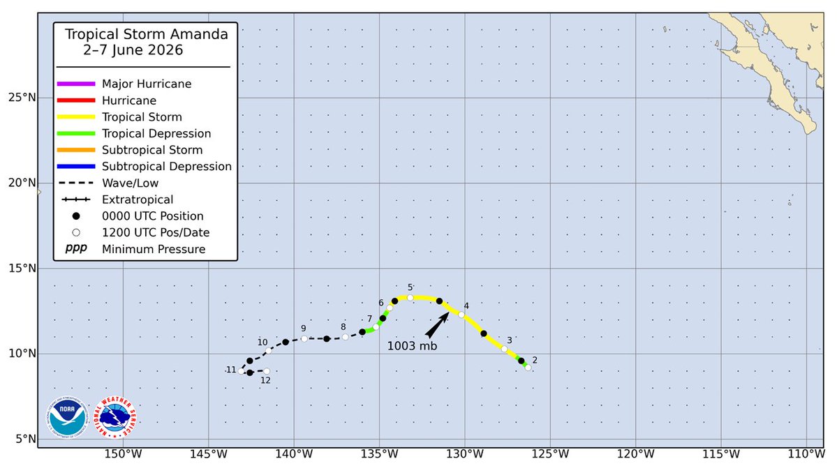
NHC has completed its post-analysis and posted the Tropical Cyclone Report for Tropical Storm #Amanda (June 2-7, 2026).
Full report available here: https://t.co/vEbwRqrHKM
Tropical Storm Elida does not look impressive and has yet to possess a healthy inner core. Deep convection has waned since July 16th at 18z. Dry air has significantly impacted its structure, and the storm is struggling to wrap bursts of convection. #wxtwitter#tropicalstorm
🚨 TERRIFYING! Moment caught on a Ring camera shows a deranged man in a long coat crashing out asking “where is your daughter?” And threatened the man on the cam that he “will end him” if he doesn’t open the door
How would you handle this tense situation?
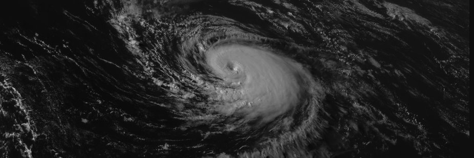
@AlanSevere The JTWC actually fixed DT 7.5 at 09z. Hopefully, the JTWC has a reasonable estimate for 12z. At this point, Sinlaku is likely 160-165 kt for 12z given the sustained T 7.5 since 3z. Absolutely incredible typhoon!
For the first time in recorded history, a tropical cyclone has made landfall in New Zealand. Tropical Storm Vaianu made landfall in Pukehina, North Island, New Zealand on April 12 near 02:00 UTC, with 1-minute sustained winds of 60 kt (70 mph/110 kph) unofficially. Despite cold sea surface temperatures of 19°C, the storm has been situated under an upper-level trough that is responsible for creating instability and convection. In addition, the storm has maintained a deep warm core south of 35 degrees, which is impressive at such a high latitude in the South Pacific.
Severe wind gusts of up to 75 kt (85 mph/140 kph) are still possible in the North Island as the storm accelerates south. Residents in the North Island should remain in shelter due to strong winds and flooding. Such winds can break tree limbs, uproot trees, and cause widespread power outages. Stay safe, everyone!
After nearly 900 days, the remarkable streak of the South Pacific not producing a major cyclone on the Saffir-Simpson Hurricane Wind Scale (SSHWS) has come to a close. The South Pacific has finally generated a major cyclone on April 7th at 0z. Cyclone Vaianu has intensified to a Category 3 major cyclone with 1-minute sustained winds of 100 kt (115 mph/185 kph). The Joint Typhoon Warning Center (JTWC) also upgraded Vaianu with winds of 100 kt. The JTWC fixed T 5.5 at 0z. The last major cyclone before Vaianu was Category 4 Cyclone Lola in October 2023.
An earlier microwave image from WSFM indicated Vaianu was almost done with its eyewall replacement cycle (EWRC) about 8 hours ago. Given the recent improvements in infrared and Dvorak imagery, Vaianu has completed its EWRC. The cyclone is expected to continue intensifying on Tuesday and may reach Category 4 intensity on the SSHWS. The storm is located in warm sea surface temperatures of 28-29°C and is in a relatively favorable jet interaction with moderately strong poleward outflow. However, its window for intensification is closing soon as the jet interaction turns unfavorable. The exact timing of Vaianu moving into an unfavorable environment is uncertain, but likely on Tuesday or Wednesday.
Vaianu is located west of Suva, the capital of Fiji, and the storm's rainbands have brought widespread flooding across the country. Residents should remain in their shelters. After peaking, Vaianu will head southward and weaken due to strong wind shear and cooler sea surface temperatures. The storm will then transition into a post-tropical cyclone north of New Zealand by the end of this week. Residents in the North Island should watch out for strong wind gusts, rough surf, squally showers, and potential flash flooding this Saturday. Stay safe, everyone!
Cyclone Maila, the first storm named by the Papua New Guinea National Weather Service (PNGNWS) in over 18 years and the strongest tropical cyclone on record in the Papua New Guinea area of responsibility, is currently analyzed at 90-95 knots (105-110 mph). This intensity is supported by the T5.0 subjective Dvorak fix from PGTW at 20z. Maila is currently stalling in the northern Coral Sea, benefiting from high ocean heat content (OHC) that continues to fuel its rapid intensification phase. The system is expected to reach Category 3 status and possibly Category 4, provided moderate to high mid-level wind shear does not impede further intensification. Earlier today, this shear was observed disrupting the wrapping of vortical hot towers (VHTs).
This stalling motion is the result of a near-equatorial ridge (NER) positioned to the north of Maila and a subtropical ridge (STR) to its south over Australia. Consequently, excessive and potentially catastrophic rainfall is expected over the Conflict Islands of Papua New Guinea, with some areas possibly receiving upwards of 500 mm (19.69 in) of rain.
As the subtropical ridge dips southeastward, Maila will begin tracking west-southwest toward a possible landfall on mainland Papua New Guinea and later in the Cape York Peninsula — the same region impacted by Cyclone Narelle just over a week ago. There is also a possibility of regeneration once the system moves over the Gulf of Carpentaria. This scenario is supported by the GFS model, in contrast to the ECMWF (Euro) model, which depicts the system weakening over inland Queensland following landfall in Cape York.
The full life of Hurricane Catarina, which made landfall 22 years ago today, from just after its subtropical transition through landfall. To this day, Catarina remains the only bonified tropical cyclone in the South Atlantic on record.
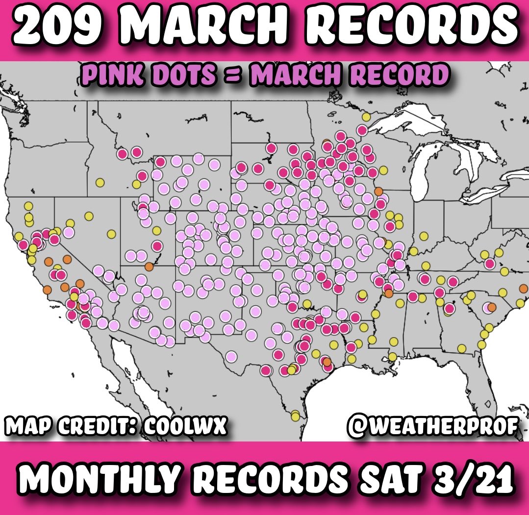
Never seen anything like this. 200+ monthly records set today alone! Every pink dot means a city set its new all-time highest March temperature! That’s around 570 new monthly records in the last 4 days. Some set multiple times. By far the most rogue #heatwave the US has experienced in memory.












![pogowo1's tweet photo. @NWSStateCollege [7:05 pm] Pea sized hail in State College, PA. https://t.co/8XFcvAfmfU](https://pbs.twimg.com/media/HEDT2RSbIAAb2l7.jpg)