Working on a new #remotesensing model for identifying fans of the @Eagles in multispectral satellite imagery: "Eagles Support Index"
🤞for publication in a future edition of @ISPRS_SC "Journal of Photogrammetry and Remote Sensing" after a few tweaks. #FlyEaglesFly
Our recently released #rastervision library makes building new deep learning models for image recognition a breeze, but what about data storage and visualization? Read about what Raster Vision means for the future of @rasterfoundry https://t.co/Iy89gFkjkU
In the interest of science, if you'd like to replicate these results, simply use the formula (Green ^10) - (Red + Blue) as shown in the template below. The above example uses #Sentinel2 data over Philadelphia.
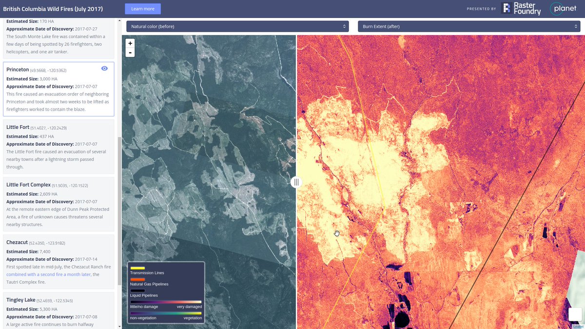
Raster Foundry creates powerful and stunning visual analysis tools using @planetlabs imagery. Exciting to see what GeoTrellis can power. https://t.co/28N32pjciC
@jackschoonover @planetlabs Whatcha workin on Jack? Could try a free but lower pace/lower resolution data source like @NASAEarthData Landsat or @ESA_EO Sentinel.