How would you rate the accuracy and practical usefulness of my long-range forecasts for Autumn 2025 and Winter 2026 so far?
(Rating Scale):
(5🌟) Excellent (Highly accurate & very useful)
(4🌟) Good (Mostly accurate & useful)
(3🌟) Moderate (Mixed performance)
(2🌟) Low accuracy (Limited usefulness )
(1🌟) Not useful / Missed expectations
Your feedback helps refine future outlooks and improve regional targeting.
Please also mention your country/region in the comments so I can prioritize areas of highest relevance and usability .
Starting next week, I'll share seasonal long-range forecasts through free and affordable paid subscriptions, including advanced insights for agriculture, agribusiness, weather & climate.
🙏🫶🙏Follow, subscribe & support: https://t.co/T2WUktUBfq
@TlmImad75406@Recretos@nblovesmtns لو كنت مكانك، أخوي عماد، مستقبلاً بذكر مصدر التحليل. هذا أفضل لك، وما بتخسر أي شيء لما تنسب التحليل لمصدره.بالعكس، الناس بتقدّر جهدك أكثر وبتشوف في شخصك الجانب المهني و الاحترافي بنفس القدر ، خصوصاً لما تحترم جهود الآخرين .
Another highly valuable application of historical mountain weather data is improving the accuracy and lead time of modelled wind forecasts. Achieving reliable forecasts up to 48 hours in advance could significantly enhance safety for mountain visitors, ski resort operators.
It's well known that mountain weather varies wildly over a micro-scale, beyond even what the highest resolution models can output. I trained an ML model to adjust HRRR forecasts to historical sensor data observations at Mammoth, and vastly improved wind forecasts at 2 day lead
Many friends ask about the Azores High, which just appeared in the GFS model over North Africa and Iberia today: Will it settle there for long?
This temporary subsidence was highlighted several times in my forecasts over the past few weeks. It is transient.
🌧️ 🔴🚦Iberian Peninsula & Southwestern Europe — Late November to Early December Outlook
🟡🔴Early warning 🇫🇷🇪🇸
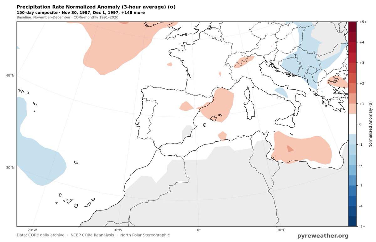
🚥Another wet phase may develop across the Iberian Peninsula and southwestern Europe during the final days of November and the first decade of December, as suggested by a 20-member Structural Analog Ensemble covering November 27–December 10.
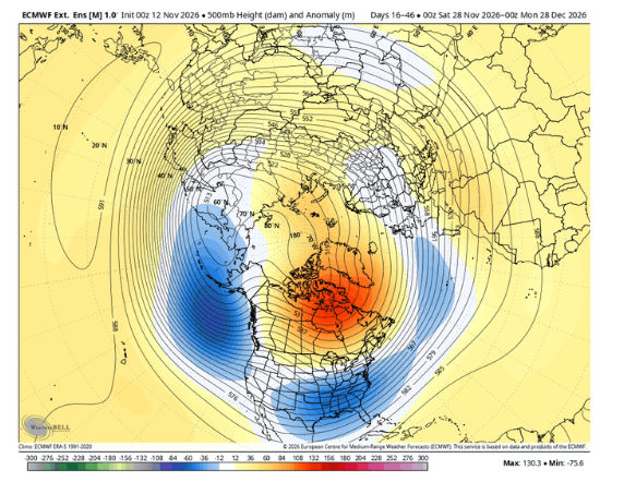
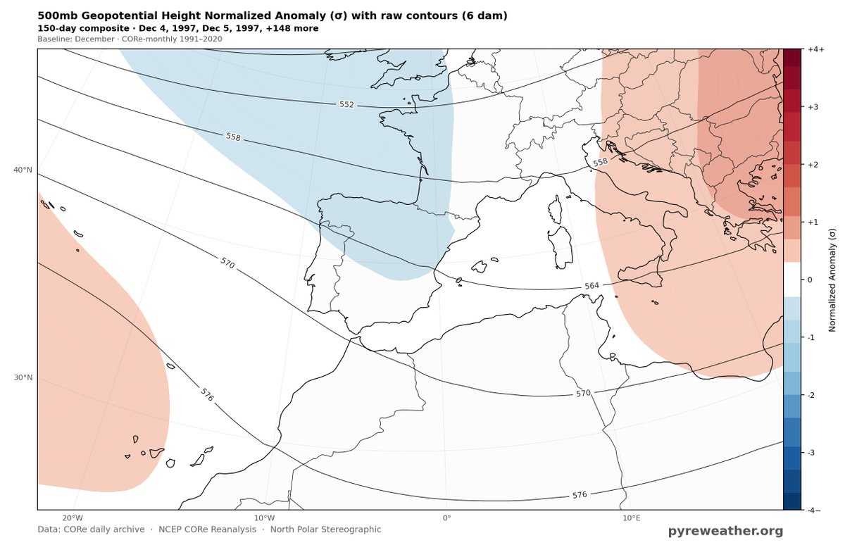
🌊 500 hPa Circulation Pattern
The 500 hPa anomaly patterns suggest the potential establishment or persistence of a low-pressure system over the Bay of Biscay. This is a typical winter-like circulation configuration, potentially associated with a wave-1 planetary Rossby wave pattern .
⛈️ Potential Regional Impacts
Such a configuration could favor the return of storm activity across the Balearic Sea, the eastern and southern fringes of Spain, and parts of North Africa.
⚠️🔴 The eastern side of Spain, in particular, may experience an elevated risk of torrential rainfall episodes during the first decade of December. However, the attached rainfall anomaly maps do not yet capture the actual spatial and temporal distribution or localized intensity of these potential events, as each map represents predicted rainfall probabilities based on a 10-day moving average. I will soon share additional NOAA NCEP maps using 3-day moving averages to better reveal the potential spatial and temporal imprints of torrential rainfall and flood-prone areas.
🌊 Interestingly, a similar Iberian Sea storm configuration developed last October, contributing to severe flooding across eastern Spain, particularly the Albacete region and Valencia. I previously shared an outlook warning about the potential return of this storm pattern in December. 📌 I encouraged everyone to bookmark the warning video published last month for future reference and comparison. The video link has been added in the comments.
⚠️ Please note that this remains a long-range probabilistic outlook, not a deterministic flood forecast. The actual timing, location, and severity of any potential rainfall events will require further monitoring and shorter-range model confirmation.
☀️ Mid-November: A Temporary Settled Phase
The period from November 12–23 may be characterized by relatively enhanced atmospheric subsidence, associated with the northward expansion or strengthening of the Azores High (anticyclone).
🔄 This blocking influence may gradually weaken or become disrupted toward the final third of November, potentially allowing a transition toward a more unsettled circulation pattern as the month draws to a close.
Kindly share 🔄 the early warnings and subscribe . Early warnings save lives and property.
Best regards
Mr. M @Statisticizer
3) Sharav troughs usually move eastward, but their final destination remains uncertain in NWP models due to complex synoptics and a lack of reliable African desert data and archives over the past century. Quiet regular occurrence during this period in stronger Elninos.
1) A cold core deep Sharav Trough (ST) Desert system might develop between 20-28 November over Western Libya. This trough system may have a cold deep core extending eastwards toward Levant & Egypt. Sharav Troughs are names after Libyan ( Sharaf coastal region) and ( see comments)
2)And this type of Mediterranean Desert Troughs can sometimes transform into severe rainy events over N. African coasts and the levant as well as the inland desert regions of Tunis, Libya and East Algeria when all ingredients for rainfall are available due to their microclimates
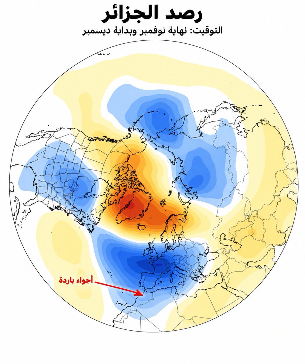
Late November and early December synoptic evolution suggests a possible cold intrusion into SW Europe and the western Mediterranean, aligning with higher odds of troughing and potential snowfall across parts of Iberia and North Africa. These tentative outlooks are promising.
@DraganD97970@Lipe30_ I have made a recent forecast for snow ( Balkans and Anatolia) .
Please use @Grok to find those forecasts quickly where i mention Greece, Slovenia, Türkiye, and adjacent states either for monthly or weekly analyses November, December and January. Many forecasts.
@nblovesmtns The error component derived from historical observational data, particularly when sufficiently long records are available, can help refine model performance and extend the forecast lead time, providing a more reliable forward-looking perspective.
@pyreweather@Statisticizer Seems like we have been anticipating it for so long, we can finally look back and see whos medium and long range forecasts were most accurate! @Statisticizer
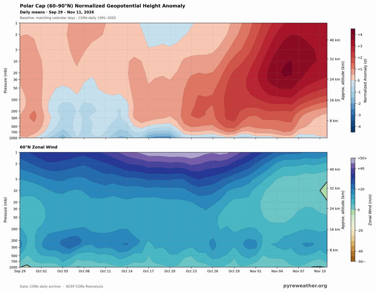
BOOM! Here it is!! That little green wedge on the right side of the lower image? that's the easterly turn of the 10mb winds at 60N Latitude.
The Sudden Stratospheric Warming event has officially arrived!!
@Statisticizer