KSW x TMH is officially open!🌍🎉✨ Our collaborative exhibition with Kristjana S. Williams runs from 10th March - 21st April at The Map House, London.
Find out more about the exhibition here: https://t.co/PDnKyHNpVI
Exhibition catalogue: https://t.co/10KXXiEJAY
The Map House in full bloom 💐 Inspired by @TheRHS Chelsea Flower Show just around the corner, we have adorned the gallery window with fine original botanical and natural history engravings. Explore now: https://t.co/pIjVmTbT2U
#maps#antiques#chelseaflowershow2023
We are excited to announce that from 10th March to 21st April 2023, Icelandic artist Kristjana S. Williams will be exhibiting her extraordinary and immersive map-based artwork at London’s oldest map specialist, The Map House.
Find out more: https://t.co/PDnKyHNpVI
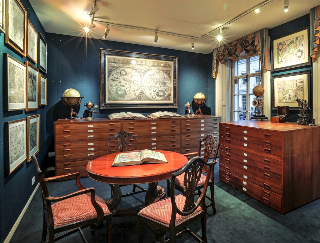
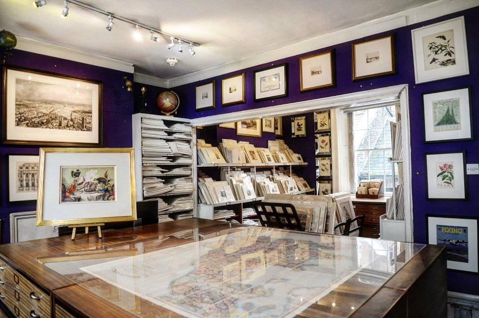
Happy New Year! 🎆 We hope you had a splendid break and look forward to welcoming you to explore The Map House in 2023 🔎🗺️
The gallery is open Monday to Friday from 10:30am - 6pm and Saturdays from 10:30am - 5pm. Closed Sundays and Bank Holidays.
https://t.co/Iiz40LDa6q
Festive Opening Hours🌍🎄
Open Sat 24 Dec, 10:30am-5pm
*please call the gallery to confirm
Closed Sun 25 to Tues 27 Dec
Open Wed 28 to Fri 30 Dec, 10:30am-6pm and Sat 31 Dec 10:30am-5pm
Closed Sun 1 and Mon 2 Jan 2023
Business as usual from Tues 3rd Jan
https://t.co/mEEFx947ZG
Late-Night Christmas Shopping, Wed 7th Dec 'til 8pm🎄🌍🥂
The Map House & the Beauchamp Place Association invite you to celebrate the festive season with an evening of shopping with participating boutiques on Beauchamp Place. Refreshments available
https://t.co/eX0SRG9Kt9
🌍In 1611, cartographer John Speed published his ‘Theatre of the Empire of Great Britain’. The 2nd of this work’s 4 volumes covered Wales and included a map of Wales along with individual maps of the 13 Welsh counties.
But can you guess where in Wales this is?
#whereinwales
View photos and explore “The World in Maps 1400–1600,” a new exhibition at Yale’s Beinecke Rare Book and Manuscript Library: https://t.co/Y6oq4ZJgvh @BeineckeLibrary#Yale
We have a free event this Saturday that's specifically for awesome older people!
Come and explore our nautical chart collection - from the earliest Portolans to the latest Admiralty charts, via Samuel Pepys!⛵️
#SilverSaturday
Book 👉 https://t.co/ARrkRbEpyt
Announcing the 32nd season of talks in the ‘Maps & Society’ series, partly in-person at the University of London’s Warburg Institute and partly online, starting in December. All are welcome. For the full details see: https://t.co/FGWvbCukrA
Applications invited for the J.B. Harley Research Fellowships in the History of Cartography.
A funding opportunity for anyone irrespective of nationality, discipline or profession wishing to work with early map collections in the UK.
Deadline 1 November https://t.co/txyAECDXov
🌍Where in Wales?
In 1611, cartographer John Speed published his ‘Theatre of the Empire of Great Britain’. The 2nd of this work’s 4 volumes covered Wales and included a map of Wales along with individual maps of the 13 Welsh counties.
But can you guess where in Wales this is?
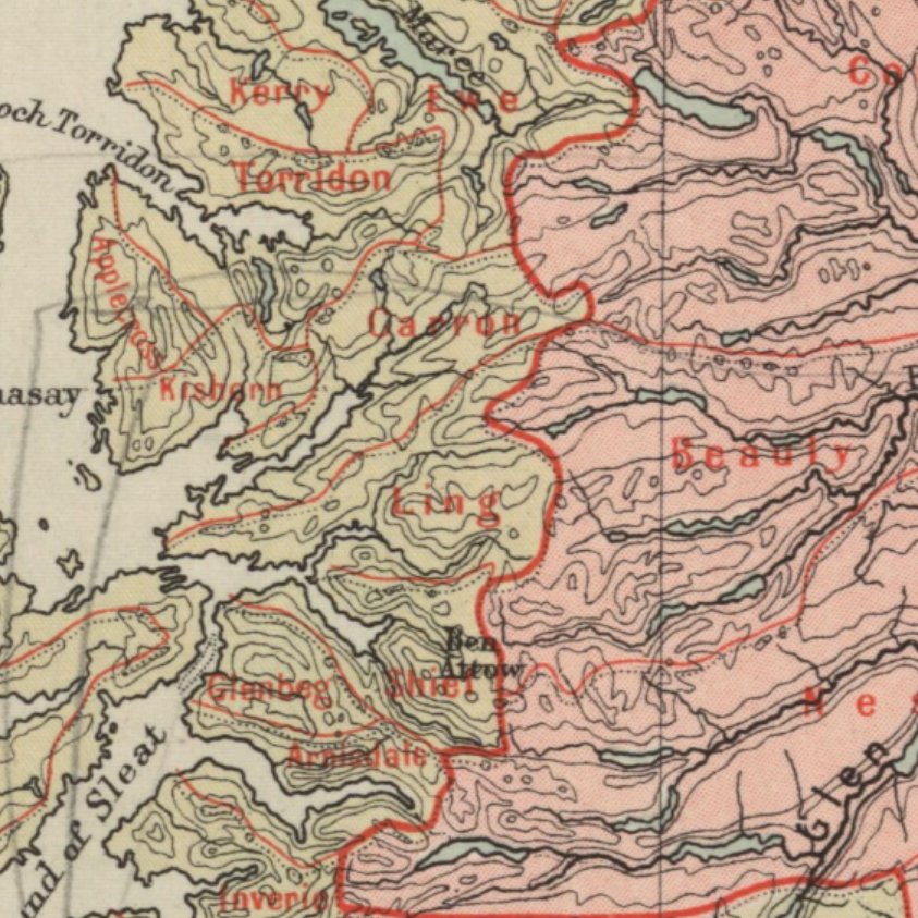
This map of Scotland's River Basins clearly shows the Scottish watershed, the divide separating river systems that flow to the east into the North Sea from those flowing west and north into the Atlantic Ocean. From Survey Atlas of Scotland, 1912. https://t.co/WZDwpYLCjP
From execution cages to river frolics - introducing Remigius Hogenberg’s 1570 view of Münster, currently on exhibition at the Stadtmuseum Münster https://t.co/m8Upz3Kkpj
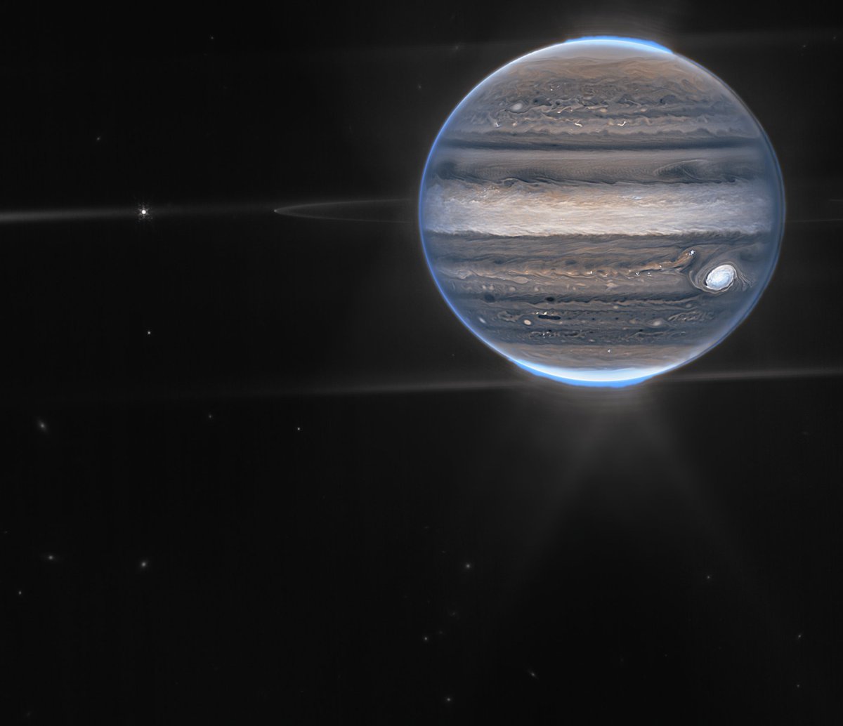
Giant news from a giant planet!
@NASAWebb captured a new view of Jupiter in infrared light, uncovering clues to the planet’s inner life. Two moons, rings, and distant galaxies are visible. Get the details: https://t.co/6WKbAQY78z
Seizing the opportunity on #mapmonstermonday to share some choice details from our 1648 terrestrial #globe by Johannes Janssonius and Jodocus Hondius II, including a bevy of trumpeting mer-people, a giant leonine fish-creature, and the monstrous and mythical Appalachian Salt Lake
How cool is this! The first European roadmap was published around 1500 in Nürnberg (Germany). The map faces south so you’ll have to adjust mentally when reading it. Source: https://t.co/fD4CqBnL6N