This has to be one of the most incredible and terrifying satellite loops that I've seen in a while. You can see 5 violent mesovorts spinning around the eye of #Melissa this morning.
The remnant MCS over the Ohio Valley should help scattered thunderstorms fire across portions of PA and NY later this afternoon as it travels east.
We'll have to see just how far east this activity can get, but the main threat today would be locally damaging winds.
Aguacero 5.8 is live.
🛰 GOES-West & Himawari, satellite coverage across the whole Pacific
⚡ Lightning counter for layouts & popups
🎨 Brightness/contrast/saturation sliders for satellite basemaps
📦 Bundles can now save the model they were built with
https://t.co/1Zh9E6vYnV
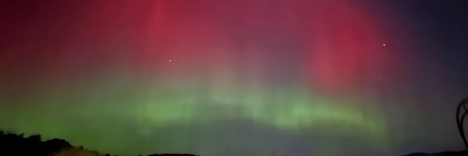
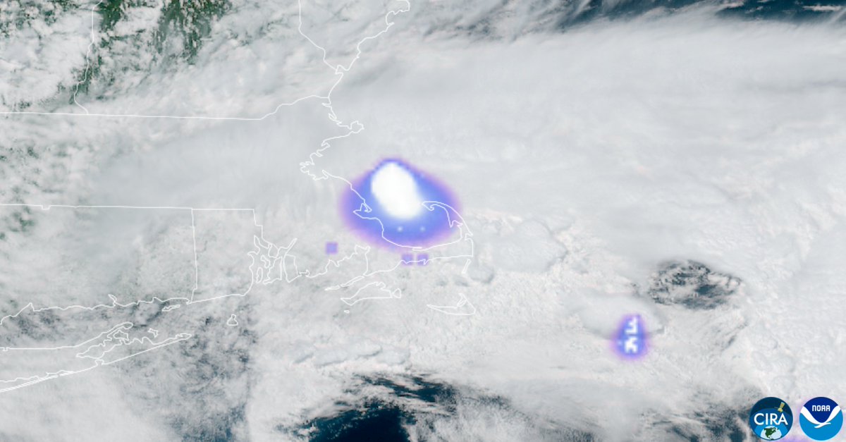
Reports of an explosion hears around Boston I believe are going to be a rather significant bolide/meteor entering the atmosphere. Very large "flash" detected by GOES-19 GLM that does not correlate with active thunderstorms. #MAwx
So...uh...how are all the mets and forecasters out there feeling about this one?
Not having the HREF anymore is going to take me a long, long time to get used to. 😬
https://t.co/hN3lYfRPcK
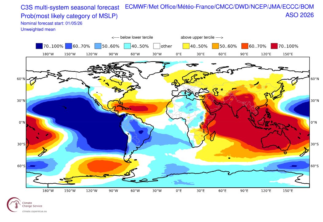
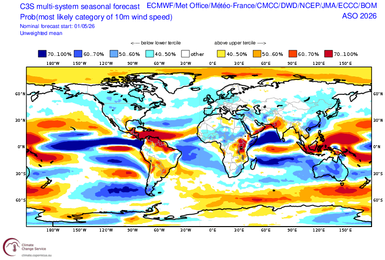
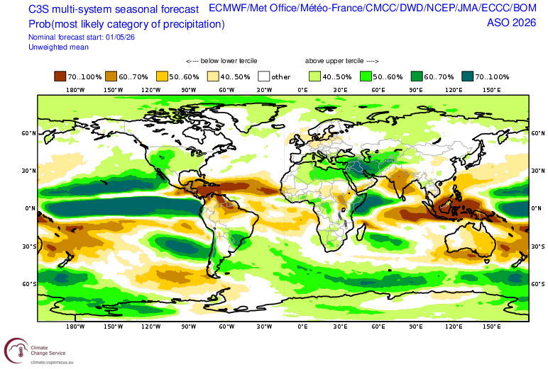
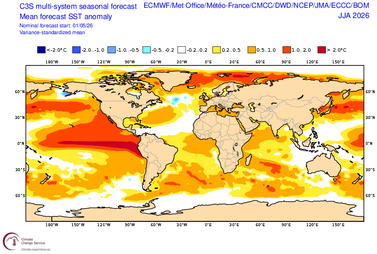
Two things jump out to me in the latest C3S climate model means:
1) This is easily the most hostile pre-season forecast Atlantic look I have ever seen in this composite: MDR cooler SST than the subtropics, large-scale subsidence from El Niño, enhanced trade winds on top of the upper level shear.
2) This is probably about as favorable of a large-scale setup for Hawaii hurricane threats as you will ever see, with a strong Niño and +PMM.
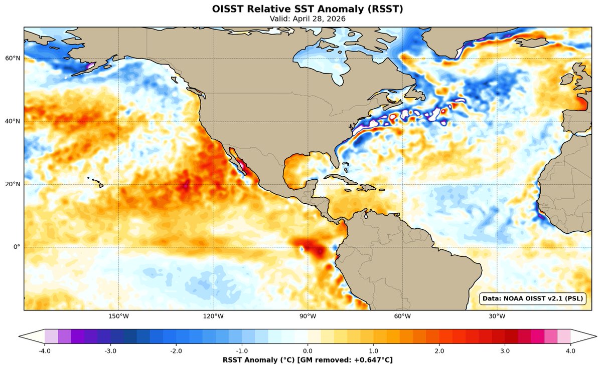
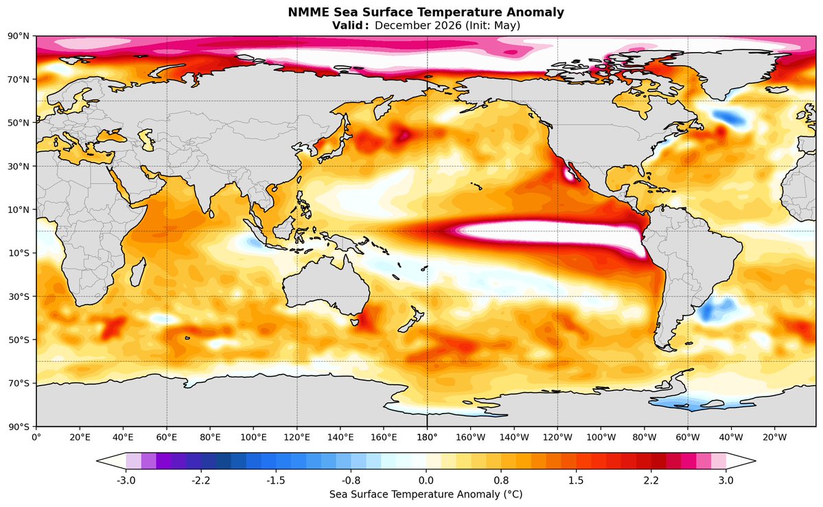
The NMME has Niño 3.4 peaking in December around 3.1°C and roughly 2.41°C with the global mean removed (RONI).
This El Niño certainly looks like it could be one for the books!
Comparing some of the latest forecast runs to past strong El Niño events shows we are in for quite a historic ride, if verified. Both the BOM and CFSv2 use the Relative ENSO index forecast. Interesting to see how close the new BOM forecast is to the ECMWF.
@AndyHazelton@webberweather@PaulRoundy1@tcrawf_nh@BenNollWeather
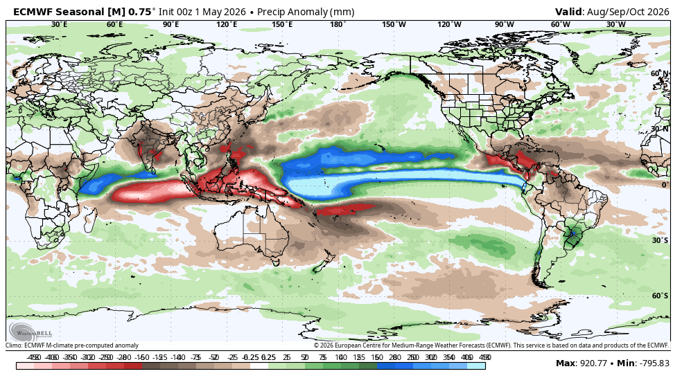
The updated ECMWF seasonal model continues to show a *very* strong El Niño developing through the summer months.
This is just about as unfavorable as it gets for the Atlantic hurricane season, and the current SST configuration certainly won't help the situation.
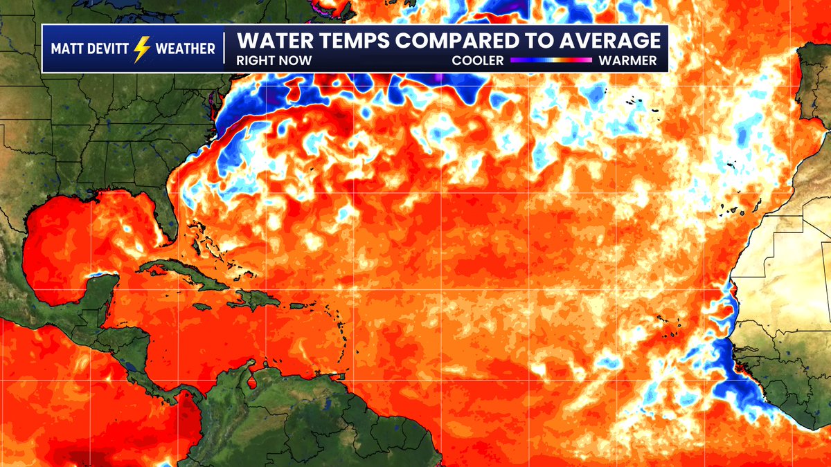
Andy is right, this is actually a very important detail. Most TV stations have built in the standard look on the left...which makes it look too warm because it compares it to an outdated average. Look what happens when I adjusted it to Andy's recommendation for a more accurate assessment (right). Pretty sizable change that tells a different story.
Precipitation output from the CanSIPS also shows a strong signal for reduced activity in the Atlantic from August to October.
The East Pacific and Central Pacific may have quite the year, especially given sea surface temperatures well above normal for this time of year.
New CanSIPS outlook now shows a super El Niño this year.
The ensemble mean of the new run peaks at +2.0˚C in the central equatorial Pacific during December, whereas the previous run had +1.6˚C.
The most extreme ensemble member nearly reaches +4.0˚C.
PSA, I would avoid using this CRW SST anomaly product. It makes things look unrealistically warm for two reasons:
1) Outdated climo average of 1985-1990+1993.
2) Slightly deceptive colorbar where anything slightly above zero is yellow.
For a more realistic look, use the same plot from @cyclonicwx with a more realistic climatology, preferably the one with the global mean anomaly removed (which is what matters for comparing basins).
https://t.co/K0XchzYxsI
The environment just south of Lyndsay is absolutely primed right now. Impressive overlap of 3CAPE and surface vorticity right where we have some very agitated CU developing.
Very high potential for anything that can go up there.
The 12z HRRR shows an exceptionally favorable environment for intense supercells across central and southern #Oklahoma later this evening.
All hazards will be in play, with very large hail and even a few strong tornadoes possible given the impressive thermodynamics.
MiniCOW packs MegaPOWER! Observes birth and ingestion of satellite tornado
and Fujiwara effect deflecting tornado. Tornado transitions 2x between clear eye and debris ball. Prelim data from most powerful mobile radar, 1 MegaWatt C-band storm-penetrating miniCOW in Braman, OK 🌪️